Back Bay

Bay in Wigtownshire

Scotland

Back Bay

Wall This picture was taken looking SE from NX141313. The dry stone wall typical of this area is clearly shown. In the distance can be seen the Mull of Galloway Lighthouse.
Wall Credit: Dave Smethurst

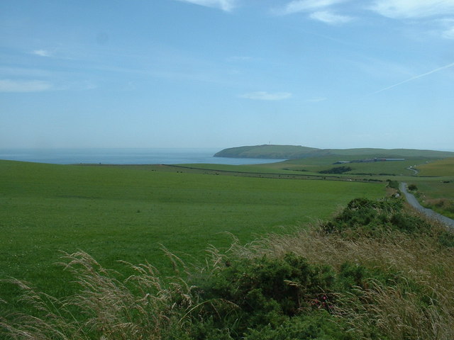
Back Bay is a picturesque coastal area located in Wigtownshire, Scotland. Situated on the southwest coast of the country, Back Bay offers stunning views of the Irish Sea and is renowned for its unspoiled beauty.

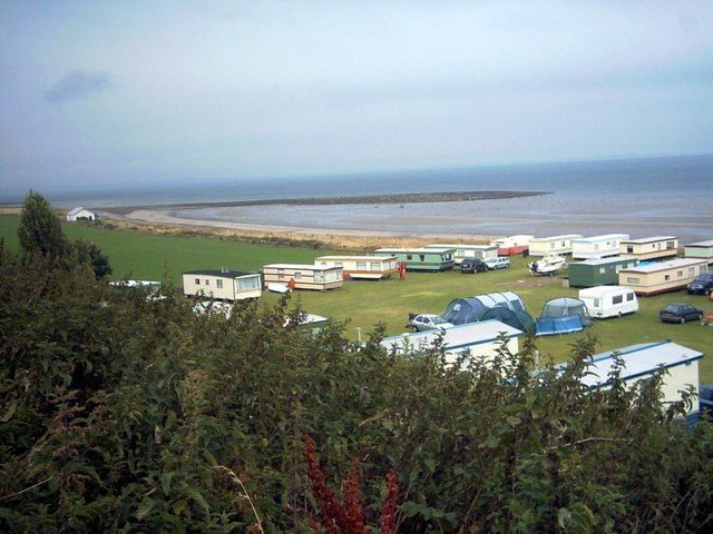
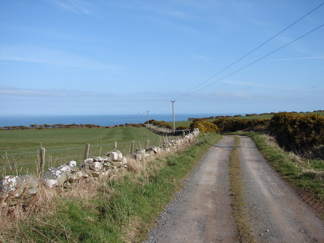
The bay is characterized by its expansive sandy beach, which stretches for approximately 2 miles and is a popular destination for locals and tourists alike. The beach is backed by dunes and a nature reserve, providing a haven for a wide range of wildlife and offering visitors the opportunity to explore the diverse flora and fauna of the area.

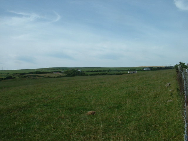
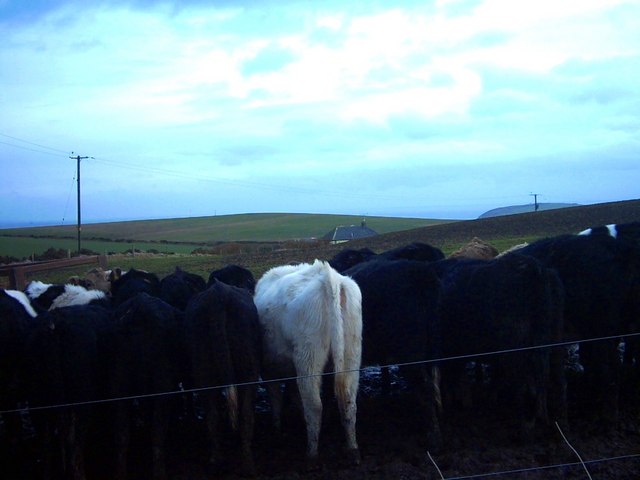
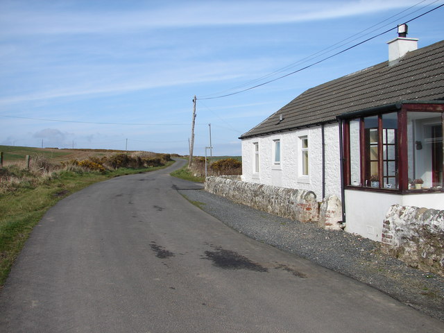
Back Bay is surrounded by rolling hills and fertile farmland, creating a charming rural landscape. The area is known for its agricultural heritage, with farming playing a significant role in the local economy. The nearby villages of Kirkcolm and Leswalt offer a glimpse into the traditional way of life in this part of Wigtownshire.

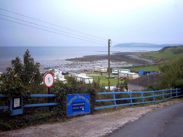
For outdoor enthusiasts, Back Bay offers numerous opportunities for activities such as walking, birdwatching, and water sports. The bay is particularly popular with windsurfers and kitesurfers, who flock to the area to take advantage of the strong coastal winds.

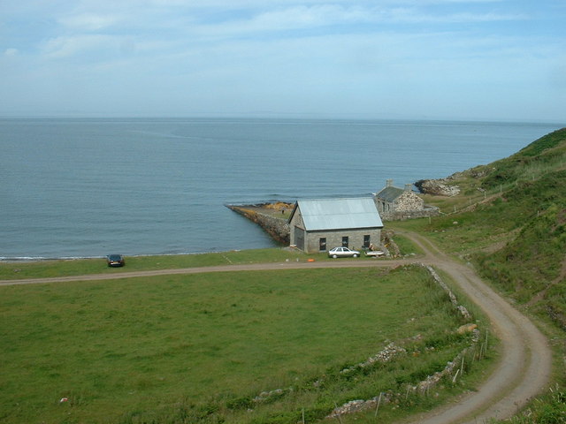
In addition to its natural beauty, Back Bay is also home to a vibrant community. The area boasts a range of amenities, including cafes, restaurants, and accommodation options, making it an ideal destination for those looking to relax and enjoy the tranquility of the Scottish coast.

Whether you are seeking a peaceful retreat or an active adventure, Back Bay in Wigtownshire offers something for everyone, combining stunning natural scenery with a warm and welcoming community.

If you have any feedback on the listing, please let us know in the comments section below.

Back Bay Images

Images are sourced within 2km of 54.655517/-4.882851 or Grid Reference NX1432. Thanks to Geograph Open Source API. All images are credited.

Wall This picture was taken looking SE from NX141313. The dry stone wall typical of this area is clearly shown. In the distance can be seen the Mull of Galloway Lighthouse.
Wall
This picture was taken looking SE from NX141313. The dry stone wall typical of this area is clearly shown. In the distance can be seen the Mull of Galloway Lighthouse.
Fields near Castlemoor Looking south, towards the Mull of Galloway.
Fields near Castlemoor
Looking south, towards the Mull of Galloway.
Cottages at Castlemoor Looking north.
Cottages at Castlemoor
Looking north.
Cottage and Quay On the eastern, Luce Bay, side of the Mull of Galloway.  The cottage appears intact from this angle, but the other side of the roof is missing.
Cottage and Quay
On the eastern, Luce Bay, side of the Mull of Galloway. The cottage appears intact from this angle, but the other side of the roof is missing.
East Tarbet This is the 'neck' of the Mull of Galloway. A tarbet is a place where a boat could be dragged from one side of a headland or island to the other [which is probably not done much these days]. This side is on Luce Bay, the point on the other side of the headland is on the Irish Sea and is called, somewhat predictably, West Tarbet.
East Tarbet
This is the 'neck' of the Mull of Galloway. A tarbet is a place where a boat could be dragged from one side of a headland or island to the other [which is probably not done much these days]. This side is on Luce Bay, the point on the other side of the headland is on the Irish Sea and is called, somewhat predictably, West Tarbet.
Maryport Caravan Park In the background can faintly be seen The Mull of Galloway and lighthouse.
Maryport Caravan Park
In the background can faintly be seen The Mull of Galloway and lighthouse.
Maryport Caravan Park Set on a sandy beach, the shingle bar is called 'Ringwee'.  The Wigtownshire coast across Luce Bay can faintly be seen on the horizon.
Maryport Caravan Park
Set on a sandy beach, the shingle bar is called 'Ringwee'. The Wigtownshire coast across Luce Bay can faintly be seen on the horizon.
East Tarbet Quay, Mull of Galloway A swimmer was rescued and treated for hypothermia after trying to swim out to his boat.  The currents hereabouts are notoriously treacherous.
East Tarbet Quay, Mull of Galloway
A swimmer was rescued and treated for hypothermia after trying to swim out to his boat. The currents hereabouts are notoriously treacherous.
West Tarbet, Mull of Galloway West Tarbet is the bay at the narrow neck of land a mile from Mull of Galloway.  Just how many Tarbets are there in Scotland?
West Tarbet, Mull of Galloway
West Tarbet is the bay at the narrow neck of land a mile from Mull of Galloway. Just how many Tarbets are there in Scotland?
Pulinkum Farm and Slewmag Just the roof of buildings on Pulinkum Farm can be seen.  The hill behind is Slewmag, and the Mull of Galloway can be seen in the distance on the right of the picture.
Pulinkum Farm and Slewmag
Just the roof of buildings on Pulinkum Farm can be seen. The hill behind is Slewmag, and the Mull of Galloway can be seen in the distance on the right of the picture.
Country Road The end of the road is nigh!  These passing places feature at regular intervals on this single-track road the (eventually) leads to the Mull of Galloway whose lighthouse may be seen in the far distance. Luce Bay is on the left.
Country Road
The end of the road is nigh! These passing places feature at regular intervals on this single-track road the (eventually) leads to the Mull of Galloway whose lighthouse may be seen in the far distance. Luce Bay is on the left.
Mull of Galloway Farm & Cottage
West Tarbet
West Tarbet
East Tarbet Lighthouse on the Mull of Galloway in the background
East Tarbet
Lighthouse on the Mull of Galloway in the background
Creechan Farm Track Track from B7041 leads east and down to Creechan Farm on The Rhins.
Creechan Farm Track
Track from B7041 leads east and down to Creechan Farm on The Rhins.
East Cairngaan Cottage Remote cottage situated on the lane from Mull School (B7041) to Cardrain. Nearby is Jenny Smit's Well, a natural spring.
East Cairngaan Cottage
Remote cottage situated on the lane from Mull School (B7041) to Cardrain. Nearby is Jenny Smit's Well, a natural spring.
Tank  at  West Tarbet 40ft Tank, washed ashore at West Tarbet
Tank at West Tarbet
40ft Tank, washed ashore at West Tarbet
Isthmus of East and West Tarbet Bays Difficult to show but the beginnings of the isthmus can just be seen.
Isthmus of East and West Tarbet Bays
Difficult to show but the beginnings of the isthmus can just be seen.
Show me another place!

Back Bay is located at Grid Ref: NX1432 (Lat: 54.655517, Lng: -4.882851)

Unitary Authority: Dumfries and Galloway

Police Authority: Dumfries and Galloway

What 3 Words

///drooling.conceals.croutons. Near Drummore, Dumfries & Galloway

Related Wikis

Cairngaan

Cairngaan, Wigtownshire, is the southmost settlement in Scotland. The hamlet of Cairngaan lies just north of the Mull of Galloway (which contains Scotland...

Mull of Galloway

The Mull of Galloway (Scottish Gaelic: Maol nan Gall, pronounced [mɯːlˠ̪ nəŋ ˈkaulˠ̪]; grid reference NX158303) is the southernmost point of Scotland....

Drummore

Drummore (drum-ORE; (from Gaelic An Druim Mòr meaning "the great ridge") is the southernmost village in Scotland, located at the southern end of the Rhins...

Kirkmaiden (village)

Kirkmaiden (sometimes Maidenkirk; Scottish Gaelic: Cill M'Eudan) is a small settlement in Galloway, Scotland, located approximately 17 miles (27 km) south...

Kirkmaiden

Kirkmaiden is a parish in the Rhins of Galloway, the most southerly in Scotland; the present Church of Scotland parish has the same name as and is approximately...

Pasages (steam trawler)

ST Pasages (FD 119) was originally a Canadian "Castle" – TR series minesweeping trawler built by the Dominion Shipbuilding Company, Toronto, in 1917 for...

Port Logan

Port Logan, formerly Port Nessock, is a small village in the parish of Kirkmaiden in the Rhins of Galloway in Wigtownshire. The Gaelic name is Port Neasaig...

Nearby Amenities

Located within 500m of 54.655517,-4.882851
Source: PGS
Lat/Long: 54.6512452/-4.8808152
Source: PGS
Lat/Long: 54.6514088/-4.8810494
Source: PGS
Lat/Long: 54.6518686/-4.881752
Source: PGS
Lat/Long: 54.6523114/-4.8820367
Source: PGS
Lat/Long: 54.652732/-4.8821836
Source: PGS
Lat/Long: 54.6528781/-4.8825353
Source: PGS
Lat/Long: 54.6527426/-4.8830744
Source: PGS
Lat/Long: 54.6531206/-4.8836325
Source: PGS
Lat/Long: 54.6538023/-4.8836797
Source: PGS
Lat/Long: 54.6544357/-4.8832614
Source: PGS
Lat/Long: 54.6546927/-4.8837005
Source: PGS
Lat/Long: 54.6550602/-4.8836551
Source: PGS
Lat/Long: 54.6556033/-4.8835286
Source: PGS
Lat/Long: 54.6565691/-4.8830513
Source: PGS
Lat/Long: 54.6572407/-4.882893
Source: PGS
Lat/Long: 54.6578642/-4.883275
Source: PGS
Lat/Long: 54.6591191/-4.8823933
Source: PGS
Lat/Long: 54.6594267/-4.8820663
Source: PGS
Lat/Long: 54.6596551/-4.88188
Smithy Hill
Place: locality
Lat/Long: 54.6548789/-4.8882039
The data included in this document is from www.openstreetmap.org. The data is made available under ODbL.

Have you been to Back Bay?

Leave your review of Back Bay below (or comments, questions and feedback).