Batchworth

Settlement in Hertfordshire Three Rivers

England

Batchworth

Swanning About on the Grand Union From Common Moor Lock looking North East.
Swanning About on the Grand Union Credit: RG

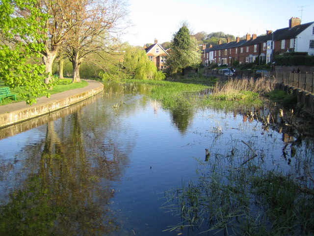
Batchworth is a charming village located in the county of Hertfordshire, England. Situated approximately 20 miles northwest of London, it falls within the Three Rivers district. The village is surrounded by picturesque countryside, with the River Colne flowing through its heart.

Batchworth has a rich history that dates back centuries. It is believed to have been settled during the Roman era, and evidence of this can still be seen in the form of Roman pottery fragments that have been discovered in the area. Throughout the medieval period, the village thrived as an agricultural community, with farming and milling being the primary industries.

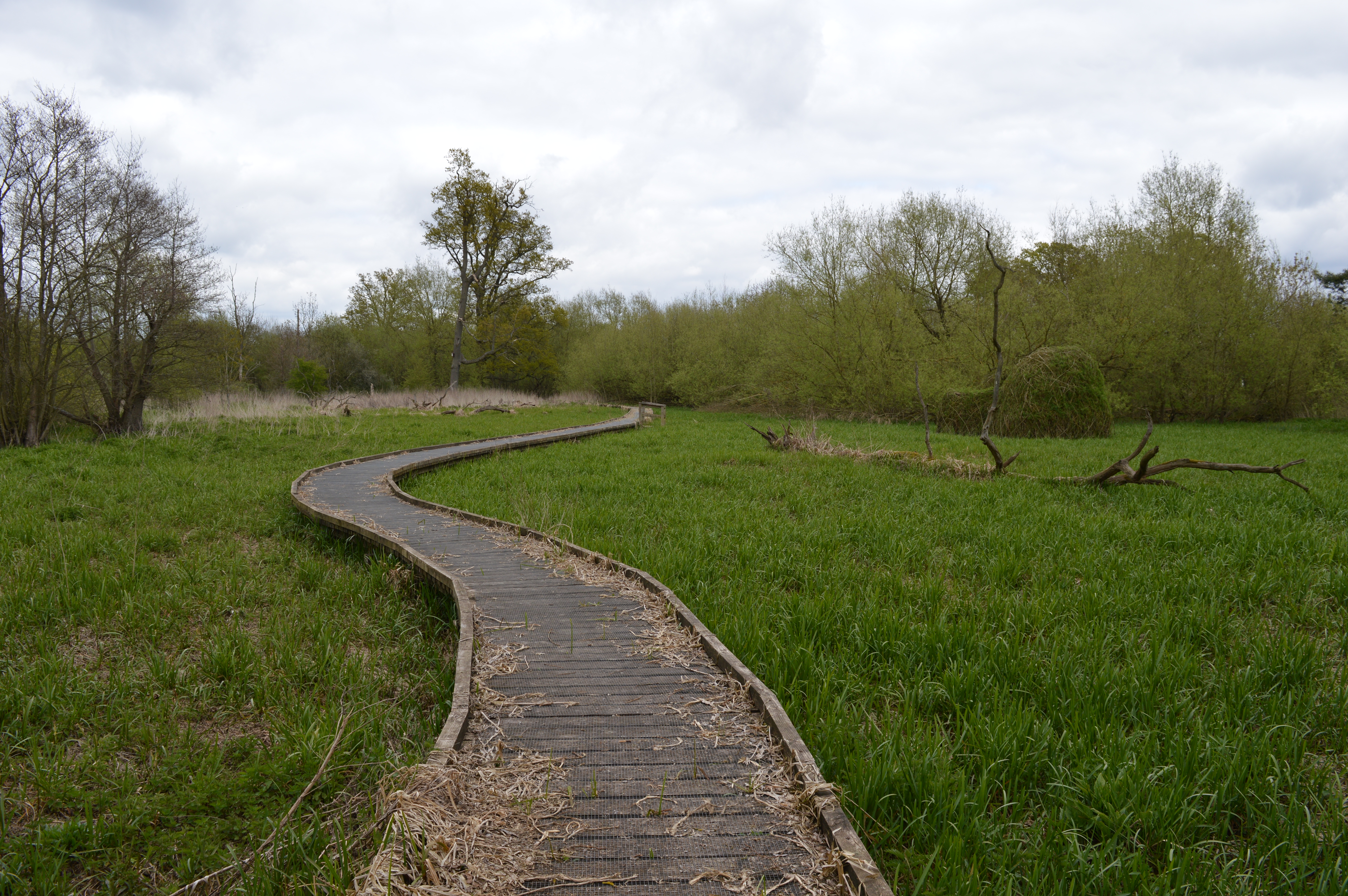
Today, Batchworth maintains its rural charm, with an abundance of green spaces and quaint cottages dotting the landscape. The village is known for its close-knit community, and residents take pride in preserving its historical character. The local church, St. Mary's, is a focal point of the village and is steeped in history, dating back to the 12th century.

Despite its tranquil atmosphere, Batchworth benefits from its proximity to major transportation links. The village is well-connected to London and other nearby towns, making it an attractive location for commuters. Nearby attractions include the Rickmansworth Aquadrome, a nature reserve and leisure facility, which offers opportunities for boating, fishing, and wildlife spotting.

In summary, Batchworth, Hertfordshire is a picturesque village with a rich history and a strong sense of community. Its idyllic setting, combined with its convenient location, makes it a desirable place to live for those seeking a peaceful countryside lifestyle within easy reach of urban amenities.

If you have any feedback on the listing, please let us know in the comments section below.
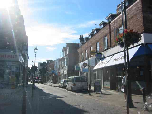
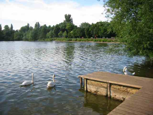
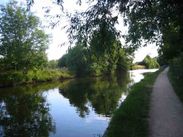
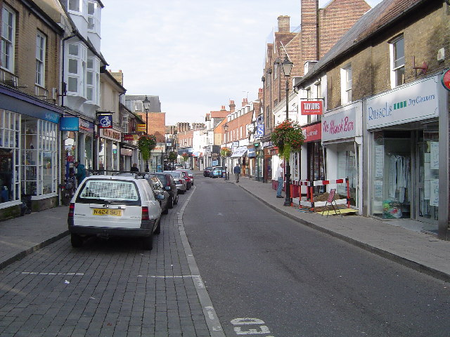
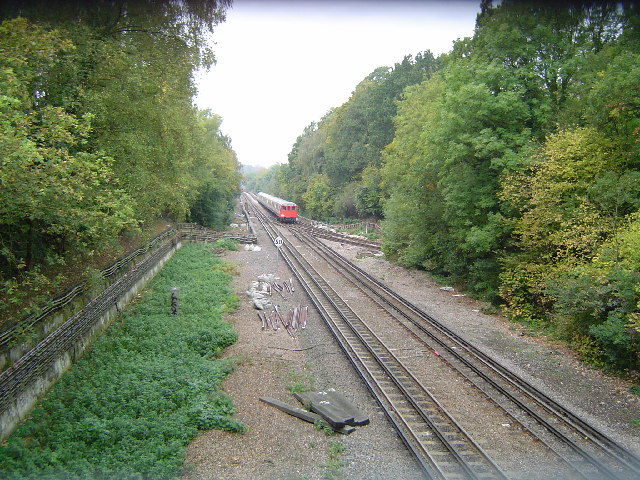
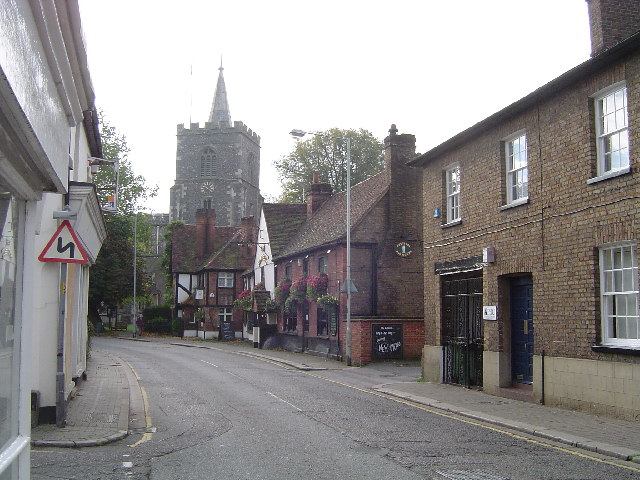
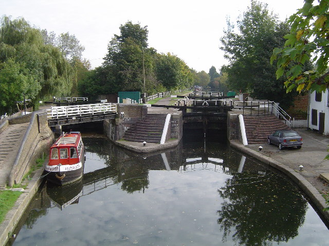
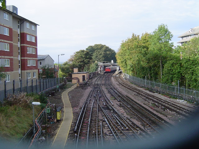
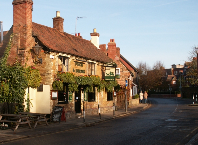
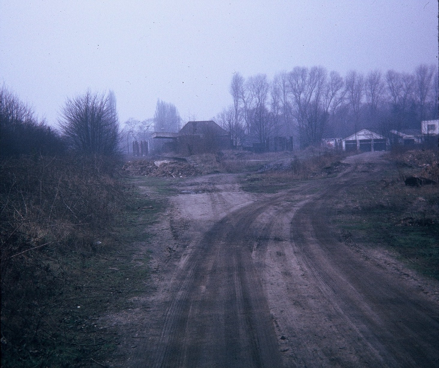
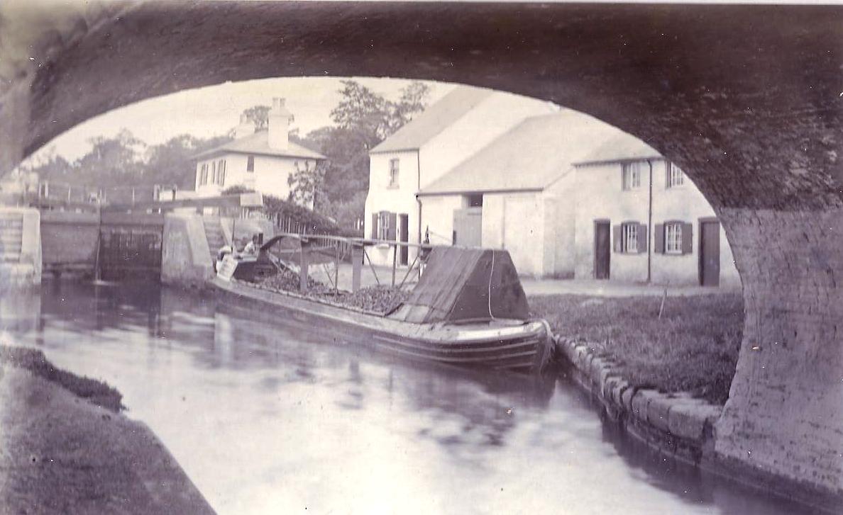
Batchworth Images

Images are sourced within 2km of 51.635094/-0.459351 or Grid Reference TQ0694. Thanks to Geograph Open Source API. All images are credited.

Swanning About on the Grand Union From Common Moor Lock looking North East.
Swanning About on the Grand Union
From Common Moor Lock looking North East.
Lot Mead Lock
Lot Mead Lock
The Station at Croxley  Green See the upper windows are open so someone works there.
The Station at Croxley Green
See the upper windows are open so someone works there.
Street Scene in Rickmansworth The lack of shoppers surprised me but it does have a pedestrian precinct atmosphere
Street Scene in Rickmansworth
The lack of shoppers surprised me but it does have a pedestrian precinct atmosphere
Batchwood  Lake at the Aquadrome  Rickmansworth This is the last of the group of lakes which spread 
southwards along the route of the River Colne
Batchwood Lake at the Aquadrome Rickmansworth
This is the last of the group of lakes which spread southwards along the route of the River Colne
Grand Union Canal  Rickmansworth The aquadrome park is just to the right of the tow path
Grand Union Canal Rickmansworth
The aquadrome park is just to the right of the tow path
Mount Vernon Hospital  Northwood By contrast this doctor's practice is a building erected perhaps in 1940
Mount Vernon Hospital Northwood
By contrast this doctor's practice is a building erected perhaps in 1940
Rickmansworth: Main Avenue, Moor Park Viewed looking downhill and eastwards towards the only shops in this exclusive housing estate, Moor Park railway station is beyond the trees at the end of the road.
Rickmansworth: Main Avenue, Moor Park
Viewed looking downhill and eastwards towards the only shops in this exclusive housing estate, Moor Park railway station is beyond the trees at the end of the road.
Rickmansworth: High Street A view looking westwards on a Sunday morning.
Rickmansworth: High Street
A view looking westwards on a Sunday morning.
Croxley Green The Green viewed looking northwards. The Coach and Horses Public House, which is a Grade II listed building, is on the left. Note the fine old style lamp posts! 

The name Croxley is reputedly derived from Croc's Lea in Saxon times, and the Green has been owned at various times by the Church, the Crown, and Gonville and Caius College, Cambridge. In 1945 it was sold by the College to Rickmansworth Urban District Council, and is now owned and maintained by their successors, Three Rivers District Council.
Croxley Green
The Green viewed looking northwards. The Coach and Horses Public House, which is a Grade II listed building, is on the left. Note the fine old style lamp posts! The name Croxley is reputedly derived from Croc's Lea in Saxon times, and the Green has been owned at various times by the Church, the Crown, and Gonville and Caius College, Cambridge. In 1945 it was sold by the College to Rickmansworth Urban District Council, and is now owned and maintained by their successors, Three Rivers District Council.
Metropolitan Line railway between Rickmansworth and Moor Park A southbound Metropolitan Line train approaches the Croxleyhall Farm Bridge from the Rickmansworth direction (and for those who collect such things, no, I did not get its number!). These tracks are shared between London Underground and Chiltern Railways. The London Underground trains go to and from Amersham and Baker Street and Aldgate, and the Chiltern Line trains run from London Marylebone to and from Aylesbury. The tracks leading to the right in front of the train go to Watford along a short section of track that is only used for early morning and late evening train positioning movements, forming one side  of the "Croxley Triangle".
Metropolitan Line railway between Rickmansworth and Moor Park
A southbound Metropolitan Line train approaches the Croxleyhall Farm Bridge from the Rickmansworth direction (and for those who collect such things, no, I did not get its number!). These tracks are shared between London Underground and Chiltern Railways. The London Underground trains go to and from Amersham and Baker Street and Aldgate, and the Chiltern Line trains run from London Marylebone to and from Aylesbury. The tracks leading to the right in front of the train go to Watford along a short section of track that is only used for early morning and late evening train positioning movements, forming one side of the "Croxley Triangle".
Metropolitan Line railway between Watford and Moor Park A northbound Metropolitan Line train approaches Croxley station on the Watford branch from the Moor Park direction (and for those who collect such things, no, I did not get its number!). This is one side of the "Croxley Triangle", and the image was taken from the overbridge by the signal box.
Metropolitan Line railway between Watford and Moor Park
A northbound Metropolitan Line train approaches Croxley station on the Watford branch from the Moor Park direction (and for those who collect such things, no, I did not get its number!). This is one side of the "Croxley Triangle", and the image was taken from the overbridge by the signal box.
Rickmansworth: Saints and Sinners The tower and spire of St Marys Church overlook The Feathers Public House in this view taken looking southwards in Church Street.
Rickmansworth: Saints and Sinners
The tower and spire of St Marys Church overlook The Feathers Public House in this view taken looking southwards in Church Street.
Grand Union Canal: Lock Number 81: Batchworth Lock Lock Number 81 on the Grand Union Canal is the one on the right, as viewed from the London Road overbridge. The lock on the left is Salter's Cut Lock leading to a short stub of canal along the River Chess. It was built in 1805 by the brewer Samuel Salter to enable access by canal to his brewery, and was later used to allow boats to reach the Rickmansworth gasworks. Compare this image with Neil's <a href="https://www.geograph.org.uk/photo/460073">TQ0694 : Batchworth Lock No 81, Grand Union Canal, with side lock</a> taken from more or less the same location in 1977.
Grand Union Canal: Lock Number 81: Batchworth Lock
Lock Number 81 on the Grand Union Canal is the one on the right, as viewed from the London Road overbridge. The lock on the left is Salter's Cut Lock leading to a short stub of canal along the River Chess. It was built in 1805 by the brewer Samuel Salter to enable access by canal to his brewery, and was later used to allow boats to reach the Rickmansworth gasworks. Compare this image with Neil's TQ0694 : Batchworth Lock No 81, Grand Union Canal, with side lock taken from more or less the same location in 1977.
Rickmansworth Station A view taken from the footbridge east of the station showing a northbound Metropolitan Line train about to depart for Amersham (and for those who collect such things, no, I did not get its number!). (The blurred grey line at the bottom of the image is part of the dense mesh security screen on the footbridge - apologies for this!) These tracks are shared between London Underground and Chiltern Railways. The London Underground trains go to and from Amersham and Baker Street and Aldgate, and the Chiltern Line trains run from London Marylebone to and from Aylesbury.
Rickmansworth Station
A view taken from the footbridge east of the station showing a northbound Metropolitan Line train about to depart for Amersham (and for those who collect such things, no, I did not get its number!). (The blurred grey line at the bottom of the image is part of the dense mesh security screen on the footbridge - apologies for this!) These tracks are shared between London Underground and Chiltern Railways. The London Underground trains go to and from Amersham and Baker Street and Aldgate, and the Chiltern Line trains run from London Marylebone to and from Aylesbury.
Old Redbrick buildings, Rickmansworth Fine old redbrick buildings at the North end of the High street. The nearest one is the Coach and Horses public house
Old Redbrick buildings, Rickmansworth
Fine old redbrick buildings at the North end of the High street. The nearest one is the Coach and Horses public house
Croxley Common Moor An SSSI in which over 140 species of plants have been discovered, the moor is grazed during the summer months. This view was taken looking northwards towards Croxley Green and the Grand Union Canal.
Croxley Common Moor
An SSSI in which over 140 species of plants have been discovered, the moor is grazed during the summer months. This view was taken looking northwards towards Croxley Green and the Grand Union Canal.
Grand Union Canal: near Croxley Common Lock New canalside residential development replacing the old Croxley paper mill, viewed looking north eastwards from Croxley Common Lock.
Grand Union Canal: near Croxley Common Lock
New canalside residential development replacing the old Croxley paper mill, viewed looking north eastwards from Croxley Common Lock.
Show me another place!

Batchworth is located at Grid Ref: TQ0694 (Lat: 51.635094, Lng: -0.459351)

Administrative County: Hertfordshire

District: Three Rivers

Police Authority: Hertfordshire

What 3 Words

///manage.lively.indoor. Near Rickmansworth, Hertfordshire

Nearby Locations

The Alders Batchworth

Related Wikis

Rickmansworth (Church Street) railway station

Rickmansworth (Church Street) railway station was a London and North Western Railway (LNWR) station in Rickmansworth, Hertfordshire, UK. Opened in 1862...

River Chess

The River Chess is a chalk stream that rises near Chesham in the Chiltern Hills, and flows for 11 miles (18 km) through Buckinghamshire and Hertfordshire...

Batchworth

Batchworth was once a hamlet and is now a civil parish and part of Rickmansworth in Hertfordshire. The parish of Batchworth was created on 1 April 2017...

Rickmansworth

Rickmansworth (), is a town in south-west Hertfordshire, England; it is located about 17 miles (27 km) north-west of central London, 5 miles (8 km) south...

Three Rivers District

Three Rivers is a local government district in south-west Hertfordshire, England. Its council is based in Rickmansworth. The district borders Hertsmere...

Classical Association

The Classical Association (CA) is an educational organisation which aims to promote and widen access to the study of classical subjects in the United Kingdom...

Moor Park Golf Club

Moor Park Golf Club is a country club located in Rickmansworth, Hertfordshire, England. It has two eighteen-hole golf courses, the High Course and the...

The Withey Beds

The Withey Beds is a 7.5 hectare Local Nature Reserve (LNR) in Rickmansworth in Hertfordshire. It was declared an LNR in 2004 by Three Rivers District...

Nearby Amenities

Located within 500m of 51.635094,-0.459351
Water Point
Access: yes
Drinking Water: yes
Man Made: water_tap
Waterway: water_point
Lat/Long: 51.6366044/-0.4650398
Seamark Type: gate
Waterway: lock_gate
Lat/Long: 51.6349061/-0.4660609
Seamark Type: gate
Waterway: lock_gate
Lat/Long: 51.6349909/-0.4664858
Seamark Type: gate
Waterway: lock_gate
Lat/Long: 51.6351097/-0.4661729
Cafe
Cafe @ Lock 81
Cuisine: bistro
Outdoor Seating: yes
Lat/Long: 51.6350285/-0.4661792
Post Box
Last Collection: 5.30pm Sat 12 noon
Post Box Type: lamp
Ref: WD3 233
Lat/Long: 51.6343501/-0.4560177
Seamark Type: gate
Waterway: lock_gate
Lat/Long: 51.6348731/-0.4664581
Information: guidepost
Tourism: information
Lat/Long: 51.6350077/-0.4665974
Direction: 85
Generator Method: photovoltaic
Generator Output Electricity: yes
Generator Solar Modules: 5
Generator Source: solar
Generator Type: solar_photovoltaic_panel
Location: roof
Power: generator
Lat/Long: 51.6370183/-0.465762
Direction: 265
Generator Method: photovoltaic
Generator Output Electricity: yes
Generator Solar Modules: 10
Generator Source: solar
Generator Type: solar_photovoltaic_panel
Location: roof
Power: generator
Lat/Long: 51.6370168/-0.4658194
Direction: 180
Generator Method: photovoltaic
Generator Output Electricity: yes
Generator Solar Modules: 15
Generator Source: solar
Generator Type: solar_photovoltaic_panel
Location: roof
Power: generator
Lat/Long: 51.633483/-0.4657338
Direction: 200
Generator Method: photovoltaic
Generator Output Electricity: yes
Generator Solar Modules: 12
Generator Source: solar
Generator Type: solar_photovoltaic_panel
Location: roof
Power: generator
Lat/Long: 51.6334208/-0.4654363
Camera Direction: 339
Camera Mount: pole
Camera Type: dome
Man Made: surveillance
Surveillance: traffic
Surveillance Type: camera
Surveillance Zone: traffic
Lat/Long: 51.6334294/-0.4634547
Crossing
Traffic Calming: island
Lat/Long: 51.6343856/-0.4628471
The data included in this document is from www.openstreetmap.org. The data is made available under ODbL.

Have you been to Batchworth?

Leave your review of Batchworth below (or comments, questions and feedback).