Cùil Lochain

Bay in Cromartyshire

Scotland

Cùil Lochain

Rocky outcrop near Inverkirkaig
Rocky outcrop near Inverkirkaig Credit: ian shiell

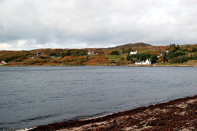
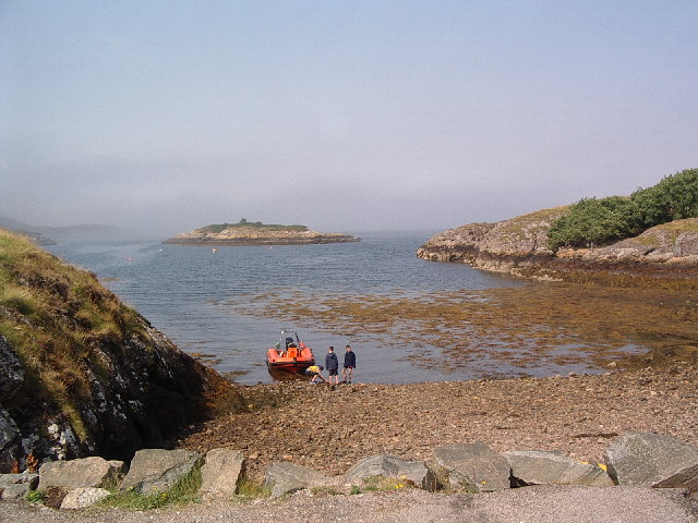
Cùil Lochain, located in Cromartyshire, is a picturesque bay nestled along the northeast coast of Scotland. Known for its natural beauty and tranquil atmosphere, this bay attracts locals and tourists alike.

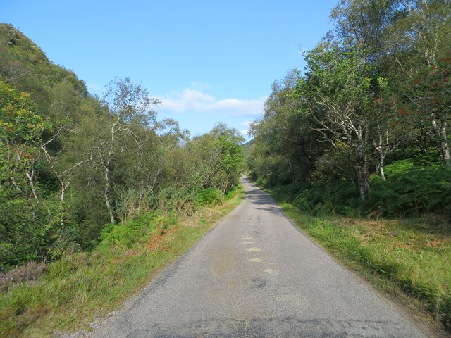
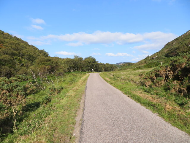
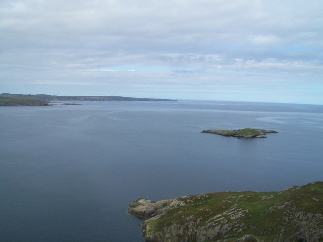
The bay is characterized by its stunning views of the North Sea, with its crystal-clear waters and rugged cliffs. The bay itself is relatively small, stretching only a few kilometers in length, but it offers a variety of recreational activities for visitors to enjoy. Fishing enthusiasts can cast their lines from the rocky shores, while nature lovers can explore the surrounding coastal paths and observe the diverse marine life.

Cùil Lochain is also home to a vibrant ecosystem, with several species of seabirds making their nests on the cliffs. Visitors can often spot fulmars, guillemots, and puffins, particularly during the breeding season. The bay is also a designated Special Protection Area, ensuring the preservation of its unique flora and fauna.

For those seeking a peaceful getaway, there are a few accommodation options available in the surrounding area. These include cozy guesthouses and self-catering cottages, providing visitors with a comfortable base to explore the bay and its surroundings. Additionally, the nearby town of Cromarty offers a range of amenities, including restaurants, shops, and historical attractions.

Cùil Lochain is a true gem on Scotland's northeast coast, offering visitors a chance to immerse themselves in nature and experience the tranquility of this idyllic bay.

If you have any feedback on the listing, please let us know in the comments section below.

Cùil Lochain Images

Images are sourced within 2km of 58.098071/-5.2770871 or Grid Reference NC0616. Thanks to Geograph Open Source API. All images are credited.

Rocky outcrop near Inverkirkaig
View north across rocky slopes near Inverkirkaig
View north-west from rocky slopes near Inverkirkaig
Assynt shore After crossing the weir at the mouth of the Allt Gleann an t-Stathain, we walked across to Rubha a'Bhrocaire, which is not an island except at the highest tides. Its western part is in the square, as is the whole of the island on the right (Eilean Mòineseach) and a small part of the island on the left (Eilean Mòr).
Assynt shore
After crossing the weir at the mouth of the Allt Gleann an t-Stathain, we walked across to Rubha a'Bhrocaire, which is not an island except at the highest tides. Its western part is in the square, as is the whole of the island on the right (Eilean Mòineseach) and a small part of the island on the left (Eilean Mòr).
Loch an Eisg Brachaidh
Loch an Eisg - Brachaidh A sheltered sea loch, around the edge of which is possibly the 'maddest' section of the 'mad wee road' that twists and turns its way south from Lochinver. Here the single track road creeps around rocky bluffs and with just a stone wall in places to prevent a drop into the sea. At least there's no 30mph limit though.
Loch an Eisg - Brachaidh
A sheltered sea loch, around the edge of which is possibly the 'maddest' section of the 'mad wee road' that twists and turns its way south from Lochinver. Here the single track road creeps around rocky bluffs and with just a stone wall in places to prevent a drop into the sea. At least there's no 30mph limit though.
Track down to the shore Track on the Inverpolly Estate. The sheltered inlet here is unnamed on the map.
Track down to the shore
Track on the Inverpolly Estate. The sheltered inlet here is unnamed on the map.
Track over Rubha Phollaidh
Weir, Lochan Sàl
Weir, Lochan Sàl
Coastline below Gleann Lochan Sàl
Poll Loisgann
Poll Loisgann
Loch an Eisg-brachaidh
Sgeir nam Boc
Sgeir nam Boc
Loch an Eisg Brachaidh
Poll Loisgann Beach at Poll Loisgann. Someone had done a good job cleaning the beach of plastics etc and stored it all under an old net for later collection perhaps.
Poll Loisgann
Beach at Poll Loisgann. Someone had done a good job cleaning the beach of plastics etc and stored it all under an old net for later collection perhaps.
Tree-lined minor road beside Allt Gleann an t-Strathain Looking north-westward.
Tree-lined minor road beside Allt Gleann an t-Strathain
Looking north-westward.
Minor road beside Allt Gleann an t-Strathain Looking south-eastward.
Minor road beside Allt Gleann an t-Strathain
Looking south-eastward.
Minor road beside Allt Gleann an t-Strathain Looking north-westward.
Minor road beside Allt Gleann an t-Strathain
Looking north-westward.
Show me another place!

Cùil Lochain is located at Grid Ref: NC0616 (Lat: 58.098071, Lng: -5.2770871)

Unitary Authority: Highland

Police Authority: Highlands and Islands

What 3 Words

///delighted.prepared.lowest. Near Clachtoll, Highland

Related Wikis

Loch Kirkaig

Loch Kirkaig is a small tidal sea loch, located in the region and parish of Assynt in south-west of Sutherland, in the west coast of Scotland and in the...

Inverkirkaig

Inverkirkaig (Scottish Gaelic: Inbhir Chirceig) is extremely remote scattered crofting township, situated on the north eastern bay, of the sea loch Loch...

Enard Bay

Enard Bay is a large remote tidal coastal embayment, located 10.5 miles northwest of Ullapool, in northwestern Ross and Cromarty, Scottish Highlands in...

Falls of Kirkaig

The Falls of Kirkaig are a waterfall in the Northwest Highlands of Scotland in the county of Sutherland. The fall is located on the River Kirkaig, south...

Badnaban

Badnaban is a remote scattered coastal village, which lies on the south shore of the sea loch, Loch Inver, in the Assynt district of the west coast of...

Strathan, Sutherland

Strathan is a remote scattered coastal village, located in Bàgh an t-strathain Bay, which lies on the south shore of the sea loch, Loch Inver, in the Assynt...

Loch Inver

Loch Inver is a 3.62-kilometre-long (1+61⁄64-nautical-mile) sea loch in Assynt, Sutherland and is on the northwest coast of Scotland. The loch meets the...

Lochinver

Lochinver (Loch an Inbhir in Gaelic) is a village that is located at the head of the sea loch Loch Inver, on the coast in the Assynt district of Sutherland...

Nearby Amenities

Located within 500m of 58.098071,-5.2770871
Source: PGS
Lat/Long: 58.1020705/-5.2790198
Source: PGS
Lat/Long: 58.1004352/-5.2792617
Source: PGS
Lat/Long: 58.0998501/-5.2767215
Source: PGS
Lat/Long: 58.1007988/-5.2715046
Source: PGS
Lat/Long: 58.1006132/-5.2715125
Source: PGS
Lat/Long: 58.1002732/-5.2714779
Created By: almien_coastlines
Source: PGS
Lat/Long: 58.099752/-5.271212
Source: PGS
Lat/Long: 58.0995707/-5.2713187
Source: PGS
Lat/Long: 58.0983553/-5.2720549
Source: PGS
Lat/Long: 58.0984086/-5.2722972
Source: PGS
Lat/Long: 58.0988937/-5.2724676
Source: PGS
Lat/Long: 58.0990161/-5.2725109
Source: PGS
Lat/Long: 58.0984929/-5.2732746
Source: PGS
Lat/Long: 58.0982901/-5.2732406
Source: PGS
Lat/Long: 58.0980717/-5.2735345
Source: PGS
Lat/Long: 58.0978427/-5.2740655
Source: PGS
Lat/Long: 58.0973395/-5.27446
Source: PGS
Lat/Long: 58.0969829/-5.2754638
Source: PGS
Lat/Long: 58.0965775/-5.2758182
Source: PGS
Lat/Long: 58.0964328/-5.2764777
Source: PGS
Lat/Long: 58.0963484/-5.2765982
Source: PGS
Lat/Long: 58.0955401/-5.2757642
Source: PGS
Lat/Long: 58.0954417/-5.2757317
Source: PGS
Lat/Long: 58.0954062/-5.2770033
Source: PGS
Lat/Long: 58.0953925/-5.2772297
Source: PGS
Lat/Long: 58.0953574/-5.2774516
Source: PGS
Lat/Long: 58.0950243/-5.2777354
Source: PGS
Lat/Long: 58.0951126/-5.2781435
Source: PGS
Lat/Long: 58.0949056/-5.279665
Source: PGS
Lat/Long: 58.0949281/-5.2798815
Source: PGS
Lat/Long: 58.0949681/-5.2803743
Source: PGS
Lat/Long: 58.0952514/-5.2807137
Source: PGS
Lat/Long: 58.0952402/-5.2814452
Source: PGS
Lat/Long: 58.0949553/-5.2818891
Source: PGS
Lat/Long: 58.0946088/-5.2820365
Source: PGS
Lat/Long: 58.0944451/-5.2814746
Source: PGS
Lat/Long: 58.094147/-5.2806598
Cuil Lochain
Natural: bay
Lat/Long: 58.0996655/-5.2739096
The data included in this document is from www.openstreetmap.org. The data is made available under ODbL.

Have you been to Cùil Lochain?

Leave your review of Cùil Lochain below (or comments, questions and feedback).