Cairn Pool

Bay in Wigtownshire

Scotland

Cairn Pool

The old military pier and breaker's yard at Cairnryan This pier and breaker's yard just to the north of Cairnryan is where the aircraft carrier Ark Royal (IV) was sent for decommissioning and breaking in the late 1970s. It has since been used as a commercial pier, but has collapsed in places and is too dangerous for use now.
The old military pier and breaker's yard at Cairnryan Credit: Colin McDonald

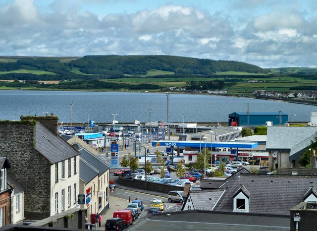
Cairn Pool, located in Wigtownshire, Scotland, is a picturesque bay that offers stunning natural beauty and diverse marine life. Situated on the western coastline, it is a popular destination for locals and tourists alike, attracting visitors with its tranquil atmosphere and breathtaking views.

The bay is characterized by its sandy beach, which stretches for approximately one mile, providing ample space for sunbathing, picnicking, and leisurely walks. The soft golden sand is perfect for children to play and build sandcastles, making it an ideal spot for families. The calm waters of Cairn Pool also make it suitable for swimming and various water activities, such as kayaking and paddleboarding.

One of the key features of Cairn Pool is its rich marine ecosystem. The bay is home to a wide range of marine species, including seals, dolphins, and a variety of seabirds. These inhabitants make it a popular spot for wildlife enthusiasts and birdwatchers. During low tide, visitors can explore the rock pools that emerge, revealing an array of fascinating marine life such as crabs, starfish, and small fish.

Cairn Pool is also steeped in history, with remnants of ancient settlements and burial sites found in the surrounding area. The bay's name itself is derived from the Gaelic word "cairn," meaning a pile of stones, suggesting the presence of such structures in the past.

Overall, Cairn Pool offers a serene and idyllic escape, combining natural beauty, recreational opportunities, and a glimpse into the region's history. Whether one seeks relaxation, adventure, or an appreciation of nature, this bay has something to offer to all who visit.

If you have any feedback on the listing, please let us know in the comments section below.

Cairn Pool Images

Images are sourced within 2km of 54.96876/-5.0253724 or Grid Reference NX0667. Thanks to Geograph Open Source API. All images are credited.

The old military pier and breaker's yard at Cairnryan This pier and breaker's yard just to the north of Cairnryan is where the aircraft carrier Ark Royal (IV) was sent for decommissioning and breaking in the late 1970s. It has since been used as a commercial pier, but has collapsed in places and is too dangerous for use now.
The old military pier and breaker's yard at Cairnryan
This pier and breaker's yard just to the north of Cairnryan is where the aircraft carrier Ark Royal (IV) was sent for decommissioning and breaking in the late 1970s. It has since been used as a commercial pier, but has collapsed in places and is too dangerous for use now.
Cairn Hill overlooking the village of Cairnryan. This hill dominates the village of Cairnryan about 6 miles North of Stranraer.
Cairn Hill overlooking the village of Cairnryan.
This hill dominates the village of Cairnryan about 6 miles North of Stranraer.
Cairnryan Ferry Port Ferry about to leave the port of Cairnryan for Larne in Northern Ireland
Cairnryan Ferry Port
Ferry about to leave the port of Cairnryan for Larne in Northern Ireland
The foreshore north of Cairn Point
Unloading Vehicles The P&O European Highlander has just arrived from Larne, Northern Ireland and is seen unloading commercial vehicles.
Unloading Vehicles
The P&O European Highlander has just arrived from Larne, Northern Ireland and is seen unloading commercial vehicles.
Mulberry Harbour 'Beetles' at Old House Point, Loch Ryan
Loch Ryan Old House Point, Mulberry Harbour 'Beetles'
Lighthouse at Cairn Point Lighthouse at Cairn Point, viewed from the European Causeway which is leaving Cairnryan for Larne.
Lighthouse at Cairn Point
Lighthouse at Cairn Point, viewed from the European Causeway which is leaving Cairnryan for Larne.
Cairn Point Pier and Lighthouse Cairn Point Pier and Lighthouse
Cairn Point Pier and Lighthouse
Old Pier Old Pier at Cairn Point
Old Pier
Old Pier at Cairn Point
A P&O Ferry in Lochryan sailing to Larne and silhouetted against the setting sun. This photo was taken between Cairn Point and Old House Point, North of Cairnryan at sunset on 12th April 2007.
A P&O Ferry in Lochryan sailing to Larne and silhouetted against the setting sun.
This photo was taken between Cairn Point and Old House Point, North of Cairnryan at sunset on 12th April 2007.
European Causeway P&O ferry from Larne arriving at Cairnryan
European Causeway
P&O ferry from Larne arriving at Cairnryan
Loch Ryan Shore The loch doesn't boast sandy beaches, as these rocks and stones testify, however the waves caused by the passing HSS ferry more than make up for this entertainment. The unusual positioning is due to the deep water channels as the ship heads across to mid-channel at Milleur Point, at the head of Loch Ryan.
Loch Ryan Shore
The loch doesn't boast sandy beaches, as these rocks and stones testify, however the waves caused by the passing HSS ferry more than make up for this entertainment. The unusual positioning is due to the deep water channels as the ship heads across to mid-channel at Milleur Point, at the head of Loch Ryan.
Looking to the west over Loch Ryan. A dredger can be seen at work in the distance.
Looking to the west over Loch Ryan.
A dredger can be seen at work in the distance.
Containers on the dockside at Cairnryan.
Looking northwards up Loch Ryan.
Cairnryan - a very busy port. A good service to and fro from Scotland to Northern Ireland runs throughout the year.
Cairnryan - a very busy port.
A good service to and fro from Scotland to Northern Ireland runs throughout the year.
Cairnryan Ferry Terminal The 'European Highlander' at the quayside at Cairnryan.
Cairnryan Ferry Terminal
The 'European Highlander' at the quayside at Cairnryan.
Show me another place!

Cairn Pool is located at Grid Ref: NX0667 (Lat: 54.96876, Lng: -5.0253724)

Unitary Authority: Dumfries and Galloway

Police Authority: Dumfries and Galloway

What 3 Words

///forgiven.overture.rugs. Near Cairnryan, Dumfries & Galloway

Nearby Locations

Cairn Pool

Related Wikis

Cairnryan

Cairnryan (Scots: The Cairn; Scottish Gaelic: Càrn Rìoghain or Machair an Sgithich) is a village in the historical county of Wigtownshire, Dumfries and...

Cairnryan Harbour

Cairnryan Harbour is a roll-on ferry terminal on Loch Ryan in south west Scotland north of Stranraer. In World War II it was developed as an emergency...

Loch Ryan

Loch Ryan (Scottish Gaelic: Loch Rìoghaine, pronounced [l̪ˠɔx ˈrˠiː.ɛɲə]) is a Scottish sea loch that acts as an important natural harbour for shipping...

RAF Wig Bay

Royal Air Force Wig Bay, or more simply RAF Wig Bay, is a former Royal Air Force station near Stranraer, Dumfries and Galloway, Scotland The following...

Kirkcolm

Kirkcolm (Scots: Kirkcoam) is a village and civil parish on the northern tip of the Rhinns of Galloway peninsula, south-west Scotland. It is in Dumfries...

Inch, Dumfries and Galloway

Inch is a civil parish in Dumfries and Galloway, southwest Scotland. It lies on the shore of Loch Ryan, in the traditional county of Wigtownshire.The...

Leswalt

Leswalt (Scottish Gaelic: Lios Uillt) is a village and civil parish in Dumfries and Galloway, south-west Scotland. It lies between Portpatrick and Stranraer...

Penwhirn Reservoir

Penwhirn Reservoir, is a reservoir in Dumfries and Galloway, Scotland, approximately 3.5 miles (6 km) east of Cairnryan. The reservoir was built in the...

Nearby Amenities

Located within 500m of 54.96876,-5.0253724
Source: PGS
Lat/Long: 54.9687994/-5.0239542
Source: PGS
Lat/Long: 54.9688888/-5.0237209
Source: PGS
Lat/Long: 54.9730047/-5.0239089
Source: PGS
Lat/Long: 54.9726904/-5.0233154
Source: PGS
Lat/Long: 54.9724086/-5.022811
Source: PGS
Lat/Long: 54.9720649/-5.0221986
Source: PGS
Lat/Long: 54.9717413/-5.0216699
Source: PGS
Lat/Long: 54.971379/-5.0209739
Source: PGS
Lat/Long: 54.9712667/-5.0207395
Source: PGS
Lat/Long: 54.971118/-5.0204616
Source: PGS
Lat/Long: 54.9707418/-5.019736
Source: PGS
Lat/Long: 54.9705358/-5.0193799
Source: PGS
Lat/Long: 54.9702463/-5.0189591
Source: PGS
Lat/Long: 54.9697926/-5.0185032
Source: PGS
Lat/Long: 54.9690989/-5.0179988
Crossing
Crossing: island
Lat/Long: 54.9706653/-5.0191547
Bus Stop
Post Office
Naptan AtcoCode: 680000265501
Naptan Bearing: NW
Naptan CommonName: Post Office
Naptan Indicator: opp PO
Naptan Landmark: Post Office
Naptan NaptanCode: 34237268
Naptan Notes: none
Naptan Street: Main Road
Naptan Verified: no
Source: naptan_import
Lat/Long: 54.9709711/-5.0199663
Bus Stop
Post Office
Naptan AtcoCode: 680000265502
Naptan Bearing: SE
Naptan CommonName: Post Office
Naptan Indicator: o/s PO
Naptan Landmark: Post Office
Naptan NaptanCode: 34237267
Naptan Notes: none
Naptan Street: Main Road
Naptan Verified: no
Source: naptan_import
Lat/Long: 54.9710725/-5.0198645
Post Box
Brand: Royal Mail
Brand Wikidata: Q638098
Operator: Royal Mail
Operator Wikidata: Q638098
Post Box Mounting: pier
Post Box Type: lamp
Ref: DG9 36
Source: survey
Survey Date: 2021-12-19
Wikimedia Commons: File:Cairnryan village - (3) - geograph.org.uk - 2904901.jpg
Lat/Long: 54.9711255/-5.0198356
The data included in this document is from www.openstreetmap.org. The data is made available under ODbL.

Have you been to Cairn Pool?

Leave your review of Cairn Pool below (or comments, questions and feedback).