Cairnsim Bay

Bay in Wigtownshire

Scotland

Cairnsim Bay

Sea Cave, North end of Cairgarroch Bay
Sea Cave, North end of Cairgarroch Bay Credit: Tony Page

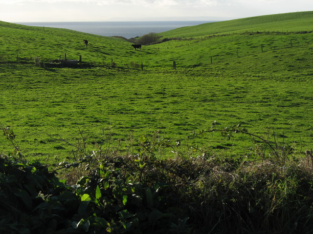
Cairnsmore Bay, located in Wigtownshire, Scotland, is a picturesque bay nestled along the southern coast of the country. This bay is part of the larger Solway Firth, a body of water known for its natural beauty and diverse wildlife.

Cairnsmore Bay is known for its stunning sandy beaches, which stretch for approximately two miles along the coastline. The bay offers breathtaking views of the surrounding hills and cliffs, creating a serene and idyllic setting. The pristine waters of the bay are also a haven for various marine species, making it a popular spot for birdwatching and wildlife enthusiasts.

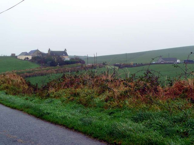
The bay's location near the town of Newton Stewart provides visitors with easy access to amenities and accommodations. The area offers a range of activities for both locals and tourists, including scenic walks along the coastal path, fishing, and water sports such as kayaking and windsurfing.

Cairnsmore Bay is also rich in history and is home to several notable landmarks. One such landmark is the Cairnsmore of Fleet, a prominent hill that stands at 711 meters and offers panoramic views of the bay and surrounding countryside. Additionally, the bay is close to the popular Wigtown Bay Nature Reserve, a protected area renowned for its diverse bird population and wetland habitats.

Overall, Cairnsmore Bay in Wigtownshire is a hidden gem, offering visitors a perfect blend of natural beauty, outdoor activities, and historical landmarks. Whether one seeks relaxation, adventure, or an opportunity to connect with nature, Cairnsmore Bay is a destination worth exploring.

If you have any feedback on the listing, please let us know in the comments section below.

Cairnsim Bay Images

Images are sourced within 2km of 54.812786/-5.0674795 or Grid Reference NX0250. Thanks to Geograph Open Source API. All images are credited.

Sea Cave, North end of Cairgarroch Bay
Not a tank on the lawn! But a Husqvarna Automower 435X AWD on the lawn at Knockinaam Lodge.
'Designed for rough terrain and steep hills, the Husqvarna Automower 435X AWD is loaded with features including all-wheel drive, Bluetooth, cellular, and GPS technologies, a pivoting rear end, and an ultra-quiet battery-powered motor.'
<span class="nowrap"><a title="https://uk.pcmag.com/home-security-products/127908/husqvarna-automower-435x-awd" rel="nofollow ugc noopener" href="https://uk.pcmag.com/home-security-products/127908/husqvarna-automower-435x-awd">Link</a><img style="margin-left:2px;" alt="External link" title="External link - shift click to open in new window" src="https://s1.geograph.org.uk/img/external.png" width="10" height="10"/></span>
Not a tank on the lawn!
But a Husqvarna Automower 435X AWD on the lawn at Knockinaam Lodge. 'Designed for rough terrain and steep hills, the Husqvarna Automower 435X AWD is loaded with features including all-wheel drive, Bluetooth, cellular, and GPS technologies, a pivoting rear end, and an ultra-quiet battery-powered motor.' LinkExternal link
Knockinaam Lodge Hotel '19th century country house hotel, fully restored to create a stylish and relaxed ambience for our guests as they enjoy stunning scenery and food served in our 3 AA rosette restaurant.'
<span class="nowrap"><a title="https://www.knockinaamlodge.com/" rel="nofollow ugc noopener" href="https://www.knockinaamlodge.com/">Link</a><img style="margin-left:2px;" alt="External link" title="External link - shift click to open in new window" src="https://s1.geograph.org.uk/img/external.png" width="10" height="10"/></span>
The odd 'box' on the lawn is in fact a mower! 
See <a title="https://www.geograph.org.uk/photo/7284516" href="https://www.geograph.org.uk/photo/7284516">Link</a>
Knockinaam Lodge Hotel
'19th century country house hotel, fully restored to create a stylish and relaxed ambience for our guests as they enjoy stunning scenery and food served in our 3 AA rosette restaurant.' LinkExternal link The odd 'box' on the lawn is in fact a mower! See Link
Spittal House Farm South east of the Port of Spittal Burn that flows into Port of Spittal Bay.
The Caledonian Cheese Company is based in Stranraer.
Spittal House Farm
South east of the Port of Spittal Burn that flows into Port of Spittal Bay. The Caledonian Cheese Company is based in Stranraer.
Livestock transportation business, Port of Spittal
Portayew bay
Portayew bay
Portayew Burn The Antrim Mountains (approxiamtely 60km) can be seen on the horizon.
Portayew Burn
The Antrim Mountains (approxiamtely 60km) can be seen on the horizon.
Spittal farmland and road bend
Port of Spittal & Knockinaam Lodge
Port of Spittal cliffs
Houses at Kirklauchline
Meoul Croft roadend
Meoul Croft roadend
Misty day in The Rhins Note:  also spelt 'Rhinns' but OS currently prefer one 'n'.
Misty day in The Rhins
Note: also spelt 'Rhinns' but OS currently prefer one 'n'.
Knockinaam Lodge Hotel Built as a hunting lodge in 1869 by Lady Hunter-Blair. Seen shortly before sunset.
Knockinaam Lodge Hotel
Built as a hunting lodge in 1869 by Lady Hunter-Blair. Seen shortly before sunset.
Knockinaam Lodge Hotel Seen from beside the steps down to the beach.
Knockinaam Lodge Hotel
Seen from beside the steps down to the beach.
Port of Spittal Bay Rocks of the Moffat Shale Group (Ordovician) form the cliffs at the northern end of the bay.
Port of Spittal Bay
Rocks of the Moffat Shale Group (Ordovician) form the cliffs at the northern end of the bay.
Port of Spittal Bay Looking south.
Port of Spittal Bay
Looking south.
Blue plaque commemorating Lieutenant Commander Malcolm David Wanklyn This plaque, erected by the Submariners Association, on the wall of Knockinaam Lodge, reads:

SUBMARINERS   ASSOCIATION

LIEUTENANT COMMANDER
MALCOLM DAVID WANKLYN
VC, DSO**, Royal Navy
Learned to shoot and fish here

Awarded the VC for his actions in command of
HM Submarine Upholder on 24th May 1941
operating off the coast of Sicily. Without
working Asdic he skilfully penetrated a heavily
defended convoy & sank a large troop transport.
In 25 further Mediterranean patrols he
achieved a very high attrition record against
enemy targets, sinking in excess of
130,000 tons of shipping.
He was lost with Upholder in April 1942.
Blue plaque commemorating Lieutenant Commander Malcolm David Wanklyn
This plaque, erected by the Submariners Association, on the wall of Knockinaam Lodge, reads: SUBMARINERS ASSOCIATION LIEUTENANT COMMANDER MALCOLM DAVID WANKLYN VC, DSO**, Royal Navy Learned to shoot and fish here Awarded the VC for his actions in command of HM Submarine Upholder on 24th May 1941 operating off the coast of Sicily. Without working Asdic he skilfully penetrated a heavily defended convoy & sank a large troop transport. In 25 further Mediterranean patrols he achieved a very high attrition record against enemy targets, sinking in excess of 130,000 tons of shipping. He was lost with Upholder in April 1942.
Show me another place!

Cairnsim Bay is located at Grid Ref: NX0250 (Lat: 54.812786, Lng: -5.0674795)

Unitary Authority: Dumfries and Galloway

Police Authority: Dumfries and Galloway

What 3 Words

///spilled.starfish.relaxed. Near Stranraer, Dumfries & Galloway

Related Wikis

Knockinaam Lodge

Knockinaam Lodge is a hotel and restaurant located about 3.5 miles South of Portpatrick, Dumfries & Galloway, Scotland. As of 2008, the restaurant holds...

Dunskey Castle

Dunskey Castle is a ruined, 12th-century tower house or castle, located 0.5 miles (0.80 km) south of the village of Portpatrick, Rhinns, Wigtownshire,...

Colfin railway station

Colfin railway station, located in Wigtownshire, Scotland, between Portpatrick and Stranraer, was a station on the Portpatrick and Wigtownshire Joint Railway...

Dunskey

Dunskey Estate (also known as Portree Estate) is north of Portpatrick on the west coast of Scotland. The B-listed mansion dates from the start of the twentieth...

Portpatrick railway station

Portpatrick railway station was a railway station serving the village of Portpatrick, Dumfries & Galloway, Scotland. Opened in 1862 the station served...

Portpatrick

Portpatrick is a village and civil parish in the historical county of Wigtownshire, Dumfries and Galloway, Scotland. It is located on the west coast of...

Rhins of Galloway

The Rhins (or Rhinns) of Galloway is a double-headed peninsula in southwestern Scotland. It takes the form of a hammerhead projecting into the Irish Sea...

Stoneykirk

Stoneykirk (Scottish Gaelic: Eaglais Steafain) is an area and a village in the heart of the Rhins of Galloway, Wigtownshire, in the administrative council...

Nearby Amenities

Located within 500m of 54.812786,-5.0674795
Created By: dmgroom_coastlines
Source: PGS
Lat/Long: 54.815214/-5.073653
Created By: dmgroom_coastlines
Source: PGS
Lat/Long: 54.81509/-5.073426
Created By: dmgroom_coastlines
Source: PGS
Lat/Long: 54.814586/-5.072956
Created By: dmgroom_coastlines
Source: PGS
Lat/Long: 54.814461/-5.072727
Created By: dmgroom_coastlines
Source: PGS
Lat/Long: 54.81422/-5.071828
Created By: dmgroom_coastlines
Source: PGS
Lat/Long: 54.814108/-5.070935
Created By: dmgroom_coastlines
Source: PGS
Lat/Long: 54.8136/-5.070688
Created By: dmgroom_coastlines
Source: PGS
Lat/Long: 54.813475/-5.070459
Created By: dmgroom_coastlines
Source: PGS
Lat/Long: 54.813363/-5.069566
Created By: dmgroom_coastlines
Source: PGS
Lat/Long: 54.812851/-5.06954
Created By: dmgroom_coastlines
Source: PGS
Lat/Long: 54.812994/-5.06866
Created By: dmgroom_coastlines
Source: PGS
Lat/Long: 54.813001/-5.068217
Created By: dmgroom_coastlines
Source: PGS
Lat/Long: 54.812904/-5.066438
Created By: dmgroom_coastlines
Source: PGS
Lat/Long: 54.812396/-5.066191
Created By: dmgroom_coastlines
Source: PGS
Lat/Long: 54.811635/-5.065708
Created By: dmgroom_coastlines
Source: PGS
Lat/Long: 54.811511/-5.065479
Created By: dmgroom_coastlines
Source: PGS
Lat/Long: 54.811387/-5.065252
Created By: dmgroom_coastlines
Source: PGS
Lat/Long: 54.811262/-5.065023
Created By: dmgroom_coastlines
Source: PGS
Lat/Long: 54.811285/-5.063693
Created By: dmgroom_coastlines
Source: PGS
Lat/Long: 54.811292/-5.06325
Created By: dmgroom_coastlines
Source: PGS
Lat/Long: 54.811082/-5.060578
Created By: dmgroom_coastlines
Source: PGS
Lat/Long: 54.810958/-5.060351
The data included in this document is from www.openstreetmap.org. The data is made available under ODbL.

Have you been to Cairnsim Bay?

Leave your review of Cairnsim Bay below (or comments, questions and feedback).