Camas an Trusdair

Bay in Ross-shire

Scotland

Camas an Trusdair

Forest path, Beinn Eighe forest
Forest path, Beinn Eighe forest Credit: David Brown

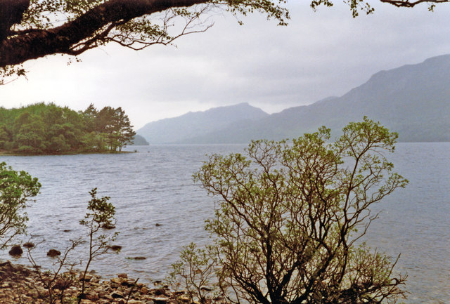
Camas an Trusdair, also known as Bay of Trudair, is a picturesque coastal area located in Ross-shire, Scotland. Situated on the eastern coast of the Highlands, this bay offers breathtaking views of the North Sea and a serene environment for visitors to enjoy.

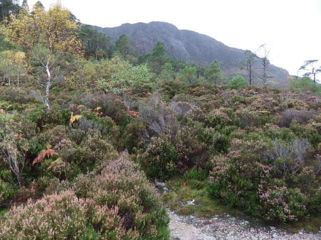
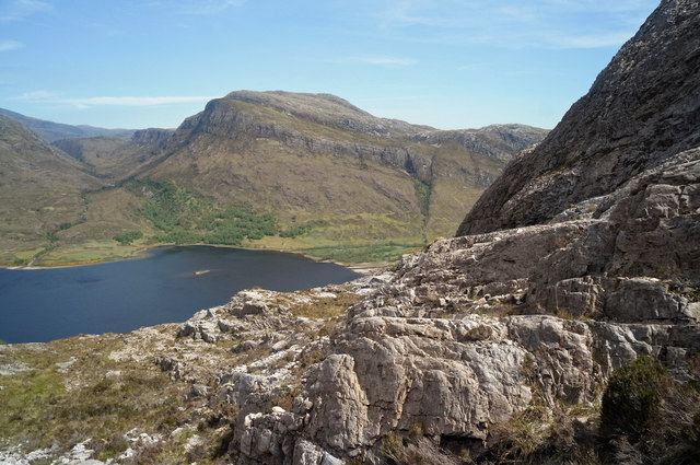
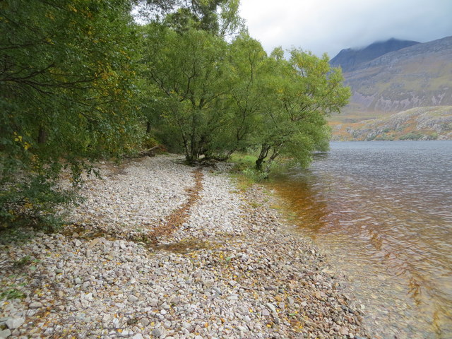
The bay is characterized by its sandy beaches, rocky cliffs, and clear blue waters, making it a popular destination for beachgoers and nature enthusiasts. The pristine beaches provide ample space for picnicking, sunbathing, and swimming during the warmer months.

The surrounding area is rich in wildlife and offers excellent opportunities for birdwatching. Visitors may be lucky enough to spot various seabird species, including gulls, puffins, and oystercatchers. The bay is also home to a diverse range of marine life, such as seals and dolphins, which can sometimes be seen swimming near the shore.

Camas an Trusdair is not only known for its natural beauty but also for its historical significance. The bay is situated near several ancient archaeological sites, including Pictish stone carvings and Iron Age settlements. These remnants of the past provide a fascinating glimpse into the area's rich cultural heritage.

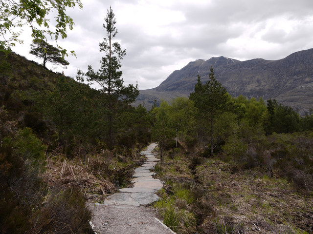
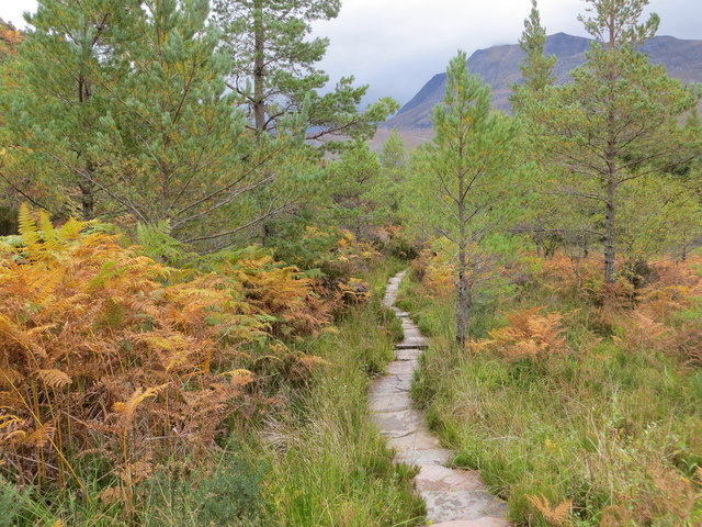
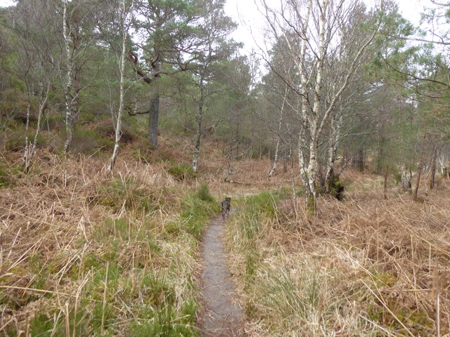
For those seeking outdoor adventures, the bay offers opportunities for coastal walks and hiking. The nearby hills and cliffs provide stunning panoramic views and challenging terrain for more experienced hikers.

Overall, Camas an Trusdair is a hidden gem along the Scottish coast, offering visitors a chance to connect with nature, explore history, and enjoy the tranquility of this breathtaking bay.

If you have any feedback on the listing, please let us know in the comments section below.

Camas an Trusdair Images

Images are sourced within 2km of 57.633465/-5.3289132 or Grid Reference NH0165. Thanks to Geograph Open Source API. All images are credited.

Forest path, Beinn Eighe forest
Forest burn
Forest burn
Paved path on Beinn Eighe National Nature Reserve There are two constructed and waymarked paths on the Beinn Eighe National Nature Reserve, the Woodland Trail and the Mountain Trail. Here, close to the A832, on the south side of the road the path has been re-routed and the two routes coincide now returning to the car park entirely on that side of the road. The massive stone slabs carry the way over an area of bog.
Paved path on Beinn Eighe National Nature Reserve
There are two constructed and waymarked paths on the Beinn Eighe National Nature Reserve, the Woodland Trail and the Mountain Trail. Here, close to the A832, on the south side of the road the path has been re-routed and the two routes coincide now returning to the car park entirely on that side of the road. The massive stone slabs carry the way over an area of bog.
Tree line The last sizeable Scots pine on this stretch of the mountain trail, at just over 300m. Loch Maree is below.
Tree line
The last sizeable Scots pine on this stretch of the mountain trail, at just over 300m. Loch Maree is below.
Loch Maree and pines A view from the high point of the woodland trail down the loch towards Meall Mheinnidh and Beinn Airigh Charr.
Loch Maree and pines
A view from the high point of the woodland trail down the loch towards Meall Mheinnidh and Beinn Airigh Charr.
Woodland trail, Coille na Glas-Leitire The Gaelic name means the 'wood of the grey slope', referring to the Cambrian quartzite rock of these hillsides. Here there is luxuriant growth at an altitude of less than 100m.
Woodland trail, Coille na Glas-Leitire
The Gaelic name means the 'wood of the grey slope', referring to the Cambrian quartzite rock of these hillsides. Here there is luxuriant growth at an altitude of less than 100m.
Dead pine The booklet for the Woodland Trail informs that Scots pines can live for 700 years or more, then take centuries after that to decay fully.
Dead pine
The booklet for the Woodland Trail informs that Scots pines can live for 700 years or more, then take centuries after that to decay fully.
NW on Loch Maree from Taagan Nature Trail parking place near Kinlochewe, 1994 View NW on A832 Achnasheen - Poolewe road, with slopes of Ben Venue (2,231 ft.) on the right and further back Slioch (3,217 ft.). (Cf. <a href="https://www.geograph.org.uk/photo/2268894">NH0065 : Gairloch : Glas Leitire</a>).
NW on Loch Maree from Taagan Nature Trail parking place near Kinlochewe, 1994
View NW on A832 Achnasheen - Poolewe road, with slopes of Ben Venue (2,231 ft.) on the right and further back Slioch (3,217 ft.). (Cf. NH0065 : Gairloch : Glas Leitire).
Cairns for marking the Mountain Trail Cairns abound in the steep section of the mountain trail.

The mountain trail is described in detail in <span class="nowrap"><a title="http://www.snh.org.uk/pdfs/publications/designatedareas/beinneighemounttrail.pdf" rel="nofollow ugc noopener" href="http://www.snh.org.uk/pdfs/publications/designatedareas/beinneighemounttrail.pdf">Link</a><img style="margin-left:2px;" alt="External link" title="External link - shift click to open in new window" src="https://s1.geograph.org.uk/img/external.png" width="10" height="10"/></span>
Cairns for marking the Mountain Trail
Cairns abound in the steep section of the mountain trail. The mountain trail is described in detail in LinkExternal link
Steep rock section of the Beinn Eighe Reserve Mountain Trail Cairns mark the way.

For more information on the Mountain Trail see <span class="nowrap"><a title="http://www.snh.org.uk/pdfs/publications/designatedareas/beinneighemounttrail.pdf" rel="nofollow ugc noopener" href="http://www.snh.org.uk/pdfs/publications/designatedareas/beinneighemounttrail.pdf">Link</a><img style="margin-left:2px;" alt="External link" title="External link - shift click to open in new window" src="https://s1.geograph.org.uk/img/external.png" width="10" height="10"/></span>
Steep rock section of the Beinn Eighe Reserve Mountain Trail
Cairns mark the way. For more information on the Mountain Trail see LinkExternal link
Way marker cairns on the Mountain Trail In the steep terrain, the cairns are reassuring. Loch Maree in the background.
Way marker cairns on the Mountain Trail
In the steep terrain, the cairns are reassuring. Loch Maree in the background.
East end of Loch Maree from the Mountain Trail And nearer at hand a steep path to gain height on the Mountain Trail.
East end of Loch Maree from the Mountain Trail
And nearer at hand a steep path to gain height on the Mountain Trail.
Descending to Loch Maree on the Mountain Trail Beautiful Scots Pine become more prominent as you descend.  Slioch ahead commands attention.
Descending to Loch Maree on the Mountain Trail
Beautiful Scots Pine become more prominent as you descend. Slioch ahead commands attention.
On the combined Mountain and Woodland Trail Walk Highlands and the signposts suggest that where the Mountain Trail joins the Woodland Trail the Woodland Trail be followed clockwise back to the car park.
On the combined Mountain and Woodland Trail
Walk Highlands and the signposts suggest that where the Mountain Trail joins the Woodland Trail the Woodland Trail be followed clockwise back to the car park.
On the Woodland Trail, Beinn Eighe Reserve For information on the trail read the booklet.  <span class="nowrap"><a title="http://www.snh.org.uk/pdfs/publications/designatedareas/Beinneighewoodtrail.pdf" rel="nofollow ugc noopener" href="http://www.snh.org.uk/pdfs/publications/designatedareas/Beinneighewoodtrail.pdf">Link</a><img style="margin-left:2px;" alt="External link" title="External link - shift click to open in new window" src="https://s1.geograph.org.uk/img/external.png" width="10" height="10"/></span>
On the Woodland Trail, Beinn Eighe Reserve
For information on the trail read the booklet. LinkExternal link
Shoreline path beside Loch Maree Looking north-westward.
Shoreline path beside Loch Maree
Looking north-westward.
Paved path through an area of Scots Pines Looking south-eastward.
Paved path through an area of Scots Pines
Looking south-eastward.
Path at Beinn Eighe National Nature Reserve
Show me another place!

Camas an Trusdair is located at Grid Ref: NH0165 (Lat: 57.633465, Lng: -5.3289132)

Unitary Authority: Highland

Police Authority: Highlands and Islands

What 3 Words

///lace.shops.removable. Near Kinlochewe, Highland

Related Wikis

Taagan

Taagan (Scottish Gaelic: Na Tathagan) is a hamlet in Ross and Cromarty, in the Highland council area of Scotland. It is situated about 2 km north west...

Anancaun

Anancaun (Scottish Gaelic: Àth nan Ceann) is a small hamlet located in Ross-shire, Scotland, within the Scottish council area of Highland. == References ==

Cape Wrath Trail

Cape Wrath Trail is a hiking route that runs through the Scottish Highlands and along the west coast of Scotland. It is approximately 200 miles (321 km...

Kinlochewe

Kinlochewe (Scottish Gaelic: Ceann Loch Iù or Iùbh) is a village in Wester Ross in the Northwest Highlands of Scotland. It is in the parish of Gairloch...

Nearby Amenities

Located within 500m of 57.633465,-5.3289132
Ford: yes
Lat/Long: 57.6311505/-5.3252698
The data included in this document is from www.openstreetmap.org. The data is made available under ODbL.

Have you been to Camas an Trusdair?

Leave your review of Camas an Trusdair below (or comments, questions and feedback).