Rhu Nòa

Bay in Ross-shire

Scotland

Rhu Nòa

The eastern side of Loch Allt an Daraich Cliffs drop straight into the waters of the loch. Ruadh-stac Mòr makes its presence felt in the distance.
The eastern side of Loch Allt an Daraich Credit: Nigel Brown

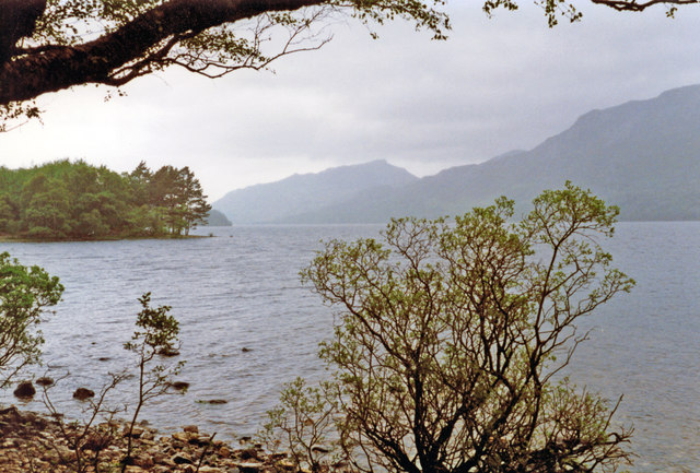
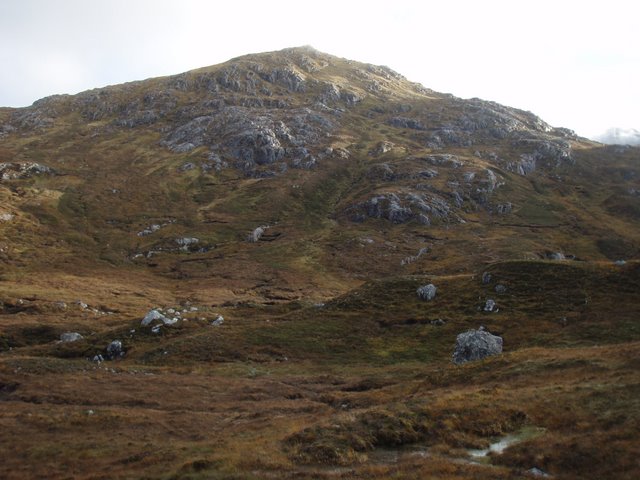
Rhu Nòa, located in Ross-shire, Scotland, is a stunning bay renowned for its natural beauty and picturesque landscapes. Situated on the east coast of the Highland Peninsula, this bay is a popular destination for visitors seeking tranquility and breathtaking views.

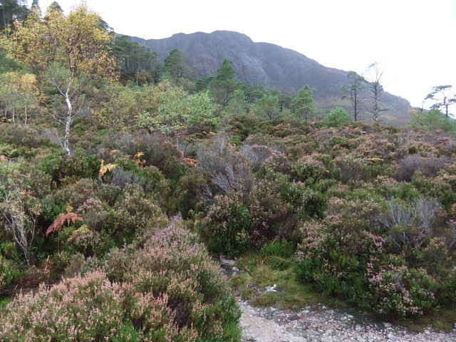
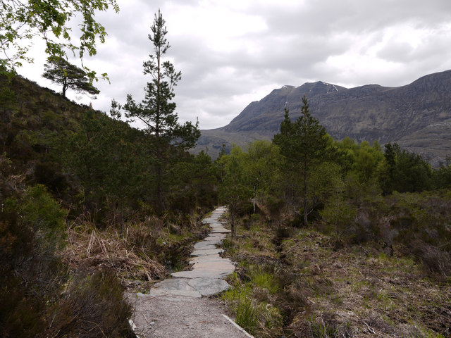
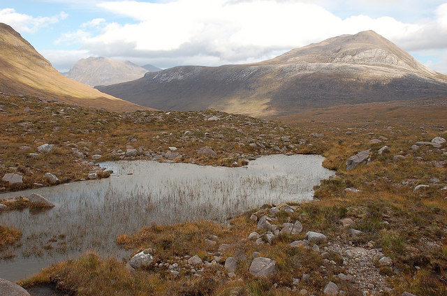
Rhu Nòa is characterized by its pristine sandy beaches, crystal-clear turquoise waters, and dramatic cliffs that provide a dramatic backdrop against the sea. The bay is nestled amidst lush green hills, adding to its charm and creating a peaceful atmosphere. The bay's secluded location makes it an ideal spot for those seeking a quiet retreat away from the bustling city life.

The bay is not only visually appealing but also boasts a rich marine ecosystem. It is home to a diverse range of flora and fauna, making it a popular destination for nature enthusiasts and birdwatchers. Visitors can spot various bird species such as gannets, puffins, and terns. The bay is also a haven for seals, which can often be seen lounging on the rocks or swimming in the bay.

For those interested in water activities, Rhu Nòa offers opportunities for kayaking, paddleboarding, and swimming in its calm waters. The bay is also a popular spot for fishing, with anglers drawn to its abundance of fish species.

Overall, Rhu Nòa in Ross-shire is a hidden gem, offering visitors a chance to immerse themselves in nature's beauty while enjoying various outdoor activities. Whether it's strolling along the beach, exploring the cliffs, or simply taking in the breathtaking views, Rhu Nòa is a must-visit destination for nature lovers and those seeking tranquility.

If you have any feedback on the listing, please let us know in the comments section below.

Rhu Nòa Images

Images are sourced within 2km of 57.628058/-5.3420407 or Grid Reference NH0064. Thanks to Geograph Open Source API. All images are credited.

The eastern side of Loch Allt an Daraich Cliffs drop straight into the waters of the loch. Ruadh-stac Mòr makes its presence felt in the distance.
The eastern side of Loch Allt an Daraich
Cliffs drop straight into the waters of the loch. Ruadh-stac Mòr makes its presence felt in the distance.
Meall a' Ghiuthais Seen from the viewpoint on the Mountain Trail.
Meall a' Ghiuthais
Seen from the viewpoint on the Mountain Trail.
View from the Mountain Trail Looking over Loch Maree to Meall a' Mhùinidh rising beyond.
View from the Mountain Trail
Looking over Loch Maree to Meall a' Mhùinidh rising beyond.
Forest path, Beinn Eighe forest
Forest burn
Forest burn
Quarzite slabs with perched boulders The mountain, Meall a' Ghiubhais has extensive exposures of rock on its upper slopes. The view is from the 'Mountain Trail' on the Beinn Eighe National Nature Reserve. The obvious snow-patched mountain is Fionn Bheinn.
Quarzite slabs with perched boulders
The mountain, Meall a' Ghiubhais has extensive exposures of rock on its upper slopes. The view is from the 'Mountain Trail' on the Beinn Eighe National Nature Reserve. The obvious snow-patched mountain is Fionn Bheinn.
Cairn and perched boulder beside mountain path The path is the 'Mountain Trail' on the Beinn Eighe National Nature Reserve. The path has surely been realigned as the location of the camera as assessed by GPS receiver doesn't coincide with the line on the map. Slioch is the mountain which lies beyond the inky darkness of Loch Maree.
Cairn and perched boulder beside mountain path
The path is the 'Mountain Trail' on the Beinn Eighe National Nature Reserve. The path has surely been realigned as the location of the camera as assessed by GPS receiver doesn't coincide with the line on the map. Slioch is the mountain which lies beyond the inky darkness of Loch Maree.
Paved path on Beinn Eighe National Nature Reserve There are two constructed and waymarked paths on the Beinn Eighe National Nature Reserve, the Woodland Trail and the Mountain Trail. Here, close to the A832, on the south side of the road the path has been re-routed and the two routes coincide now returning to the car park entirely on that side of the road. The massive stone slabs carry the way over an area of bog.
Paved path on Beinn Eighe National Nature Reserve
There are two constructed and waymarked paths on the Beinn Eighe National Nature Reserve, the Woodland Trail and the Mountain Trail. Here, close to the A832, on the south side of the road the path has been re-routed and the two routes coincide now returning to the car park entirely on that side of the road. The massive stone slabs carry the way over an area of bog.
Woodland in valley of Allt na h-Airighe The gorge of the Allt na h-Airighe as seen from the 'Mountain Trail' of the Beinn Eighe National Nature Reserve.
Woodland in valley of Allt na h-Airighe
The gorge of the Allt na h-Airighe as seen from the 'Mountain Trail' of the Beinn Eighe National Nature Reserve.
Tree line The last sizeable Scots pine on this stretch of the mountain trail, at just over 300m. Loch Maree is below.
Tree line
The last sizeable Scots pine on this stretch of the mountain trail, at just over 300m. Loch Maree is below.
Upper parts of the mountain trail At a height of about 450m the trail is now on open hillside with patchy cover of heather on the quartzite rock. Across Loch Maree is Gleann Bianasdail which is one way in to the wilds of the Fisherfield Forest and its fine remote mountains.
Upper parts of the mountain trail
At a height of about 450m the trail is now on open hillside with patchy cover of heather on the quartzite rock. Across Loch Maree is Gleann Bianasdail which is one way in to the wilds of the Fisherfield Forest and its fine remote mountains.
Conservation cairn, mountain trail At 550m this is the highest point on the mountain trail and would be a good closer viewpoint for Beinn Eighe. However, the mist was showing no signs of lifting so we descended.
Conservation cairn, mountain trail
At 550m this is the highest point on the mountain trail and would be a good closer viewpoint for Beinn Eighe. However, the mist was showing no signs of lifting so we descended.
Loch Maree and pines A view from the high point of the woodland trail down the loch towards Meall Mheinnidh and Beinn Airigh Charr.
Loch Maree and pines
A view from the high point of the woodland trail down the loch towards Meall Mheinnidh and Beinn Airigh Charr.
Woodland trail, Coille na Glas-Leitire The Gaelic name means the 'wood of the grey slope', referring to the Cambrian quartzite rock of these hillsides. Here there is luxuriant growth at an altitude of less than 100m.
Woodland trail, Coille na Glas-Leitire
The Gaelic name means the 'wood of the grey slope', referring to the Cambrian quartzite rock of these hillsides. Here there is luxuriant growth at an altitude of less than 100m.
Dead pine The booklet for the Woodland Trail informs that Scots pines can live for 700 years or more, then take centuries after that to decay fully.
Dead pine
The booklet for the Woodland Trail informs that Scots pines can live for 700 years or more, then take centuries after that to decay fully.
Through the trees to Loch Maree
A 832 passing through Beinn Eighe National Nature Reserve
NW on Loch Maree from Taagan Nature Trail parking place near Kinlochewe, 1994 View NW on A832 Achnasheen - Poolewe road, with slopes of Ben Venue (2,231 ft.) on the right and further back Slioch (3,217 ft.). (Cf. <a href="https://www.geograph.org.uk/photo/2268894">NH0065 : Gairloch : Glas Leitire</a>).
NW on Loch Maree from Taagan Nature Trail parking place near Kinlochewe, 1994
View NW on A832 Achnasheen - Poolewe road, with slopes of Ben Venue (2,231 ft.) on the right and further back Slioch (3,217 ft.). (Cf. NH0065 : Gairloch : Glas Leitire).
Show me another place!

Rhu Nòa is located at Grid Ref: NH0064 (Lat: 57.628058, Lng: -5.3420407)

Unitary Authority: Highland

Police Authority: Highlands and Islands

What 3 Words

///slurping.mandolin.commenced. Near Kinlochewe, Highland

Related Wikis

Taagan

Taagan (Scottish Gaelic: Na Tathagan) is a hamlet in Ross and Cromarty, in the Highland council area of Scotland. It is situated about 2 km north west...

Anancaun

Anancaun (Scottish Gaelic: Àth nan Ceann) is a small hamlet located in Ross-shire, Scotland, within the Scottish council area of Highland. == References ==

Meall a' Ghiubhais

Meall a' Ghiubhais (887 m) is a mountain in the Northwest Highlands, Scotland. It lies in Wester Ross, close to the village of Kinlochewe. The mountain...

Cape Wrath Trail

Cape Wrath Trail is a hiking route that runs through the Scottish Highlands and along the west coast of Scotland. It is approximately 200 miles (321 km...

Kinlochewe

Kinlochewe (Scottish Gaelic: Ceann Loch Iù or Iùbh) is a village in Wester Ross in the Northwest Highlands of Scotland. It is in the parish of Gairloch...

Slioch

Slioch (Scottish Gaelic: Sleaghach) is a mountain in the Scottish Highlands situated in Wester Ross, eight kilometres north of the village of Kinlochewe...

Ruadh-stac Beag

Ruadh-stac Beag (896 m) is a mountain in the Northwest Highlands of Scotland. An outlier of the Munro Beinn Eighe but a mountain in its own right, it is...

Beinn Eighe

Beinn Eighe (Scottish Gaelic for 'file mountain') is a mountain massif in the Torridon area of Wester Ross in the Northwest Highlands of Scotland. Lying...

Have you been to Rhu Nòa?

Leave your review of Rhu Nòa below (or comments, questions and feedback).