Caladh Harbour

Bay in Argyllshire

Scotland

Caladh Harbour

The A8003 road out of Tighnabruaich Looking north from the lay-by at the Loch Riddon viewpoint, where the road peaks and starts to descend again..
The A8003 road out of Tighnabruaich Credit: Thomas Nugent

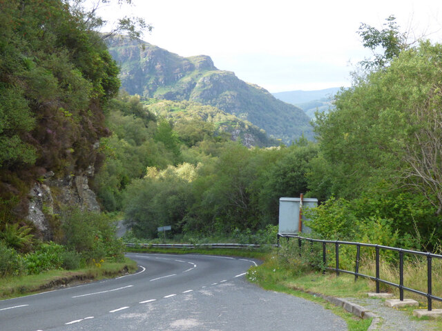
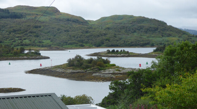
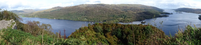
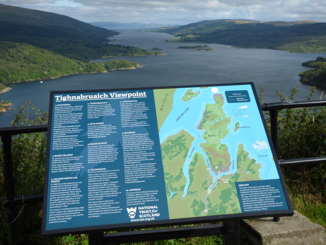
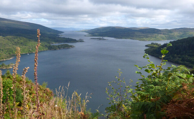
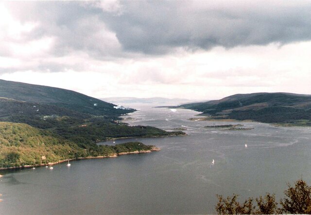
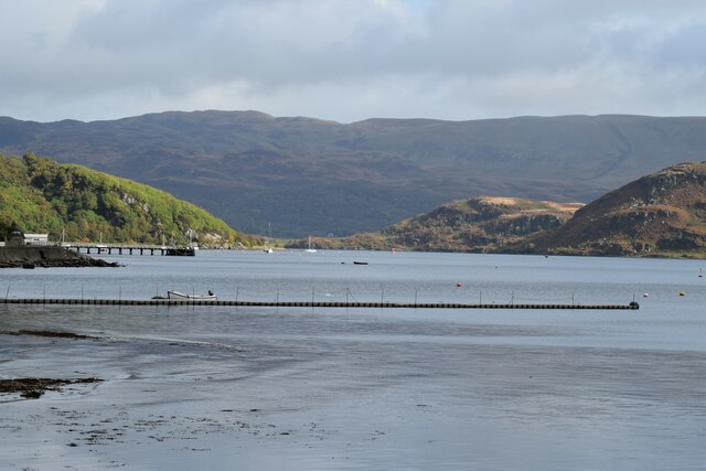
Caladh Harbour, located in Argyllshire, Scotland, is a picturesque bay known for its natural beauty and historical significance. Nestled along the western coast of Scotland, the bay offers stunning views of the surrounding landscape, including rolling hills, rugged cliffs, and the sparkling waters of the Atlantic Ocean.

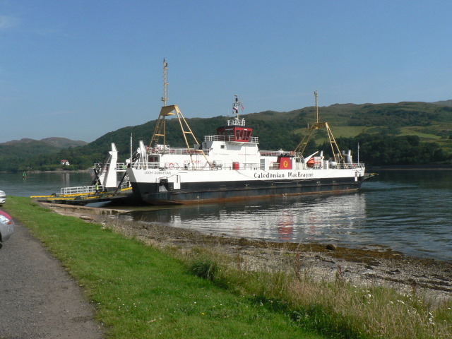
The bay is situated within the wider area of Argyll and Bute, which is renowned for its rich maritime history and cultural heritage. Caladh Harbour, in particular, has played a significant role in the region's past as a bustling fishing and trading port. Its sheltered waters and strategic location made it an ideal hub for maritime activities.

Today, Caladh Harbour continues to attract visitors and locals alike with its tranquil atmosphere and idyllic scenery. The bay is a popular spot for leisure activities such as boating, fishing, and wildlife watching. Its calm waters provide an excellent environment for water sports enthusiasts, making it an ideal destination for sailing and kayaking.

The surrounding area offers a range of amenities and attractions for visitors to enjoy. The nearby coastal village of Tarbert is renowned for its quaint charm, with its traditional whitewashed buildings, charming shops, and local eateries. The region is also home to a variety of wildlife, including seals, dolphins, and seabirds, making it a haven for nature enthusiasts.

In summary, Caladh Harbour is a picturesque bay in Argyllshire, Scotland, offering breathtaking views, a rich history, and a range of recreational activities. Whether it's exploring the bay's maritime heritage, enjoying water sports, or simply taking in the beauty of the natural surroundings, Caladh Harbour is a must-visit destination for those seeking a serene coastal experience.

If you have any feedback on the listing, please let us know in the comments section below.

Caladh Harbour Images

Images are sourced within 2km of 55.93386/-5.1960841 or Grid Reference NS0075. Thanks to Geograph Open Source API. All images are credited.

The A8003 road out of Tighnabruaich Looking north from the lay-by at the Loch Riddon viewpoint, where the road peaks and starts to descend again..
The A8003 road out of Tighnabruaich
Looking north from the lay-by at the Loch Riddon viewpoint, where the road peaks and starts to descend again..
The Kyles of Bute Looking towards the Isle of Bute and the Rhubodach ferry slipway from the B866 road at Glachavoil.
The Kyles of Bute
Looking towards the Isle of Bute and the Rhubodach ferry slipway from the B866 road at Glachavoil.
The Burnt Islands In the Kyles of Bute near Colintraive. Viewed from the B866 road at Glachavoil.
The Burnt Islands
In the Kyles of Bute near Colintraive. Viewed from the B866 road at Glachavoil.
The B866 road at Loch Riddon A patch of Skunk Cabbage can be seen on the left. See also <a href="https://www.geograph.org.uk/photo/6978368">NS0177 : Skunk Cabbage by the B866 road at Loch Riddon</a>.
The B866 road at Loch Riddon
A patch of Skunk Cabbage can be seen on the left. See also NS0177 : Skunk Cabbage by the B866 road at Loch Riddon.
Skunk Cabbage by the B866 road at Loch Riddon By the roadside near Eilean Dearg, see also <a href="https://www.geograph.org.uk/photo/6978366">NS0177 : The B866 road at Loch Riddon</a>.
Skunk Cabbage by the B866 road at Loch Riddon
By the roadside near Eilean Dearg, see also NS0177 : The B866 road at Loch Riddon.
Boulder above Loch Riddon Is the boulder a glacial erratic, or is it an exposure of country rock? It commands a fine view over Loch Riddon.
Boulder above Loch Riddon
Is the boulder a glacial erratic, or is it an exposure of country rock? It commands a fine view over Loch Riddon.
Loch Riddon and Kyles of Bute A fine view in 'panorama' format from the viewpoint above Loch Riddon, which is to the left, and includes the Kyles of Bute to the right.
Loch Riddon and Kyles of Bute
A fine view in 'panorama' format from the viewpoint above Loch Riddon, which is to the left, and includes the Kyles of Bute to the right.
Tighnabruaich Viewpoint Also known as Loch Ruel viewpoint, by the side of the A8003 road, around three miles from Tighnabruaich. Looking down the east side of the Kyles of Bute.
Tighnabruaich Viewpoint
Also known as Loch Ruel viewpoint, by the side of the A8003 road, around three miles from Tighnabruaich. Looking down the east side of the Kyles of Bute.
Loch Riddon and the Kyles of Bute As seen from the viewpoint by the A8003 road <a href="https://www.geograph.org.uk/photo/6997204">NS0077 : Tighnabruaich Viewpoint</a>.
Loch Riddon and the Kyles of Bute
As seen from the viewpoint by the A8003 road NS0077 : Tighnabruaich Viewpoint.
Loch Riddon, Kyles of Bute Rubha na Croiche at the north end of the Kyles of Bute.
Loch Riddon, Kyles of Bute
Rubha na Croiche at the north end of the Kyles of Bute.
West Kyle From Tighnabruaich
West Kyle
From Tighnabruaich
The A886 road Dropping down to Loch Riddon, with the 297m high Creagan Dubh in the distance.
The A886 road
Dropping down to Loch Riddon, with the 297m high Creagan Dubh in the distance.
Cruach a'Bhealaich Viewed from the A886 road.
Cruach a'Bhealaich
Viewed from the A886 road.
Cruach a'Bhealaich Viewed from the A886 road.
Cruach a'Bhealaich
Viewed from the A886 road.
A8003 heading to Tighnabruaich
A8003 north of Tighnabruaich
View to the Kyles of Bute
View indicator on the hill above Tighnabruaich
Show me another place!

Caladh Harbour is located at Grid Ref: NS0075 (Lat: 55.93386, Lng: -5.1960841)

Unitary Authority: Argyll and Bute

Police Authority: Argyll and West Dunbartonshire

What 3 Words

///miracle.pony.remaking. Near Port Bannatyne, Argyll & Bute

Nearby Locations

Caladh Harbour Eilean Dubh

Related Wikis

Eilean Dubh, Kyles of Bute

This particular Eilean Dubh (Scottish Gaelic: Black Island) is sometimes known as Glen Caladh Island and lies just off the Cowal peninsula in the Kyles...
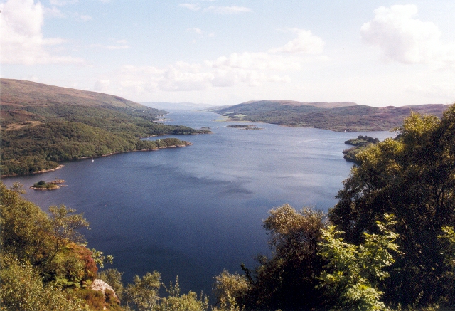
Kyles of Bute

The Kyles of Bute (Scottish Gaelic: Na Caoil Bhòdach) form a narrow sea channel that separates the northern end of the Isle of Bute from the Cowal peninsula...

Eilean Dearg, Loch Ruel

Eilean Dearg is a small island in Loch Ruel (or Loch Riddon) in Argyll, Scotland. The island was once home to a castle, which was destroyed by naval action...

Burnt Islands

The Burnt Islands (Scottish Gaelic: Na h-Eileanan Loisgte) are three small islands that lie in the Kyles of Bute, on the Cowal Peninsula, Argyll and Bute...

Loch Ruel

Loch Ruel or Loch Riddon; extends north from the Kyles of Bute and is a sea loch in Argyll and Bute, Scotland. == See also == River Ruel == References... ==

Colintraive

Colintraive (Scottish Gaelic: Caol an t-Snàimh) is a village in Argyll and Bute, Scotland. Once the site where cattle were swum across the narrows to the...
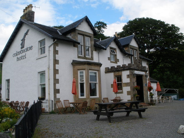
Colintraive Hotel

The Colintraive Hotel (also known as The Colintraive) is a hotel and pub in Colintraive, Argyll and Bute, Scotland. It was formerly a hunting lodge for...

Rhubodach

Rhubodach is a small settlement on the north-eastern shore of the Isle of Bute, Argyll and Bute, Scotland. The name rhubodach may come from the Gaelic...

Nearby Amenities

Located within 500m of 55.93386,-5.1960841
Source: PGS
Lat/Long: 55.9318128/-5.1931856
Source: PGS
Lat/Long: 55.9320199/-5.1935906
Source: PGS
Lat/Long: 55.9322678/-5.1935107
Source: PGS
Lat/Long: 55.9324228/-5.1938878
Source: PGS
Lat/Long: 55.9326734/-5.1942901
Source: PGS
Lat/Long: 55.933013/-5.1945015
Source: PGS
Lat/Long: 55.9333901/-5.1947596
Source: PGS
Lat/Long: 55.9337546/-5.1946526
Source: PGS
Lat/Long: 55.9339472/-5.1944296
Source: PGS
Lat/Long: 55.9341254/-5.1940568
Source: PGS
Lat/Long: 55.9338965/-5.1929694
Source: PGS
Lat/Long: 55.9335737/-5.1924931
Source: PGS
Lat/Long: 55.9332849/-5.1919308
Source: PGS
Lat/Long: 55.9329998/-5.1919132
Source: PGS
Lat/Long: 55.9327729/-5.19211
Source: PGS
Lat/Long: 55.9324475/-5.1918762
Source: PGS
Lat/Long: 55.9322271/-5.1918611
Source: PGS
Lat/Long: 55.9299899/-5.1999437
Created By: dmgroom_coastlines
Source: PGS
Lat/Long: 55.930767/-5.199699
Source: PGS
Lat/Long: 55.9313752/-5.1998263
Source: PGS
Lat/Long: 55.9318289/-5.1996922
Source: PGS
Lat/Long: 55.9324447/-5.1994234
Source: PGS
Lat/Long: 55.9316477/-5.19836
Source: PGS
Lat/Long: 55.9315312/-5.1979997
Source: PGS
Lat/Long: 55.9321408/-5.1973787
Source: PGS
Lat/Long: 55.932118/-5.1971649
Source: PGS
Lat/Long: 55.9317613/-5.1972122
Source: PGS
Lat/Long: 55.9320543/-5.1963989
Source: PGS
Lat/Long: 55.9322277/-5.1958566
Source: PGS
Lat/Long: 55.9324757/-5.1963548
Source: PGS
Lat/Long: 55.9327529/-5.1961887
Source: PGS
Lat/Long: 55.9327991/-5.1960701
Source: PGS
Lat/Long: 55.9330517/-5.1964576
Source: PGS
Lat/Long: 55.9330007/-5.1969756
Source: PGS
Lat/Long: 55.9330291/-5.1972905
Source: PGS
Lat/Long: 55.933189/-5.1976202
Source: PGS
Lat/Long: 55.9341038/-5.1977586
Source: PGS
Lat/Long: 55.9346784/-5.1966867
Source: PGS
Lat/Long: 55.9346054/-5.1964945
Source: PGS
Lat/Long: 55.9347721/-5.1952413
Source: PGS
Lat/Long: 55.9351895/-5.1945648
Source: PGS
Lat/Long: 55.9354193/-5.1944784
Source: PGS
Lat/Long: 55.9358291/-5.1944816
Source: PGS
Lat/Long: 55.9363934/-5.1944065
Source: PGS
Lat/Long: 55.9367636/-5.1946469
Source: PGS
Lat/Long: 55.9369739/-5.1951189
Created By: dmgroom_coastlines
Source: PGS
Lat/Long: 55.937757/-5.195532
Source: PGS
Lat/Long: 55.9380009/-5.1957895
Source: PGS
Lat/Long: 55.938237/-5.1960513
Caladh Castle
Historic: ruins
Lat/Long: 55.9316825/-5.2001769
Seamark Rock Water Level: awash
Seamark Type: rock
Lat/Long: 55.9312577/-5.1971126
Seamark Rock Water Level: awash
Seamark Type: rock
Lat/Long: 55.9316123/-5.192813
The data included in this document is from www.openstreetmap.org. The data is made available under ODbL.

Have you been to Caladh Harbour?

Leave your review of Caladh Harbour below (or comments, questions and feedback).