Blackstone Bay

Bay in Argyllshire

Scotland

Blackstone Bay

The A83 coming in to Furnace, Argyll
The A83 coming in to Furnace, Argyll Credit: Alpin Stewart

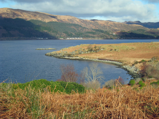
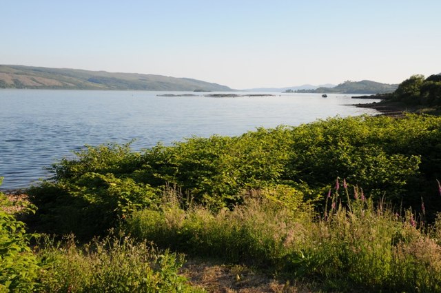
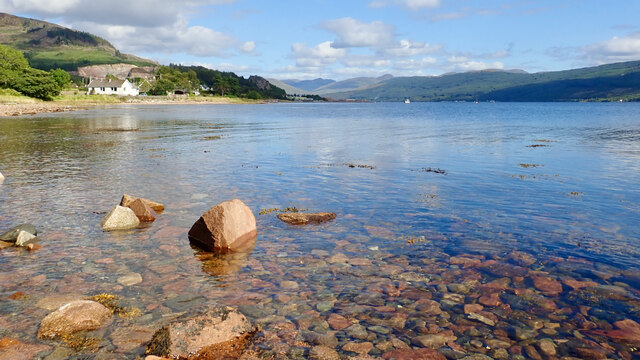
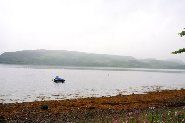
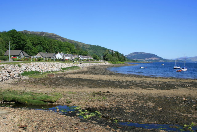
Blackstone Bay is a picturesque bay located in Argyllshire, a historic county in Scotland. Situated on the western coast of the country, the bay is known for its stunning natural beauty and tranquil atmosphere.

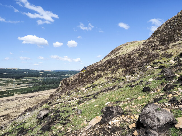
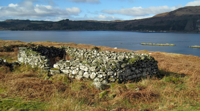
Surrounded by rugged cliffs and lush greenery, Blackstone Bay offers breathtaking views of the surrounding landscape. The bay itself is characterized by its dark pebbly beach, giving it its name. The dark stones create a stark contrast against the clear blue waters of the bay, making it a popular spot for photography enthusiasts.

The bay is also home to a diverse range of wildlife, including seals, seabirds, and occasionally dolphins. Visitors often indulge in birdwatching and wildlife spotting activities, taking advantage of the bay's serene environment and rich biodiversity.

For adventure seekers, Blackstone Bay offers opportunities for kayaking, sailing, and fishing. Its calm waters make it an ideal destination for water sports enthusiasts of all skill levels. The bay's proximity to the nearby mountains also makes it a great starting point for hiking and exploring the surrounding nature trails.

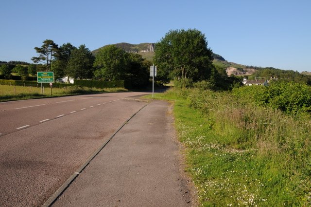
Blackstone Bay is easily accessible by road, and there are nearby parking facilities for visitors. The area is also well-connected by public transportation, making it a popular destination for day trips and weekend getaways.

Overall, Blackstone Bay is a hidden gem in Argyllshire, offering visitors a chance to escape the hustle and bustle of city life and immerse themselves in the beauty of Scotland's natural landscape.

If you have any feedback on the listing, please let us know in the comments section below.

Blackstone Bay Images

Images are sourced within 2km of 56.137444/-5.2165456 or Grid Reference NS0098. Thanks to Geograph Open Source API. All images are credited.

The A83 coming in to Furnace, Argyll
A83 near Crarae
A83 near Crarae
Slump in vicinity of Cnoc na Craoibh-fearna Cnoc na Craoibh-fearna translates from Gaelic as Oak Tree Hill and refers to part of the southern slope of Beinn Ghlas.
The small slump at the centre of the image is a mass of peat and vegetation that has ruptured from the slope above where stony ground is now exposed; it appears to have been a recent event. Another, rather larger slump was discovered elsewhere on Beinn Ghlas.
Slump in vicinity of Cnoc na Craoibh-fearna
Cnoc na Craoibh-fearna translates from Gaelic as Oak Tree Hill and refers to part of the southern slope of Beinn Ghlas. The small slump at the centre of the image is a mass of peat and vegetation that has ruptured from the slope above where stony ground is now exposed; it appears to have been a recent event. Another, rather larger slump was discovered elsewhere on Beinn Ghlas.
Peat banks close to summit of Beinn Ghlas Peat banks just south-east of the trig point on Beinn Ghlas.
The distant view is to mountains beyond Loch Fyne with Beinn Bheula at the centre. The peaks to the left of that include those of the 'Arrochar Alps'.
Peat banks close to summit of Beinn Ghlas
Peat banks just south-east of the trig point on Beinn Ghlas. The distant view is to mountains beyond Loch Fyne with Beinn Bheula at the centre. The peaks to the left of that include those of the 'Arrochar Alps'.
Landslip debris on steep hill face Boulders, stones and peat blocks are strewn over a wide area having swept down the steep west face of Beinn Ghlas from a relatively small slump above. A hill walker traversing the slope can be seen at the centre of the image.
Another, much more contained slip was seen on the same day on the south face of the hill - <a title="https://www.geograph.org.uk/photo/7465348" href="https://www.geograph.org.uk/photo/7465348">Link</a> .
Landslip debris on steep hill face
Boulders, stones and peat blocks are strewn over a wide area having swept down the steep west face of Beinn Ghlas from a relatively small slump above. A hill walker traversing the slope can be seen at the centre of the image. Another, much more contained slip was seen on the same day on the south face of the hill - Link .
Kilbride Island, Loch Fyne
Remains of sheiling Looking past Kilbride Island towards Crarae on the far shore
Remains of sheiling
Looking past Kilbride Island towards Crarae on the far shore
Burn flowing into Whitebridge Bay The Allt an Bhocain adds a little water to Loch Fyne. The strong young shoots appearing are of a Polygonum.
Burn flowing into Whitebridge Bay
The Allt an Bhocain adds a little water to Loch Fyne. The strong young shoots appearing are of a Polygonum.
White Bridge Cottage On the A83 running along the west side of Loch Fyne.
White Bridge Cottage
On the A83 running along the west side of Loch Fyne.
A83 at Blackstone Bay
Old Milestone by the A83, Whitebridge Bay, Kilmichael Glassary parish Stone post by the A83, in parish of Kilmichael Glassary (Argyll and Bute District), Whitebridge Bay, in low wall in front of modern bungalow.

Inscription reads:-
9
(To Inveraray)

Surveyed

Milestone Society National ID: AB_IYLG09
Old Milestone by the A83, Whitebridge Bay, Kilmichael Glassary parish
Stone post by the A83, in parish of Kilmichael Glassary (Argyll and Bute District), Whitebridge Bay, in low wall in front of modern bungalow. Inscription reads:- 9 (To Inveraray) Surveyed Milestone Society National ID: AB_IYLG09
The A83 entering Furnace The A83 entering Furnace beside Long Fyne.
The A83 entering Furnace
The A83 entering Furnace beside Long Fyne.
Blackstone Bay Blackstone Bay, part of Loch Fyne near Sandhole, south of Furnace.
Blackstone Bay
Blackstone Bay, part of Loch Fyne near Sandhole, south of Furnace.
Houses on the A83 Houses overlooking the A83 near Sandhole south of Furnace.
Houses on the A83
Houses overlooking the A83 near Sandhole south of Furnace.
Loch Fyne at Furnace
Loch Fyne Mooring A small boat moored by the shore near Sandhole.
Loch Fyne Mooring
A small boat moored by the shore near Sandhole.
Sheep by Sandhole Sheep grazing in a field between Sandhole and Furnace.
Sheep by Sandhole
Sheep grazing in a field between Sandhole and Furnace.
A83 at Sandhole
A83 at Sandhole
Show me another place!

Blackstone Bay is located at Grid Ref: NS0098 (Lat: 56.137444, Lng: -5.2165456)

Unitary Authority: Argyll and Bute

Police Authority: Argyll and West Dunbartonshire

What 3 Words

///develops.lifestyle.selects. Near Inveraray, Argyll & Bute

Nearby Locations

Blackstone Bay

Related Wikis

Crarae

Crarae is a settlement in Argyll and Bute, Scotland, on the shore of Loch Fyne. It lies on the A83, north of Lochgilphead. The location is known for the...

Furnace, Argyll

Furnace (Scottish Gaelic: An Fhùirneis) (formerly Inverleacainn (Scottish Gaelic: Inbhir Leacainn)) is a village in Argyll and Bute, on the west coast...

Crarae Reservoir

The Crarae Reservoir is located 2.5 kilometres north west of the village of Crarae, on the west side of Loch Fyne. The concrete dam is 13.7 metres high...

Minard, Argyll

Minard is a remote village on the western shore of Loch Fyne, situated between Inveraray and Lochgilphead. Minard is 13+1⁄2 miles (21.7 km) southwest of...

Nearby Amenities

Located within 500m of 56.137444,-5.2165456
Created By: dmgroom_coastlines
Source: PGS
Lat/Long: 56.1381988/-5.215891
Created By: dmgroom_coastlines
Source: PGS
Lat/Long: 56.1382068/-5.215433
Created By: dmgroom_coastlines
Source: PGS
Lat/Long: 56.1387188/-5.215462
Created By: dmgroom_coastlines
Source: PGS
Lat/Long: 56.1388798/-5.213637
Created By: dmgroom_coastlines
Source: PGS
Lat/Long: 56.1391518/-5.212735
Created By: dmgroom_coastlines
Source: PGS
Lat/Long: 56.1392838/-5.212514
Created By: dmgroom_coastlines
Source: PGS
Lat/Long: 56.1394158/-5.212291
Created By: dmgroom_coastlines
Source: PGS
Lat/Long: 56.1395688/-5.210924
Created By: dmgroom_coastlines
Source: PGS
Lat/Long: 56.1400848/-5.210725
Created By: dmgroom_coastlines
Source: PGS
Lat/Long: 56.1363508/-5.218996
Created By: dmgroom_coastlines
Source: PGS
Lat/Long: 56.1363668/-5.218079
Created By: dmgroom_coastlines
Source: PGS
Lat/Long: 56.1366228/-5.218094
Created By: dmgroom_coastlines
Source: PGS
Lat/Long: 56.134381/-5.222093
Created By: dmgroom_coastlines
Source: PGS
Lat/Long: 56.134514/-5.221872
Created By: dmgroom_coastlines
Source: PGS
Lat/Long: 56.134645/-5.221649
Created By: dmgroom_coastlines
Source: PGS
Lat/Long: 56.134778/-5.221428
Created By: dmgroom_coastlines
Source: PGS
Lat/Long: 56.13491/-5.221206
Created By: dmgroom_coastlines
Source: PGS
Lat/Long: 56.1350338/-5.220985
Created By: dmgroom_coastlines
Source: PGS
Lat/Long: 56.1351658/-5.220762
Created By: dmgroom_coastlines
Source: PGS
Lat/Long: 56.1353018/-5.220312
Created By: dmgroom_coastlines
Source: PGS
Lat/Long: 56.1355578/-5.220326
Bus Stop
Bench: yes
Naptan AtcoCode: 60709306
Naptan NaptanCode: 54723727
Shelter: yes
Lat/Long: 56.139618/-5.2147532
The data included in this document is from www.openstreetmap.org. The data is made available under ODbL.

Have you been to Blackstone Bay?

Leave your review of Blackstone Bay below (or comments, questions and feedback).