Little Stoke

Settlement in Staffordshire Stafford

England

Little Stoke

Hire boats in Stone, Staffordshire This is the Trent and Mersey Canal at Stone. The very distinctive lime green livery of the Canal Cruising Company can be seen on Elinor Ginger and Frances.
Hire boats in Stone, Staffordshire Credit: Roger Kidd

Little Stoke is a small village located in the county of Staffordshire, England. Situated approximately 7 miles southwest of Stoke-on-Trent, it falls under the Staffordshire Moorlands district. The village is nestled in a rural setting, surrounded by picturesque countryside and rolling hills.

Little Stoke has a rich history that can be traced back to the medieval period. It is believed to have been established as a farming community, and remnants of its agricultural past can still be seen today. The village is characterized by charming traditional cottages, many of which date back several centuries.

Despite its small size, Little Stoke offers a range of amenities to its residents. These include a local primary school, a village hall, and a church. The village also benefits from good transport links, with nearby roads connecting it to the wider area.

The natural beauty of the surrounding countryside makes Little Stoke an attractive destination for outdoor enthusiasts. There are several walking and cycling routes in the area, providing opportunities to explore the scenic landscapes. Additionally, the village is within close proximity to the Peak District National Park, offering further recreational options.

The community in Little Stoke is known for its strong sense of togetherness and community spirit. Residents often come together for various events and activities, fostering a friendly and welcoming atmosphere.

In summary, Little Stoke is a quaint and historic village in Staffordshire, offering a peaceful rural lifestyle and a close-knit community. It is an ideal place for those seeking a tranquil retreat amidst the beauty of the English countryside.

If you have any feedback on the listing, please let us know in the comments section below.
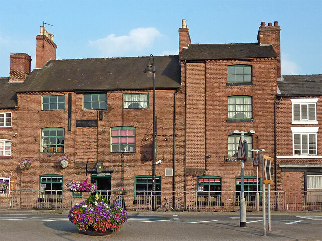
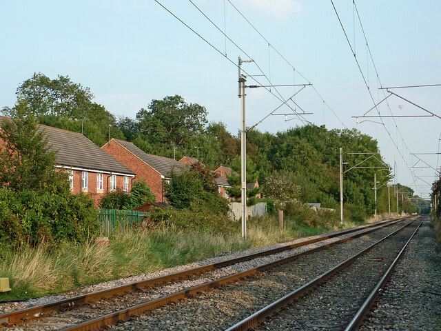
Little Stoke Images

Images are sourced within 2km of 52.89121/-2.129279 or Grid Reference SJ9132. Thanks to Geograph Open Source API. All images are credited.

Hire boats in Stone, Staffordshire This is the Trent and Mersey Canal at Stone. The very distinctive lime green livery of the Canal Cruising Company can be seen on Elinor Ginger and Frances.
Hire boats in Stone, Staffordshire
This is the Trent and Mersey Canal at Stone. The very distinctive lime green livery of the Canal Cruising Company can be seen on Elinor Ginger and Frances.
Boatyard buildings in Stone, Staffordshire This is the Trent and Mersey Canal at Stone above Yard Lock No 28. The Canal Cruising Company operates its lime green liveried hireboat business from here.
Boatyard buildings in Stone, Staffordshire
This is the Trent and Mersey Canal at Stone above Yard Lock No 28. The Canal Cruising Company operates its lime green liveried hireboat business from here.
Frances and Elinor Ginger in Stone, Staffordshire At the base of the long established Canal Cruising Company Limited are two narrowboats in their distinctive lime green livery.
Trent and Mersey Canal.
Frances and Elinor Ginger in Stone, Staffordshire
At the base of the long established Canal Cruising Company Limited are two narrowboats in their distinctive lime green livery. Trent and Mersey Canal.
Dry dock and service wharf in Stone, Staffordshire This is part of the base at the long established Canal Cruising Company Limited above Yard Lock, No 28. Three dry docks are available for hire as well as a fleet of narrowboats. This one is thought to have been built at the same time as Brindley built this section of canal in the 1770s.
Trent and Mersey Canal.
Dry dock and service wharf in Stone, Staffordshire
This is part of the base at the long established Canal Cruising Company Limited above Yard Lock, No 28. Three dry docks are available for hire as well as a fleet of narrowboats. This one is thought to have been built at the same time as Brindley built this section of canal in the 1770s. Trent and Mersey Canal.
Covered dry dock in Stone, Staffordshire Three dry docks are available for hire as well as a fleet of narrowboats at the long established Canal Cruising Company.
Trent and Mersey Canal.
Covered dry dock in Stone, Staffordshire
Three dry docks are available for hire as well as a fleet of narrowboats at the long established Canal Cruising Company. Trent and Mersey Canal.
The Swan Inn in Stone, Staffordshire Built in 1771, the building was originally warehouses servicing the Trent and Mersey Canal wharf. These were converted into a pub in the mid 19th century.
The Swan Inn in Stone, Staffordshire
Built in 1771, the building was originally warehouses servicing the Trent and Mersey Canal wharf. These were converted into a pub in the mid 19th century.
Former warehouses in Stone, Staffordshire These old canal Grade II listed warehouses in Stafford Road have been fully converted to retail, hospitality and office purposes. The Old Swan Inn was transformed into a pub as early as the mid 19th century. Lock Keepers is a hair salon.
Former warehouses in Stone, Staffordshire
These old canal Grade II listed warehouses in Stafford Road have been fully converted to retail, hospitality and office purposes. The Old Swan Inn was transformed into a pub as early as the mid 19th century. Lock Keepers is a hair salon.
Swan Inn pub sign in Stone, Staffordshire The former warehouse was transformed into an inn in the mid 19th century.

<a href="https://www.geograph.org.uk/photo/6940976">SJ9033 : The Swan Inn in Stone, Staffordshire</a>
Swan Inn pub sign in Stone, Staffordshire
The former warehouse was transformed into an inn in the mid 19th century. SJ9033 : The Swan Inn in Stone, Staffordshire
St Michael's Church in Stone, Staffordshire This is the Church of St Michael and St Wulfad. It was built in 1758, designed by William Robinson of Greenwich. It is an early example of Gothic Revival architecture. Previously the site contained the twelfth century Priory Church of St Mary and St Wulfad. <span class="nowrap"><a title="http://www.thepotteries.org/tour/003.htm" rel="nofollow ugc noopener" href="http://www.thepotteries.org/tour/003.htm">Link</a><img style="margin-left:2px;" alt="External link" title="External link - shift click to open in new window" src="https://s1.geograph.org.uk/img/external.png" width="10" height="10"/></span>
St Michael's Church in Stone, Staffordshire
This is the Church of St Michael and St Wulfad. It was built in 1758, designed by William Robinson of Greenwich. It is an early example of Gothic Revival architecture. Previously the site contained the twelfth century Priory Church of St Mary and St Wulfad. LinkExternal link
Church and war memorial in Stone, Staffordshire This is the Church of St Michael and St Wulfad. It was built in 1758, designed by William Robinson of Greenwich. It is an early example of Gothic Revival architecture. Previously the site contained the twelfth century Priory Church of St Mary and St Wulfad. <span class="nowrap"><a title="http://www.thepotteries.org/tour/003.htm" rel="nofollow ugc noopener" href="http://www.thepotteries.org/tour/003.htm">Link</a><img style="margin-left:2px;" alt="External link" title="External link - shift click to open in new window" src="https://s1.geograph.org.uk/img/external.png" width="10" height="10"/></span>
Church and war memorial in Stone, Staffordshire
This is the Church of St Michael and St Wulfad. It was built in 1758, designed by William Robinson of Greenwich. It is an early example of Gothic Revival architecture. Previously the site contained the twelfth century Priory Church of St Mary and St Wulfad. LinkExternal link
St Michael's Church tower in Stone, Staffordshire This is the Church of St Michael and St Wulfad. It was built in 1758, designed by William Robinson of Greenwich. It is an early example of Gothic Revival architecture. Previously the site contained the twelfth century Priory Church of St Mary and St Wulfad. <span class="nowrap"><a title="http://www.thepotteries.org/tour/003.htm" rel="nofollow ugc noopener" href="http://www.thepotteries.org/tour/003.htm">Link</a><img style="margin-left:2px;" alt="External link" title="External link - shift click to open in new window" src="https://s1.geograph.org.uk/img/external.png" width="10" height="10"/></span>
St Michael's Church tower in Stone, Staffordshire
This is the Church of St Michael and St Wulfad. It was built in 1758, designed by William Robinson of Greenwich. It is an early example of Gothic Revival architecture. Previously the site contained the twelfth century Priory Church of St Mary and St Wulfad. LinkExternal link
Railway in Stone Staffordshire Looking south-east towards Rugeley, this is the line from Stoke-on-Trent, seen from the Church Street level crossing. The railway authorities insist on naming this Church Lane Crossing.
Railway in Stone Staffordshire
Looking south-east towards Rugeley, this is the line from Stoke-on-Trent, seen from the Church Street level crossing. The railway authorities insist on naming this Church Lane Crossing.
Railway in Stone Staffordshire Looking north-west towards Stone station and Stoke-on-Trent, this is the line from Rugeley, seen with telephoto assistance from the Church Lane level crossing. The bridge ahead carries a footpath.

Railway bureaucracy causes confusion here because Church Street changes to Redhill Road. There is no Church Lane!
Railway in Stone Staffordshire
Looking north-west towards Stone station and Stoke-on-Trent, this is the line from Rugeley, seen with telephoto assistance from the Church Lane level crossing. The bridge ahead carries a footpath. Railway bureaucracy causes confusion here because Church Street changes to Redhill Road. There is no Church Lane!
Railway in Stone Staffordshire Looking south-east towards Rugeley in warm evening sunlight, this is the line from Stoke-on-Trent, seen from the Church Lane level crossing. Railway bureaucracy causes confusion here because Church Street changes to Redhill Road. There is no Church Lane!

 The houses are in The Sidings, so one is tempted to surmise what preceded the housing there. However, Victorian maps reveal that there were no railway sidings here, just small fields.
Railway in Stone Staffordshire
Looking south-east towards Rugeley in warm evening sunlight, this is the line from Stoke-on-Trent, seen from the Church Lane level crossing. Railway bureaucracy causes confusion here because Church Street changes to Redhill Road. There is no Church Lane! The houses are in The Sidings, so one is tempted to surmise what preceded the housing there. However, Victorian maps reveal that there were no railway sidings here, just small fields.
Church Lane level crossing in Stone, Staffordshire Looking north-east, the railway line between Rugeley and Stoke-on-Trent crosses here. Railway bureaucracy causes confusion because Church Street changes to Redhill Road here. There is no Church Lane!

<a href="https://www.geograph.org.uk/photo/1097293">SJ9033 : 2008 : Control box at Church Lane level crossing</a>
Church Lane level crossing in Stone, Staffordshire
Looking north-east, the railway line between Rugeley and Stoke-on-Trent crosses here. Railway bureaucracy causes confusion because Church Street changes to Redhill Road here. There is no Church Lane! SJ9033 : 2008 : Control box at Church Lane level crossing
Trent and Mersey Canal in Stone, Staffordshire This shows the footpath leading from Stafford Road near The Star public house, in warm evening sunlight.
Trent and Mersey Canal in Stone, Staffordshire
This shows the footpath leading from Stafford Road near The Star public house, in warm evening sunlight.
Station Road in Stone, Staffordshire Looking north-west up Station Road, the Crown and Anchor is on the corner with Newcastle Street. That abandoned purple plastic barrier in Newcastle Street was still there a year later!
Station Road in Stone, Staffordshire
Looking north-west up Station Road, the Crown and Anchor is on the corner with Newcastle Street. That abandoned purple plastic barrier in Newcastle Street was still there a year later!
Crown and Anchor in Stone, Staffordshire The Crown and Anchor is on the corner at the junction of Station Road and Newcastle Street. That abandoned purple plastic barrier in Newcastle Street was still there a year later!
Crown and Anchor in Stone, Staffordshire
The Crown and Anchor is on the corner at the junction of Station Road and Newcastle Street. That abandoned purple plastic barrier in Newcastle Street was still there a year later!
Show me another place!

Little Stoke is located at Grid Ref: SJ9132 (Lat: 52.89121, Lng: -2.129279)

Administrative County: Staffordshire

District: Stafford

Police Authority: Staffordshire

What 3 Words

///prefect.yacht.letters. Near Stone, Staffordshire

Nearby Locations

Little Stoke Stoke, Little

Related Wikis

Aston-by-Stone railway station

Aston-by-Stone railway station is a disused railway station in the village of Aston, Staffordshire, England. == History == Opened by the North Staffordshire...

Lichfield Road, Stone

Lichfield Road is a cricket ground in Stone, Staffordshire. The ground was established in 1948, when Staffordshire played Buckinghamshire in the grounds...

Aston-By-Stone

Aston-By-Stone is a village and civil parish in the Borough of Stafford in Staffordshire, England. It is close to the town of Stone and city of Stoke-on...

Stone Priory

Stone Priory was a priory founded at Stone in Staffordshire, England, in about 670 AD. The priory's church was dedicated to Saint Mary and Saint Wulfad...
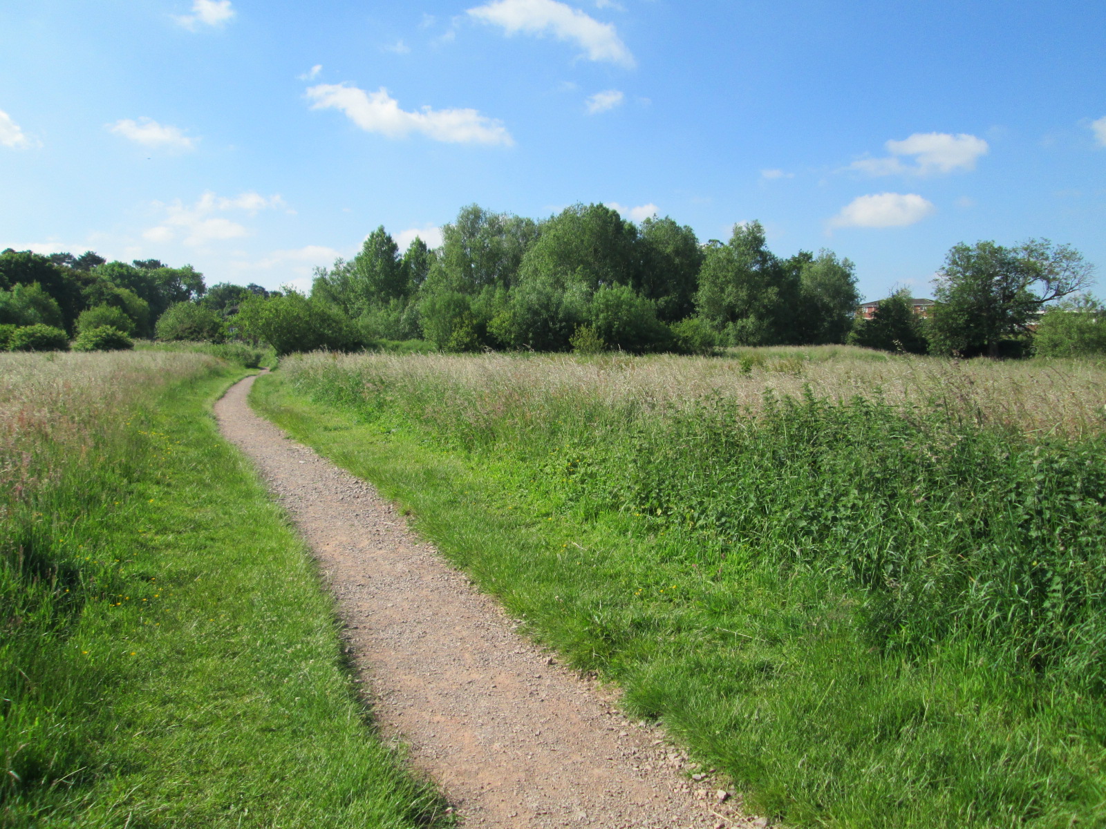
Stone Meadows

Stone Meadows is a local nature reserve adjacent to Stone, in Staffordshire, England. There are three separate meadows by the River Trent. Goodall Meadow...

Stone, Staffordshire

Stone is a market town and civil parish in Staffordshire, England, situated approximately 7 miles (11 km) north of the county town of Stafford, 7 miles...

St Dominic's Priory School, Stone

St Dominic's Priory School is an independent Catholic day school in the town of Stone, Staffordshire, halfway between Stoke-on-Trent and Stafford. The...

Alleyne's Academy

Alleyne's Academy (formerly Alleyne's High School) is a coeducational secondary school and sixth form with academy status. It is located in Stone, Staffordshire...

Related Videos

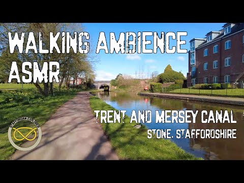
Walking Ambience - Trent and Mersey Canal #1 - ASMR

Join me for an ASMR walk along a section of the Trent and Mersey Canal, through the town of Stone in Staffordshire, UK Packed ...

Trip Around Stone with Elsa Barrett

A tour around Stone, Staffordshire.

Days Inn Stafford Hotel M6 Southbound - Have They Got The Basics Right?

only accessible by the motorway booked last minute.

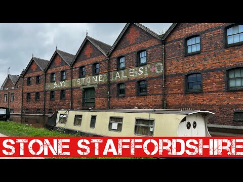
A walk around Stone Staffordshire

Stone is a market town and civil parish in Staffordshire, England, 7 miles north of Stafford, 7 miles south of Stoke-on-Trent and 15 ...

Nearby Amenities

Located within 500m of 52.89121,-2.129279
Bus Stop
Uttoxeter Road
Bus: yes
Naptan AtcoCode: 3800C750601
Naptan Bearing: SE
Naptan CommonName: Uttoxeter Road
Naptan Indicator: Adj
Naptan Landmark: Uttoxeter Road
Naptan Street: Lichfield Road
Naptan Verified: no
Public Transport: platform
Source: naptan_import
Lat/Long: 52.8908703/-2.126071
Bus Stop
Uttoxeter Road
Bus: yes
Naptan AtcoCode: 3800C750602
Naptan Bearing: NW
Naptan CommonName: Uttoxeter Road
Naptan Indicator: Opp
Naptan Landmark: Uttoxeter Road
Naptan Street: Lichfield Road
Naptan Verified: no
Public Transport: platform
Source: naptan_import
Lat/Long: 52.891777/-2.1272628
Bus Stop
St Michaels Mount
Bus: yes
Naptan AtcoCode: 3800C750901
Naptan Bearing: SE
Naptan CommonName: St Michaels Mount
Naptan Indicator: Adj
Naptan Landmark: St Michaels Mount
Naptan Street: Lichfield Road
Naptan Verified: no
Public Transport: platform
Source: naptan_import
Lat/Long: 52.893805/-2.1306429
Bus Stop
St Michaels Mount
Bus: yes
Naptan AtcoCode: 3800C750902
Naptan Bearing: NW
Naptan CommonName: St Michaels Mount
Naptan Indicator: Opp
Naptan Landmark: St Michaels Mount
Naptan Street: Lichfield Road
Naptan Verified: no
Public Transport: platform
Source: naptan_import
Lat/Long: 52.8938765/-2.1310445
Aston-by-Stone
Crossing: traffic_signals
Railway: level_crossing
Lat/Long: 52.8919315/-2.1254464
Traffic Signals
Source: survey
Lat/Long: 52.8912881/-2.1266159
Aston-by-Stone
Crossing: traffic_signals
Railway: level_crossing
Lat/Long: 52.8919068/-2.1254909
Barrier: cycle_barrier
Lat/Long: 52.8878908/-2.1266619
Leisure: playground
Lat/Long: 52.8888813/-2.1261686
Aston-by-Stone
Historic Railway: station
Railway: site
Lat/Long: 52.8916631/-2.1252049
Pub
The Three Crowns
Addr Postcode: ST15 8QU
Addr Street: Lichfield Road
Brand: Vintage Inns
Brand Wikidata: Q87067899
Contact Website: https://www.vintageinn.co.uk/restaurants/midlands/thethreecrownsstone
Fhrs Id: 1195454
Source Addr: FHRS Open Data
Lat/Long: 52.8908058/-2.1257502
Street Lamp
Lat/Long: 52.8932947/-2.1336825
Street Lamp
Lat/Long: 52.893111/-2.1334894
Street Lamp
Lat/Long: 52.8929027/-2.1333868
Street Lamp
Lat/Long: 52.892681/-2.1332138
Street Lamp
Lat/Long: 52.8924743/-2.1331548
Street Lamp
Lat/Long: 52.8898927/-2.1311083
Street Lamp
Lat/Long: 52.889542/-2.1308387
Street Lamp
Lat/Long: 52.8892183/-2.1306027
Street Lamp
Lat/Long: 52.8889205/-2.1302788
Building Levels: 2
Lat/Long: 52.8883296/-2.1280019
Barrier: cycle_barrier
Lat/Long: 52.8936994/-2.123228
Barrier: cycle_barrier
Lat/Long: 52.890554/-2.1259739
Power: pole
Lat/Long: 52.8884204/-2.1302774
Waste Basket
Lat/Long: 52.8891857/-2.1263151
Fuel
Lat/Long: 52.8917052/-2.1273176
The data included in this document is from www.openstreetmap.org. The data is made available under ODbL.

Have you been to Little Stoke?

Leave your review of Little Stoke below (or comments, questions and feedback).