Portobello

Bay in Wigtownshire

Scotland

Portobello

Cattle feed lot near Castle Ban At the end of the road from Mains of Aries; 33 metres from the rocky west coast.
Cattle feed lot near Castle Ban Credit: M J Richardson

Portobello is a small and picturesque village located in Wigtownshire, Scotland. Situated on the bay of the same name, it offers stunning views of the Irish Sea and is surrounded by beautiful countryside. The village is part of the larger Portobello Estate, which includes a mix of residential homes, holiday cottages, and farmland.

The beach at Portobello is a major attraction for both locals and visitors. With its golden sands and clear waters, it provides a perfect spot for sunbathing, picnicking, and engaging in various water activities such as swimming and sailing. The bay is also known for its abundant marine life, making it a popular spot for fishing enthusiasts.

Portobello is a close-knit community with a friendly and welcoming atmosphere. It has a small but thriving local economy, with a few shops, cafes, and restaurants catering to the needs of residents and tourists. Additionally, the village hosts regular events and festivals that draw people from all around the region.

Nature lovers will appreciate the surrounding countryside, which offers plenty of opportunities for hiking, cycling, and birdwatching. The nearby Galloway Forest Park is a great destination for outdoor enthusiasts, offering extensive trails, wildlife spotting, and even stargazing due to its Dark Sky Park status.

Overall, Portobello is a charming coastal village that combines natural beauty, outdoor recreational activities, and a strong sense of community. Whether enjoying the beach, exploring the countryside, or simply soaking up the tranquil atmosphere, visitors to Portobello are sure to have a memorable experience.

If you have any feedback on the listing, please let us know in the comments section below.

Portobello Images

Images are sourced within 2km of 54.949436/-5.1865591 or Grid Reference NW9666. Thanks to Geograph Open Source API. All images are credited.

Cattle feed lot near Castle Ban At the end of the road from Mains of Aries; 33 metres from the rocky west coast.
Cattle feed lot near Castle Ban
At the end of the road from Mains of Aries; 33 metres from the rocky west coast.
Grassland and Gorse at Mains of Aries The rock over which the sea is breaking is the Ebbstone or Craig Laggan <a href="https://www.geograph.org.uk/photo/7418717">NW9569 : Craig Laggan or the Ebbstone</a>.
Grassland and Gorse at Mains of Aries
The rock over which the sea is breaking is the Ebbstone or Craig Laggan NW9569 : Craig Laggan or the Ebbstone.
Pillar at Mains of Airies A strange structure by the edge of the track west of the farm. It is not mentioned on Canmore, but there is a Medieval Motte nearby. In the field beyond is a smartly constructed watering place for cattle. Beyond that is Orbain Hill.
Pillar at Mains of Airies
A strange structure by the edge of the track west of the farm. It is not mentioned on Canmore, but there is a Medieval Motte nearby. In the field beyond is a smartly constructed watering place for cattle. Beyond that is Orbain Hill.
Pastures at Mains of Airies Extensive grass fields on the flanks of Lingloskin Hill, with a  brick-built watering trough serving both sides of the fence.
Pastures at Mains of Airies
Extensive grass fields on the flanks of Lingloskin Hill, with a brick-built watering trough serving both sides of the fence.
Approaching Little Cairnbrock on the B738
Bends on the B738
Bends on the B738
Approaching a junction on the B738
A junction on the B738 The turning to the left is a minor road to Leswalt.
A junction on the B738
The turning to the left is a minor road to Leswalt.
A straight stretch on the B738
The turning to Mains of Cairnbrock
The turning to Cairnbrock Cottages
Cottages beside the B738 The entrance to High Auchneel is between the two white cottages on the right.
Cottages beside the B738
The entrance to High Auchneel is between the two white cottages on the right.
Passing Manley on the B738 Manley is a bungalow built quite recently.
Passing Manley on the B738
Manley is a bungalow built quite recently.
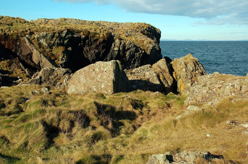
Rocky coast near Castle Ban Far on the horizon, beyond Dally Bay, Craig Laggan can be seen. This is the remains of a sea stack.
Rocky coast near Castle Ban
Far on the horizon, beyond Dally Bay, Craig Laggan can be seen. This is the remains of a sea stack.
Ruin on the hill Described as a fort on the map!
Ruin on the hill
Described as a fort on the map!
Wet fields, Slewkennen Hill
Mains of Cairnbrock
Mains of Cairnbrock
Knocklemine Hill
Knocklemine Hill
Show me another place!

Portobello is located at Grid Ref: NW9666 (Lat: 54.949436, Lng: -5.1865591)

Unitary Authority: Dumfries and Galloway

Police Authority: Dumfries and Galloway

What 3 Words

///reissued.starting.estimate. Near Cairnryan, Dumfries & Galloway

Nearby Locations

Portobello

Related Wikis

Galdenoch Castle

Galdenoch Castle is a tower house near the Scottish village of Leswalt in the Council Area Dumfries and Galloway . The ruin is listed as a Scheduled Monument...

Ervie

Ervie is a small village in Dumfries and Galloway, Scotland, in the Rhins of Galloway, just outside Stranraer.

Leswalt

Leswalt (Scottish Gaelic: Lios Uillt) is a village and civil parish in Dumfries and Galloway, south-west Scotland. It lies between Portpatrick and Stranraer...

Corsewall Point

Corsewall Point, or Corsill Point, is a headland at the northern end of the Rhins of Galloway in Scotland. A lighthouse, Corsewall Lighthouse, was placed...

Nearby Amenities

Located within 500m of 54.949436,-5.1865591
Created By: dmgroom_coastlines
Source: PGS
Lat/Long: 54.953521/-5.184929
Created By: dmgroom_coastlines
Source: PGS
Lat/Long: 54.953505/-5.185818
Created By: dmgroom_coastlines
Source: PGS
Lat/Long: 54.952477/-5.185986
Created By: dmgroom_coastlines
Source: PGS
Lat/Long: 54.951965/-5.185958
Created By: dmgroom_coastlines
Source: PGS
Lat/Long: 54.951709/-5.185944
Created By: dmgroom_coastlines
Source: PGS
Lat/Long: 54.951445/-5.186375
Created By: dmgroom_coastlines
Source: PGS
Lat/Long: 54.950422/-5.18632
Created By: dmgroom_coastlines
Source: PGS
Lat/Long: 54.950166/-5.186306
Created By: dmgroom_coastlines
Source: PGS
Lat/Long: 54.94965/-5.186499
Created By: dmgroom_coastlines
Source: PGS
Lat/Long: 54.949674/-5.185165
Created By: dmgroom_coastlines
Source: PGS
Lat/Long: 54.949158/-5.185361
Created By: dmgroom_coastlines
Source: PGS
Lat/Long: 54.948898/-5.185568
Created By: dmgroom_coastlines
Source: PGS
Lat/Long: 54.948882/-5.186458
Created By: dmgroom_coastlines
Source: PGS
Lat/Long: 54.948118/-5.186195
Created By: dmgroom_coastlines
Source: PGS
Lat/Long: 54.947606/-5.186167
Created By: dmgroom_coastlines
Source: PGS
Lat/Long: 54.947086/-5.186584
Created By: dmgroom_coastlines
Source: PGS
Lat/Long: 54.946831/-5.18657
Created By: dmgroom_coastlines
Source: PGS
Lat/Long: 54.946575/-5.186556
Created By: dmgroom_coastlines
Source: PGS
Lat/Long: 54.946319/-5.186542
Created By: dmgroom_coastlines
Source: PGS
Lat/Long: 54.945039/-5.186472
The data included in this document is from www.openstreetmap.org. The data is made available under ODbL.

Have you been to Portobello?

Leave your review of Portobello below (or comments, questions and feedback).