Broad Port

Bay in Wigtownshire

Scotland

Broad Port

The turning to Cairnbrock Cottages
The turning to Cairnbrock Cottages Credit: Ann Cook

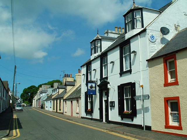
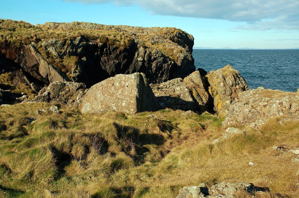
Broad Port is a picturesque bay located in Wigtownshire, a historic county in southwestern Scotland. Nestled along the rugged coastline of the Irish Sea, this charming bay offers stunning natural beauty and a tranquil atmosphere.

The bay is characterized by its wide sandy beach, which stretches for approximately half a mile and is backed by grassy dunes. The beach is known for its clean and clear waters, making it an ideal spot for swimming, sunbathing, and picnicking. The bay is also a popular destination for water sports enthusiasts, with activities such as kayaking and paddleboarding available.

Surrounded by rolling hills and scenic countryside, Broad Port offers breathtaking vistas of the surrounding landscape. The bay is home to a variety of wildlife, including seabirds and seals, which can often be spotted along the shore.

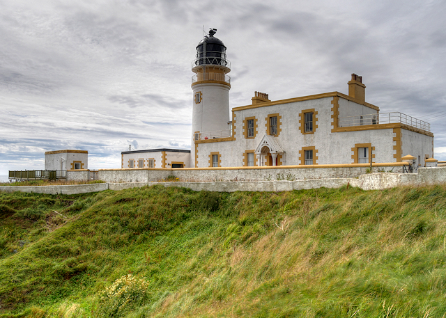
In addition to its natural beauty, Broad Port has historical significance. The bay was once a bustling port, serving as a hub for trade and fishing. Although the port is no longer operational, remnants of its maritime past can still be seen, adding to the bay's charm and character.

Visitors to Broad Port will find a peaceful and idyllic setting, perfect for relaxation and exploration. Whether strolling along the beach, taking in the panoramic views, or indulging in water activities, Broad Port offers a delightful experience for nature lovers and history enthusiasts alike.

If you have any feedback on the listing, please let us know in the comments section below.

Broad Port Images

Images are sourced within 2km of 54.932904/-5.1864529 or Grid Reference NW9564. Thanks to Geograph Open Source API. All images are credited.

The turning to Cairnbrock Cottages
Cottages beside the B738 The entrance to High Auchneel is between the two white cottages on the right.
Cottages beside the B738
The entrance to High Auchneel is between the two white cottages on the right.
Passing Manley on the B738 Manley is a bungalow built quite recently.
Passing Manley on the B738
Manley is a bungalow built quite recently.
Knocknain farm
Knocknain farm
Galdenoch Castle Built in the 16th-century by the Agnews of Lochnaw, the castle is said to have been the scene of poltergeist activity. According to the legend, the spirit was finally laid to rest by the singing of a minister.
Galdenoch Castle
Built in the 16th-century by the Agnews of Lochnaw, the castle is said to have been the scene of poltergeist activity. According to the legend, the spirit was finally laid to rest by the singing of a minister.
Kiln Hill with Knocknain Farm Viewed from the north-east.
Kiln Hill with Knocknain Farm
Viewed from the north-east.
Mains of Cairnbrock
Mains of Cairnbrock
Knocklemine Hill
Knocklemine Hill
Galdenoch Castle
Galdenoch Castle
Stone Seating at Galdenoch
Galdenoch Castle
Galdenoch Castle
Galdenoch Castle
Galdenoch Castle
Galdenoch Castle
Galdenoch Castle
Galdenoch Castle
Galdenoch Castle
Road to the B738
Road to the B738
Galdenoch Castle
Galdenoch Castle
Galdenoch Castle
Galdenoch Castle
Show me another place!

Broad Port is located at Grid Ref: NW9564 (Lat: 54.932904, Lng: -5.1864529)

Unitary Authority: Dumfries and Galloway

Police Authority: Dumfries and Galloway

What 3 Words

///fantastic.baffle.broadcast. Near Stranraer, Dumfries & Galloway

Related Wikis

Galdenoch Castle

Galdenoch Castle is a tower house near the Scottish village of Leswalt in the Council Area Dumfries and Galloway . The ruin is listed as a Scheduled Monument...

Ervie

Ervie is a small village in Dumfries and Galloway, Scotland, in the Rhins of Galloway, just outside Stranraer.

Leswalt

Leswalt (Scottish Gaelic: Lios Uillt) is a village and civil parish in Dumfries and Galloway, south-west Scotland. It lies between Portpatrick and Stranraer...

Kirkcolm

Kirkcolm (Scots: Kirkcoam) is a village and civil parish on the northern tip of the Rhinns of Galloway peninsula, south-west Scotland. It is in Dumfries...

Killantringan Lighthouse

Killantringan Lighthouse is a lighthouse located near Portpatrick in Dumfries and Galloway, south-west Scotland. The light came into operation in 1900...

MV Craigantlet

MV Craigantlet was a German-owned, Cyprus-registered container ship operated on time-charter by Cawoods Containers Ltd of Belfast. She ran aground on 26...

RAF Wig Bay

Royal Air Force Wig Bay, or more simply RAF Wig Bay, is a former Royal Air Force station near Stranraer, Dumfries and Galloway, Scotland The following...

Corsewall Point

Corsewall Point, or Corsill Point, is a headland on the northwest coast of Wigtownshire, Kirkcolm near Stranraer, Dumfries and Galloway, Scotland. A lighthouse...

Nearby Amenities

Located within 500m of 54.932904,-5.1864529
Created By: dmgroom_coastlines
Source: PGS
Lat/Long: 54.936857/-5.185583
Created By: dmgroom_coastlines
Source: PGS
Lat/Long: 54.936345/-5.185556
Created By: dmgroom_coastlines
Source: PGS
Lat/Long: 54.936089/-5.185542
Created By: dmgroom_coastlines
Source: PGS
Lat/Long: 54.935834/-5.185528
Created By: dmgroom_coastlines
Source: PGS
Lat/Long: 54.93557/-5.185958
Created By: dmgroom_coastlines
Source: PGS
Lat/Long: 54.935306/-5.186389
Created By: dmgroom_coastlines
Source: PGS
Lat/Long: 54.933506/-5.186736
Created By: dmgroom_coastlines
Source: PGS
Lat/Long: 54.93325/-5.186722
Created By: dmgroom_coastlines
Source: PGS
Lat/Long: 54.933126/-5.186492
Created By: dmgroom_coastlines
Source: PGS
Lat/Long: 54.933014/-5.185597
Created By: dmgroom_coastlines
Source: PGS
Lat/Long: 54.932498/-5.185792
Created By: dmgroom_coastlines
Source: PGS
Lat/Long: 54.932235/-5.186222
Created By: dmgroom_coastlines
Source: PGS
Lat/Long: 54.931719/-5.186416
Created By: dmgroom_coastlines
Source: PGS
Lat/Long: 54.931703/-5.187305
Created By: dmgroom_coastlines
Source: PGS
Lat/Long: 54.931195/-5.187056
Created By: dmgroom_coastlines
Source: PGS
Lat/Long: 54.930683/-5.187028
Created By: dmgroom_coastlines
Source: PGS
Lat/Long: 54.930423/-5.187235
Created By: dmgroom_coastlines
Source: PGS
Lat/Long: 54.930311/-5.18634
Created By: dmgroom_coastlines
Source: PGS
Lat/Long: 54.930199/-5.185444
Source: PGS
Lat/Long: 54.9291996/-5.1850417
Source: PGS
Lat/Long: 54.9289707/-5.1852401
Source: PGS
Lat/Long: 54.9288694/-5.1859263
Created By: dmgroom_coastlines
Source: PGS
Lat/Long: 54.928896/-5.186708
The data included in this document is from www.openstreetmap.org. The data is made available under ODbL.

Have you been to Broad Port?

Leave your review of Broad Port below (or comments, questions and feedback).