Anglas Bay

Bay in Pembrokeshire

Wales

Anglas Bay

Old stone field boundaries on Crincoed Point An isolated pocket of the coast, by-passed by the main Pembrokeshire Coast Path and therefore quiet and packed with wildlife; larks, wagtails, stonechats.
Old stone field boundaries on Crincoed Point Credit: Jeremy Bolwell

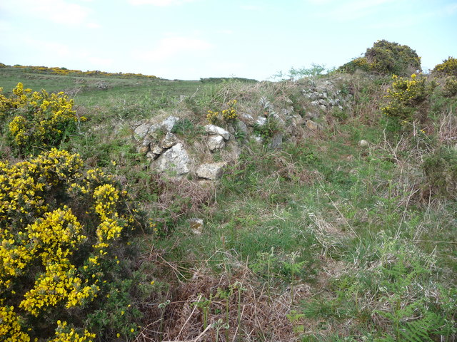
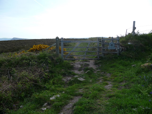
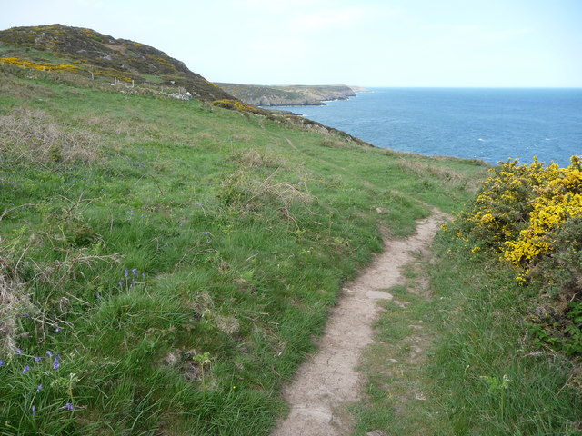
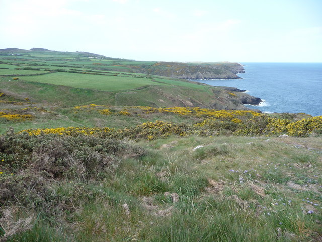
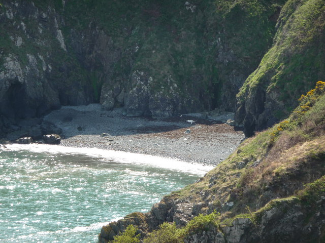
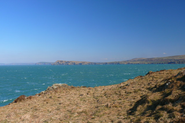
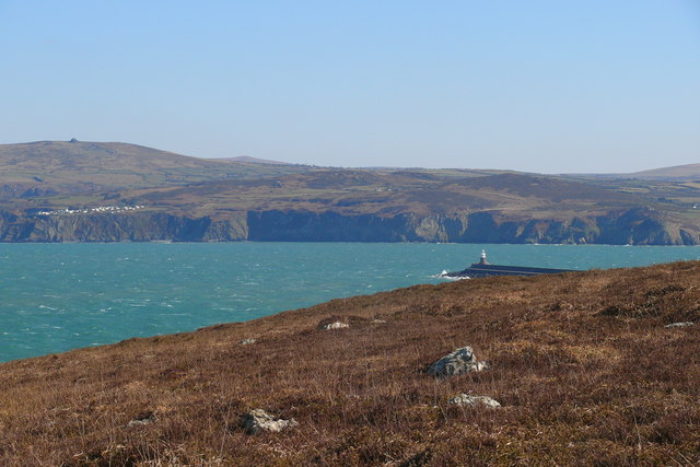
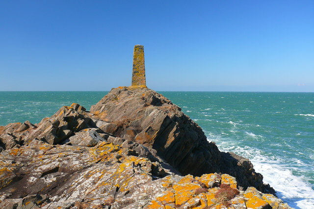
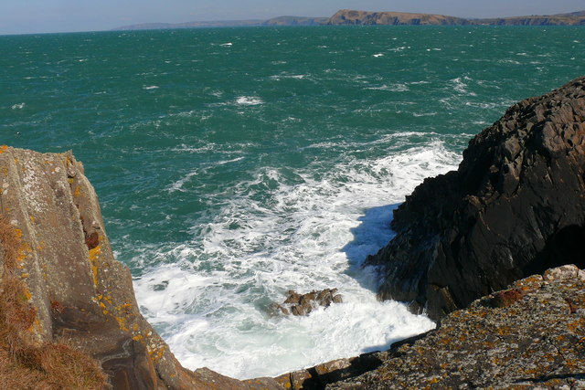
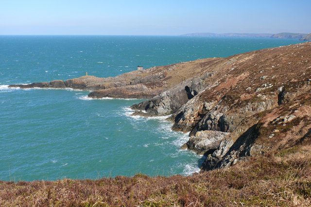
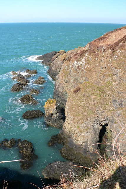
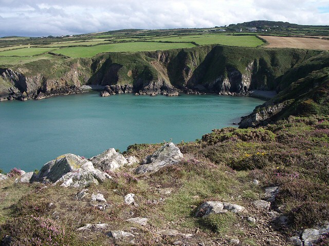
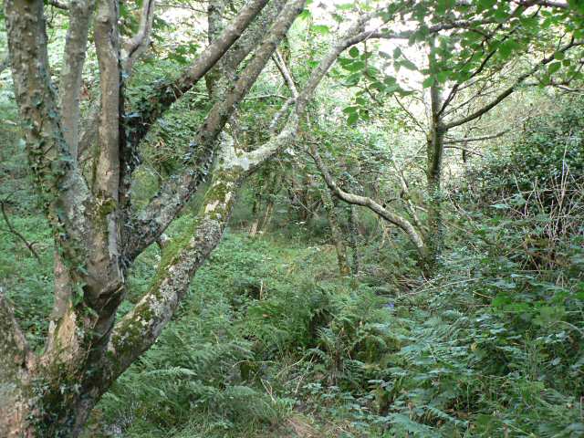
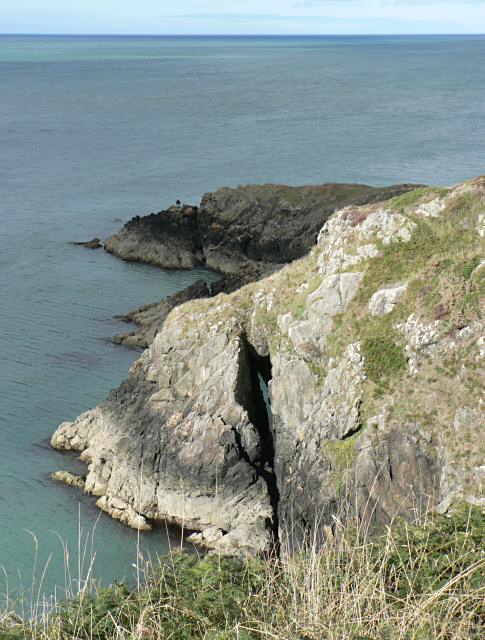
Anglas Bay is a picturesque coastal bay located in Pembrokeshire, Wales. Situated on the western coast of the country, it is a popular destination for both locals and tourists seeking natural beauty and tranquility. The bay is nestled between two rocky headlands, offering stunning views of the surrounding cliffs and the vast expanse of the Celtic Sea.

One of the defining features of Anglas Bay is its pristine sandy beach, which stretches for approximately 500 meters. The beach is renowned for its crystal-clear waters and has been awarded the prestigious Blue Flag status for its cleanliness and environmental management. With its gently sloping shoreline, it is an ideal spot for families and sunbathers to relax and enjoy the sun.

The bay also offers a range of activities for outdoor enthusiasts. The surrounding cliffs provide excellent opportunities for coastal walking and birdwatching, with sightings of various seabirds such as puffins and gannets being common. Additionally, the bay's calm waters make it a popular spot for kayaking and paddleboarding, allowing visitors to explore the coastline from a different perspective.

For those interested in marine life, Anglas Bay is home to a diverse range of sea creatures. Dolphins and seals are often spotted in the waters, delighting visitors with their playful antics. The bay's underwater ecosystem is also rich in marine biodiversity, making it a popular destination for snorkeling and scuba diving.

With its stunning natural beauty and range of activities, Anglas Bay is a must-visit destination for those seeking a coastal retreat in Pembrokeshire.

If you have any feedback on the listing, please let us know in the comments section below.
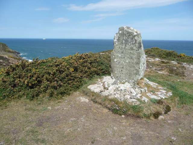
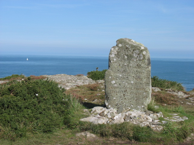
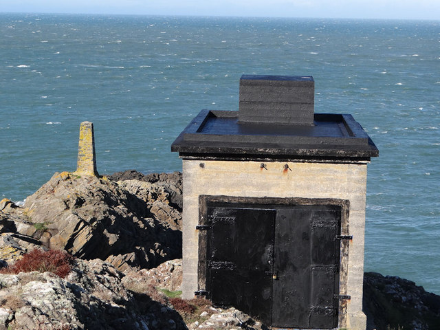
Anglas Bay Images

Images are sourced within 2km of 52.02494/-4.9966819 or Grid Reference SM9440. Thanks to Geograph Open Source API. All images are credited.

Old stone field boundaries on Crincoed Point An isolated pocket of the coast, by-passed by the main Pembrokeshire Coast Path and therefore quiet and packed with wildlife; larks, wagtails, stonechats.
Old stone field boundaries on Crincoed Point
An isolated pocket of the coast, by-passed by the main Pembrokeshire Coast Path and therefore quiet and packed with wildlife; larks, wagtails, stonechats.
N.T. gate into Pen Anglas The Pembrokeshire Coast Path passes through this headland maintained by the National Trust.
N.T. gate into Pen Anglas
The Pembrokeshire Coast Path passes through this headland maintained by the National Trust.
Carnfathach looking west From this distinctive knoll you get excellent views down the coastline westwards towards Carregwastad Point.
Carnfathach looking west
From this distinctive knoll you get excellent views down the coastline westwards towards Carregwastad Point.
Part of the Pembrokeshire Coast Path Yes, that little grey figure down there is a walker ahead of me on the coastal path, no doubt also enjoying this section of varied coastline, even if the harmless St. Mark's flies are thick in the air, the gorse tugs at your clothing and small loose stones slip under your boots.
Part of the Pembrokeshire Coast Path
Yes, that little grey figure down there is a walker ahead of me on the coastal path, no doubt also enjoying this section of varied coastline, even if the harmless St. Mark's flies are thick in the air, the gorse tugs at your clothing and small loose stones slip under your boots.
Monument stone on Carregwastad Point An ideal place for a rest, a brew, something to eat and a chat with some Aussie backpackers doing the whole Pembrokeshire Coast Path, a couple with huge rucksacks and an indomitable Aussie spirit to match.
Monument stone on Carregwastad Point
An ideal place for a rest, a brew, something to eat and a chat with some Aussie backpackers doing the whole Pembrokeshire Coast Path, a couple with huge rucksacks and an indomitable Aussie spirit to match.
Beach flotsam below Carregwastad Point I had seen a grey seal bottling in Aber Felin cove here and scanning the beach for other seals I spied what appears to be a large portion of dead pony. A grey pony seems to have fallen down the very steep gully above this beach and either been injured or trapped on the beach (though I can't believe that if this was the case that a rescue wasn't attempted) and subsequently died. Gulls were interested in the carcase and vulture-like hopped on and off, chased each other and generally set off a macabre scene.
Beach flotsam below Carregwastad Point
I had seen a grey seal bottling in Aber Felin cove here and scanning the beach for other seals I spied what appears to be a large portion of dead pony. A grey pony seems to have fallen down the very steep gully above this beach and either been injured or trapped on the beach (though I can't believe that if this was the case that a rescue wasn't attempted) and subsequently died. Gulls were interested in the carcase and vulture-like hopped on and off, chased each other and generally set off a macabre scene.
On Carregwastad Point The memorial marks the invasion on 22 February 1797 by a small French force. It is difficult to work out what they hoped to achieve, landing in such a remote spot, though they no doubt assumed that it would take some time for a defending army to be sent there. However they appear to have been a somewhat ill-disciplined bunch, for it is said that they got drunk and surrendered to the local population two days later!
On Carregwastad Point
The memorial marks the invasion on 22 February 1797 by a small French force. It is difficult to work out what they hoped to achieve, landing in such a remote spot, though they no doubt assumed that it would take some time for a defending army to be sent there. However they appear to have been a somewhat ill-disciplined bunch, for it is said that they got drunk and surrendered to the local population two days later!
Pen Anglas Fog Warning Station The fog warning station at Pen Anglas
Pen Anglas Fog Warning Station
The fog warning station at Pen Anglas
Crincoed Point Golygfa dros Crincoed Point tuag at Pen Dinas / A view over Crincoed Point towards  Dinas Head.
Crincoed Point
Golygfa dros Crincoed Point tuag at Pen Dinas / A view over Crincoed Point towards Dinas Head.
Bae Abergwaun / Fishguard Bay
Pen Anglas
Pen Anglas
Pen Anglas
Pen Anglas
Bae Anglas Bay
Bae Anglas Bay
Aber Felin
Aber Felin
Aber Felin View from Carregwastad Point
Aber Felin
View from Carregwastad Point
Last invasion of Britain - Carregwastad Point The inscription on the stone reads:
1897 CARREG GOFFA GLANIAD Y FFRANCOD CHWEFROR 22 1797
MEMORIAL STONE OF THE LANDING OF THE FRENCH FEBRUARY 22 1797
The story of this invasion can be read from information boards in Goodwick. It failed; the French troops discovered a cache of liquor saved from a shipwreck and were easily overcome by local men and women.
Last invasion of Britain - Carregwastad Point
The inscription on the stone reads: 1897 CARREG GOFFA GLANIAD Y FFRANCOD CHWEFROR 22 1797 MEMORIAL STONE OF THE LANDING OF THE FRENCH FEBRUARY 22 1797 The story of this invasion can be read from information boards in Goodwick. It failed; the French troops discovered a cache of liquor saved from a shipwreck and were easily overcome by local men and women.
Cwm Felin This deep wooded george makes a striking contrast to the rest of the coastal path in this area.
Cwm Felin
This deep wooded george makes a striking contrast to the rest of the coastal path in this area.
Natural arch
Natural arch
Show me another place!

Anglas Bay is located at Grid Ref: SM9440 (Lat: 52.02494, Lng: -4.9966819)

Unitary Authority: Pembrokeshire

Police Authority: Dyfed Powys

What 3 Words

///exonerate.dispose.acrobat. Near Goodwick, Pembrokeshire

Related Wikis

Fishguard Lifeboat Station

Fishguard Lifeboat Station (based in Goodwick, Pembrokeshire, Wales) is a Royal National Lifeboat Institution (RNLI) station. Located on the quay between...

Pencaer

Pencaer is a community which covers an area of dispersed settlement in Pembrokeshire, Wales, on the peninsula of Pen Caer and comprises the village of...

Fishguard Harbour railway station

Fishguard Harbour railway station serves the port of Fishguard Harbour, Wales. It is the terminus of one of the branches of the West Wales Line from Swansea...

Llanwnda, Pembrokeshire

Llanwnda is a rural village and parish to the north of the Welsh county of Pembrokeshire and part of the community of Pencaer. It lies some two miles northwest...

Nearby Amenities

Located within 500m of 52.02494,-4.9966819
Seamark Beacon Special Purpose Category: warning
Seamark Beacon Special Purpose Colour: white
Seamark Fog Signal Category: diaphone
Seamark Fog Signal Group: 2
Seamark Fog Signal Period: 60
Seamark Light Reference: A 5270
Seamark Name: Penanglas,
Seamark Type: beacon_special_purpose
Source: US NGA Pub. 114.(2020)
Lat/Long: 52.0252333/-4.9910667
Porth Maen
Natural: bay
Lat/Long: 52.0250048/-5.0003589
Anglas Bay
Natural: bay
Lat/Long: 52.0245031/-4.9938358
The data included in this document is from www.openstreetmap.org. The data is made available under ODbL.

Have you been to Anglas Bay?

Leave your review of Anglas Bay below (or comments, questions and feedback).