Port an Aoil

Bay in Ross-shire

Scotland

Port an Aoil

Creag Tharbh Crags on the far side of Loch Maree from Slattadale with the low lying pine covered islands in the middle distance.
Creag Tharbh Credit: Richard Webb

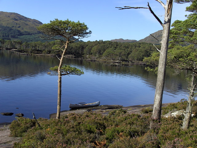
Port an Aoil, located in Ross-shire, Scotland, is a small and picturesque bay known for its stunning natural beauty and tranquil atmosphere. The bay is surrounded by rugged cliffs and lush greenery, creating a peaceful and secluded setting for visitors to enjoy.

The bay is a popular spot for fishing enthusiasts, with a variety of fish species found in its waters, including mackerel, herring, and cod. The clear blue waters of Port an Aoil also make it a great location for swimming and snorkeling during the warmer months.

Visitors to Port an Aoil can take in the breathtaking views of the bay from the nearby walking trails or simply relax on the sandy beaches and soak up the peaceful surroundings. The bay is also home to a variety of bird species, making it a great spot for birdwatching and wildlife enthusiasts.

Overall, Port an Aoil is a hidden gem in Ross-shire, offering a peaceful and scenic escape from the hustle and bustle of everyday life. Whether you're looking to relax on the beach, explore the surrounding nature, or try your hand at fishing, Port an Aoil has something for everyone to enjoy.

If you have any feedback on the listing, please let us know in the comments section below.
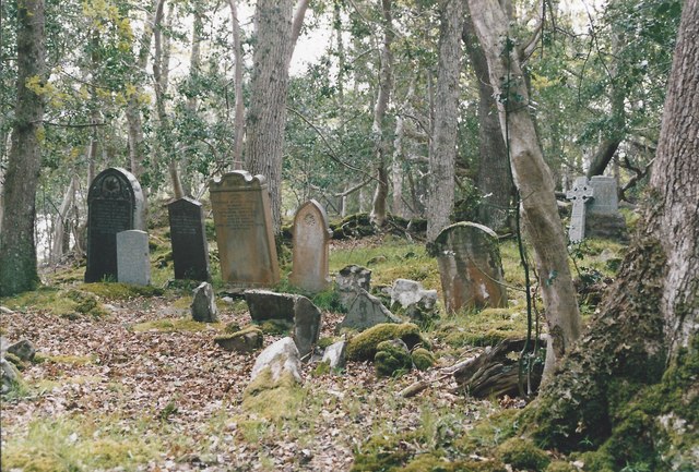
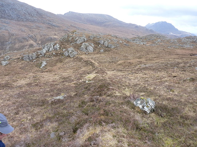
Port an Aoil Images

Images are sourced within 2km of 57.696545/-5.4697828 or Grid Reference NG9372. Thanks to Geograph Open Source API. All images are credited.

Creag Tharbh Crags on the far side of Loch Maree from Slattadale with the low lying pine covered islands in the middle distance.
Creag Tharbh
Crags on the far side of Loch Maree from Slattadale with the low lying pine covered islands in the middle distance.
Awaiting the Ferry - Loch Maree After a day on the hills relaxing on a pebble beach for the Loch Maree Hotel Ferry Boat.
Awaiting the Ferry - Loch Maree
After a day on the hills relaxing on a pebble beach for the Loch Maree Hotel Ferry Boat.
Wild land above Letterewe Rough ground above Letterewe. At this point we were contouring around the lower slopes of Meall Mheinnidh between two different paths that lead to Letterewe. Slioch is visible in the distance in the centre of the picture.
Wild land above Letterewe
Rough ground above Letterewe. At this point we were contouring around the lower slopes of Meall Mheinnidh between two different paths that lead to Letterewe. Slioch is visible in the distance in the centre of the picture.
Small rocky ridge on the climb up Beinn Airigh Charr After crossing the path to letterewe we had a short snack break sitting on the rocks forming this little ridge. The grassy summit of Beinn Airigh Charr is just visible in the centre right of the photo.
Small rocky ridge on the climb up Beinn Airigh Charr
After crossing the path to letterewe we had a short snack break sitting on the rocks forming this little ridge. The grassy summit of Beinn Airigh Charr is just visible in the centre right of the photo.
Burial Ground, Isle Maree
A Loch Maree sunset from Slioch This was taken from the Munro summit before I settled into a bivvy bag for the night. The two small white patches in the black foreground are small lochans on the southeast side of Beinn Lair. Slioch was the final summit during my Munro round. For a sunrise view next morning see <a href="https://www.geograph.org.uk/photo/621329">NH0269 : Sunrise on Slioch</a>.
A Loch Maree sunset from Slioch
This was taken from the Munro summit before I settled into a bivvy bag for the night. The two small white patches in the black foreground are small lochans on the southeast side of Beinn Lair. Slioch was the final summit during my Munro round. For a sunrise view next morning see NH0269 : Sunrise on Slioch.
Spur of the ridge on Carnan Maire High on the eastern side of Mheall a' Choire Ghlais, the ridge of Carnan Maire drops SE towards the Strathan Buidhe. This part of it holds the remains of a field boundary of some sort - a length of turf & rock wall about 3' high and maybe 200 yards long, seen here in midshot.
Spur of the ridge on Carnan Maire
High on the eastern side of Mheall a' Choire Ghlais, the ridge of Carnan Maire drops SE towards the Strathan Buidhe. This part of it holds the remains of a field boundary of some sort - a length of turf & rock wall about 3' high and maybe 200 yards long, seen here in midshot.
Field boundary on the hillside A closer view along the length of the field boundary, almost a wall, seen from a distance in <a href="https://www.geograph.org.uk/photo/5352649">NG9374 : Spur of the ridge on Carnan Maire</a>. The normal sources of information such as Historic Environment Scotland ('Canmore') or Historic Environment Record ('HER') give no clues.
Field boundary on the hillside
A closer view along the length of the field boundary, almost a wall, seen from a distance in NG9374 : Spur of the ridge on Carnan Maire. The normal sources of information such as Historic Environment Scotland ('Canmore') or Historic Environment Record ('HER') give no clues.
Hillside above the Strathan Buidhe A short stretch of the hillside descending from Mheall a' Choire Ghlais, steep but easily negotiated, on the way down into the pass.
Hillside above the Strathan Buidhe
A short stretch of the hillside descending from Mheall a' Choire Ghlais, steep but easily negotiated, on the way down into the pass.
A deertrack above the Strathan Buidhe The deer know the easy ways up and down these hills, so following their tracks rarely takes you too far astray. A narrow path here threads its way between some steep bluffs.
A deertrack above the Strathan Buidhe
The deer know the easy ways up and down these hills, so following their tracks rarely takes you too far astray. A narrow path here threads its way between some steep bluffs.
Stalker's path through the Strathan Buidhe The path is one of two that join the settlement at Letterewe with the main Kernsary - Carnmore path on the south side of the Fionn Loch. The other runs through the Bealach Mhèinnidh in <a href="https://www.geograph.org.uk/gridref/NG9673">NG9673</a>.
Stalker's path through the Strathan Buidhe
The path is one of two that join the settlement at Letterewe with the main Kernsary - Carnmore path on the south side of the Fionn Loch. The other runs through the Bealach Mhèinnidh in NG9673.
Shallow lochans above the Strathan Buidhe A series of small lochans dot this part of the hillside, this being one of the larger albeit shallow ones. Meall Mheinnidh at 722m looms large above.
Shallow lochans above the Strathan Buidhe
A series of small lochans dot this part of the hillside, this being one of the larger albeit shallow ones. Meall Mheinnidh at 722m looms large above.
The larger lochan Larger (and apparently deeper, less vegetated) than its neighbours, this lochan looks out to the SE towards Slioch.
The larger lochan
Larger (and apparently deeper, less vegetated) than its neighbours, this lochan looks out to the SE towards Slioch.
Lochan with a view Over Loch Maree to the hills of Torridon. It would make a spectacular campsite, but we were bent on another Corbett this particular afternoon, so maybe it'll have to wait for another day.
Lochan with a view
Over Loch Maree to the hills of Torridon. It would make a spectacular campsite, but we were bent on another Corbett this particular afternoon, so maybe it'll have to wait for another day.
Unnamed tributary of the Allt Bealach nan Sac One of several small burns draining the southern slopes of Meall Mheinnidh. This one issues from a lochan high on the hillside.
Unnamed tributary of the Allt Bealach nan Sac
One of several small burns draining the southern slopes of Meall Mheinnidh. This one issues from a lochan high on the hillside.
Down the hill towards the Glac Iain Duibh
Small islands across Camas a' Chonnaidh
Eilean a' Chlamhain and Eilean Mhic an Fhùlaraich from Creag Ghiuthais
Show me another place!

Port an Aoil is located at Grid Ref: NG9372 (Lat: 57.696545, Lng: -5.4697828)

Unitary Authority: Highland

Police Authority: Highlands and Islands

What 3 Words

///duos.ribcage.roofer. Near Gairloch, Highland

Nearby Locations

Isle Maree Port an Aoil

Related Wikis

Eilean Sùbhainn

Eilean Sùbhainn is the largest of several small islands in Loch Maree, Wester Ross, Scotland. It is the second largest freshwater island in Scotland after...

Loch Maree

Loch Maree (Scottish Gaelic: Loch Ma-ruibhe) is a loch in Wester Ross in the Northwest Highlands of Scotland. At 21.7 km (13.46 mi) long and with a maximum...

Garbh Eilean, Loch Maree

Garbh Eilean is a forested island in Loch Maree, Wester Ross, Scotland. Garbh Eilean lies between Eilean Sùbhainn and Eilean Ruairidh Mòr. The islands...

Letterewe

Letterewe is a large estate of several tens of thousands of acres on the north-eastern shore of Loch Maree, South-East of Poolewe, in Wester Ross, Scotland...

Have you been to Port an Aoil?

Leave your review of Port an Aoil below (or comments, questions and feedback).