Padstow Bay

Bay in Cornwall

England

Padstow Bay

Pentire Point A number of tourists/walkers can be seen on the South West Coast Path on top of the headland.
Pentire Point Credit: David Dixon

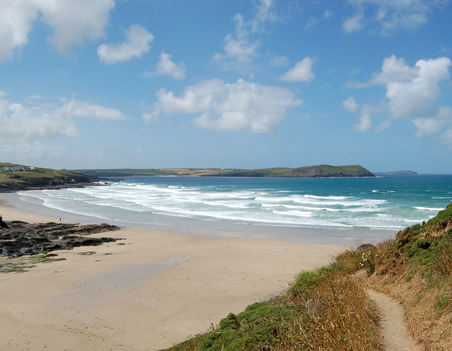
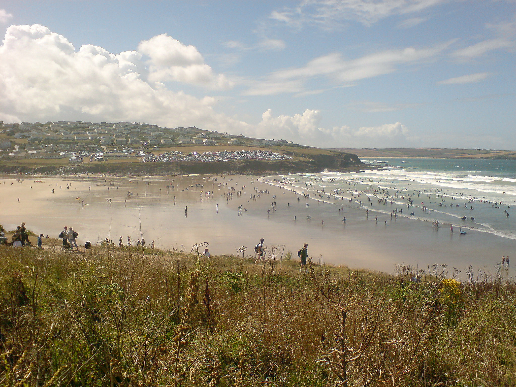
Padstow Bay is a picturesque stretch of coastline located in the charming town of Padstow, Cornwall. This bay is known for its stunning views, sandy beaches, and clear waters, making it a popular destination for locals and tourists alike.

The bay is surrounded by rugged cliffs and rolling hills, creating a dramatic backdrop for visitors to enjoy. The sandy beaches are perfect for sunbathing, swimming, and beachcombing, while the crystal-clear waters are ideal for water sports such as surfing, kayaking, and paddleboarding.

Padstow Bay is also home to a variety of wildlife, including seals, seabirds, and even the occasional dolphin or whale. Birdwatchers will appreciate the diverse bird species that can be spotted along the coastline.

For those looking to explore the area further, there are plenty of walking trails and coastal paths that offer breathtaking views of the bay and its surroundings. Visitors can also enjoy fresh seafood at the local restaurants and cafes in Padstow town, known for its delicious fish and chips and seafood platters.

Overall, Padstow Bay is a beautiful and serene destination that offers something for everyone to enjoy.

If you have any feedback on the listing, please let us know in the comments section below.
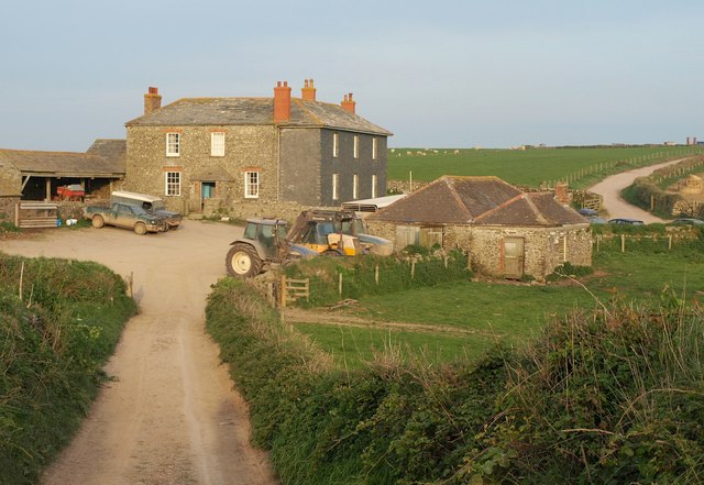
Padstow Bay Images

Images are sourced within 2km of 50.575763/-4.9331152 or Grid Reference SW9279. Thanks to Geograph Open Source API. All images are credited.

Pentire Point A number of tourists/walkers can be seen on the South West Coast Path on top of the headland.
Pentire Point
A number of tourists/walkers can be seen on the South West Coast Path on top of the headland.
Fields at Pentire Farm
Small Inlet
Small Inlet
Pentire Farm
Pentire Farm
Coastline northeast of Pentire Point
Lambs and ewes, Pentire Farm A balmy spring evening is worth a gambol, though I can't imagine how these young lambs are coping with those mangolds.
Lambs and ewes, Pentire Farm
A balmy spring evening is worth a gambol, though I can't imagine how these young lambs are coping with those mangolds.
Pentire Farm A hazy late evening sun illuminates the farm buildings. Much of the headland area here is let by the National Trust to be worked by the farm. Taken from footpath 546/32/1.
Pentire Farm
A hazy late evening sun illuminates the farm buildings. Much of the headland area here is let by the National Trust to be worked by the farm. Taken from footpath 546/32/1.
Bluebells at Com Head Some of the swathes of bluebells adorning clifftop fields and coastal slopes along Port Quin Bay. Here the South West Coast Path is following footpath 546/31/4.
Bluebells at Com Head
Some of the swathes of bluebells adorning clifftop fields and coastal slopes along Port Quin Bay. Here the South West Coast Path is following footpath 546/31/4.
Gorse at Com Head Illuminated by late sunshine, gorse blooms on either side of the South West Coast Path, here following footpath 546/31/4 towards The Rumps and Pentire Head.
Gorse at Com Head
Illuminated by late sunshine, gorse blooms on either side of the South West Coast Path, here following footpath 546/31/4 towards The Rumps and Pentire Head.
Bluebells near Com Head The sun is below the headland, and virtually setting anyway, but these bluebells in a coastal combe demand to be captured. The path isn't the coast path, which is just above to the left, but is setting off towards the tip of Com Head.
Bluebells near Com Head
The sun is below the headland, and virtually setting anyway, but these bluebells in a coastal combe demand to be captured. The path isn't the coast path, which is just above to the left, but is setting off towards the tip of Com Head.
Sea Campion above Pengirt Cove Silene maritima growing by the coast path. In the background are Com Head and The Mouls.
Sea Campion above Pengirt Cove
Silene maritima growing by the coast path. In the background are Com Head and The Mouls.
Coast path above Pengirt Cove The South West Coast Path a little further NNW from <a href="https://www.geograph.org.uk/photo/2389949">SW9480 : Sea Campion above Pengirt Cove</a>. Ahead is Com Head, with The Mouls offshore.
Coast path above Pengirt Cove
The South West Coast Path a little further NNW from SW9480 : Sea Campion above Pengirt Cove. Ahead is Com Head, with The Mouls offshore.
Coast path at Com Head The South West Coast Path crosses a dip and climbs towards Com Head. The bluebells on the clifftop are shown in <a href="https://www.geograph.org.uk/photo/2389119">SW9480 : Bluebells near Com Head</a>.
Coast path at Com Head
The South West Coast Path crosses a dip and climbs towards Com Head. The bluebells on the clifftop are shown in SW9480 : Bluebells near Com Head.
Pentire Farm A similar view to <a href="https://www.geograph.org.uk/photo/226092">SW9380 : Pentire Farm</a>, also taken from the South West Coast Path near Com Head, with Stepper Point and Trevose Head visible in the distance.
Pentire Farm
A similar view to SW9380 : Pentire Farm, also taken from the South West Coast Path near Com Head, with Stepper Point and Trevose Head visible in the distance.
Coast northwest of Com Head A similar view to <a href="https://www.geograph.org.uk/photo/2389095">SW9380 : Gorse at Com Head</a>, taken the following morning, and illustrating the transformation that a different light creates. Offshore is The Mouls.
Coast northwest of Com Head
A similar view to SW9380 : Gorse at Com Head, taken the following morning, and illustrating the transformation that a different light creates. Offshore is The Mouls.
Coast northwest of Com Head Coves and cliffs between Com Head and The Rumps, with The Mouls offshore. Drifts of bluebells are above the cliffs.
Coast northwest of Com Head
Coves and cliffs between Com Head and The Rumps, with The Mouls offshore. Drifts of bluebells are above the cliffs.
Approaching The Rumps The South West Coast Path descending towards the headland with its two hills. Bluebells are on the coastal slope on the right.
Approaching The Rumps
The South West Coast Path descending towards the headland with its two hills. Bluebells are on the coastal slope on the right.
Sea squill near The Rumps By the South West Coast Path south of The Rumps. Scilla verna appreciates short turf and the National Trust policy is to use Dartmoor ponies or cattle to graze these cliffs to encourage it and similar plants.
Sea squill near The Rumps
By the South West Coast Path south of The Rumps. Scilla verna appreciates short turf and the National Trust policy is to use Dartmoor ponies or cattle to graze these cliffs to encourage it and similar plants.
Show me another place!

Padstow Bay is located at Grid Ref: SW9279 (Lat: 50.575763, Lng: -4.9331152)

Unitary Authority: Cornwall

Police Authority: Devon and Cornwall

What 3 Words

///walkway.commuting.surfaces. Near Polzeath, Cornwall

Nearby Locations

Padstow Bay

Related Wikis

River Camel

The River Camel (Cornish: Dowr Kammel, meaning crooked river) is a river in Cornwall, England. It rises on the edge of Bodmin Moor and with its tributaries...

New Polzeath

New Polzeath (Cornish: Polsegh Nowyth, meaning new Polzeath) is a coastal settlement immediately north-east of Polzeath in north Cornwall, England, United...

Polzeath

Polzeath (;Standard Written Form: Polsegh, meaning dry creek) is a small seaside resort village in the civil parish of St Minver in Cornwall, England,...

Pentire Head

Pentire Head (Cornish: Penn Tir, meaning "headland") is a headland and peninsula on the Atlantic coast in North Cornwall, England, and is about one mile...

Have you been to Padstow Bay?

Leave your review of Padstow Bay below (or comments, questions and feedback).