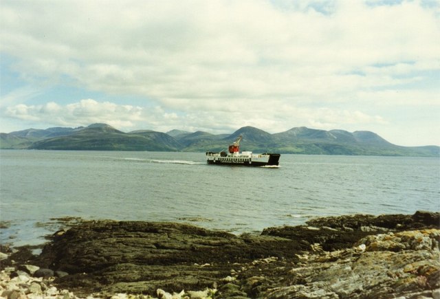
Port a' Chruidh

Bay in Argyllshire

Scotland

Port a' Chruidh

Entrance Gate to Skipness House
Entrance Gate to Skipness House Credit: Mick Garratt

The requested URL returned error: 429 Too Many Requests

If you have any feedback on the listing, please let us know in the comments section below.

Port a' Chruidh Images

Images are sourced within 2km of 55.776056/-5.3165086 or Grid Reference NR9258. Thanks to Geograph Open Source API. All images are credited.

Entrance Gate to Skipness House
Stile over wall
Stile over wall
Gatehouse and gates to Skipness Castle
Skipness House There is new building going on here, which may be an extension to the excellent Skipness Seafood Cabin.
Skipness House
There is new building going on here, which may be an extension to the excellent Skipness Seafood Cabin.
Skipness Castle
Skipness Castle
Fence below Cnoc na Sgratha, Kintyre, Argyll Looking towards the Cowal peninsula on the other side of the water.
Fence below Cnoc na Sgratha, Kintyre, Argyll
Looking towards the Cowal peninsula on the other side of the water.
Impenetrable shoreline Rocks rising steeply up out of the sea, followed by dense scrub and trees - difficult going on land - which explains why the sea has always been the main through route in this part of the country.
Impenetrable shoreline
Rocks rising steeply up out of the sea, followed by dense scrub and trees - difficult going on land - which explains why the sea has always been the main through route in this part of the country.
Port Bàn A view over the pleasant and isolated bay of Port Bàn.
Port Bàn
A view over the pleasant and isolated bay of Port Bàn.
Glacial erratic boulder A magnificent and completely isolated glacially-derived boulder, or erratic, sitting on the lower, sandy shore of Port Bàn. My assistant for the mission was Damson, since my own dog decided he'd rather play at sandcastles by the car. Skipness House, castle and chapel can be seen in the background.
Glacial erratic boulder
A magnificent and completely isolated glacially-derived boulder, or erratic, sitting on the lower, sandy shore of Port Bàn. My assistant for the mission was Damson, since my own dog decided he'd rather play at sandcastles by the car. Skipness House, castle and chapel can be seen in the background.
Inclined strata Despite the dynamic metamorphism of these sedimentary rocks the layering observed here is mostly of sedimentary origin in the layering of a sequence of turbidites, which are inclined steeply to the east. These rocks are assigned to the Beinn Bheula Schist Formation, which is part of the Dalradian Supergroup of metamorphic rocks.
Inclined strata
Despite the dynamic metamorphism of these sedimentary rocks the layering observed here is mostly of sedimentary origin in the layering of a sequence of turbidites, which are inclined steeply to the east. These rocks are assigned to the Beinn Bheula Schist Formation, which is part of the Dalradian Supergroup of metamorphic rocks.
Storm beach A significant bank of shingle forms a storm beach above the normal high-tide line. Skipness House is seen in the background.
Storm beach
A significant bank of shingle forms a storm beach above the normal high-tide line. Skipness House is seen in the background.
Collapsing boathouse The old boathouse is in a state of great disrepair, which is a shame for such a neat structure with a proper, slated roof. Ironically, the distant ruin of Skipness Castle is behind barriers due to structural difficulties.
Collapsing boathouse
The old boathouse is in a state of great disrepair, which is a shame for such a neat structure with a proper, slated roof. Ironically, the distant ruin of Skipness Castle is behind barriers due to structural difficulties.
Topping the rushes Maintenance in progress, cutting the rushes to improve the condition of the wet pasture behind the storm beach.
Topping the rushes
Maintenance in progress, cutting the rushes to improve the condition of the wet pasture behind the storm beach.
Woodland, Skipness
Woodland, Skipness
Skipness River Running through established woodland near the river's mouth at Skipness.
Skipness River
Running through established woodland near the river's mouth at Skipness.
Skipness Castle
Skipness Castle
Skipness Chapel
Skipness Chapel
North entrance to Skipness Castle, Kintyre
Show me another place!

Port a' Chruidh is located at Grid Ref: NR9258 (Lat: 55.776056, Lng: -5.3165086)

Unitary Authority: Argyll and Bute

Police Authority: Argyll and West Dunbartonshire

What 3 Words

///petty.parent.downfield. Near Lochranza, North Ayrshire

Nearby Locations

Port a' Chruidh

Related Wikis

St Brendan's Chapel, Skipness

St Brendan's Chapel, also known as Kilbrannan Chapel, and Skipness Chapel, is a medieval chapel near Skipness, Argyll and Bute, Scotland. The chapel appears...

Skipness

Skipness (Scottish Gaelic: Sgibinis, pronounced [ˈs̪kʲipɪnɪʃ]) is a village on the east coast of Kintyre in Scotland, located just over 7 miles (11 km...

County of Bute

The County of Bute (Scottish Gaelic: Siorrachd Bhòid), also known as Buteshire, is a historic county and registration county of Scotland.The county comprises...

Claonaig

Claonaig (Scottish Gaelic: Claonaig, pronounced [ˈkʰl̪ˠɯːnɛkʲ]) is a hamlet on the east coast of the Kintyre peninsula in western Scotland, linked to Lochranza...

Nearby Amenities

Located within 500m of 55.776056,-5.3165086
Created By: dmgroom_coastlines
Source: PGS
Lat/Long: 55.772078/-5.318443
Created By: dmgroom_coastlines
Source: PGS
Lat/Long: 55.772598/-5.31802
Created By: dmgroom_coastlines
Source: PGS
Lat/Long: 55.77273/-5.317799
Created By: dmgroom_coastlines
Source: PGS
Lat/Long: 55.772863/-5.317581
Source: PGS
Lat/Long: 55.773583/-5.3171505
Source: PGS
Lat/Long: 55.7737706/-5.3169902
Source: PGS
Lat/Long: 55.773951/-5.3168619
Source: PGS
Lat/Long: 55.7743443/-5.3167143
Source: PGS
Lat/Long: 55.7749613/-5.3162396
Source: PGS
Lat/Long: 55.7755819/-5.3159445
Source: PGS
Lat/Long: 55.775802/-5.3162268
Source: PGS
Lat/Long: 55.7762566/-5.3162781
Source: PGS
Lat/Long: 55.7766354/-5.3162653
Source: PGS
Lat/Long: 55.777393/-5.3158162
Source: PGS
Lat/Long: 55.777743/-5.3158227
Created By: dmgroom_coastlines
Source: PGS
Lat/Long: 55.778773/-5.316568
Source: PGS
Lat/Long: 55.7792829/-5.3166237
Source: PGS
Lat/Long: 55.7798751/-5.3169004
The data included in this document is from www.openstreetmap.org. The data is made available under ODbL.

Have you been to Port a' Chruidh?

Leave your review of Port a' Chruidh below (or comments, questions and feedback).