Camas a' Bhrothais

Bay in Argyllshire

Scotland

Camas a' Bhrothais

Clach Toll Natural Arch
Clach Toll Natural Arch Credit: thejackrustles

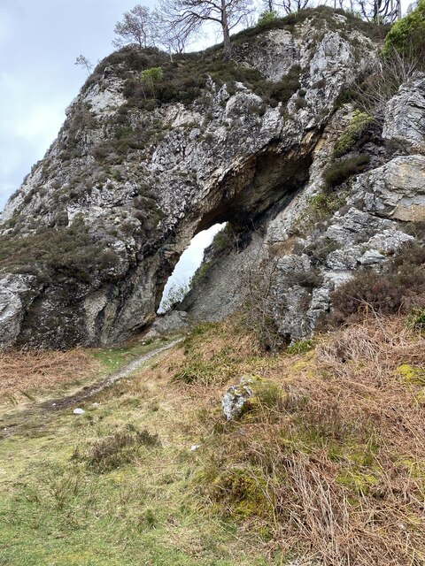
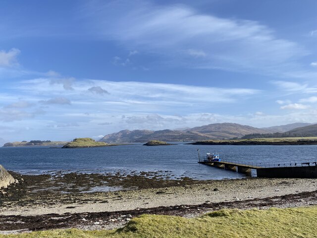
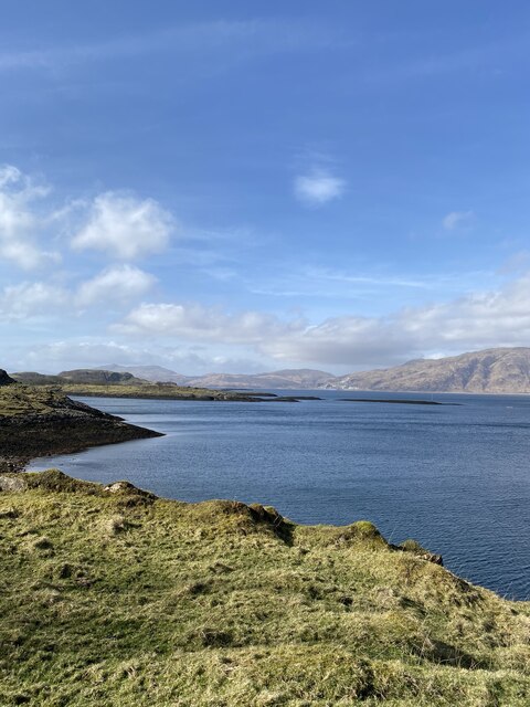
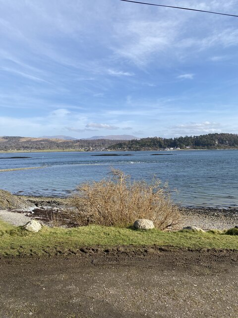
Camas a' Bhrothais, also known as Bay of Brotus, is a picturesque coastal area located in Argyllshire, Scotland. Situated on the west coast of the country, it offers stunning views of the Atlantic Ocean and the surrounding rugged landscapes.

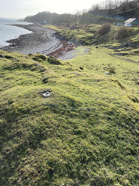
The bay is characterized by its sandy beach, which stretches for approximately half a mile and is flanked by rocky cliffs on either side. The beach is known for its pristine white sand and clear turquoise waters, making it a popular destination for locals and tourists alike.

Surrounded by rolling hills and lush greenery, Camas a' Bhrothais provides a tranquil and idyllic setting for visitors to relax and enjoy the natural beauty of the area. It is not uncommon to spot various species of seabirds soaring overhead or see seals basking on the rocks near the shore.

The bay is also a great spot for outdoor activities such as swimming, snorkeling, and beachcombing. The calm waters and gentle waves make it suitable for families and individuals of all ages to enjoy a dip in the sea or explore the marine life beneath the surface.

Access to Camas a' Bhrothais is relatively easy, with a car park located nearby and a short walk down to the beach. There are no facilities on-site, so visitors are advised to bring their own supplies and be respectful of the natural environment.

Overall, Camas a' Bhrothais is a hidden gem on the west coast of Scotland, offering a peaceful retreat and a chance to immerse oneself in the unspoiled beauty of Argyllshire.

If you have any feedback on the listing, please let us know in the comments section below.

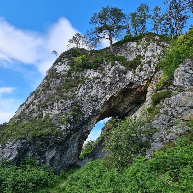
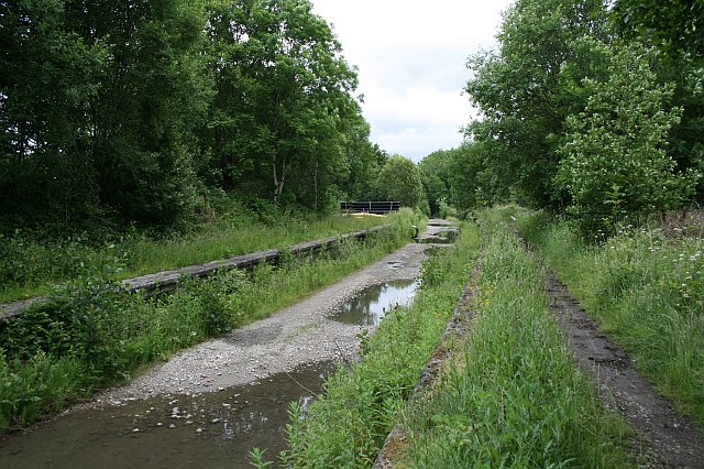
Camas a' Bhrothais Images

Images are sourced within 2km of 56.557913/-5.4077979 or Grid Reference NM9045. Thanks to Geograph Open Source API. All images are credited.

Clach Toll Natural Arch
Lismore jetty
Lismore jetty
Port Aineainn
Port Aineainn
Location of Flush Bracket OSBM 12093: The Point (Lismore)
Port Appin from Lismore
Bolt: The Point (Lismore) <span class="nowrap"><a title="https://www.bench-marks.org.uk/bm22635" rel="nofollow ugc noopener" href="https://www.bench-marks.org.uk/bm22635">Link</a><img style="margin-left:2px;" alt="External link" title="External link - shift click to open in new window" src="https://s1.geograph.org.uk/img/external.png" width="10" height="10"/></span>
Bolt: The Point (Lismore)
Location of Bolt: The Point (Lismore)
Natural arch, Clach Thoull
Rubh' Àird Ghainimh The north end of Lismore.
Rubh' Àird Ghainimh
The north end of Lismore.
Rubha Mòr, Lismore
Rubha Mòr, Lismore
Inn Island, south tip from Lismore
Coastline at Rubha Clach Tholl
Clach Thoull The name meaning 'holed rock'. Clach Thoull was created when the sea level was much higher than presently and the land was formed. A prominent narrow spit of land some 150 feet high runs north-easterly from here for three-quarter of a mile with many small caves.
Clach Thoull
The name meaning 'holed rock'. Clach Thoull was created when the sea level was much higher than presently and the land was formed. A prominent narrow spit of land some 150 feet high runs north-easterly from here for three-quarter of a mile with many small caves.
The Lismore ferry approaches Lismore The lower part of the jetty is covered by the tide.
Eilean nan Caorach (left) and Inn Island (right) are in the mid distance.
Castle Stalker <a href="https://www.geograph.org.uk/gridref/NM9247">NM9247</a> is just visible beyond Inn Island.
The Lismore ferry approaches Lismore
The lower part of the jetty is covered by the tide. Eilean nan Caorach (left) and Inn Island (right) are in the mid distance. Castle Stalker NM9247 is just visible beyond Inn Island.
Beach and headland At the NE end of Lismore.
Eilean nan Caorach is on the right, with Shuna Island <a href="https://www.geograph.org.uk/gridref/NM9148">NM9148</a> beyond to its left.
Beach and headland
At the NE end of Lismore. Eilean nan Caorach is on the right, with Shuna Island NM9148 beyond to its left.
Jetty at NE end of Lismore Used by the ferry from Port Appin, which is straight ahead. The ferry must avoid the islets in the straits.
On the left is Inn Island, with the beacon on Sgeir Bhuidhe (see <a href="https://www.geograph.org.uk/photo/2254673">NM9046 : Eilean nan Caorach</a>) visible beyond.
Jetty at NE end of Lismore
Used by the ferry from Port Appin, which is straight ahead. The ferry must avoid the islets in the straits. On the left is Inn Island, with the beacon on Sgeir Bhuidhe (see NM9046 : Eilean nan Caorach) visible beyond.
Limestone crag At the NE end of Lismore.
Limestone crag
At the NE end of Lismore.
Show me another place!

Camas a' Bhrothais is located at Grid Ref: NM9045 (Lat: 56.557913, Lng: -5.4077979)

Unitary Authority: Argyll and Bute

Police Authority: Argyll and West Dunbartonshire

What 3 Words

///moisture.crystal.signature. Near Oban, Argyll & Bute

Related Wikis

Airds Bay

Airds Bay is a small bay south-west of Port Appin on the west coast of Scotland. It is located at the south-western end of Appin in Argyll and Bute, forming...

Castle Stalker

Castle Stalker (Scottish Gaelic: Caisteal an Stalcaire) is a four-storey tower house or keep in the Scottish county of Argyll. It is set on a tidal islet...

Appin railway station

Appin was a railway station in Scotland, close to the Sound of Shuna on the east shore of Loch Laiche - an arm of Loch Linnhe, Portnacroish, Appin in Argyll...

Eriska

Eriska is a flat tidal island at the entrance to Loch Creran on the west coast of Scotland. Privately owned by the Buchanan-Smiths from 1973 until August...

Nearby Amenities

Located within 500m of 56.557913,-5.4077979
Source: PGS
Lat/Long: 56.5615284/-5.4039645
Source: PGS
Lat/Long: 56.5612059/-5.4049648
Source: PGS
Lat/Long: 56.5609934/-5.4058505
Source: PGS
Lat/Long: 56.5607985/-5.4070058
Source: PGS
Lat/Long: 56.5607879/-5.4074872
Source: PGS
Lat/Long: 56.5606979/-5.4082796
Source: PGS
Lat/Long: 56.5604961/-5.4080326
Source: PGS
Lat/Long: 56.5601272/-5.4074341
Source: PGS
Lat/Long: 56.5594725/-5.4067041
Source: PGS
Lat/Long: 56.5590185/-5.4063008
Source: PGS
Lat/Long: 56.5584518/-5.4058214
Source: PGS
Lat/Long: 56.5579585/-5.4058791
Source: PGS
Lat/Long: 56.5578697/-5.4058601
Source: PGS
Lat/Long: 56.5573102/-5.4059544
Source: PGS
Lat/Long: 56.5564833/-5.4058631
Source: PGS
Lat/Long: 56.5559384/-5.4063621
Source: PGS
Lat/Long: 56.5554756/-5.4070217
Source: PGS
Lat/Long: 56.5553578/-5.4075235
Source: PGS
Lat/Long: 56.5552568/-5.4077649
Source: PGS
Lat/Long: 56.5551672/-5.407822
Source: PGS
Lat/Long: 56.5554473/-5.4077451
Source: PGS
Lat/Long: 56.5556237/-5.4080531
Source: PGS
Lat/Long: 56.555653/-5.4091512
Source: PGS
Lat/Long: 56.5557318/-5.4094135
Source: PGS
Lat/Long: 56.555668/-5.4097831
Source: PGS
Lat/Long: 56.5554783/-5.4101219
Source: PGS
Lat/Long: 56.5546746/-5.4118517
Public Bookcase
Port Appin Book Exchange
Booth: K6
Disused Amenity: telephone
Man Made: telephone_box
Public Bookcase Type: phone_box
Source: survey
Lat/Long: 56.554912/-5.4093603
Turning Circle
Lat/Long: 56.5566656/-5.4014992
Parking
Capacity: 8
Fee: no
Parking: surface
Source: survey
Lat/Long: 56.5541514/-5.408411
Seamark Light 1 Character: Fl
Seamark Light 1 Colour: red
Seamark Light 1 Group: 2
Seamark Light 1 Height: 7
Seamark Light 1 Period: 7
Seamark Light 1 Range: 9
Seamark Light 1 Sector End: 220
Seamark Light 1 Sector Start: 184
Seamark Light 1 Sequence: 0.5+(1.5),0.5+(4.5)
Seamark Light 2 Character: Fl
Seamark Light 2 Colour: white
Seamark Light 2 Group: 2
Seamark Light 2 Height: 7
Seamark Light 2 Period: 7
Seamark Light 2 Range: 9
Seamark Light 2 Sector End: 184
Seamark Light 2 Sector Start: 220
Seamark Light 2 Sequence: 0.5+(1.5),0.5+(4.5)
Seamark Light Reference: A 4160
Seamark Name: Sgeir Bhuidhe-Appin
Seamark Type: light_minor
Source: US NGA Pub. 114. 2011-05-26.
Lat/Long: 56.5606167/-5.41065
Port Appin
Name En: Port Appin
Name Gd: Port na h-Apainn
Place: village
Source: survey
Wikidata: Q2104618
Lat/Long: 56.5561943/-5.4022247
Post Box
Post Box Type: wall
Ref: PA38 40
Royal Cypher: scottish_crown
Source: survey
Lat/Long: 56.5550082/-5.4094674
Marker: cable
Lat/Long: 56.5547937/-5.4112373
Power: pole
Lat/Long: 56.5552224/-5.4019475
Power: pole
Lat/Long: 56.5536732/-5.4055631
Power: pole
Lat/Long: 56.5535416/-5.4070571
Power: pole
Lat/Long: 56.553478/-5.4078886
Power: pole
Lat/Long: 56.5536303/-5.4079878
Power: pole
Lat/Long: 56.5536658/-5.4087362
Power: pole
Lat/Long: 56.5538565/-5.4096025
Power: pole
Lat/Long: 56.5537619/-5.4103133
Power: pole
Lat/Long: 56.5543946/-5.4107666
Power: pole
Lat/Long: 56.5541713/-5.4109544
Power: pole
Transformer: distribution
Lat/Long: 56.5555868/-5.401568
Power: pole
Lat/Long: 56.557032/-5.4009263
Power: pole
Lat/Long: 56.5572003/-5.4000565
Power: pole
Lat/Long: 56.5581491/-5.4003111
Defibrillator
Defibrillator Location: outside by entrance to Port Appin Stores
Emergency: defibrillator
Ref GB The Circuit: 7800DB7E-DEA5-49BA-8DA5-AB0200BA7B47
Lat/Long: 56.5548588/-5.4093216
Appin Craft Shop
Addr City: Port Appin
Shop: yes
Lat/Long: 56.5549686/-5.4095139
Leisure: picnic_table
Lat/Long: 56.5551174/-5.4095251
Leisure: picnic_table
Lat/Long: 56.555142/-5.4095443
Leisure: picnic_table
Lat/Long: 56.5551277/-5.4094733
Leisure: picnic_table
Lat/Long: 56.5551558/-5.4094902
Post Box
Ref: PA38 14
Source: survey
Lat/Long: 56.5583873/-5.3998532
The data included in this document is from www.openstreetmap.org. The data is made available under ODbL.

Have you been to Camas a' Bhrothais?

Leave your review of Camas a' Bhrothais below (or comments, questions and feedback).