Camas Liathach

Bay in Inverness-shire

Scotland

Camas Liathach

Beach of Loch Hourn beside Fraoch Eilean Fraoch Eilean is a tiny island on the south side of Loch Hourn; it's out of view to the right.
Ladhar Bheinn is the incomparable mountain beyond!
Beach of Loch Hourn beside Fraoch Eilean Credit: Trevor Littlewood

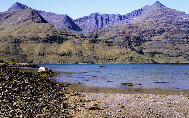
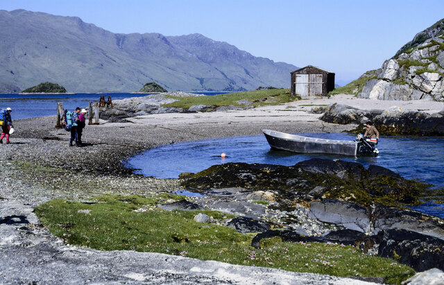
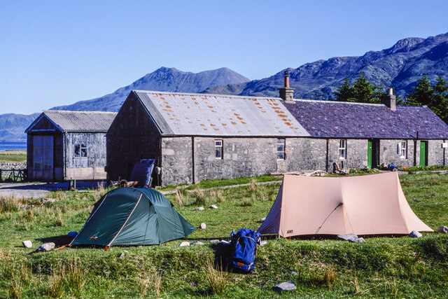
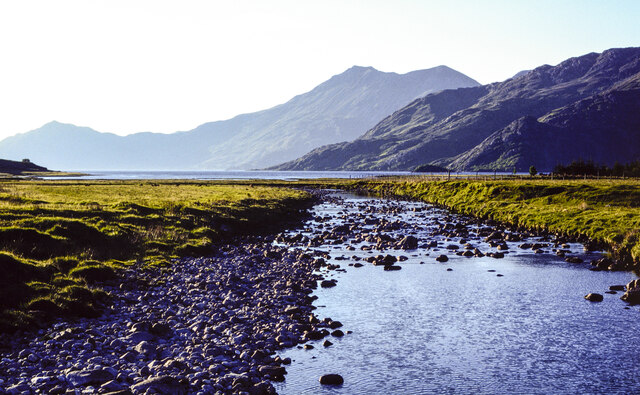
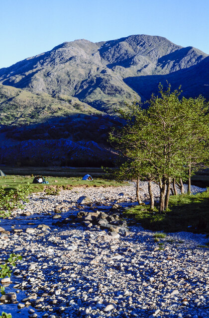
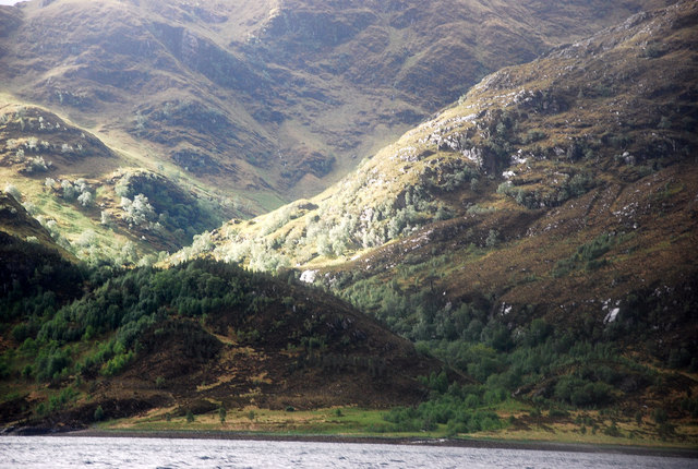
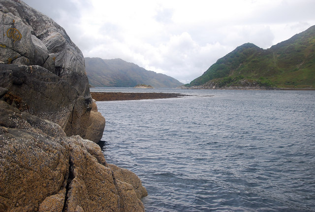
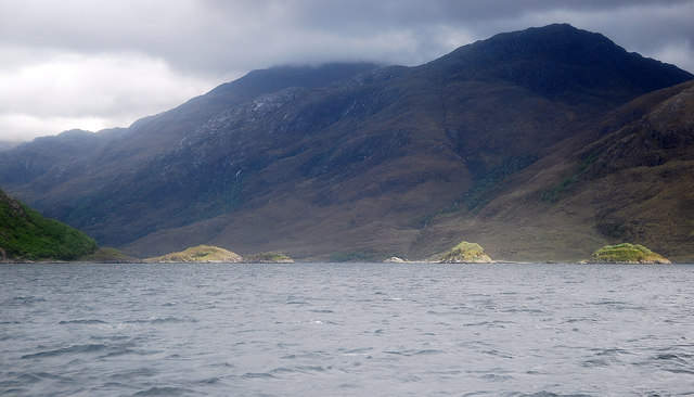
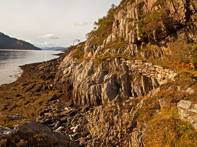
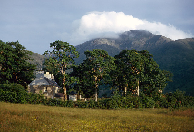
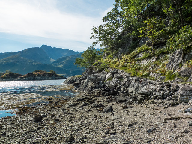
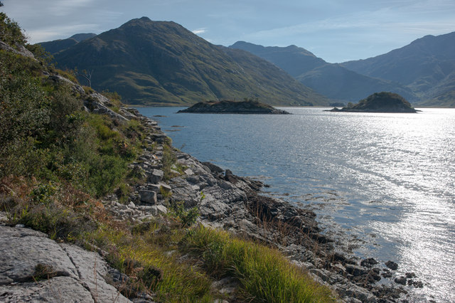
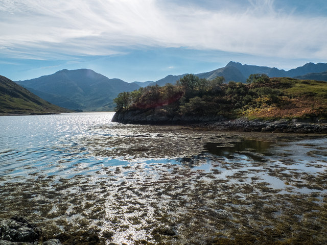
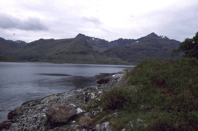
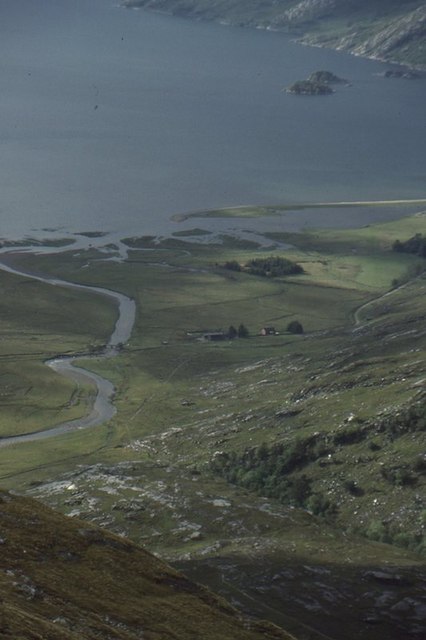
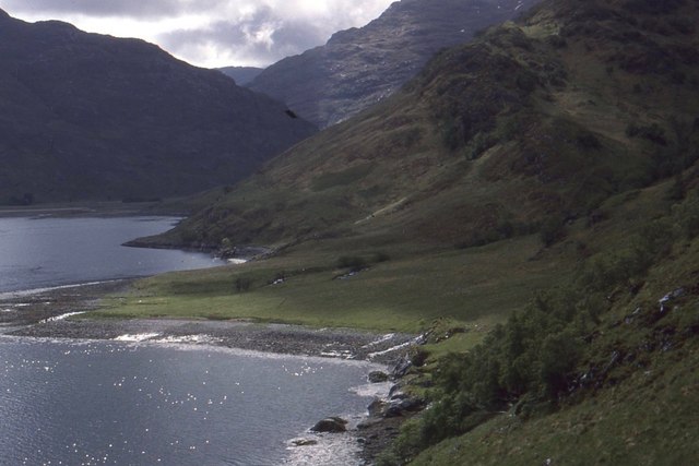
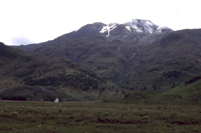
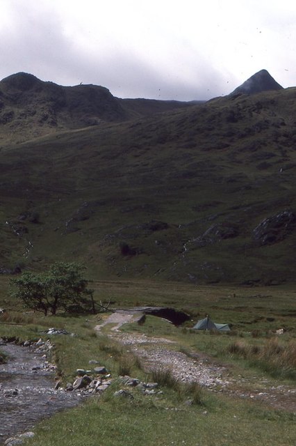
Camas Liathach is a picturesque bay located in Inverness-shire, Scotland. Situated on the west coast of the Scottish Highlands, it is renowned for its stunning natural beauty and tranquil atmosphere. The bay is nestled between rugged cliffs and rolling green hills, offering breathtaking panoramic views of the surrounding landscape.

Camas Liathach is characterized by its pristine sandy beach, which stretches for approximately half a mile along the bay. The beach is composed of fine golden sand, making it an ideal spot for sunbathing, picnicking, or simply enjoying a leisurely stroll. The crystal-clear waters of the bay are perfect for swimming, and many visitors also take advantage of the bay's calm conditions for kayaking and paddleboarding.

Surrounded by lush vegetation and diverse wildlife, Camas Liathach is a haven for nature enthusiasts. The bay is home to a variety of bird species, including oystercatchers, gulls, and terns. Seals can often be spotted lounging on the rocks, and lucky visitors may even catch a glimpse of dolphins or porpoises swimming in the bay.

In addition to its natural beauty, Camas Liathach offers visitors a chance to explore the rich history and culture of the Scottish Highlands. Nearby, there are several archaeological sites and ancient ruins that provide insight into the area's past, including a Pictish fort and a burial cairn.

Overall, Camas Liathach is a hidden gem in Inverness-shire, offering visitors a peaceful retreat in the midst of stunning natural surroundings and a glimpse into Scotland's rich history. Whether you are in search of relaxation, outdoor activities, or cultural exploration, this bay has something to offer for everyone.

If you have any feedback on the listing, please let us know in the comments section below.

Camas Liathach Images

Images are sourced within 2km of 57.092243/-5.5205513 or Grid Reference NG8605. Thanks to Geograph Open Source API. All images are credited.

Beach of Loch Hourn beside Fraoch Eilean Fraoch Eilean is a tiny island on the south side of Loch Hourn; it's out of view to the right.
Ladhar Bheinn is the incomparable mountain beyond!
Beach of Loch Hourn beside Fraoch Eilean
Fraoch Eilean is a tiny island on the south side of Loch Hourn; it's out of view to the right. Ladhar Bheinn is the incomparable mountain beyond!
Isthmus at Fraoch Eilean Fraoch Eilean is across the isthmus where there's the boathouse. The boat on the water to the right of the beach was manned by David Mackenzie, a keeper or ghillie at Barrisdale. He was to carry out passengers - some can be seen - to Kinloch Hourn.
Isthmus at Fraoch Eilean
Fraoch Eilean is across the isthmus where there's the boathouse. The boat on the water to the right of the beach was manned by David Mackenzie, a keeper or ghillie at Barrisdale. He was to carry out passengers - some can be seen - to Kinloch Hourn.
Tents and bothy at Barrisdale, 1991 Two tents, (there were others), and the bothy / bunkhouse at Barrisdale in perfect weather for making ascents to the three Munros in the vicinity.
Another Munro is in view distantly at the centre of the image: Beinn Sgritheall, across Loch Hourn, a small section of which can be seen.
Tents and bothy at Barrisdale, 1991
Two tents, (there were others), and the bothy / bunkhouse at Barrisdale in perfect weather for making ascents to the three Munros in the vicinity. Another Munro is in view distantly at the centre of the image: Beinn Sgritheall, across Loch Hourn, a small section of which can be seen.
River Barrisdale flowing towards Barrisdale Bay, 1991 The River Barrisdale flowing downstream from a bridge to enter the bay which is part of Loch Hourn.
The mountain at the centre of the image is Beinn Sgritheall.
River Barrisdale flowing towards Barrisdale Bay, 1991
The River Barrisdale flowing downstream from a bridge to enter the bay which is part of Loch Hourn. The mountain at the centre of the image is Beinn Sgritheall.
Bouldery bed of River Barrisdale The extent of the boulderiness of the course of the river betrays the breadth of the water flow at times of spate. The view is upstream from the bridge over the river just south of the campsite and bothy. Several tents are pitched further on. 
Luinne Bheinn is the mountain.
Bouldery bed of River Barrisdale
The extent of the boulderiness of the course of the river betrays the breadth of the water flow at times of spate. The view is upstream from the bridge over the river just south of the campsite and bothy. Several tents are pitched further on. Luinne Bheinn is the mountain.
Inbhir Dhorrcail The famous north corrie of Ladhar Bheinn lies off the top of the photo. This coastal area is wild and remote as is Knoydart!
Inbhir Dhorrcail
The famous north corrie of Ladhar Bheinn lies off the top of the photo. This coastal area is wild and remote as is Knoydart!
Loch Hourn From Fraoch Eilean a view west with Barrisdale Bay off to the left of the photo.
Loch Hourn
From Fraoch Eilean a view west with Barrisdale Bay off to the left of the photo.
Corr Eileanan Pretty islets studding Loch Hourn near Barrisdale Bay.
Corr Eileanan
Pretty islets studding Loch Hourn near Barrisdale Bay.
Herring Route to Corran Path constructed in 1900 century by locals to facilitate the transportation on foot of herring catches to the
village of Corran
Herring Route to Corran
Path constructed in 1900 century by locals to facilitate the transportation on foot of herring catches to the village of Corran
Barrisdale Lodge in 1965 Some fine Scots Pine trees surrounded Barrisdale Lodge in 1965.  The mix of trees in 2009 appear a little different <a href="https://www.geograph.org.uk/photo/1353608">NG8704 : Barrisdale Lodge</a>.  Luinne Bheinn dominates the view into Knoydart.
Barrisdale Lodge in 1965
Some fine Scots Pine trees surrounded Barrisdale Lodge in 1965. The mix of trees in 2009 appear a little different NG8704 : Barrisdale Lodge. Luinne Bheinn dominates the view into Knoydart.
A' Chiste Dhubh The coastal path from Corran to all intents ends here at the narrows in Loch Hourn. Progress from here to Kinloch Hourn starts to get difficult certainly beyond this septuagenarian.
A' Chiste Dhubh
The coastal path from Corran to all intents ends here at the narrows in Loch Hourn. Progress from here to Kinloch Hourn starts to get difficult certainly beyond this septuagenarian.
Coastal path from Corran Approaching the islands in Loch Hourn at A'Chiste Dhubh with Barrisdale in the distance.
Coastal path from Corran
Approaching the islands in Loch Hourn at A'Chiste Dhubh with Barrisdale in the distance.
Tidal Island on Loch Hourn Accessible at low tide, Eilean a' Gharb-làin is pictured here with the hills of Knoydart behind.
Tidal Island on Loch Hourn
Accessible at low tide, Eilean a' Gharb-làin is pictured here with the hills of Knoydart behind.
Shore of Loch Hourn Opposite Barrisdale at the end of the Herring path from Corran.
Shore of Loch Hourn
Opposite Barrisdale at the end of the Herring path from Corran.
Barisdale View from on the west ridge of Sgùrr a' Choire Bheithe.
Barisdale
View from on the west ridge of Sgùrr a' Choire Bheithe.
Inbhir Dhorrcail An alluvial fan beneath the great northern corrie of Ladhar Bheinn.
Inbhir Dhorrcail
An alluvial fan beneath the great northern corrie of Ladhar Bheinn.
Bog, Barrisdale There is a large marshy area at Barrisdale, crossed by the usual route up Ladhar Bheinn.   Barrisdale is dominated by the fine peak of Luinne Bheinn.
Bog, Barrisdale
There is a large marshy area at Barrisdale, crossed by the usual route up Ladhar Bheinn. Barrisdale is dominated by the fine peak of Luinne Bheinn.
Bridge, Barisdale It had just been repaired after being broken up by visitors for firewood.
Bridge, Barisdale
It had just been repaired after being broken up by visitors for firewood.
Show me another place!

Camas Liathach is located at Grid Ref: NG8605 (Lat: 57.092243, Lng: -5.5205513)

Unitary Authority: Highland

Police Authority: Highlands and Islands

What 3 Words

///notched.heeding.clocking. Near Glenelg, Highland

Related Wikis

Druim Fada (Loch Hourn)

Druim Fada (711 m) is a mountain in the Northwest Highlands of Scotland. Located on the northern shore of Loch Hourn in Ross and Cromarty. A long, craggy...

Corran, Loch Hourn

Corran (Scottish Gaelic: An Corran) is a hamlet on the northern shore of Loch Hourn, in Lochalsh in Inverness-shire in the Highlands of Scotland. It is...

Ladhar Bheinn

Ladhar Bheinn is the highest mountain in the Knoydart region of the Highlands of Scotland. It is the most westerly Munro on the Scottish mainland. The...

Luinne Bheinn

Luinne Bheinn (939 m) is a mountain in the Northwest Highlands of Scotland, on the Knoydart Peninsula in Lochaber. The mountain is rough and rocky. The...

Nearby Amenities

Located within 500m of 57.092243,-5.5205513
Source: PGS
Lat/Long: 57.0945911/-5.5138439
Source: PGS
Lat/Long: 57.0944304/-5.5142181
Source: PGS
Lat/Long: 57.094242/-5.5148073
Source: PGS
Lat/Long: 57.0938452/-5.5150169
Source: PGS
Lat/Long: 57.093565/-5.5151098
Source: PGS
Lat/Long: 57.0934301/-5.5149237
Source: PGS
Lat/Long: 57.0932196/-5.5148526
Source: PGS
Lat/Long: 57.0921799/-5.5154543
Source: PGS
Lat/Long: 57.0917154/-5.5157288
Source: PGS
Lat/Long: 57.0910625/-5.5155467
Source: PGS
Lat/Long: 57.0907095/-5.5156002
Source: PGS
Lat/Long: 57.0904101/-5.5156469
Source: PGS
Lat/Long: 57.0897163/-5.5155118
Source: PGS
Lat/Long: 57.0894456/-5.5157574
Source: PGS
Lat/Long: 57.088832/-5.516598
Source: PGS
Lat/Long: 57.0882085/-5.5170101
The data included in this document is from www.openstreetmap.org. The data is made available under ODbL.

Have you been to Camas Liathach?

Leave your review of Camas Liathach below (or comments, questions and feedback).