Miller's Port

Bay in Argyllshire

Scotland

Miller's Port

Limestone and flowers, Druim Mòr A long limestone ridge at the south end of Lismore.
Limestone and flowers, Druim Mòr Credit: Richard Webb

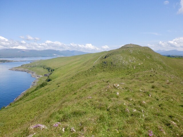
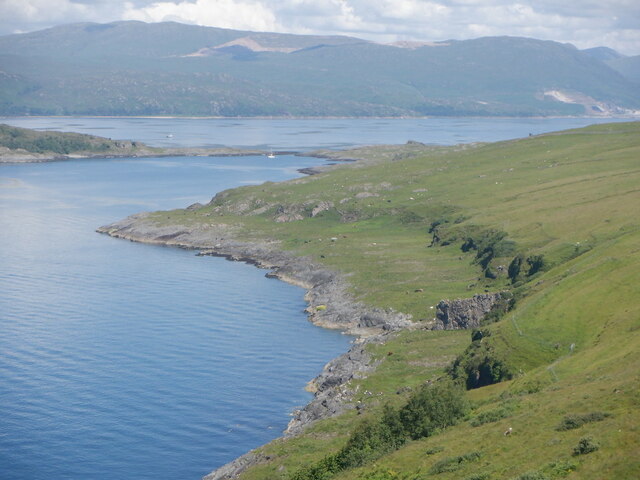
Miller's Port is a picturesque bay located in Argyllshire, Scotland. Situated on the western coast of the Scottish mainland, this charming port offers stunning views of the surrounding natural beauty and a rich maritime history. The bay is named after Captain James Miller, a prominent figure in the area's fishing industry during the 19th century.

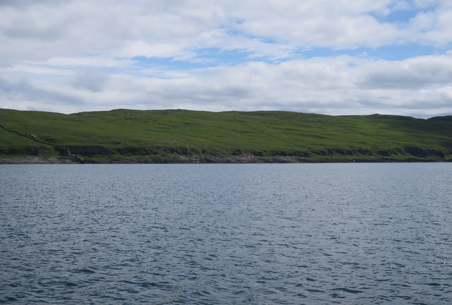
The bay is nestled between rolling hills and rocky cliffs, providing a sheltered haven for fishing boats and yachts. The waters of Miller's Port are renowned for their abundance of fish, attracting anglers from all over the region. Fishing remains an integral part of the local economy, and visitors can often observe fishermen preparing their nets or unloading their catches at the bustling port.

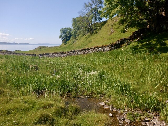
Beyond its maritime activities, Miller's Port offers a range of recreational opportunities for outdoor enthusiasts. The bay is a popular spot for kayaking and canoeing, with its calm waters and stunning coastal scenery. Hikers can explore the nearby hills and enjoy breathtaking views of the bay and surrounding countryside.

For those seeking tranquility, Miller's Port is also home to a beautiful sandy beach. Visitors can relax on the shore, bask in the sun, and take in the peaceful atmosphere of the bay.

Miller's Port is easily accessible by road, with a small parking area available near the port. The nearby village offers a selection of quaint accommodations, including cozy B&Bs and traditional Scottish inns, allowing visitors to fully immerse themselves in the charm of this idyllic coastal destination.

If you have any feedback on the listing, please let us know in the comments section below.

Miller's Port Images

Images are sourced within 2km of 56.475554/-5.5538729 or Grid Reference NM8137. Thanks to Geograph Open Source API. All images are credited.

Limestone and flowers, Druim Mòr A long limestone ridge at the south end of Lismore.
Limestone and flowers, Druim Mòr
A long limestone ridge at the south end of Lismore.
Cnoc Sneachdach, Lismore The high (by Lismore standards) ridge running along the south of the island.
Cnoc Sneachdach, Lismore
The high (by Lismore standards) ridge running along the south of the island.
Bàgh Clach an Dobhrain The west side of Lismore in part of the island depopulated by clearance. This is a very good example of a raised beach. 
The Glensanda quarry is visible beyond the anchorage and Bernera Island.
Bàgh Clach an Dobhrain
The west side of Lismore in part of the island depopulated by clearance. This is a very good example of a raised beach. The Glensanda quarry is visible beyond the anchorage and Bernera Island.
The Fiart Road, Lismore The south of the island running down to Dalnarrow through fine limestone scenery.
The Fiart Road, Lismore
The south of the island running down to Dalnarrow through fine limestone scenery.
The Fiart Road, Lismore The road to Dalnarrow passing through fine limestone scenery.
The Fiart Road, Lismore
The road to Dalnarrow passing through fine limestone scenery.
Coast of Lismore On the left, a dry stone wall merges with a protruding igneous dyke, which finishes the job down to the coast.
Coast of Lismore
On the left, a dry stone wall merges with a protruding igneous dyke, which finishes the job down to the coast.
Between the Ridges Track on the southern end of Lismore between Garbh Druim (rough ridge) on the left and Druim Mor (big ridge) on the right. The day is warming up and is actually feeling like summer.
Between the Ridges
Track on the southern end of Lismore between Garbh Druim (rough ridge) on the left and Druim Mor (big ridge) on the right. The day is warming up and is actually feeling like summer.
Gleann Beithe A shallow waterbody and fringing marshland in Gleann Beithe, north of Dalnarrow.
Gleann Beithe
A shallow waterbody and fringing marshland in Gleann Beithe, north of Dalnarrow.
Track on Lismore About 2km from the southwestern tip of the island.
Track on Lismore
About 2km from the southwestern tip of the island.
Rough grassland on Lismore At the southern end of the island.
Rough grassland on Lismore
At the southern end of the island.
The Fiart Road The road to the southern end of Lismore.
The Fiart Road
The road to the southern end of Lismore.
Mill site, Fiart The site of a mill (the burn enters the sea at Miller's Port) which would have serviced the pre-clearance south of Lismore.
Mill site, Fiart
The site of a mill (the burn enters the sea at Miller's Port) which would have serviced the pre-clearance south of Lismore.
Burn, Miller's Port Downstream from the mill site.
Burn, Miller's Port
Downstream from the mill site.
Mill site, Fiart A water mill served the pre-clearance population of the southern part of Lismore. Some of the stonework and lade remain.
Mill site, Fiart
A water mill served the pre-clearance population of the southern part of Lismore. Some of the stonework and lade remain.
Loch Fiart, Lismore
Loch Fiart, Lismore
Loch Fiart, Lismore
Loch Fiart, Lismore
Tree beside Loch Fiart Protected by rocks from the sheep.
Tree beside Loch Fiart
Protected by rocks from the sheep.
The Fiart Road, Lismore The south of the island running down to Dalnarrow through fine limestone scenery.
The Fiart Road, Lismore
The south of the island running down to Dalnarrow through fine limestone scenery.
Show me another place!

Miller's Port is located at Grid Ref: NM8137 (Lat: 56.475554, Lng: -5.5538729)

Unitary Authority: Argyll and Bute

Police Authority: Argyll and West Dunbartonshire

What 3 Words

///vowel.tested.thumps. Near Oban, Argyll & Bute

Related Wikis

Lismore Seminary

Lismore Seminary was situated in Kilcheran House on the island of Lismore in the Inner Hebrides part of Argyll, Scotland. It served as a seminary for the...

Achanduin Castle

Achanduin Castle, (also known as Achadun Castle and Acha-Dun), is a castle, now in ruins, located about 5.0 kilometres (3.1 mi) west of Achnacroish on...

Creag Island

Creag Island is an island in Scotland. It is located in Argyll and Bute council area, in the northwestern part of the country, 600 km northwest of the...

Bernera Island

Bernera Island (Scottish Gaelic: Beàrnaraigh) or simply Bernera is a tidal island off Lismore, in Argyll, Scotland. == History == In the 6th century, Bernera...

Nearby Amenities

Located within 500m of 56.475554,-5.5538729
Rubha na Gaoith
Natural: cape
Lat/Long: 56.4754017/-5.5528657
Miller's Port
Natural: bay
Lat/Long: 56.4754788/-5.554003
Port Ruadh
Natural: bay
Lat/Long: 56.4778963/-5.5485957
The data included in this document is from www.openstreetmap.org. The data is made available under ODbL.

Have you been to Miller's Port?

Leave your review of Miller's Port below (or comments, questions and feedback).