Barnacarry Bay

Bay in Argyllshire

Scotland

Barnacarry Bay

Trig point on Beinn Mhor
Trig point on Beinn Mhor Credit: Steven Brown

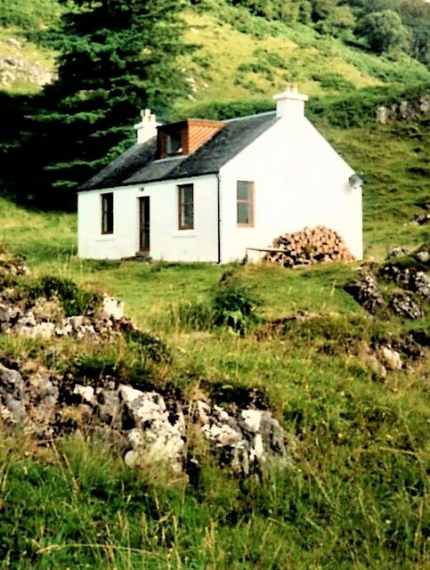
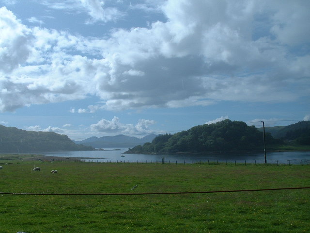
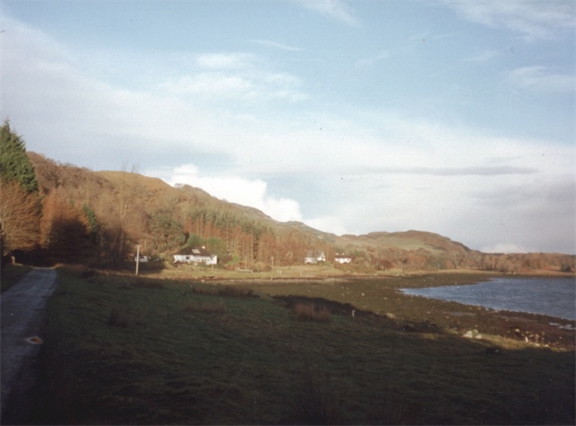
Barnacarry Bay is a stunning coastal bay located in Argyllshire, Scotland. Situated on the western coast of the region, it offers breathtaking views of the surrounding landscape and provides a peaceful retreat for visitors.

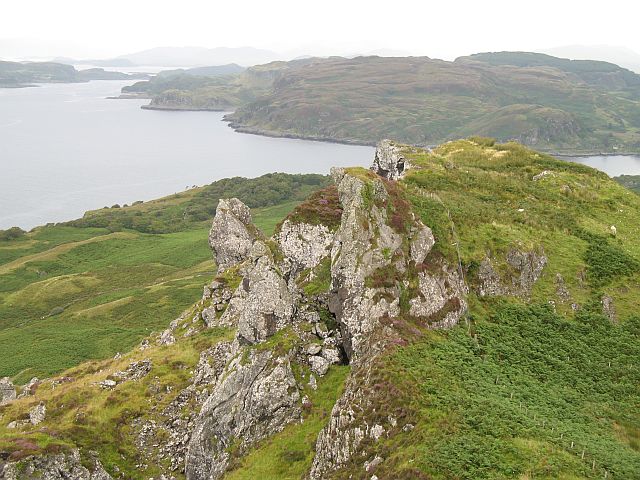
The bay is characterized by its pristine sandy beach, which stretches for approximately 1.5 kilometers and is backed by rugged cliffs and rolling hills. The crystal-clear waters of the bay are perfect for swimming, snorkeling, and other water activities. The beach is relatively secluded and less crowded, making it an ideal spot for relaxation and solitude.

The bay is also known for its diverse wildlife and rich marine ecosystem. Visitors can often spot seals, dolphins, and various species of birds in the area. The bay is a popular spot for birdwatching enthusiasts, who can observe a wide range of seabirds soaring through the skies or nesting on the cliffs.

Surrounding the bay, visitors can explore the picturesque coastal trails and enjoy panoramic views of the Scottish Highlands. The area is renowned for its natural beauty and offers numerous hiking and cycling routes, allowing visitors to immerse themselves in the stunning scenery.

Barnacarry Bay is a hidden gem in Argyllshire, offering a tranquil and unspoiled coastal experience. With its beautiful beach, diverse wildlife, and breathtaking views, it is a must-visit destination for nature lovers and those seeking a peaceful escape in the heart of Scotland.

If you have any feedback on the listing, please let us know in the comments section below.

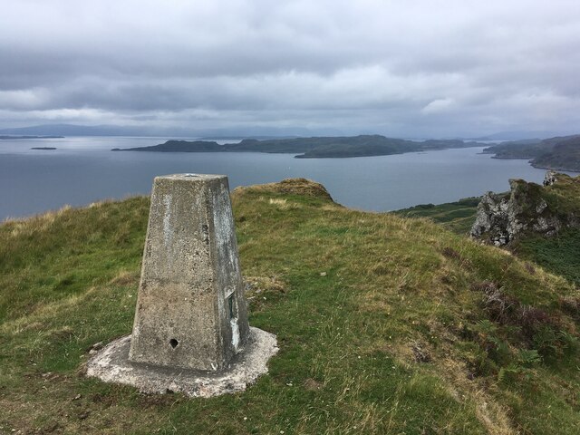
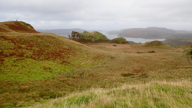
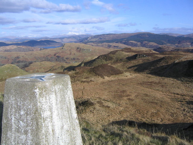
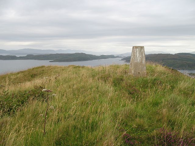
Barnacarry Bay Images

Images are sourced within 2km of 56.345598/-5.544242 or Grid Reference NM8122. Thanks to Geograph Open Source API. All images are credited.

Trig point on Beinn Mhor
Crags, Losgann Lornach
Beinn Mhòr and Losgann Lornach
Coast below Beinn Mhòr
Ancient fort with crags below, north-east of summit of Beinn Mhor Beinn Mhor is a low hill rising to just 194m overlooking the Firth of Lorn which is the main body of water in view. The ancient fort is/was located on the rise at the right side of the image, above the crags. The distant sea view is through the Sound of Kerrera with the island of Kerrera being the land mass at the left side of the photograph.
Ancient fort with crags below, north-east of summit of Beinn Mhor
Beinn Mhor is a low hill rising to just 194m overlooking the Firth of Lorn which is the main body of water in view. The ancient fort is/was located on the rise at the right side of the image, above the crags. The distant sea view is through the Sound of Kerrera with the island of Kerrera being the land mass at the left side of the photograph.
Beinn Mhor View northwards across rugged cliffs towards the Sound of Kerrera
Beinn Mhor
View northwards across rugged cliffs towards the Sound of Kerrera
Coastline near Clachan, Argyll Alongside the Firth of Lorn looking towards Kerrera.
Coastline near Clachan, Argyll
Alongside the Firth of Lorn looking towards Kerrera.
Beinn Mhor Lovely walk in sunshine to start the day with Jim Bloomer. Summit 150m SE is lower and summit 175m SSW at NM 79807 21405 is 1m lower.

Name: Beinn Mhor
Hill number: 1404
Height: 194m / 636ft
Area: 19A: Oban to Loch Fyne
Class: Ma
Grid ref: NM 79842 21578
Summit feature: ground 2m NE of trig point
Drop: 162m
Col: 32m  NM810220
Beinn Mhor
Lovely walk in sunshine to start the day with Jim Bloomer. Summit 150m SE is lower and summit 175m SSW at NM 79807 21405 is 1m lower. Name: Beinn Mhor Hill number: 1404 Height: 194m / 636ft Area: 19A: Oban to Loch Fyne Class: Ma Grid ref: NM 79842 21578 Summit feature: ground 2m NE of trig point Drop: 162m Col: 32m NM810220
Beach Beach overlooking the Firth of Lorne
Beach
Beach overlooking the Firth of Lorne
Cliffs at Beinn Mor Cliffs forming what is called the Toad of Lorne when viewed from seaward
Cliffs at Beinn Mor
Cliffs forming what is called the Toad of Lorne when viewed from seaward
Summit of Beinn Mor From the trig point on Beinn Mor looking NE
Summit of Beinn Mor
From the trig point on Beinn Mor looking NE
trig point on Beinn Mor Looking north towards Kerrera
trig point on Beinn Mor
Looking north towards Kerrera
Beinn Mhòr The summit, with Kerrera beyond.
Beinn Mhòr
The summit, with Kerrera beyond.
Shattered crags, Beinn Mhòr North ridge with basalt crags falling to hazel covered screes below. A dramatic change from the lush cattle pastures to the south of the summit.
Shattered crags, Beinn Mhòr
North ridge with basalt crags falling to hazel covered screes below. A dramatic change from the lush cattle pastures to the south of the summit.
Woodland below Beinn Mhòr The seaward crags of Beinn Mhòr fall to screes and woodland.
Woodland below Beinn Mhòr
The seaward crags of Beinn Mhòr fall to screes and woodland.
'Ring of Bright Water' (film location) - Minard Point Tigh Beg Croft and this part of the coastline at the entrance to Loch Feochan was used in the 1968 filming of 'Ring of Bright Water'.
'Ring of Bright Water' (film location) - Minard Point
Tigh Beg Croft and this part of the coastline at the entrance to Loch Feochan was used in the 1968 filming of 'Ring of Bright Water'.
Ardentallen Point Loch Feochan looking West towards the Firth of Lorne
Ardentallen Point
Loch Feochan looking West towards the Firth of Lorne
Show me another place!

Barnacarry Bay is located at Grid Ref: NM8122 (Lat: 56.345598, Lng: -5.544242)

Unitary Authority: Argyll and Bute

Police Authority: Argyll and West Dunbartonshire

What 3 Words

///cornering.locate.ripples. Near Oban, Argyll & Bute

Nearby Locations

Barnacarry Bay Beinn Bhàn

Related Wikis

Ardentallen

Ardentallen (Scottish Gaelic: Àird an t-Sàilein) is a village in Argyll and Bute, Scotland. == References ==
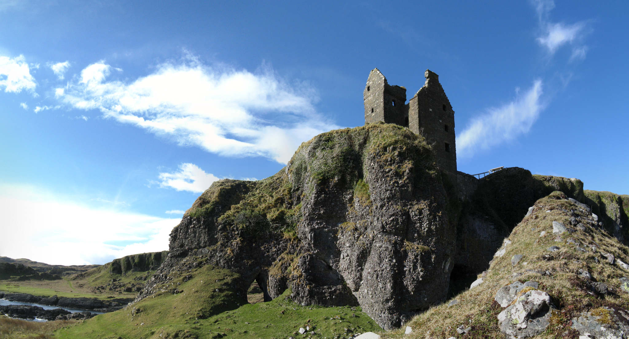
Gylen Castle

Gylen Castle is a ruined castle, or tower house, at the south end of the island of Kerrera in Argyll and Bute, Scotland, on a promontory overlooking the...
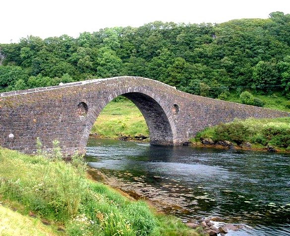
Clachan Bridge

The Clachan Bridge is a simple, single-arched, hump-backed, masonry bridge spanning the Clachan Sound, 13 kilometres (8 mi) southwest of Oban in Argyll...

Battle of Lagganmore

The Battle of Lagganmore took place in 1646 at Lagganmore in Glen Euchar, west of Loch Scammadale. It was part of the Wars of the Three Kingdoms, though...

Kerrera

Kerrera (; Scottish Gaelic: Cearara or Cearrara) is an island in the Scottish Inner Hebrides, close to the town of Oban. In 2016 it had a population of...

Seil

Seil (; Scottish Gaelic: Saoil, Scottish Gaelic pronunciation: [ˈs̪ɯːl]) is one of the Slate Islands, located on the east side of the Firth of Lorn, 7...

Balvicar

Balvicar (Scottish Gaelic: Baile a' Bhiocair) is a village on the island of Seil, a small island seven miles (eleven kilometres) southwest of Oban, Scotland...

Lorn and Islands Hospital

Lorn & Islands Hospital is a rural general hospital on the southern outskirts of Oban in Argyll, Scotland. It is managed by NHS Highland. == History... ==

Nearby Amenities

Located within 500m of 56.345598,-5.544242
Source: PGS
Lat/Long: 56.3490737/-5.5408592
Barrnacarry
Place: farm
Lat/Long: 56.3415678/-5.5438897
Barrnacarry Bay
Natural: bay
Lat/Long: 56.3471921/-5.544641
Power: pole
Lat/Long: 56.3414096/-5.5439651
The data included in this document is from www.openstreetmap.org. The data is made available under ODbL.

Have you been to Barnacarry Bay?

Leave your review of Barnacarry Bay below (or comments, questions and feedback).