South Tarbet Bay

Bay in Inverness-shire

Scotland

South Tarbet Bay

Kylesmorar, Loch Nevis Pretty little settlement which has been given some TLC.  There is a holiday home - maybe two.  The former school is the building on the right.  Also a family of happy free ranging pigs. It is a delightful spot.
Kylesmorar, Loch Nevis Credit: Glen Breaden

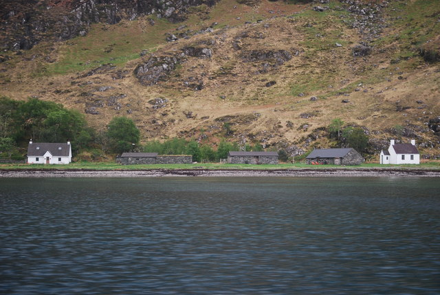
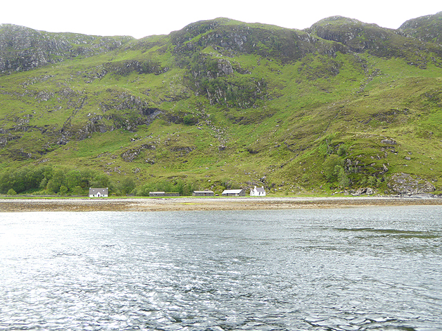
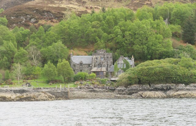
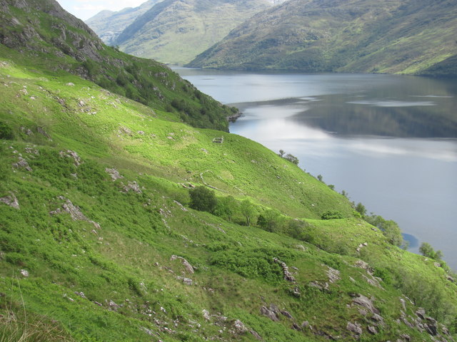
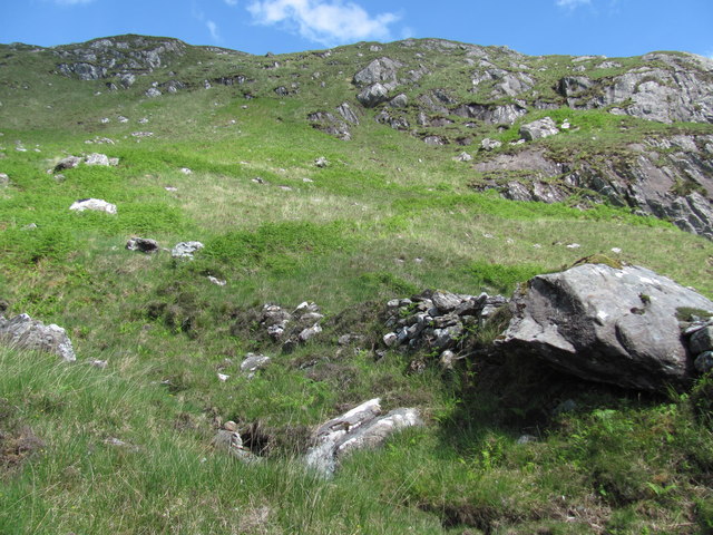
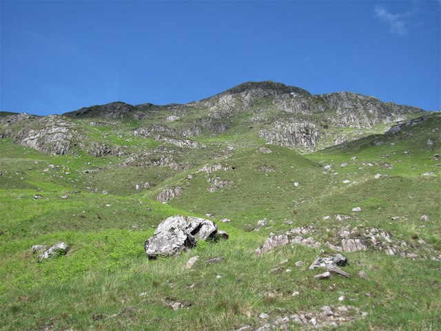
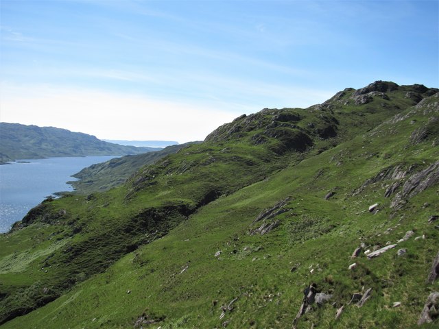
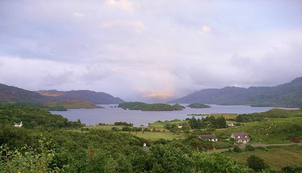
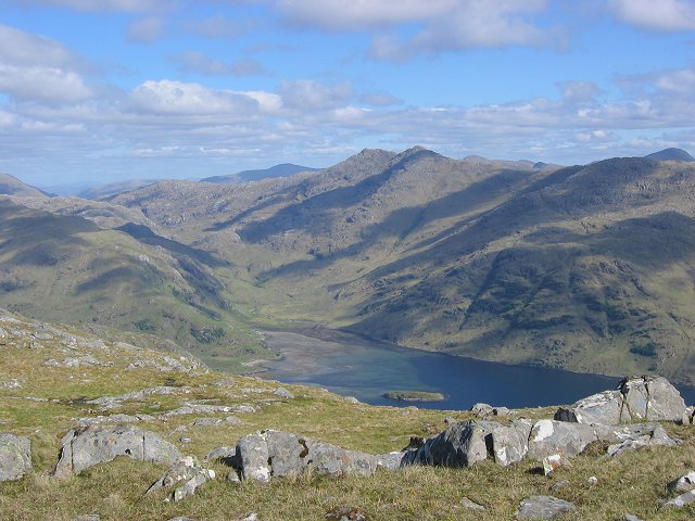
South Tarbet Bay is a picturesque bay located in Inverness-shire, Scotland. It is situated on the western shore of Loch Nevis, a sea loch that is known for its stunning natural beauty and rugged coastline. The bay is surrounded by rolling hills and lush greenery, creating a peaceful and serene atmosphere for visitors to enjoy.

South Tarbet Bay is a popular destination for outdoor enthusiasts, as it offers a range of activities such as hiking, fishing, and bird watching. The bay is also a great spot for wildlife enthusiasts, as it is home to a variety of bird species and marine life.

The bay is easily accessible by road, with a small parking area available for visitors. There are also a number of walking trails that lead down to the water's edge, providing stunning views of the surrounding landscape.

Overall, South Tarbet Bay is a hidden gem in the Scottish Highlands, offering visitors a peaceful retreat in the midst of nature's beauty. Whether you're looking to relax on the beach, explore the surrounding countryside, or simply enjoy the tranquility of the bay, South Tarbet Bay has something to offer for everyone.

If you have any feedback on the listing, please let us know in the comments section below.

South Tarbet Bay Images

Images are sourced within 2km of 56.960512/-5.6230208 or Grid Reference NM7991. Thanks to Geograph Open Source API. All images are credited.

Kylesmorar, Loch Nevis Pretty little settlement which has been given some TLC.  There is a holiday home - maybe two.  The former school is the building on the right.  Also a family of happy free ranging pigs. It is a delightful spot.
Kylesmorar, Loch Nevis
Pretty little settlement which has been given some TLC. There is a holiday home - maybe two. The former school is the building on the right. Also a family of happy free ranging pigs. It is a delightful spot.
Cottages at Kylesmorar The word "Kyle" means "narrows". At one point Loch Nevis narrows to a mere 250 metres across.
Cottages at Kylesmorar
The word "Kyle" means "narrows". At one point Loch Nevis narrows to a mere 250 metres across.
Tarbet Bay Entering the bay aboard the MV Western Isles, a boat too large to dock at the small jetty. On this occasion a small boat was due to come out to collect some goods, but it never appeared, so the skipper made an about turn and we sailed away again.
Tarbet Bay
Entering the bay aboard the MV Western Isles, a boat too large to dock at the small jetty. On this occasion a small boat was due to come out to collect some goods, but it never appeared, so the skipper made an about turn and we sailed away again.
Fancy residence at Tarbet Not quite what one would expect in such a remote location. Access presumably by boat or via a path.
Fancy residence at Tarbet
Not quite what one would expect in such a remote location. Access presumably by boat or via a path.
Remote settlement This settlement was probably for summer use only. There is a good supply of stream water and plenty of grazing available. Several ruins were here including shielings and walls. The big scale OS map shows these clearly.
Remote settlement
This settlement was probably for summer use only. There is a good supply of stream water and plenty of grazing available. Several ruins were here including shielings and walls. The big scale OS map shows these clearly.
Steep terrain The Loch is the deepest of all freshwater lochs and the steep sides are a clue to this fact. There was no Geograph for this square until 2017 and for a good reason; the terrain is difficult to cross with no paths except those made by deer.
Steep terrain
The Loch is the deepest of all freshwater lochs and the steep sides are a clue to this fact. There was no Geograph for this square until 2017 and for a good reason; the terrain is difficult to cross with no paths except those made by deer.
Stream providing water to a former settlement Whoever lived at the ruined settlement here would have used this stream for water in preference to scrambling steeply down to the loch.
Stream providing water to a former settlement
Whoever lived at the ruined settlement here would have used this stream for water in preference to scrambling steeply down to the loch.
A shieling; farming settlement This was one of several ruins here and is probably the main dwelling of a summer farmstead, known as a shieling in Scotland.
A shieling; farming settlement
This was one of several ruins here and is probably the main dwelling of a summer farmstead, known as a shieling in Scotland.
A stream giving shelter for trees The streams on this mountainside were invariably host to trees whereas the surrounding areas were mostly without trees.
A stream giving shelter for trees
The streams on this mountainside were invariably host to trees whereas the surrounding areas were mostly without trees.
Drystone wall This is one of the ruined walls of a farming settlement in an open and well-watered area where people farmed in the past.
Drystone wall
This is one of the ruined walls of a farming settlement in an open and well-watered area where people farmed in the past.
Ruined wall of old farm Several walls in this area were largely hidden by the bracken which grew on them. There are several ruins of former buildings here, presumably shielings.
Ruined wall of old farm
Several walls in this area were largely hidden by the bracken which grew on them. There are several ruins of former buildings here, presumably shielings.
A natural home for deer This less steep terrain provided pasture for farm animals in the past, at least in summer months. The top cliffs had four deer sentinels visible when I arrived but when they saw me the herd was encouraged to leave.
A natural home for deer
This less steep terrain provided pasture for farm animals in the past, at least in summer months. The top cliffs had four deer sentinels visible when I arrived but when they saw me the herd was encouraged to leave.
Drystone wall This is one of several remnants of walls at this location which has become partly hidden by bracken and other vegetation growing on it.
Drystone wall
This is one of several remnants of walls at this location which has become partly hidden by bracken and other vegetation growing on it.
Easier terrain above Loch Morar The steep slopes above the north shore of Loch Morar ease off near the ridge summit and the grass cover is easier for walking. However there's no easy route to get here. The stream cut in a rather straight notch may be following a geological fault line.
Easier terrain above Loch Morar
The steep slopes above the north shore of Loch Morar ease off near the ridge summit and the grass cover is easier for walking. However there's no easy route to get here. The stream cut in a rather straight notch may be following a geological fault line.
Overview of old shielings This may have been a productive place for farming but the access was difficult. By land the going was very tough and arriving by water entailed a steep climb up the mountainside.
Overview of old shielings
This may have been a productive place for farming but the access was difficult. By land the going was very tough and arriving by water entailed a steep climb up the mountainside.
Home for a fox? This area would not have much food for a fox to find but the hole seemed about the right size for this rather than rabbits.
Home for a fox?
This area would not have much food for a fox to find but the hole seemed about the right size for this rather than rabbits.
Kylesmorar, Loch Nevis
Shore at Tarbet The small settlement of Tarbet, Loch Nevis, lies at the foot of the short track that runs between Lochs Nevis and Morar.
Shore at Tarbet
The small settlement of Tarbet, Loch Nevis, lies at the foot of the short track that runs between Lochs Nevis and Morar.
Show me another place!

South Tarbet Bay is located at Grid Ref: NM7991 (Lat: 56.960512, Lng: -5.6230208)

Unitary Authority: Highland

Police Authority: Highlands and Islands

What 3 Words

///timeless.collapsed.reporting. Near Arisaig, Highland

Related Wikis

Tarbet, Loch Nevis

Tarbet (Scottish Gaelic: An Tairbeart or Tairbeart Loch Nibheis) is a place on the south shore of Loch Nevis in Scotland, about 6 miles (10 kilometres...

Loch Morar

Loch Morar (Scottish Gaelic: Loch Mòrair) is a freshwater loch in Lochaber, Highland, Scotland. It is the fifth-largest loch by surface area in Scotland...

Beinn Bhuidhe (Knoydart)

Beinn Bhuidhe (855m) is a mountain in the Northwest Highlands of Scotland. It lies in a very remote area of Knoydart, Lochaber. Lying on the north side...

Loch Nevis

Loch Nevis (Scottish Gaelic: Loch Nibheis) is a sea loch in Lochaber on the west coast of Scotland. It runs inland from the Sound of Sleat, and is bounded...

Nearby Amenities

Located within 500m of 56.960512,-5.6230208
South Tarbet Bay
Natural: bay
Source: Scottish Popular Edition
Lat/Long: 56.9599438/-5.6224269
The data included in this document is from www.openstreetmap.org. The data is made available under ODbL.

Have you been to South Tarbet Bay?

Leave your review of South Tarbet Bay below (or comments, questions and feedback).