An Sean Inbhir

Bay in Ross-shire

Scotland

An Sean Inbhir

Loch na h-Uamhaidh Beag
Loch na h-Uamhaidh Beag Credit: David Brown

An Sean Inbhir, also known as Shandwick Bay, is a picturesque coastal area located in Ross-shire, Scotland. It is situated on the eastern coast of the Highland region, approximately 30 miles north of Inverness.

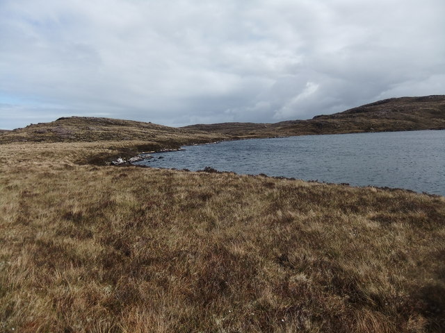
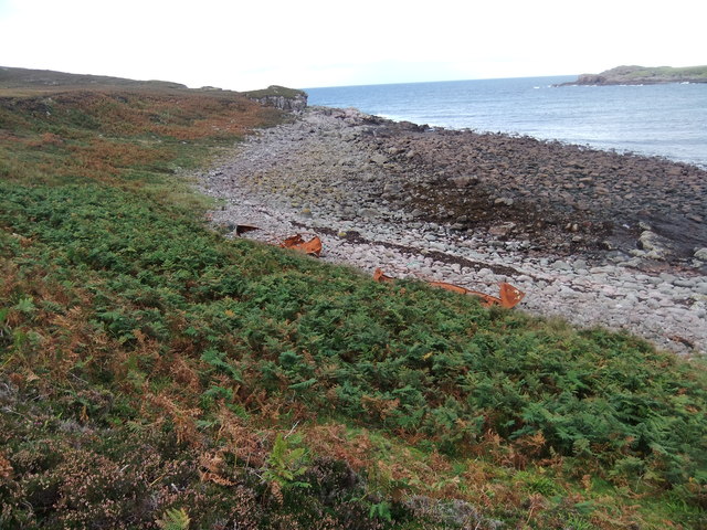
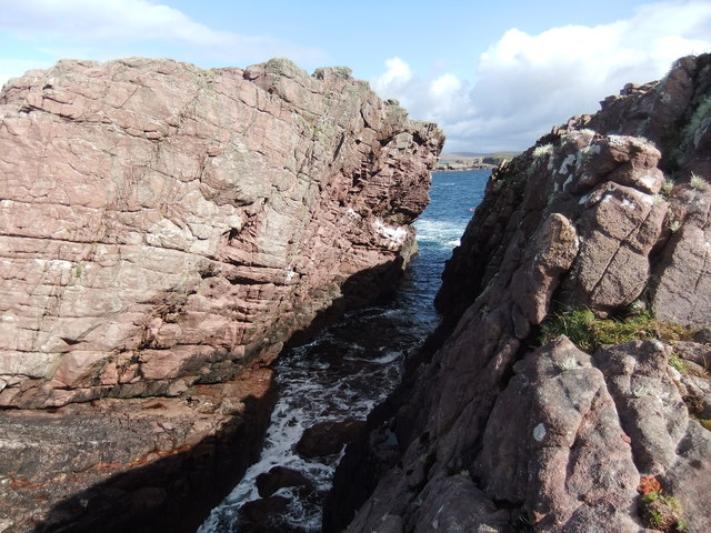
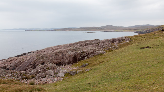
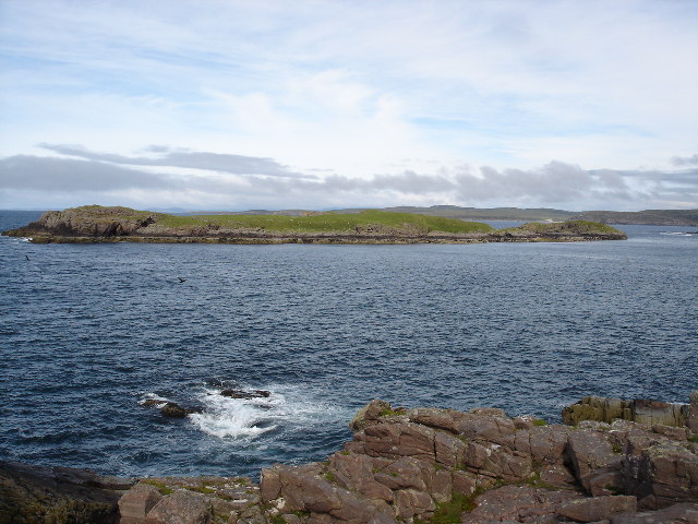
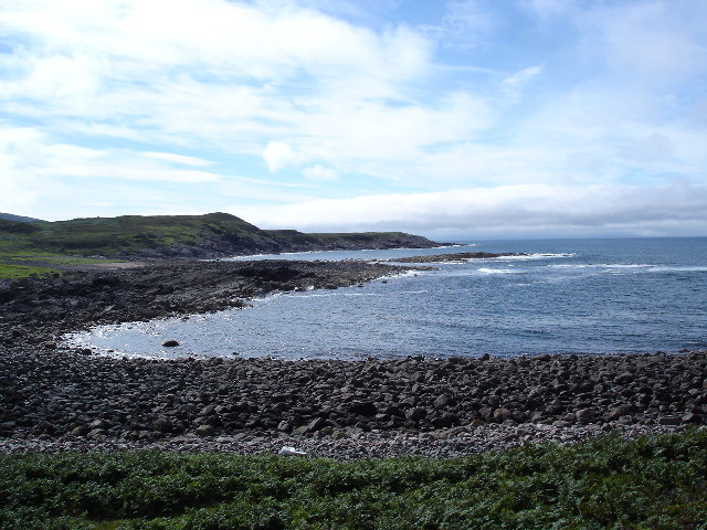
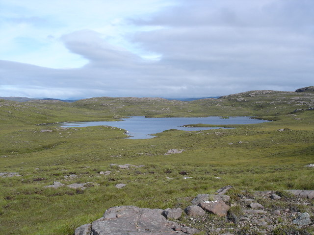
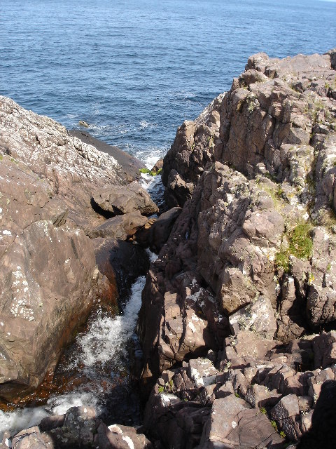
The bay is notable for its stunning sandy beach, which stretches for over a mile and is backed by rolling sand dunes. The beach offers visitors breathtaking views of the Moray Firth and the surrounding cliffs, making it a popular destination for nature lovers and outdoor enthusiasts.

An Sean Inbhir is also known for its rich history and archaeological significance. The area is home to the remains of an Iron Age fort, which overlooks the bay and provides a glimpse into the region's ancient past. Visitors can explore the fort's earthworks and defensive ditches, as well as enjoy the panoramic views it offers.

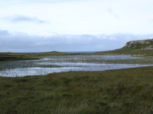
The bay is a haven for wildlife, with various bird species including oystercatchers, curlews, and terns that can be observed along the shoreline. In addition, seals can often be spotted swimming in the waters of the bay, adding to the area's natural beauty.

For those looking to explore the surrounding area, An Sean Inbhir is located near several charming coastal villages, such as Balintore and Portmahomack, where visitors can experience traditional Scottish hospitality and enjoy local cuisine.

Overall, An Sean Inbhir, Ross-shire, offers a harmonious blend of natural beauty, historical significance, and wildlife diversity, making it a must-visit destination for those seeking a tranquil coastal escape in the Scottish Highlands.

If you have any feedback on the listing, please let us know in the comments section below.

An Sean Inbhir Images

Images are sourced within 2km of 57.867025/-5.7315944 or Grid Reference NG7892. Thanks to Geograph Open Source API. All images are credited.

Loch na h-Uamhaidh Beag
Beach with rusting lifeboats
Stac Rhuadh An attempt to get on the Stac thwarted by a huge chasm!
Stac Rhuadh
An attempt to get on the Stac thwarted by a huge chasm!
Bouldery beach with wrecked lifeboats The beach is at a bay south of Eilean Furadh Mòr near to where, on 26 Feb 1944, the US 'Liberty Ship', William H. Welch foundered and was lost with most of her crew. The rusting remains of several of the ship's lifeboats lie on the beach
Bouldery beach with wrecked lifeboats
The beach is at a bay south of Eilean Furadh Mòr near to where, on 26 Feb 1944, the US 'Liberty Ship', William H. Welch foundered and was lost with most of her crew. The rusting remains of several of the ship's lifeboats lie on the beach
Remains of lifeboat This is the remains of one of the lifeboats from the William H Welch, a liberty ship which went aground near here on 25th February 1944.
Remains of lifeboat
This is the remains of one of the lifeboats from the William H Welch, a liberty ship which went aground near here on 25th February 1944.
View across Camas Dubh
Rocky northern coastline
Path through the bracken
View east along the coastline
Coastal image east of Rubha Reidh lighthouse Image shows 'Tess' my mountain rescue dog looking east across Camas Mor towards Sron a Gheodha Dhuibh and beyond.  Photograph taken while working with Dollar Academy Duke of Edinburgh Award Scheme in June 2012.
Coastal image east of Rubha Reidh lighthouse
Image shows 'Tess' my mountain rescue dog looking east across Camas Mor towards Sron a Gheodha Dhuibh and beyond. Photograph taken while working with Dollar Academy Duke of Edinburgh Award Scheme in June 2012.
Eilean Furadh Mòr Typical narrow Hydro pillar design. Neatly lettered cap "HMS COOK 1951" Landed off RIB onto rocks and scrambled easy slabs to pillar which is at summit. Very nice little island. Alan Holmes group charter out of Ullapool with only 5 out of 12 in the group bagging the island and the trig.
Eilean Furadh Mòr
Typical narrow Hydro pillar design. Neatly lettered cap "HMS COOK 1951" Landed off RIB onto rocks and scrambled easy slabs to pillar which is at summit. Very nice little island. Alan Holmes group charter out of Ullapool with only 5 out of 12 in the group bagging the island and the trig.
Wrecked lifeboats from the William H Welch The Liberty ship the William H Welch ran aground with loss of 72 lives.  The lifeboats washed ashore but had not been used.
Wrecked lifeboats from the William H Welch
The Liberty ship the William H Welch ran aground with loss of 72 lives. The lifeboats washed ashore but had not been used.
Eilean Furadh Mor over Caolas an Fhuraidh Taken from the headland adjacent to Stac Rhuadh. I was actually 60m outside the grid square when I took the picture.  Getting onto the stack would prove an interesting challenge.
Eilean Furadh Mor over Caolas an Fhuraidh
Taken from the headland adjacent to Stac Rhuadh. I was actually 60m outside the grid square when I took the picture. Getting onto the stack would prove an interesting challenge.
Sgeir Mhor Sgeir is gaelic for skerry, a small rocky island.  Although at low tide is you can walk out to the point.
Sgeir Mhor
Sgeir is gaelic for skerry, a small rocky island. Although at low tide is you can walk out to the point.
Loch an t-Sean -inbhir Looking towards the sea which can be just glimpsed in the background
Loch an t-Sean -inbhir
Looking towards the sea which can be just glimpsed in the background
Loch na h-Uamhaidh Moire Taken from the highest point in the gridsquare looking east.
Loch na h-Uamhaidh Moire
Taken from the highest point in the gridsquare looking east.
Abhainn na Leumas as it meets the sea This river drains the series of lochs below the Loch Maree fault
Abhainn na Leumas as it meets the sea
This river drains the series of lochs below the Loch Maree fault
Show me another place!

An Sean Inbhir is located at Grid Ref: NG7892 (Lat: 57.867025, Lng: -5.7315944)

Unitary Authority: Highland

Police Authority: Highlands and Islands

What 3 Words

///handbag.emotional.protester. Near Gairloch, Highland

Related Wikis

Cove, Highland

Cove is a remote hamlet located on the northwestern shore of the sea loch Loch Ewe, and 8 mi (13 km) northwest of Poolewe in Ross-shire, Scottish Highlands...

Rua Reidh Lighthouse

Rua Reidh Lighthouse stands close to the entrance to Loch Ewe in Wester Ross, Scotland. == History == The name "Rua Reidh" is a semi-anglicisation of...

Mellon Charles

Mellon Charles (Scottish Gaelic: Meallan Theàrlaich) is a remote crofting village on the north east shore of Loch Ewe near Gairloch in Wester Ross, in...

Ormiscaig

Ormiscaig (Scottish Gaelic: Ormasgaig) is a remote crofting village on the north east shore of Loch Ewe in Achnasheen, Ross-shire, Scottish Highlands and...

Nearby Amenities

Located within 500m of 57.867025,-5.7315944
Source: PGS
Lat/Long: 57.8697709/-5.725489
Source: PGS
Lat/Long: 57.8692571/-5.7260195
Source: PGS
Lat/Long: 57.8692255/-5.7286693
Source: PGS
Lat/Long: 57.8688543/-5.7284619
Source: PGS
Lat/Long: 57.8686724/-5.7292018
Source: PGS
Lat/Long: 57.868467/-5.7294095
Source: PGS
Lat/Long: 57.8680326/-5.7291793
Source: PGS
Lat/Long: 57.8672354/-5.7297343
Source: PGS
Lat/Long: 57.8661273/-5.7300856
Source: PGS
Lat/Long: 57.8659219/-5.730458
Created By: almien_coastlines
Source: PGS
Lat/Long: 57.865858/-5.730766
Source: PGS
Lat/Long: 57.8658001/-5.7313026
Source: PGS
Lat/Long: 57.8658295/-5.7318929
Created By: almien_coastlines
Source: PGS
Lat/Long: 57.86596/-5.731975
Source: PGS
Lat/Long: 57.8661511/-5.7323347
Source: PGS
Lat/Long: 57.866552/-5.7329603
Source: PGS
Lat/Long: 57.8666562/-5.7334533
Source: PGS
Lat/Long: 57.8665592/-5.7337791
Source: PGS
Lat/Long: 57.8666015/-5.7341279
Source: PGS
Lat/Long: 57.8664786/-5.7349434
Source: PGS
Lat/Long: 57.8662984/-5.736304
Source: PGS
Lat/Long: 57.8660399/-5.737222
Source: PGS
Lat/Long: 57.8656932/-5.7379623
Source: PGS
Lat/Long: 57.8655387/-5.7384467
Source: PGS
Lat/Long: 57.8654021/-5.7389789
The data included in this document is from www.openstreetmap.org. The data is made available under ODbL.

Have you been to An Sean Inbhir?

Leave your review of An Sean Inbhir below (or comments, questions and feedback).