Little Shelford
Settlement in Cambridgeshire South Cambridgeshire
England
Little Shelford
Little Shelford is a small village located in the county of Cambridgeshire, England. Situated approximately 7 miles south of the city of Cambridge, Little Shelford is nestled in the picturesque countryside of the South Cambridgeshire district. The village is home to a population of around 1,000 residents.
Known for its charming and quintessentially English character, Little Shelford boasts a rich history dating back to medieval times. The village is famous for its well-preserved thatched cottages, traditional architecture, and scenic landscapes, making it an attractive destination for visitors seeking a glimpse into rural England.
The heart of the village is centered around the historic St. Margaret's Church, which dates back to the 12th century. The church's stunning architecture and serene atmosphere make it a popular venue for weddings and other religious ceremonies. Additionally, the village has a vibrant community spirit, with various clubs and societies catering to different interests, including gardening, sports, and arts.
Little Shelford benefits from its proximity to Cambridge, as it provides easy access to the city's amenities and cultural offerings. The village is well-connected by road, with the M11 motorway just a short drive away, and has a regular bus service to Cambridge and other nearby towns.
Overall, Little Shelford is a tranquil and idyllic village, offering residents and visitors alike a peaceful retreat from the hustle and bustle of city life, while still enjoying the conveniences and attractions of nearby Cambridge.
If you have any feedback on the listing, please let us know in the comments section below.
Little Shelford Images
Images are sourced within 2km of 52.142587/0.119222 or Grid Reference TL4551. Thanks to Geograph Open Source API. All images are credited.


Little Shelford is located at Grid Ref: TL4551 (Lat: 52.142587, Lng: 0.119222)
Administrative County: Cambridgeshire
District: South Cambridgeshire
Police Authority: Cambridgeshire
What 3 Words
///package.defected.compounds. Near Harston, Cambridgeshire
Nearby Locations
Related Wikis

Little Shelford
Little Shelford is a village located to the south of Cambridge, in the county of Cambridgeshire, in eastern England. The River Granta lies between it...
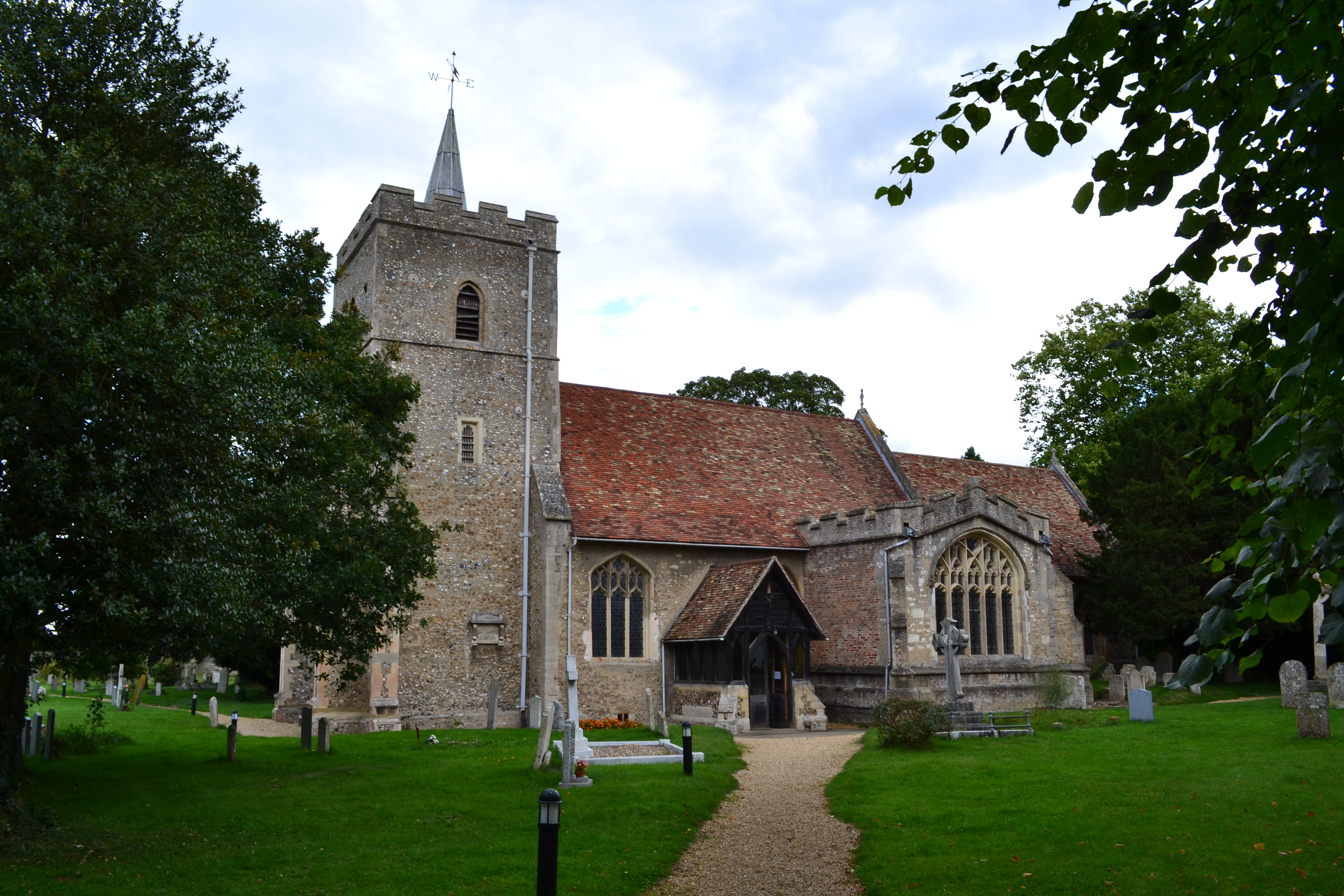
Church of All Saints, Little Shelford
The Church of All Saints is a Church of England parish church in Little Shelford, Cambridgeshire. The church is a Grade II* listed building, and dates...

Great Shelford F.C.
Great Shelford Football Club are a football club based in Great Shelford, near Cambridge, England. Established in 1912, they currently play in the Cambridgeshire...

Hauxton
Hauxton is a small village in Cambridgeshire, England around 5 miles to the south-west of Cambridge. == History == Hauxton has been occupied for well over...

Great Shelford
Great Shelford is a village located approximately 4 miles (6.4 km) to the south of Cambridge, in Cambridgeshire, in eastern England. In 1850 Great Shelford...
South Cambridgeshire
South Cambridgeshire is a local government district of Cambridgeshire, England, with a population of 162,119 at the 2021 census. It was formed on 1 April...

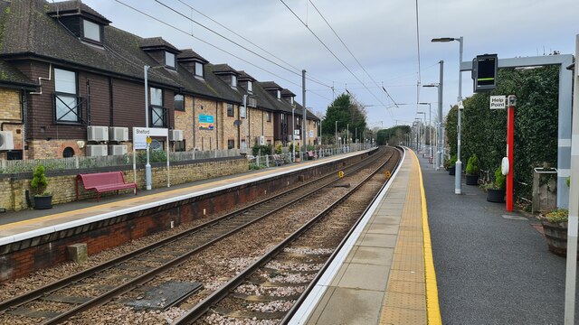
Shelford railway station
Shelford railway station is on the West Anglia Main Line serving the villages of Great Shelford, Little Shelford and Stapleford in Cambridgeshire, England...

Hauxton Mill
The Hauxton Mill is a classic English watermill on the old A10 road between Cambridge and Royston, England. It was partially destroyed by a fire, treated...
Nearby Amenities
Located within 500m of 52.142587,0.119222Have you been to Little Shelford?
Leave your review of Little Shelford below (or comments, questions and feedback).