Camas nam Beathag

Bay in Argyllshire

Scotland

Camas nam Beathag

Looking north east along Loch Shiel
Looking north east along Loch Shiel Credit: simon stewart

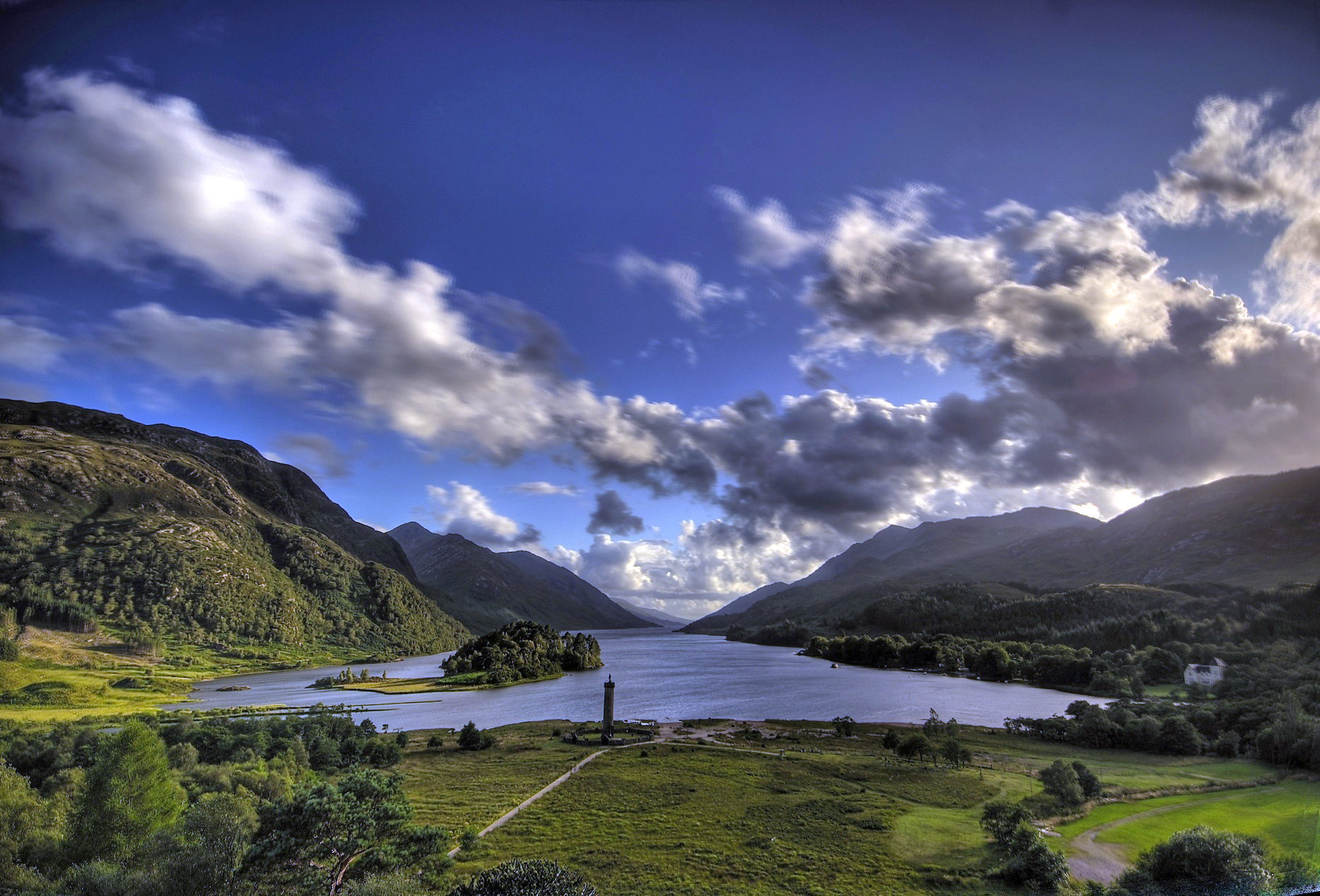
Camas nam Beathag is a picturesque bay located in Argyllshire, Scotland. Situated along the rugged and stunning west coast, the bay offers breathtaking views of the surrounding landscapes and the vast Atlantic Ocean.

The bay is characterized by its pristine sandy beach, which is framed by tall cliffs and rolling hills covered in lush green vegetation. The beach stretches for about a mile and is a popular spot for locals and tourists alike, especially during the summer months. The clear turquoise waters of the bay are inviting for swimming, kayaking, and other water activities.

The bay is also known for its diverse wildlife. Visitors may spot a variety of bird species, including oystercatchers, gannets, and puffins. Seals are often seen basking on the rocks, while dolphins and even occasional whales can be spotted in the deeper waters.

In addition to its natural beauty, Camas nam Beathag holds historical significance. The area is dotted with ancient ruins, including standing stones and burial cairns, providing a glimpse into the rich history of the region.

The bay is easily accessible by road, and there is a small car park nearby for visitors. Facilities such as public toilets and picnic areas are available, making it a convenient and enjoyable destination for a day trip or a longer visit.

Overall, Camas nam Beathag offers a serene and idyllic setting, perfect for nature lovers, beach enthusiasts, and those seeking a tranquil escape in the scenic Argyllshire region of Scotland.

If you have any feedback on the listing, please let us know in the comments section below.

Camas nam Beathag Images

Images are sourced within 2km of 56.767712/-5.6280947 or Grid Reference NM7869. Thanks to Geograph Open Source API. All images are credited.

Looking north east along Loch Shiel
Shoreline & forestry below Druim Breac Somewhere is the mouth of An Garbh-allt
Shoreline & forestry below Druim Breac
Somewhere is the mouth of An Garbh-allt
Small quarry on loch-side access road/track Below Màman Odhar: Quarry appears active.
Small quarry on loch-side access road/track
Below Màman Odhar: Quarry appears active.
Small tree in scrubby woodland Near Fasadh am Fhamhair
Small tree in scrubby woodland
Near Fasadh am Fhamhair
Wooded hillside, north side of Loch Shiel
Woodland above shoreline, North Loch Shiel
The River Polloch About to flow into Loch Shiel.
The River Polloch
About to flow into Loch Shiel.
Craft workshop at Polloch Polloch is a remote location - at a road end over the hill, north from Strontian. At the time the image was recorded, May 2004, it was the home of Clarissa Crafts and still was in 2009 - <a title="https://www.geograph.org.uk/photo/1261363" href="https://www.geograph.org.uk/photo/1261363">Link</a>. No reference can be found currently, (December 2017), to the operation.
Craft workshop at Polloch
Polloch is a remote location - at a road end over the hill, north from Strontian. At the time the image was recorded, May 2004, it was the home of Clarissa Crafts and still was in 2009 - Link. No reference can be found currently, (December 2017), to the operation.
Forestry Commission building, Polloch By the car park, not sure if the Forestry are still using it.  There is a bike hire business up the hill, worth checking out for the lovely run up Loch Shiel.
Forestry Commission building, Polloch
By the car park, not sure if the Forestry are still using it. There is a bike hire business up the hill, worth checking out for the lovely run up Loch Shiel.
Car park signs, Polloch I do hope that the sign is a camper van deterrent and not an attempt to hinder multi day trips in the hills.   I am not so ambitious today, a quick run up to Scammodale to fill in a gap on our map.
Car park signs, Polloch
I do hope that the sign is a camper van deterrent and not an attempt to hinder multi day trips in the hills. I am not so ambitious today, a quick run up to Scammodale to fill in a gap on our map.
Old log stack These are big logs from quite large trees. Why they have been left to rot is a mystery.  Usually smaller logs are left around for habitat enrichment purposes.
Old log stack
These are big logs from quite large trees. Why they have been left to rot is a mystery. Usually smaller logs are left around for habitat enrichment purposes.
Polloch The settlement seen from the road along Loch Shiel to Callop.
Polloch
The settlement seen from the road along Loch Shiel to Callop.
Loch, Polloch Once part of Loch Shiel, this body of water is now surrounded by alluvial deposits from the River Polloch.
Loch, Polloch
Once part of Loch Shiel, this body of water is now surrounded by alluvial deposits from the River Polloch.
River Polloch enters Loch Shiel Loch Shiel has a natural shoreline so deposition features are preserved and easy to see. Here a big river deposits banks in an inlet of Loch Shiel, a fjord which has been sealed off from the sea by isostatic uplift.  Much of the land here has been planted by the Forestry Commission.
River Polloch enters Loch Shiel
Loch Shiel has a natural shoreline so deposition features are preserved and easy to see. Here a big river deposits banks in an inlet of Loch Shiel, a fjord which has been sealed off from the sea by isostatic uplift. Much of the land here has been planted by the Forestry Commission.
Alluvial deposits, Polloch Marshy flat land with peaty pools where material has been dumped into Loch Shiel from the River Polloch.
Alluvial deposits, Polloch
Marshy flat land with peaty pools where material has been dumped into Loch Shiel from the River Polloch.
Road along Loch Shiel An unsealed road between Polloch and Callop along Loch Shiel.
Road along Loch Shiel
An unsealed road between Polloch and Callop along Loch Shiel.
An inlet on Loch Shiel The Polloch inlet, visible from the road after clear felling.
An inlet on Loch Shiel
The Polloch inlet, visible from the road after clear felling.
Short cut above Loch Shiel The path cuts out a long loop of logging road.  It is waymarked from the pier.   A bit more scenic than a few years ago <a href="https://www.geograph.org.uk/photo/523631">NM7869 : Forest track above Loch Shiel</a>.
Short cut above Loch Shiel
The path cuts out a long loop of logging road. It is waymarked from the pier. A bit more scenic than a few years ago NM7869 : Forest track above Loch Shiel.
Show me another place!

Camas nam Beathag is located at Grid Ref: NM7869 (Lat: 56.767712, Lng: -5.6280947)

Unitary Authority: Highland

Police Authority: Highlands and Islands

What 3 Words

///strongly.tickets.radiating. Near Arisaig, Highland

Nearby Locations

Camas nam Beathag

Related Wikis

Polloch

Polloch is a remote hamlet, located at the north shore of the River Polloch, in an inlet that flows into Loch Shiel, in Inverness-shire, Scottish Highlands...

Loch Shiel

See Glen Shiel for the much smaller Loch Shiel in Lochalsh.Loch Shiel (Scottish Gaelic: Loch Seile) is a freshwater loch situated 20 kilometres (12 mi...

Dalelia

Dalelia or Dalilea (from Scottish Gaelic: Dàil Eileadh [t̪aːl ˈeləɣ]) is hamlet on the north shore of Loch Shiel in Acharacle district of Argyll, Scottish...
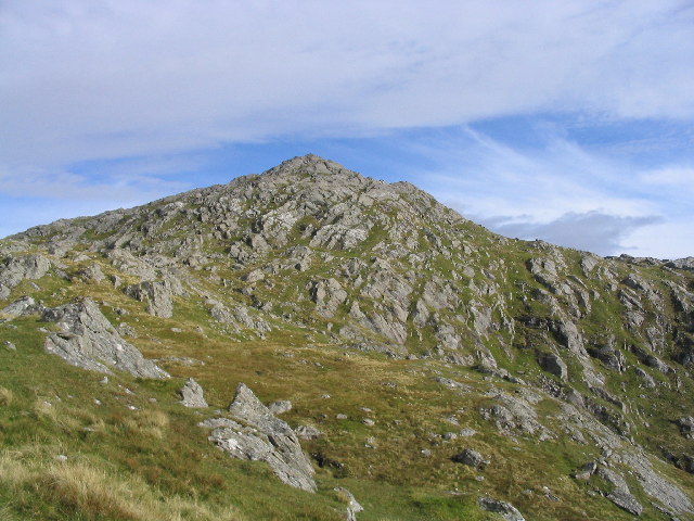
Beinn Resipol

Beinn Resipol (845 m) is a mountain of the Northwest Highlands, Scotland, in the Ardnamurchan area of Lochaber. The mountain is the most western of Scotland...

Nearby Amenities

Located within 500m of 56.767712,-5.6280947
Camas nam Beathag
Natural: bay
Lat/Long: 56.7679486/-5.6286156
The data included in this document is from www.openstreetmap.org. The data is made available under ODbL.

Have you been to Camas nam Beathag?

Leave your review of Camas nam Beathag below (or comments, questions and feedback).