Victoria Bay

Bay in Pembrokeshire

Wales

Victoria Bay

Caves at Jack Sound Three large caves and impressive rock folding in a small promontory. Wooltack Point in the background.
Caves at Jack Sound Credit: Trevor Rickard

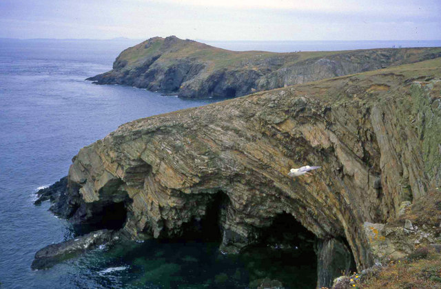
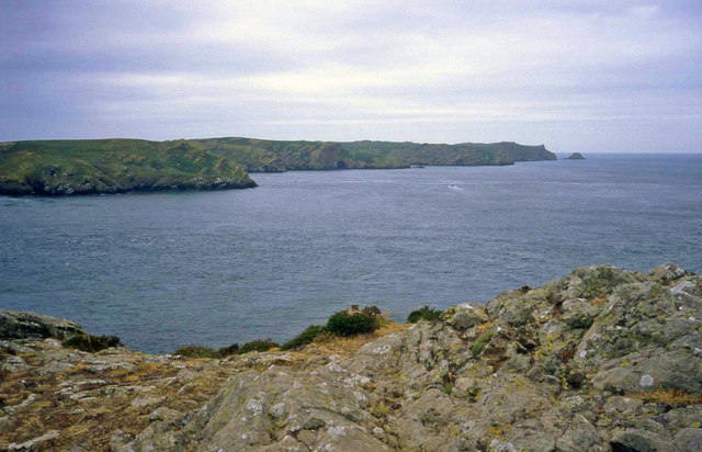
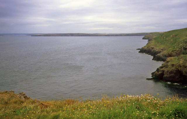
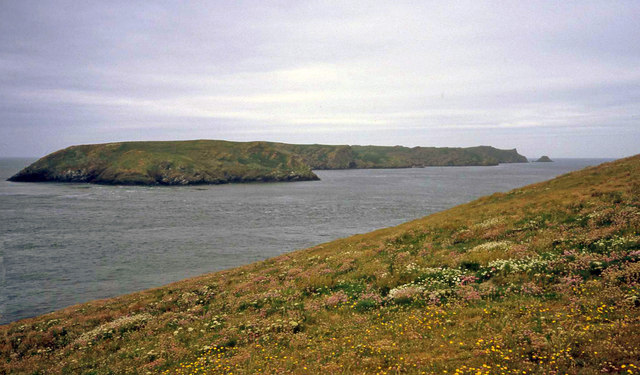
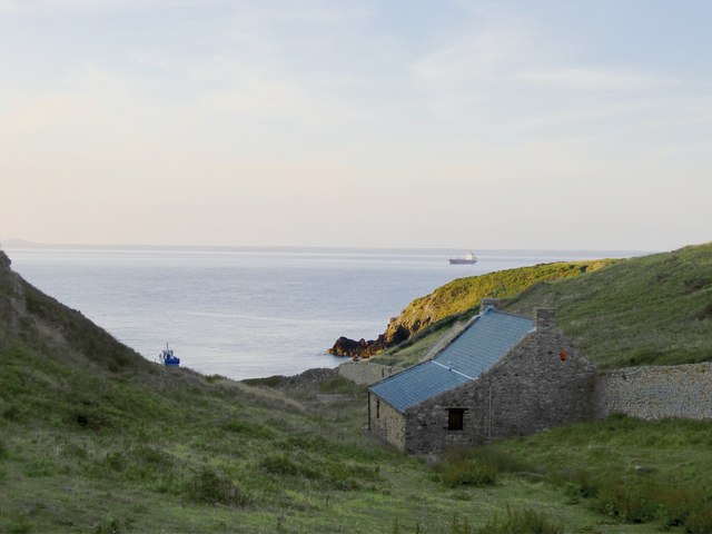
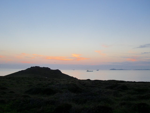
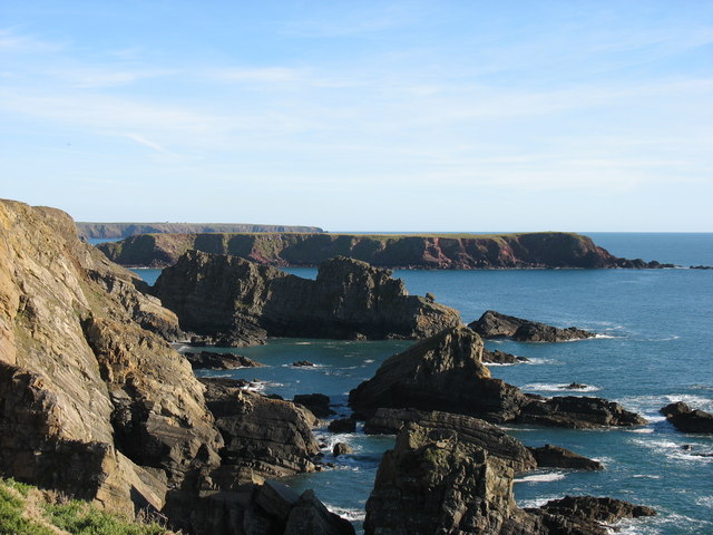
Victoria Bay, also known as Pembrokeshire Bay, is a picturesque coastal area located in the county of Pembrokeshire, Wales. Situated on the southwestern coast of the country, this bay is renowned for its stunning natural beauty and is a popular tourist destination.

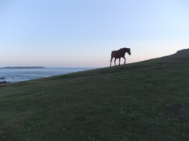
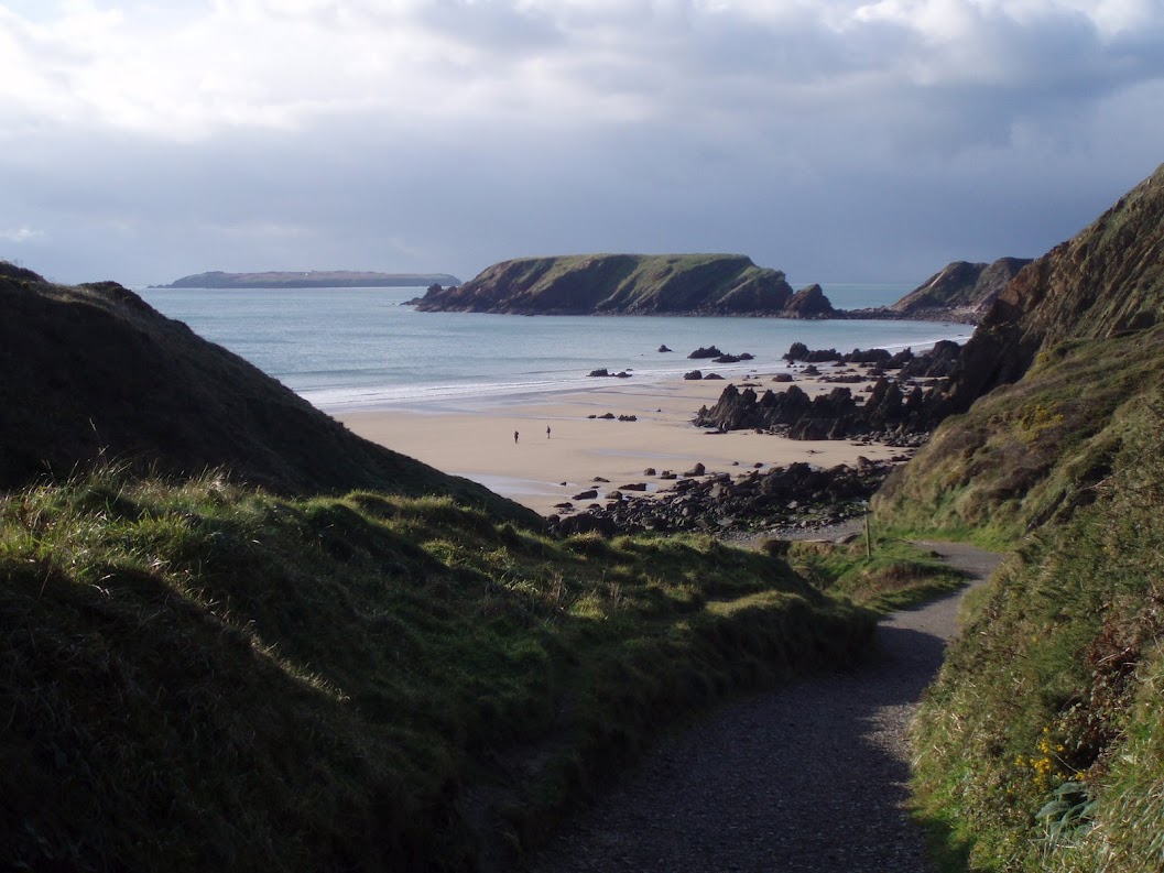
The bay is framed by rugged cliffs and boasts a sandy beach that stretches for approximately 1.5 kilometers. The beach is backed by rolling green hills and offers breathtaking views of the surrounding landscape. The turquoise waters of the bay provide a refreshing swim for visitors during the summer months.

Victoria Bay is a haven for outdoor enthusiasts and water sports enthusiasts. The bay's waves and currents make it a hotspot for surfing, attracting surfers of all skill levels. Additionally, the bay is a popular spot for kayaking, paddleboarding, and sailing.

The bay offers a range of amenities to cater to visitors' needs. There are car parks, toilets, and picnic areas available for the convenience of beachgoers. Moreover, several cafes and restaurants are situated near the waterfront, offering a variety of dining options.

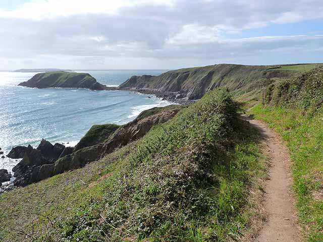
Beyond the beach, Victoria Bay provides access to scenic coastal walks and hiking trails. Explorers can venture along the Pembrokeshire Coast Path, which winds its way along the cliffs, offering breathtaking views of the bay and the surrounding countryside.

Overall, Victoria Bay is a gem of Pembrokeshire, offering a perfect blend of natural beauty, outdoor activities, and relaxation. Whether it's enjoying the beach, exploring the coastal paths, or indulging in water sports, visitors are sure to find something to suit their interests in this idyllic coastal bay.

If you have any feedback on the listing, please let us know in the comments section below.
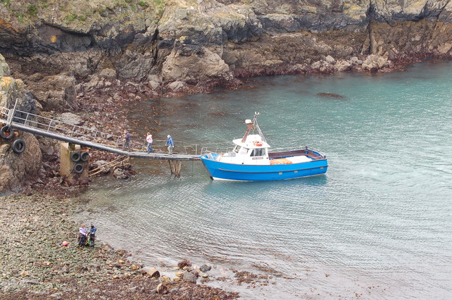
Victoria Bay Images

Images are sourced within 2km of 51.725323/-5.2354422 or Grid Reference SM7607. Thanks to Geograph Open Source API. All images are credited.

Caves at Jack Sound Three large caves and impressive rock folding in a small promontory. Wooltack Point in the background.
Caves at Jack Sound
Three large caves and impressive rock folding in a small promontory. Wooltack Point in the background.
Wooltack Point Looking westwards towards Skomer island with the Garland Stone offshore on the right.
Wooltack Point
Looking westwards towards Skomer island with the Garland Stone offshore on the right.
Coastline east of Haven Point From the grassy top of Haven Point looking east across the bay to the cliffs between Marloes and St Brides.
Coastline east of Haven Point
From the grassy top of Haven Point looking east across the bay to the cliffs between Marloes and St Brides.
Wild Flowers on Wooltack Point Looking west to Skomer. Plenty of spring blooms on the clifftop here, including thrift and sea campion.
Wild Flowers on Wooltack Point
Looking west to Skomer. Plenty of spring blooms on the clifftop here, including thrift and sea campion.
Evening at Martin's Haven
Evening at Wooltack Point, Pembrokeshire In the foreground the rocky headland of Wooltack Point, beyond it ships at anchor in St Bride's Bay, with a distant view of Ramsey Island.
Evening at Wooltack Point, Pembrokeshire
In the foreground the rocky headland of Wooltack Point, beyond it ships at anchor in St Bride's Bay, with a distant view of Ramsey Island.
Gateholm Island Gateholm is a tidal island, i.e. cut off at high tide but not at low tide. However from this perspective it seems that it would be difficult to climb to its plateau (about 40m high) even when access from Marloes Sands is easy.
Gateholm Island
Gateholm is a tidal island, i.e. cut off at high tide but not at low tide. However from this perspective it seems that it would be difficult to climb to its plateau (about 40m high) even when access from Marloes Sands is easy.
The Pembrokeshire coast south of Martin's Haven The flat-topped land in the middle distance is Gateholm Island (and this photo suggests that a few earlier photos in the square have been wrongly located, though the evidence is not strong enough to suggest a change). The more distant (and rather higher) land is the peninsula leading to St Anne's Head.
The Pembrokeshire coast south of Martin's Haven
The flat-topped land in the middle distance is Gateholm Island (and this photo suggests that a few earlier photos in the square have been wrongly located, though the evidence is not strong enough to suggest a change). The more distant (and rather higher) land is the peninsula leading to St Anne's Head.
Marloes sands in summer
Pony near Wooltack Point, on a midsummer's evening This pony had been grazing much lower down, and when it decided to head up the slope I had just a few seconds to catch this silhouette against the evening sky.  Shot taken at 21.08, a few days after midsummer.

I am posting this shot several months after the event - to celebrate the completion of my first thousand images on Geograph.
Pony near Wooltack Point, on a midsummer's evening
This pony had been grazing much lower down, and when it decided to head up the slope I had just a few seconds to catch this silhouette against the evening sky. Shot taken at 21.08, a few days after midsummer. I am posting this shot several months after the event - to celebrate the completion of my first thousand images on Geograph.
Skomer ferry arrives back at Martin's Haven
The path from Marloes Sands The building on the right is the Youth Hostel <a href="https://www.geograph.org.uk/gridref/SM7708">SM7708</a>.
The path from Marloes Sands
The building on the right is the Youth Hostel SM7708.
Gateholm Island The Pembrokeshire Coast Path traverses the cliff top at the western end of Marloes Sands. Ahead is the tidal Gateholm Island. Skokholm Island <a href="https://www.geograph.org.uk/gridref/SM7305">SM7305</a> lies on the horizon.
Gateholm Island
The Pembrokeshire Coast Path traverses the cliff top at the western end of Marloes Sands. Ahead is the tidal Gateholm Island. Skokholm Island SM7305 lies on the horizon.
Marloes Sands The magnificent beach of Marloes Sands seen from the clifftop Pembrokeshire Coast Path.
Marloes Sands
The magnificent beach of Marloes Sands seen from the clifftop Pembrokeshire Coast Path.
Marloes Sands Youth Hostel The upper floor of the near building is the "Hayloft" - warden's quarters - as occupied by me on a couple of occasions in the distant past.
Marloes Sands Youth Hostel
The upper floor of the near building is the "Hayloft" - warden's quarters - as occupied by me on a couple of occasions in the distant past.
The courtyard of Marloes Sands Youth Hostel Manned by volunteer wardens.
The courtyard of Marloes Sands Youth Hostel
Manned by volunteer wardens.
Marloes Sands The magnificent beach at Marloes Sands. The Pembrokeshire Coast Path, a 186mile (299 km) long national trail, can be seen on the cliff top ahead.
Marloes Sands
The magnificent beach at Marloes Sands. The Pembrokeshire Coast Path, a 186mile (299 km) long national trail, can be seen on the cliff top ahead.
Marloes Sands The sandy beach of Marloes Sands is pierced by many outcrops of rock.
Marloes Sands
The sandy beach of Marloes Sands is pierced by many outcrops of rock.
Show me another place!

Victoria Bay is located at Grid Ref: SM7607 (Lat: 51.725323, Lng: -5.2354422)

Unitary Authority: Pembrokeshire

Police Authority: Dyfed Powys

What 3 Words

///stealing.dignify.refrain. Near Dale, Pembrokeshire

Related Wikis

Gateholm

Gateholm or Gateholm Island is a small tidal island off the south west coast of Pembrokeshire, in the community of Marloes and St Brides, in the south...

Marloes Mere

Marloes Mere is a Site of Special Scientific Interest (or SSSI) in Pembrokeshire, South Wales. It has been designated as a Site of Special Scientific Interest...

Martin's Haven

Martin's Haven is a small bay in Pembrokeshire, Wales, UK, on the Dale Peninsula, with views across St Bride's Bay towards St David's. Its shingle beach...

Marloes Sands

Marloes Sands (Welsh: Traeth Marloes) is an approx. 1.5 kilometres (0.93 mi) long remote sandy beach in Pembrokeshire, Wales, near the village of Marloes...

Nearby Amenities

Located within 500m of 51.725323,-5.2354422
Access: yes
Barrier: kissing_gate
Bicycle: no
Foot: yes
Goods: no
Hgv: no
Horse: no
Motor Vehicle: no
Motorcar: no
Motorcycle: no
Vehicle: no
Lat/Long: 51.7249813/-5.2307683
Ford: yes
Lat/Long: 51.7255795/-5.2313038
The data included in this document is from www.openstreetmap.org. The data is made available under ODbL.

Have you been to Victoria Bay?

Leave your review of Victoria Bay below (or comments, questions and feedback).