Achadh-Chaorann Bay

Bay in Argyllshire

Scotland

Achadh-Chaorann Bay

Wooded B8024 at Wester Kilnaish
Wooded B8024 at Wester Kilnaish Credit: Gordon Brown

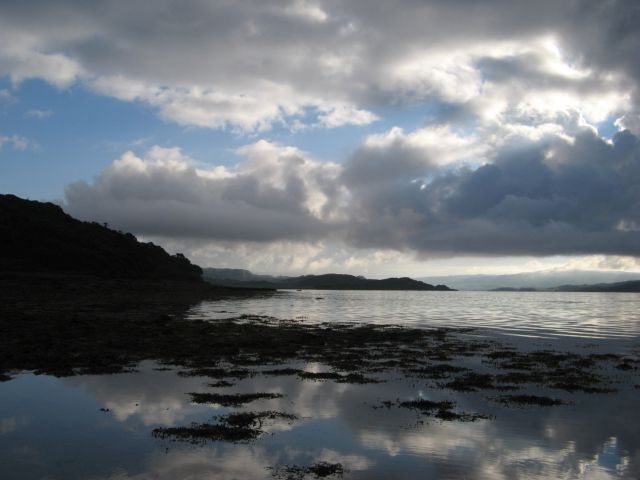
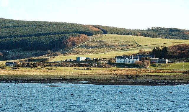
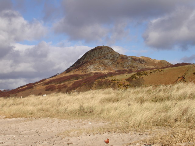
Achadh-Chaorann Bay is a picturesque coastal area located in Argyllshire, Scotland. Situated on the western coast of Scotland, it offers stunning views of the Atlantic Ocean and the surrounding rugged landscape. The bay is characterized by its pristine sandy beaches, crystal-clear waters, and rocky cliffs.

The bay is known for its rich biodiversity and is home to various species of marine life, including seals, dolphins, and numerous seabirds. The surrounding area also boasts a diverse range of flora and fauna, with lush greenery and wildflowers dotting the landscape.

The bay is a popular destination for outdoor enthusiasts, offering a range of activities such as swimming, snorkeling, and kayaking. The calm and clear waters make it an ideal spot for water sports and exploration.

The bay is also steeped in history, with several archaeological sites and ruins of ancient settlements scattered throughout the area. These historical remnants provide a glimpse into the region's past and offer visitors an opportunity to learn about its cultural heritage.

Visitors to Achadh-Chaorann Bay can enjoy the tranquility and natural beauty of the area, taking in the breathtaking views and immersing themselves in the rugged coastal landscape. Whether it's a leisurely walk along the sandy beaches or a thrilling water adventure, Achadh-Chaorann Bay offers a unique and unforgettable experience for all who visit.

If you have any feedback on the listing, please let us know in the comments section below.

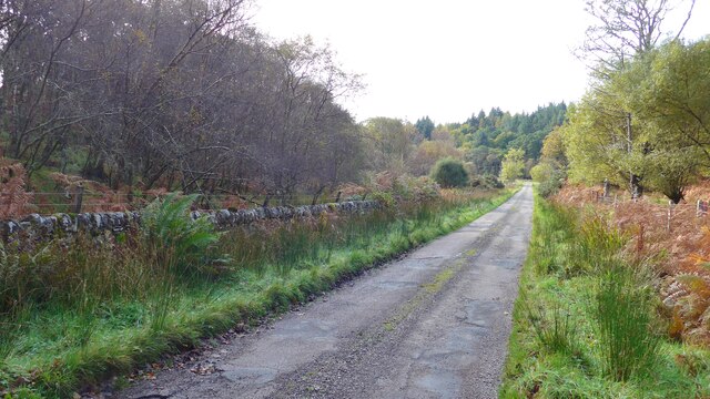
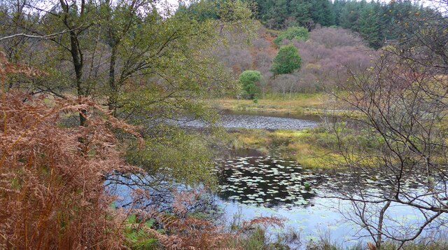
Achadh-Chaorann Bay Images

Images are sourced within 2km of 55.777695/-5.5746662 or Grid Reference NR7559. Thanks to Geograph Open Source API. All images are credited.

Wooded B8024 at Wester Kilnaish
A glimpse of West Loch Tarbert from near Dunmore Schoolhouse
Barr-na-Criche roadend
The Old Post Office At Ardpatrick roadend.
The Old Post Office
At Ardpatrick roadend.
The Ardpatrick Road at Creag na Cuile
Dunmore Schoolhouse
Dunmore Schoolhouse
Telephone kiosk at the Ardpatrick roadend
Loch Maol Moraig I'm constantly delighted by the variety of greens around, especially in the autumn!
Loch Maol Moraig
I'm constantly delighted by the variety of greens around, especially in the autumn!
Track junction in the Carse Forest Right for Low Cuildrynoch House, left for Loch a' Bhaillidh.
Track junction in the Carse Forest
Right for Low Cuildrynoch House, left for Loch a' Bhaillidh.
Old wall by the B8024
Entry to Ardpatrick House
New Trees at Ardpatrick Dunskeig on the Kintyre peninsula can clearly be seen from here.
New Trees at Ardpatrick
Dunskeig on the Kintyre peninsula can clearly be seen from here.
West Loch Tarbert from Achadh-Chaorann The view across West Loch Tarbert with the prominent hill of Dun Skeig on the Kintyre peninsula from the mouth of the small tidal bay of Achadh-Chaorann. The tip of Rubha a' Bharra Ruaidh is just visible at the opposite shore of the bay.
West Loch Tarbert from Achadh-Chaorann
The view across West Loch Tarbert with the prominent hill of Dun Skeig on the Kintyre peninsula from the mouth of the small tidal bay of Achadh-Chaorann. The tip of Rubha a' Bharra Ruaidh is just visible at the opposite shore of the bay.
An Doirlinn A wonderful intertidal area covered in an abundance of Knotted Wrack and Bladder Wrack forming a tombolo with Eilean Tràighe. It is difficult to tell where the water begins in the low morning light with strong reflections. The manicured fields of Ardpatrick form a green backdrop.
An Doirlinn
A wonderful intertidal area covered in an abundance of Knotted Wrack and Bladder Wrack forming a tombolo with Eilean Tràighe. It is difficult to tell where the water begins in the low morning light with strong reflections. The manicured fields of Ardpatrick form a green backdrop.
West Loch Tarbert Morning light over West Loch Tarbert. If you cannot beat the clouds, make a picture of them!
West Loch Tarbert
Morning light over West Loch Tarbert. If you cannot beat the clouds, make a picture of them!
Cows guarding the path On the way out the cows had gone as far as the old jetty, so I made a detour on the beach as I didn't know what they would think of my geograph assistant Madog; on the way back they were awaiting our return at the gate!
Cows guarding the path
On the way out the cows had gone as far as the old jetty, so I made a detour on the beach as I didn't know what they would think of my geograph assistant Madog; on the way back they were awaiting our return at the gate!
Shore by Ferry House A view of the shore below the built-up wall of the road leading to Ferry house and its piers.
Shore by Ferry House
A view of the shore below the built-up wall of the road leading to Ferry house and its piers.
Show me another place!

Achadh-Chaorann Bay is located at Grid Ref: NR7559 (Lat: 55.777695, Lng: -5.5746662)

Unitary Authority: Argyll and Bute

Police Authority: Argyll and West Dunbartonshire

What 3 Words

///blotting.overgrown.trading. Near Tarbert, Argyll & Bute

Nearby Locations

Achadh-Chaorann Bay

Related Wikis

Ardpatrick, Argyll

Ardpatrick (Scottish Gaelic: Àird Phàdraig) is a village at the southwestern extremity of the Knapdale, Argyll, Scotland. The village is built along the...

Ardpatrick House

Ardpatrick House is a category-B-listed 18th-century country house in Ardpatrick, South Knapdale, Argyll and Bute, Scotland. == History == A fortified...

Loup House

Loup House is a manor house north of Clachan on the Kintyre peninsula of Argyll, Scotland. The estate was once home to the chiefs of Clan MacAlister, and...

Dun Skeig

Dun Skeig is an oval Iron Age dun (fort) complex which is perched atop a rocky outcropping about 40 metres (130 ft) above sea level overlooking West Loch...

Nearby Amenities

Located within 500m of 55.777695,-5.5746662
Power: pole
Lat/Long: 55.7809571/-5.5798238
Power: pole
Lat/Long: 55.7802364/-5.5798083
Power: pole
Lat/Long: 55.7793906/-5.5812411
Ardpatrick
Name Ga: Àird Phàdraig
Place: hamlet
Lat/Long: 55.780464/-5.5794716
The data included in this document is from www.openstreetmap.org. The data is made available under ODbL.

Have you been to Achadh-Chaorann Bay?

Leave your review of Achadh-Chaorann Bay below (or comments, questions and feedback).