Applecross Bay

Bay in Ross-shire

Scotland

Applecross Bay

Coast road north of Applecross
Coast road north of Applecross Credit: Alpin Stewart

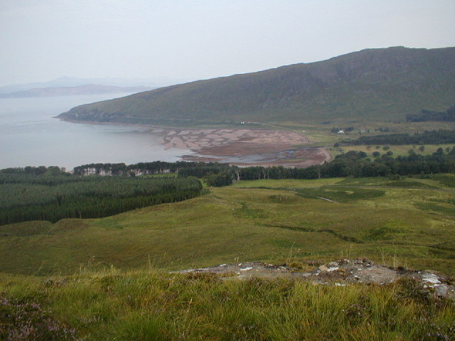
Applecross Bay is a picturesque coastal area located in the region of Ross-shire, Scotland. Situated on the western coast of the Applecross Peninsula, this bay offers stunning views of the Inner Sound and the Isle of Skye.

The bay is known for its pristine sandy beach, which stretches for approximately one mile. The sand is soft and golden, making it a popular destination for beachgoers and sunbathers during the summer months. The crystal-clear waters of the bay are ideal for swimming and other water activities.

Surrounded by dramatic cliffs and rolling hills, Applecross Bay offers breathtaking scenery and is a haven for nature lovers. The area is home to a wide variety of wildlife, including seals, dolphins, and a range of bird species. The bay is also a popular spot for fishing, with anglers enjoying the abundance of fish in the surrounding waters.

The bay is easily accessible by road, with a scenic coastal route leading visitors to the area. There are also several walking trails that allow visitors to explore the coastline and enjoy panoramic views of the bay and its surroundings.

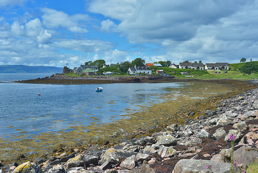
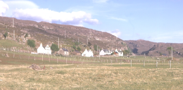
In addition to its natural beauty, Applecross Bay is also home to a small community of residents. The nearby village of Applecross offers a range of amenities, including shops, cafes, and a pub, providing visitors with a warm welcome and the opportunity to sample local cuisine and hospitality.

Overall, Applecross Bay is a tranquil and picturesque destination, offering visitors the perfect blend of natural beauty, outdoor activities, and a warm Scottish welcome.

If you have any feedback on the listing, please let us know in the comments section below.

Applecross Bay Images

Images are sourced within 2km of 57.435527/-5.8230252 or Grid Reference NG7044. Thanks to Geograph Open Source API. All images are credited.

Coast road north of Applecross
Applecross Bay Taken from the Applecross road near Rubha na Guailne. View over Applecross Bay toward distant Sgurr a' Chaorachain. Looking carefully, the Apllecross road can be seen ascending toward Bealach na Ba beyond the wooded Southern shore of Applecross Bay.
Applecross Bay
Taken from the Applecross road near Rubha na Guailne. View over Applecross Bay toward distant Sgurr a' Chaorachain. Looking carefully, the Apllecross road can be seen ascending toward Bealach na Ba beyond the wooded Southern shore of Applecross Bay.
Applecross Bay - 1983 Applecross Bay seen from C1091. Applecross and Milltown visible in the distance.
Applecross Bay - 1983
Applecross Bay seen from C1091. Applecross and Milltown visible in the distance.
The coast road north of Applecross
Cutting for the coast road
Path to Sand, Applecross A new seat and a good viewpoint
Path to Sand, Applecross
A new seat and a good viewpoint
Path to Sand, Applecross
Milestone near Applecross, Ross and Cromarty The stone lies beside the path between Applecross and Sand and is marked as a milestone on the 1:25,000 OS map.
Milestone near Applecross, Ross and Cromarty
The stone lies beside the path between Applecross and Sand and is marked as a milestone on the 1:25,000 OS map.
Old Milestone by the track, above Applecross Bay Milestone by the track/old road, in parish of Applecross (District), South side of track overlooking Applecross Bay, above line of 'new' road.

Surveyed

Milestone Society National ID: HI_APSD02
Old Milestone by the track, above Applecross Bay
Milestone by the track/old road, in parish of Applecross (District), South side of track overlooking Applecross Bay, above line of 'new' road. Surveyed Milestone Society National ID: HI_APSD02
Allt na Guailne
Allt na Guailne
Road (C1091) cut through the rock of Rubha na Guailne Looking westward. The C1091 coastal road was built in the 1970's and opened in 1975 as an alternative route from Applecross to Shieldaig and avoids the Bealach na Ba road which is often closed in winter.
Road (C1091) cut through the rock of Rubha na Guailne
Looking westward. The C1091 coastal road was built in the 1970's and opened in 1975 as an alternative route from Applecross to Shieldaig and avoids the Bealach na Ba road which is often closed in winter.
Bracken above the Bay Heather, grasses & bracken feature here. The land drops away down to Applecross Bay. On the far side is Applecross, Milton leading south to Eilean nan Naomh. I paddled up this coast line in a canoe later in the trip.
Bracken above the Bay
Heather, grasses & bracken feature here. The land drops away down to Applecross Bay. On the far side is Applecross, Milton leading south to Eilean nan Naomh. I paddled up this coast line in a canoe later in the trip.
Ancient track The last section of road around the Applecross peninsula was opened in 1976. Until this, this was the way to go between Cruarg and Sand. The views to the west from the old road are stupendous.
Ancient track
The last section of road around the Applecross peninsula was opened in 1976. Until this, this was the way to go between Cruarg and Sand. The views to the west from the old road are stupendous.
Coastline east of Rubha na Guailne With Applecross visible across the bay.
Coastline east of Rubha na Guailne
With Applecross visible across the bay.
View across the Inner Sound With the northern end of Raasay and Rona in the middle distance, and northern Skye beyond.
View across the Inner Sound
With the northern end of Raasay and Rona in the middle distance, and northern Skye beyond.
Roads depot by the Applecross road.
Shore Street, Applecross In 1980, when this photograph was taken, the new road around the coast had been open for a few years, so the area was experiencing more visitors, although it was still very quiet. Previously vehicular access was via the rather terrifying Bealach na Bà (Pass of the Cattle). This had put off a lot of potential visitors. 

The name Applecross is apparently derived not from Gaelic, but from the Pictish  Apor-crossan (confluence of River Crossan). The Picts were one of the groups who lived in Scotland long ago, and whom the Romans had to deal with, not very successfully. Applecross really means the whole of the peninsula, and not just this little settlement, which really is Shore Street, or The Street to the locals.

Unfortunately the negative for this image was disposed of long ago, and I have had to scan a faded reddish-brown print, which I've restored as best I can.
Shore Street, Applecross
In 1980, when this photograph was taken, the new road around the coast had been open for a few years, so the area was experiencing more visitors, although it was still very quiet. Previously vehicular access was via the rather terrifying Bealach na Bà (Pass of the Cattle). This had put off a lot of potential visitors. The name Applecross is apparently derived not from Gaelic, but from the Pictish Apor-crossan (confluence of River Crossan). The Picts were one of the groups who lived in Scotland long ago, and whom the Romans had to deal with, not very successfully. Applecross really means the whole of the peninsula, and not just this little settlement, which really is Shore Street, or The Street to the locals. Unfortunately the negative for this image was disposed of long ago, and I have had to scan a faded reddish-brown print, which I've restored as best I can.
View over Applecross Bay Taken from the Applecross road near Rubha na Guailne. View over Applecross Bay to Applecross (left) and Milton (right) and on toward Sron na h-Airde Bhaine
View over Applecross Bay
Taken from the Applecross road near Rubha na Guailne. View over Applecross Bay to Applecross (left) and Milton (right) and on toward Sron na h-Airde Bhaine
Show me another place!

Applecross Bay is located at Grid Ref: NG7044 (Lat: 57.435527, Lng: -5.8230252)

Unitary Authority: Highland

Police Authority: Highlands and Islands

What 3 Words

///tree.sailors.flattered. Near Kyleakin, Highland

Nearby Locations

Applecross Bay

Related Wikis

Applecross Bay

Applecross Bay is large remote tidal coastal embayment, located next to the small fishing village of Applecross and is on the west coast of the Applecross...

Applecross

Applecross (Scottish Gaelic: A' Chomraich) is a peninsula north-west of Kyle of Lochalsh in the council area of Highland, Scotland. The name Applecross...

Camusteel

Camusteel (Scottish Gaelic: Camas Teile) is a remote crofting and former fishing village in the Applecross peninsula, located less than 1 mile directly...

Camusterrach

Camusterrach (Scottish Gaelic: Camas Tearach) is a remote hamlet, situated on the west coast of Scotland, on the Applecross peninsula, in Strathcarron...

Bealach na Bà

Bealach na Bà (pronounced [bjaLəx na baː]) is a winding single track road through the mountains of the Applecross peninsula, in Wester Ross in the Scottish...

Sand, Applecross

Sand on the Applecross Peninsula in Wester Ross, Scotland, is an archaeological site. Sand is the site of a major archaeological excavation on the Inner...

Culduie

Culduie (Scottish Gaelic: Cùil Duibh) is a small hamlet, located on the southwest corner on Applecross peninsula, which is south of Applecross Village...

BUTEC

The British Underwater Test and Evaluation Centre (BUTEC) is an underwater military test and evaluation range in the Inner Sound between the island of...

Nearby Amenities

Located within 500m of 57.435527,-5.8230252
Applecross Bay
Natural: bay
Lat/Long: 57.4367753/-5.8246342
The data included in this document is from www.openstreetmap.org. The data is made available under ODbL.

Have you been to Applecross Bay?

Leave your review of Applecross Bay below (or comments, questions and feedback).