Am Port

Bay in Inverness-shire

Scotland

Am Port

Beasdale Railway Station A view of the remote unmanned Beasdale Railway Station.
Beasdale Railway Station Credit: Mr S Mudgey

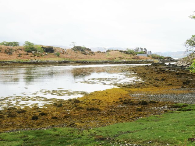
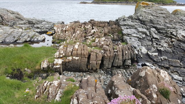
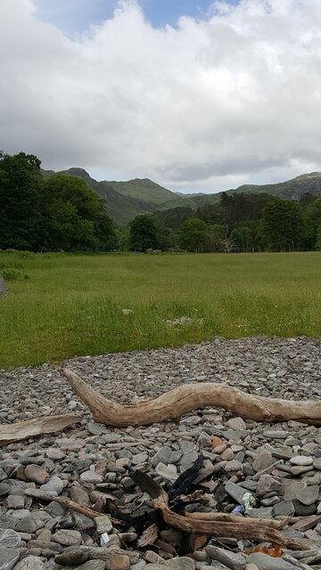
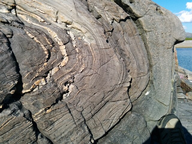
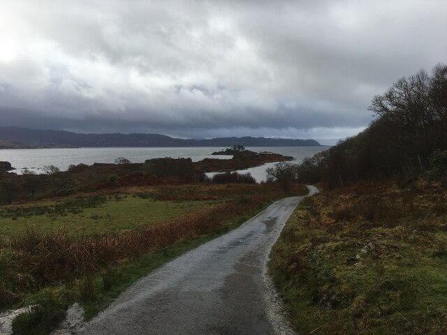
Am Port is a small bay located in Inverness-shire, Scotland. The bay is situated along the rugged coastline of the Scottish Highlands, offering stunning views of the surrounding cliffs and rocky shores. The area is known for its natural beauty and peaceful atmosphere, making it a popular destination for visitors looking to escape the hustle and bustle of city life.

Am Port is also a great spot for wildlife enthusiasts, as the bay is home to a variety of seabirds and marine life. Visitors may catch a glimpse of seabirds such as puffins, guillemots, and razorbills, as well as seals and dolphins swimming in the clear waters of the bay.

The bay is also a popular spot for outdoor activities such as hiking, birdwatching, and photography. There are several walking trails that lead along the coastline, offering panoramic views of the bay and the surrounding landscape.

Overall, Am Port is a hidden gem in the Scottish Highlands, offering visitors a chance to connect with nature and experience the beauty of the rugged Scottish coastline.

If you have any feedback on the listing, please let us know in the comments section below.

Am Port Images

Images are sourced within 2km of 56.892743/-5.7781966 or Grid Reference NM6984. Thanks to Geograph Open Source API. All images are credited.

Beasdale Railway Station A view of the remote unmanned Beasdale Railway Station.
Beasdale Railway Station
A view of the remote unmanned Beasdale Railway Station.
Inlet off Loch nan Uamh Taken from the end of a narrow lane that ends at this point. Not a good place to come by car and expect to find a turning space. Worth the visit to see the black throated diver.
Inlet off Loch nan Uamh
Taken from the end of a narrow lane that ends at this point. Not a good place to come by car and expect to find a turning space. Worth the visit to see the black throated diver.
Islets in the loch Eilean Gobblach in Loch non Uamh. Just one name appears to cover two tiny islets separated at high tide.
Islets in the loch
Eilean Gobblach in Loch non Uamh. Just one name appears to cover two tiny islets separated at high tide.
Beasdale station Request stop only, one of the least used stations in the country
Beasdale station
Request stop only, one of the least used stations in the country
The Jacobite at Beasdale station
Loch Nan Uamh Looking down Loch Nan Uamh from the 'Jacobite' steam train en route to Mallaig.  The islands are Eilean Gobhlach.
Loch Nan Uamh
Looking down Loch Nan Uamh from the 'Jacobite' steam train en route to Mallaig. The islands are Eilean Gobhlach.
Beasdale Bridge Carrying the West Highland Railway over the A830.
Beasdale Bridge
Carrying the West Highland Railway over the A830.
Traffic lights on the A830 approaching Borrodale Bridge
Woodland beside the West Highland Railway near Beasdale
View of railway from above Borrodale tunnel View of single-track railway to Mallaig taken from above Borrodale tunnel
View of railway from above Borrodale tunnel
View of single-track railway to Mallaig taken from above Borrodale tunnel
Geological dyke on shore of Rubha Aird Mhoir Rocky foreshore showing a sheet of brown igneous rock cutting grey Moine metamorphic rocks
Geological dyke on shore of Rubha Aird Mhoir
Rocky foreshore showing a sheet of brown igneous rock cutting grey Moine metamorphic rocks
Flat raised beach near Druimdarroch, below Arisaig House Flat grassland on a raised beach, near Arisaig House
Flat raised beach near Druimdarroch, below Arisaig House
Flat grassland on a raised beach, near Arisaig House
Spectacular folded rocks on foreshore Foreshore near Druimindarroch showing spectacular fold within metamorphosed Moine rocks.
Spectacular folded rocks on foreshore
Foreshore near Druimindarroch showing spectacular fold within metamorphosed Moine rocks.
No through road to Borrodale
A830 towards Mallaig
Road to Druimindarroch
A830 towards Mallaig
A830 towards Beasdale
Show me another place!

Am Port is located at Grid Ref: NM6984 (Lat: 56.892743, Lng: -5.7781966)

Unitary Authority: Highland

Police Authority: Highlands and Islands

What 3 Words

///handle.mend.voters. Near Arisaig, Highland

Related Wikis

Prince Charlie's Cave

There are many Prince Charlies Caves in the Highlands, caves where Charles Edward Stuart was said to have sheltered when on the run from the Duke of Cumberland...

Beasdale railway station

Beasdale railway station is a railway station serving Glen Beasdale in the Highland region of Scotland. This station is on the West Highland Line, sited...
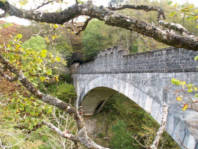
Borrodale Viaduct

The Borrodale Viaduct is a railway viaduct that carries the West Highland Line over the Borrodale Burn. == History == The West Highland Railway was built...

Druimindarroch

Druimindarroch (Scottish Gaelic: Druim nan Darach) is a small settlement which lies on the north coast of Loch nan Uamh in Lochaber, Scottish Highlands...

Nearby Amenities

Located within 500m of 56.892743,-5.7781966
Created By: dmgroom_coastlines
Source: PGS
Lat/Long: 56.890953/-5.785333
Source: PGS
Lat/Long: 56.8910018/-5.7849488
Created By: dmgroom_coastlines
Source: PGS
Lat/Long: 56.891097/-5.784642
Created By: dmgroom_coastlines
Source: PGS
Lat/Long: 56.891229/-5.784417
Created By: dmgroom_coastlines
Source: PGS
Lat/Long: 56.891363/-5.784194
Created By: dmgroom_coastlines
Source: PGS
Lat/Long: 56.891496/-5.783969
Created By: dmgroom_coastlines
Source: PGS
Lat/Long: 56.891629/-5.783746
Source: PGS
Lat/Long: 56.8918926/-5.7836291
Created By: dmgroom_coastlines
Source: PGS
Lat/Long: 56.891895/-5.783298
Created By: dmgroom_coastlines
Source: PGS
Lat/Long: 56.892028/-5.783073
Source: PGS
Lat/Long: 56.8924728/-5.7824382
Source: PGS
Lat/Long: 56.8925079/-5.7815692
Source: PGS
Lat/Long: 56.8923966/-5.7808933
Source: PGS
Lat/Long: 56.8925665/-5.7805177
Source: PGS
Lat/Long: 56.892713/-5.7802495
Created By: dmgroom_coastlines
Source: PGS
Lat/Long: 56.893145/-5.778943
Created By: dmgroom_coastlines
Source: PGS
Lat/Long: 56.893155/-5.778476
Source: PGS
Lat/Long: 56.8932815/-5.7781789
Created By: dmgroom_coastlines
Source: PGS
Lat/Long: 56.893325/-5.776617
Source: PGS
Lat/Long: 56.8930236/-5.7762691
Created By: dmgroom_coastlines
Source: PGS
Lat/Long: 56.892961/-5.775654
Created By: dmgroom_coastlines
Source: PGS
Lat/Long: 56.893238/-5.774738
Source: PGS
Lat/Long: 56.8936096/-5.7739517
Source: PGS
Lat/Long: 56.8938851/-5.7730076
Source: PGS
Lat/Long: 56.8938265/-5.7714197
Source: PGS
Lat/Long: 56.893844/-5.7710335
The data included in this document is from www.openstreetmap.org. The data is made available under ODbL.

Have you been to Am Port?

Leave your review of Am Port below (or comments, questions and feedback).