Port Bàn

Bay in Inverness-shire

Scotland

Port Bàn

Farm road, Achraig The road doesn't appear to go anywhere in particular, but there is a good view towards the craggy slopes of Creag Mhor.
Farm road, Achraig Credit: Gordon Hatton

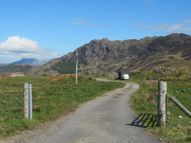
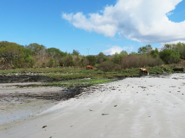
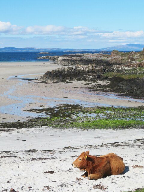
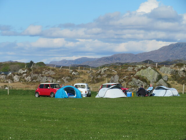
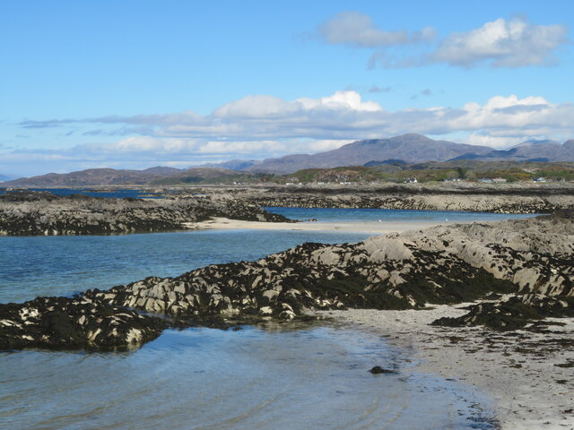
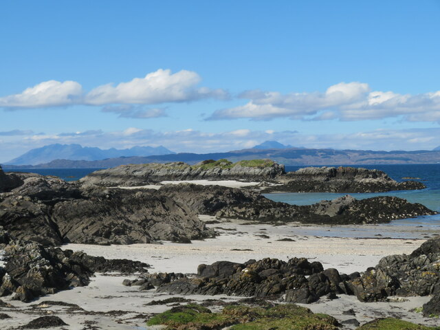
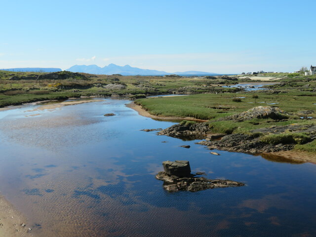
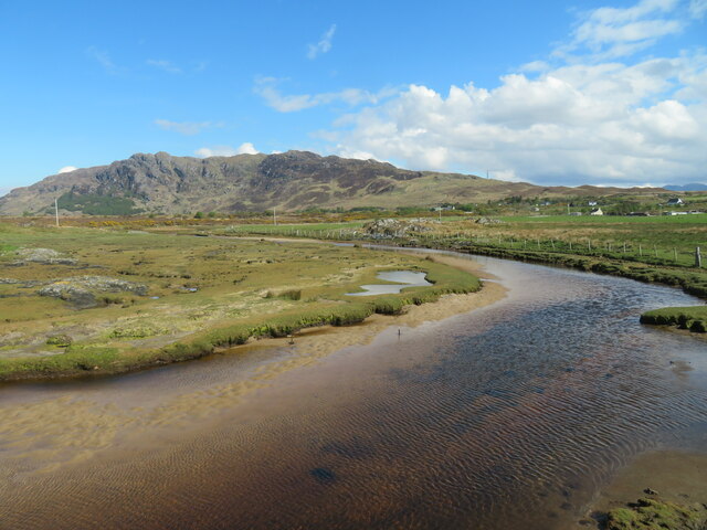
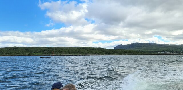
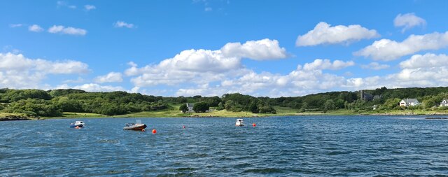
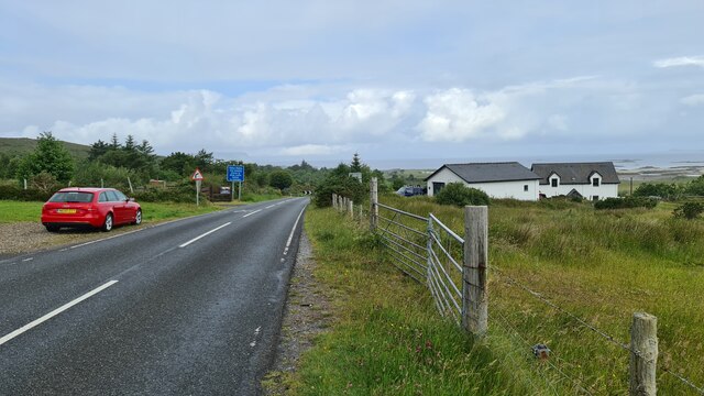
Port Bàn is a picturesque bay located in Inverness-shire, Scotland. This stunning coastal area is known for its beautiful sandy beaches, crystal-clear waters, and breathtaking views of the surrounding mountains. The bay is a popular destination for tourists and locals alike, offering a peaceful and serene setting for relaxation and recreation.

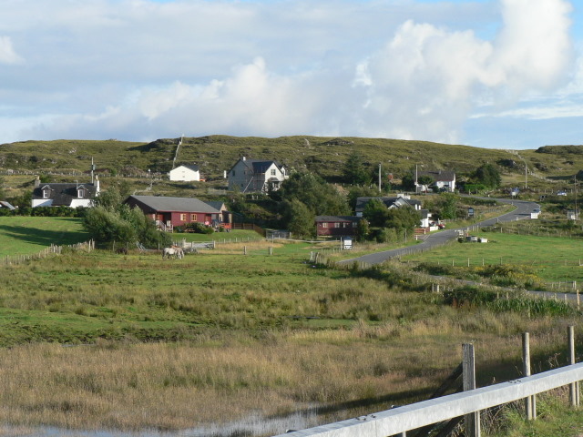
Port Bàn is also home to a small community of residents who enjoy the quiet and idyllic lifestyle that the bay provides. The area is dotted with charming cottages and traditional fishing boats, adding to the quaint and charming atmosphere of the bay.

Visitors to Port Bàn can enjoy a variety of outdoor activities, including swimming, kayaking, and hiking along the scenic coastal trails. The bay is also a great spot for birdwatching, with a variety of seabirds and wildlife to be seen.

Overall, Port Bàn is a hidden gem in the Scottish Highlands, offering visitors a tranquil and picturesque escape from the hustle and bustle of everyday life. Whether you're looking to relax on the beach, explore the surrounding countryside, or simply take in the stunning views, Port Bàn has something to offer for everyone.

If you have any feedback on the listing, please let us know in the comments section below.

Port Bàn Images

Images are sourced within 2km of 56.925033/-5.8740371 or Grid Reference NM6488. Thanks to Geograph Open Source API. All images are credited.

Farm road, Achraig The road doesn't appear to go anywhere in particular, but there is a good view towards the craggy slopes of Creag Mhor.
Farm road, Achraig
The road doesn't appear to go anywhere in particular, but there is a good view towards the craggy slopes of Creag Mhor.
White sand at Gortenachullish White sand beach at the road end from Back of Keppoch.
White sand at Gortenachullish
White sand beach at the road end from Back of Keppoch.
Beach bovine Just lazing on the beach and soaking up the spring sunshine at Gortenachullish.
Beach bovine
Just lazing on the beach and soaking up the spring sunshine at Gortenachullish.
Mini camping Mini enthusiasts with mini tents at Back of Keppoch.
Mini camping
Mini enthusiasts with mini tents at Back of Keppoch.
Coastline near Port Ban A fretted coastline of small sandy bays and rocky reefs.
Coastline near Port Ban
A fretted coastline of small sandy bays and rocky reefs.
Shoreline near Gortenchullish One can work one's way around the shoreline here at low tide, but further progress towards Eilean Ighe wasn't possible on this occasion via the shore, whilst any landward route has plenty of 'Private Keep Out' notices.
Shoreline near Gortenchullish
One can work one's way around the shoreline here at low tide, but further progress towards Eilean Ighe wasn't possible on this occasion via the shore, whilst any landward route has plenty of 'Private Keep Out' notices.
Allt Cam Carach heading seawards The last few metres of this burn which by this point has brackish waters. The mountains of Rum can be seen on the horizon.
Allt Cam Carach heading seawards
The last few metres of this burn which by this point has brackish waters. The mountains of Rum can be seen on the horizon.
Upstream along  Allt Cam Carach A slow and sluggish burn which drains a large area of low lying bog and scrubland known as Mointeach Mhor.
Upstream along Allt Cam Carach
A slow and sluggish burn which drains a large area of low lying bog and scrubland known as Mointeach Mhor.
Loch nan Ceall Taking a trip from Arisaig to Eigg
Loch nan Ceall
Taking a trip from Arisaig to Eigg
In Loch nan Ceall Heading for Eigg
In Loch nan Ceall
Heading for Eigg
Arisaig harbour
Arisaig harbour
Back of Keppoch
Back of Keppoch
Moorland next to the A830 at Kinloid Looking towards Creag Mhor.
Moorland next to the A830 at Kinloid
Looking towards Creag Mhor.
Looking out to the Sound of Sleat from Sunnyside Croft Touring & Camping Site, 2 Bunacaimb
Sunnyside Croft Touring & Camping Site, 2 Bunacaimb
Newly born lambs at Bunacaimb
Dilapidated building at Bunacaimb The green posts in the foreground are electric hook-up points for touring caravans.
Dilapidated building at Bunacaimb
The green posts in the foreground are electric hook-up points for touring caravans.
Newly built caravan site building At Bunacaimb.
Newly built caravan site building
At Bunacaimb.
Show me another place!

Port Bàn is located at Grid Ref: NM6488 (Lat: 56.925033, Lng: -5.8740371)

Unitary Authority: Highland

Police Authority: Highlands and Islands

What 3 Words

///helping.mealtime.warned. Near Arisaig, Highland

Related Wikis

Eilean Ighe

Eilean Ighe is a small tidal island near Arisaig in the Inner Hebrides of Scotland. The area is popular for sea kayaking and a challenge for larger boats...

Back of Keppoch

Back of Keppoch (Gaelic: Cùl na Ceapaich) is a small coastal settlement in the northwest Scottish Highlands, 40 miles (65 kilometres) west of Fort William...

Portnaluchaig

Portnaluchaig is a coastal hamlet, located 2 miles north of Arisaig in the Highlands of Scotland and is also in the council area of Highland. The Small...

Arisaig railway station

Arisaig railway station serves the village of Arisaig on the west coast of the Highland region of Scotland. This station is on the West Highland Line,...

Nearby Amenities

Located within 500m of 56.925033,-5.8740371
Source: PGS
Lat/Long: 56.9244942/-5.8822041
Source: PGS
Lat/Long: 56.9239882/-5.8819301
Source: PGS
Lat/Long: 56.9270438/-5.8689126
Source: PGS
Lat/Long: 56.9262909/-5.8688003
Source: PGS
Lat/Long: 56.9264993/-5.8701357
Created By: dmgroom_coastlines
Source: PGS
Lat/Long: 56.926815/-5.870222
Created By: dmgroom_coastlines
Source: PGS
Lat/Long: 56.927071/-5.870242
Created By: dmgroom_coastlines
Source: PGS
Lat/Long: 56.927672/-5.871927
Source: PGS
Lat/Long: 56.9280566/-5.8727321
Source: PGS
Lat/Long: 56.9272838/-5.8735046
Created By: dmgroom_coastlines
Source: PGS
Lat/Long: 56.926958/-5.875151
Created By: dmgroom_coastlines
Source: PGS
Lat/Long: 56.926707/-5.874899
Created By: dmgroom_coastlines
Source: PGS
Lat/Long: 56.926201/-5.874625
Created By: dmgroom_coastlines
Source: PGS
Lat/Long: 56.926223/-5.873689
Created By: dmgroom_coastlines
Source: PGS
Lat/Long: 56.925717/-5.873417
Created By: dmgroom_coastlines
Source: PGS
Lat/Long: 56.925461/-5.873397
Source: PGS
Lat/Long: 56.9251396/-5.8734622
Created By: dmgroom_coastlines
Source: PGS
Lat/Long: 56.925274/-5.875959
Source: PGS
Lat/Long: 56.9254454/-5.8765945
Source: PGS
Lat/Long: 56.9253868/-5.8774742
Source: PGS
Lat/Long: 56.9248247/-5.8770236
Source: PGS
Lat/Long: 56.9244383/-5.8772811
Created By: dmgroom_coastlines
Source: PGS
Lat/Long: 56.924097/-5.87704
Source: PGS
Lat/Long: 56.92356/-5.8773884
Source: PGS
Lat/Long: 56.923063/-5.877429
Source: PGS
Lat/Long: 56.922752/-5.877367
Created By: dmgroom_coastlines
Source: PGS
Lat/Long: 56.923036/-5.878597
Created By: dmgroom_coastlines
Source: PGS
Lat/Long: 56.922875/-5.87999
Source: PGS
Lat/Long: 56.9227871/-5.8804139
Source: PGS
Lat/Long: 56.9227403/-5.880886
Created By: dmgroom_coastlines
Source: PGS
Lat/Long: 56.923227/-5.881422
Back of Keppoch
Name En: Back of Keppoch
Name Gd: Cùl na Ceapaich
Place: hamlet
Wikidata: Q636061
Wikipedia: en:Back of Keppoch
Lat/Long: 56.9241634/-5.8674256
Tigh na Mara
Description: Field for camping, bays for caravans and camper vans, two glamping pods. Onsite toilet block and dish washing. Showers cost £1.
Phone: +44 7881 291451
Tourism: camp_site
Website: http://tigh-na-maracampsitepods.co.uk
Lat/Long: 56.923971/-5.8716553
Tourism: camp_site
Lat/Long: 56.9253997/-5.8693593
Power: pole
Lat/Long: 56.9235173/-5.8722811
Power: pole
Lat/Long: 56.9230218/-5.8720505
Power: pole
Lat/Long: 56.9225853/-5.8718545
Power: pole
Lat/Long: 56.9229164/-5.8702389
Power: pole
Lat/Long: 56.9231626/-5.8682875
The data included in this document is from www.openstreetmap.org. The data is made available under ODbL.

Have you been to Port Bàn?

Leave your review of Port Bàn below (or comments, questions and feedback).