Fishnish Bay

Bay in Argyllshire

Scotland

Fishnish Bay

Time out waiting for the Mull ferry Whilst people in camper vans who just missed the ferry to Lochaline seemed mainly to sit in the queue, those in smaller cars seemed more drawn to the picnic area just along the forest track. Such places often have a height barrier to deter overnight camping, though I didn't notice one here - the restriction to small vehicles seemed entirely voluntary in the middle of the day.
Time out waiting for the Mull ferry Credit: Andy Waddington

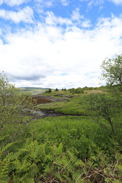
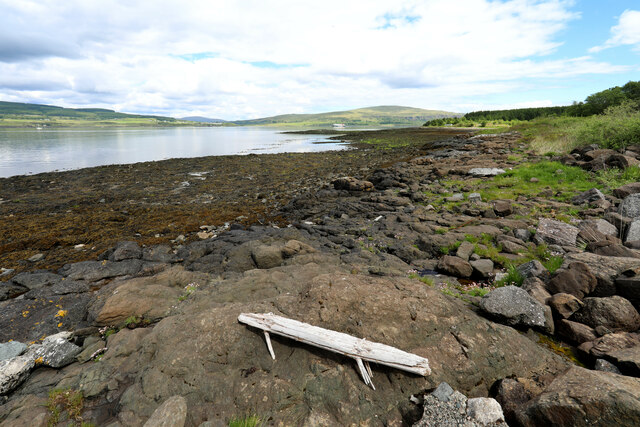
Fishnish Bay is a picturesque coastal bay located in Argyllshire, Scotland. Situated on the eastern coast of the Isle of Mull, this bay is known for its stunning natural beauty and tranquil atmosphere. With its crystal-clear waters and surrounding lush greenery, Fishnish Bay offers a pristine and idyllic setting for visitors and locals alike.

The bay is characterized by its crescent-shaped shoreline, which stretches for approximately 1.5 kilometers. The sandy beach that lines the bay is a popular spot for sunbathing, picnicking, and enjoying leisurely walks. The bay is also home to a small pier, where visitors can dock their boats or enjoy fishing in the surrounding waters.

One of the main attractions of Fishnish Bay is its rich marine life. The bay is known for its diverse ecosystem, which includes a variety of fish species, seals, and seabirds. It is a popular spot for snorkeling and diving, allowing visitors to explore the colorful underwater world. The bay also offers great opportunities for wildlife watching, with frequent sightings of dolphins and porpoises.

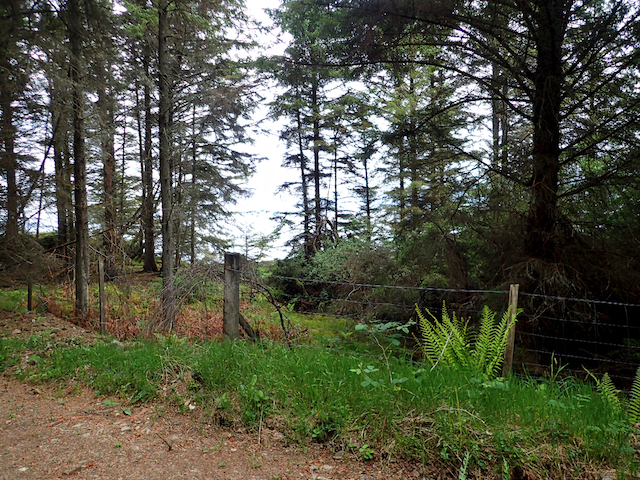
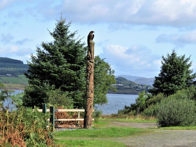
Fishnish Bay is easily accessible by road, with a small car park available near the beach area. The bay is also a starting point for various coastal walks, providing visitors with the opportunity to explore the surrounding countryside and enjoy panoramic views of the bay and its surroundings.

Overall, Fishnish Bay is a hidden gem in Argyllshire, offering a peaceful and unspoiled coastal experience for nature lovers and outdoor enthusiasts.

If you have any feedback on the listing, please let us know in the comments section below.

Fishnish Bay Images

Images are sourced within 2km of 56.513859/-5.8345495 or Grid Reference NM6442. Thanks to Geograph Open Source API. All images are credited.

Time out waiting for the Mull ferry Whilst people in camper vans who just missed the ferry to Lochaline seemed mainly to sit in the queue, those in smaller cars seemed more drawn to the picnic area just along the forest track. Such places often have a height barrier to deter overnight camping, though I didn't notice one here - the restriction to small vehicles seemed entirely voluntary in the middle of the day.
Time out waiting for the Mull ferry
Whilst people in camper vans who just missed the ferry to Lochaline seemed mainly to sit in the queue, those in smaller cars seemed more drawn to the picnic area just along the forest track. Such places often have a height barrier to deter overnight camping, though I didn't notice one here - the restriction to small vehicles seemed entirely voluntary in the middle of the day.
Looking across Sgeir Mhòr to the Sound of Mull
Fishnish Ferry Terminal Across the Sound of Mull to Lochaline
Fishnish Ferry Terminal
Across the Sound of Mull to Lochaline
Forestry road near Fishnish
Leiter Following in the footsteps of David Balfour, the hero of Robert Louis Stevenson's Kidnapped, as he makes his way back to Edinburgh to confront his wicked uncle.

Stage 1, June 2016 from Erraid to Fishnish on the Isle of Mull.

See <span class="nowrap"><a title="http://www.stevensonway.org.uk" rel="nofollow ugc noopener" href="http://www.stevensonway.org.uk">Link</a><img style="margin-left:2px;" alt="External link" title="External link - shift click to open in new window" src="https://s1.geograph.org.uk/img/external.png" width="10" height="10"/></span>
Leiter
Following in the footsteps of David Balfour, the hero of Robert Louis Stevenson's Kidnapped, as he makes his way back to Edinburgh to confront his wicked uncle. Stage 1, June 2016 from Erraid to Fishnish on the Isle of Mull. See LinkExternal link
On the old road Following in the footsteps of David Balfour, the hero of Robert Louis Stevenson's Kidnapped, as he makes his way back to Edinburgh to confront his wicked uncle.

Stage 1, June 2016 from Erraid to Fishnish on the Isle of Mull.

See <span class="nowrap"><a title="http://www.stevensonway.org.uk" rel="nofollow ugc noopener" href="http://www.stevensonway.org.uk">Link</a><img style="margin-left:2px;" alt="External link" title="External link - shift click to open in new window" src="https://s1.geograph.org.uk/img/external.png" width="10" height="10"/></span>
On the old road
Following in the footsteps of David Balfour, the hero of Robert Louis Stevenson's Kidnapped, as he makes his way back to Edinburgh to confront his wicked uncle. Stage 1, June 2016 from Erraid to Fishnish on the Isle of Mull. See LinkExternal link
Fishnish Bay Following in the footsteps of David Balfour, the hero of Robert Louis Stevenson's Kidnapped, as he makes his way back to Edinburgh to confront his wicked uncle.

Stage 1, June 2016 from Erraid to Fishnish on the Isle of Mull.

See <span class="nowrap"><a title="http://www.stevensonway.org.uk" rel="nofollow ugc noopener" href="http://www.stevensonway.org.uk">Link</a><img style="margin-left:2px;" alt="External link" title="External link - shift click to open in new window" src="https://s1.geograph.org.uk/img/external.png" width="10" height="10"/></span>
Fishnish Bay
Following in the footsteps of David Balfour, the hero of Robert Louis Stevenson's Kidnapped, as he makes his way back to Edinburgh to confront his wicked uncle. Stage 1, June 2016 from Erraid to Fishnish on the Isle of Mull. See LinkExternal link
Fishnish Point Hoping for a lunch stop on the point but found the access from the forest track was very difficult.
Fishnish Point
Hoping for a lunch stop on the point but found the access from the forest track was very difficult.
Port an t-Sluic From Fishnish ferry. The end of this part of the Stevenson Way.
Port an t-Sluic
From Fishnish ferry. The end of this part of the Stevenson Way.
MV Lochinvar departing Fishnish
Forestry pier at Rubha na Leitreach
House at Balmeanach, Mull
Fishnish Timber Pier Fishnish Timber Pier, known commercially as the Mull Commercial Marine Facility, is located close to Rubha na Leitreach on the Sound of Mull. It's a fairly recent development, not currently, (April 2018), shown on OS maps at smaller scales.
Fishnish Timber Pier
Fishnish Timber Pier, known commercially as the Mull Commercial Marine Facility, is located close to Rubha na Leitreach on the Sound of Mull. It's a fairly recent development, not currently, (April 2018), shown on OS maps at smaller scales.
Shore of Sound of Mull A view to the east along the southern side of the Sound of Mull which is also the northern shore of the island of Mull. A feature named on OS maps as 'Faoileann Ghlas', is nearby but not seen in the image.
Shore of Sound of Mull
A view to the east along the southern side of the Sound of Mull which is also the northern shore of the island of Mull. A feature named on OS maps as 'Faoileann Ghlas', is nearby but not seen in the image.
Passing Sgeir Mhor The Lochaline bound ferry passing the outcrop of Sgeir Mhor.
Passing Sgeir Mhor
The Lochaline bound ferry passing the outcrop of Sgeir Mhor.
Ferns and Foreshore A view of the shoreline by the Fishnish forest walk.
Ferns and Foreshore
A view of the shoreline by the Fishnish forest walk.
Fishnish Totem A totem pole by the Fishnish woodland walk carpark erected to celebrate Mull wildlife.
Fishnish Totem
A totem pole by the Fishnish woodland walk carpark erected to celebrate Mull wildlife.
Clearing by Balmeanach A large clearing in the forest with some deciduous trees.
Clearing by Balmeanach
A large clearing in the forest with some deciduous trees.
Show me another place!

Fishnish Bay is located at Grid Ref: NM6442 (Lat: 56.513859, Lng: -5.8345495)

Unitary Authority: Argyll and Bute

Police Authority: Argyll and West Dunbartonshire

What 3 Words

///grazes.incurring.plotter. Near Lochaline, Highland

Related Wikis

Fishnish

Fishnish (Scottish Gaelic: Finnsinis) is a ferry terminal on the Isle of Mull, roughly halfway between Tobermory and Craignure. It is owned and operated...

Lochaline

Lochaline (Scottish Gaelic: Loch Àlainn) is the main village in the Morvern area of Highland, Scotland. The coastal village is situated at the mouth of...

Sound of Mull

The Sound of Mull is a sound between the Inner Hebridean island of Mull and mainland Scotland. It forms part of the Atlantic Ocean. The Sound of Mull Project...

Lochaline Mine

Lochaline Mine is a mine on the Morvern peninsula of the Highland area of Scotland. The mine works a white cretaceous sandstone to produce high grade silica...

Nearby Amenities

Located within 500m of 56.513859,-5.8345495
Source: PGS
Lat/Long: 56.5144908/-5.8423027
Source: PGS
Lat/Long: 56.5144261/-5.8419903
Source: PGS
Lat/Long: 56.5140275/-5.8415281
Source: PGS
Lat/Long: 56.5136528/-5.8405382
Source: PGS
Lat/Long: 56.5132318/-5.8398389
Source: PGS
Lat/Long: 56.5126123/-5.8394319
Source: PGS
Lat/Long: 56.5122639/-5.839178
Source: PGS
Lat/Long: 56.5119406/-5.8389892
Created By: dmgroom_coastlines
Source: PGS
Lat/Long: 56.511776/-5.838758
Source: PGS
Lat/Long: 56.5115306/-5.8385356
Created By: dmgroom_coastlines
Source: PGS
Lat/Long: 56.511275/-5.838258
Created By: dmgroom_coastlines
Source: PGS
Lat/Long: 56.51102/-5.838239
Source: PGS
Lat/Long: 56.510487/-5.8379158
Source: PGS
Lat/Long: 56.5102064/-5.8379476
Source: PGS
Lat/Long: 56.5098293/-5.8379476
Fishnish Bay
Natural: bay
Lat/Long: 56.5128873/-5.8326752
The data included in this document is from www.openstreetmap.org. The data is made available under ODbL.

Have you been to Fishnish Bay?

Leave your review of Fishnish Bay below (or comments, questions and feedback).