An Dubh Chamas

Bay in Inverness-shire

Scotland

An Dubh Chamas

An Teampull Chapel South Rona View of the ruins of An Teampull chapel at the south of Rona with Skye in the background
An Teampull Chapel South Rona Credit: Alan Rankin

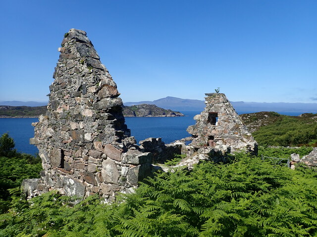
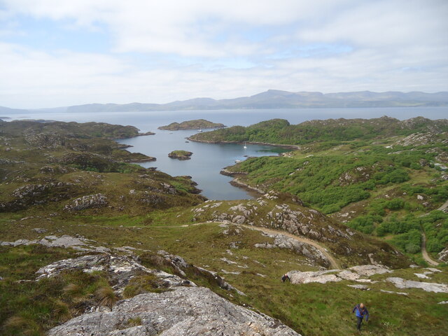
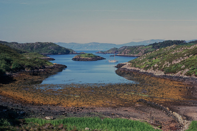
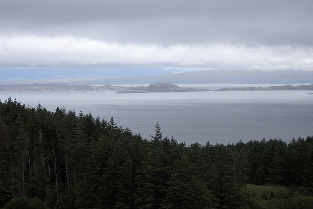
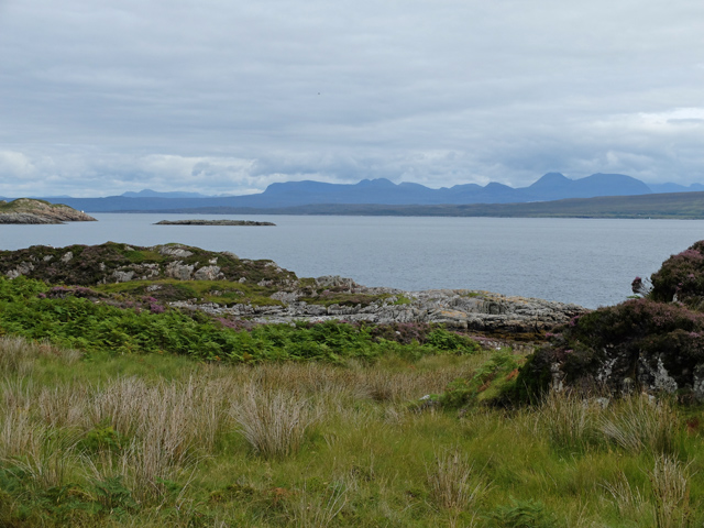
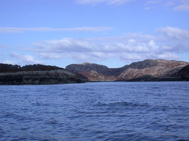
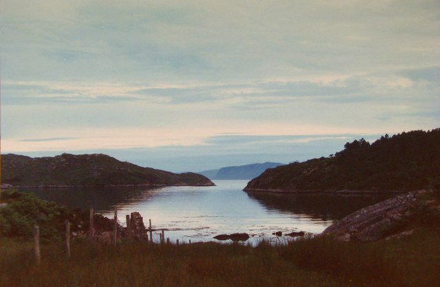
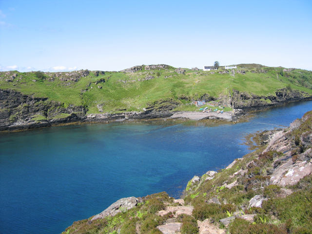
An Dubh Chamas, also known as The Bay, is a picturesque coastal area located in Inverness-shire, Scotland. Situated on the west coast, it is surrounded by stunning natural beauty and offers breathtaking views of the rugged Highland landscape.

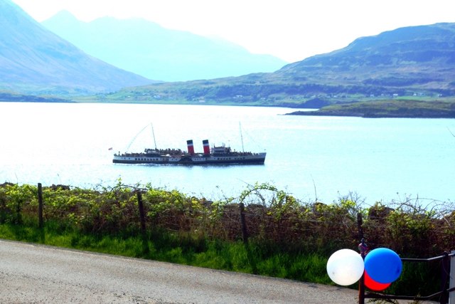
The bay is characterized by its pristine sandy beaches, clear turquoise waters, and dramatic cliffs. It is a popular destination for outdoor enthusiasts and nature lovers, attracting visitors from all over the world. The area is renowned for its diverse wildlife, including seals, dolphins, and various seabird species.

In addition to its natural beauty, An Dubh Chamas offers a range of recreational activities for visitors to enjoy. The bay is a haven for water sports enthusiasts, with opportunities for swimming, kayaking, and surfing. It is also an ideal spot for fishing, with abundant marine life in its waters.

For those seeking tranquility and relaxation, the bay provides ample opportunities for leisurely walks along the shore or picnics on the beach. The surrounding hills and cliffs offer scenic hiking trails, allowing visitors to explore the area while taking in the breathtaking views.

An Dubh Chamas is also home to a small, close-knit community. There are a few local amenities, including a cozy café and a charming bed and breakfast, providing visitors with a warm welcome and a chance to experience the local culture.

Overall, An Dubh Chamas is a hidden gem in Inverness-shire, offering a perfect blend of natural beauty, outdoor activities, and a sense of community, making it a must-visit destination for nature enthusiasts and those seeking a peaceful coastal retreat.

If you have any feedback on the listing, please let us know in the comments section below.

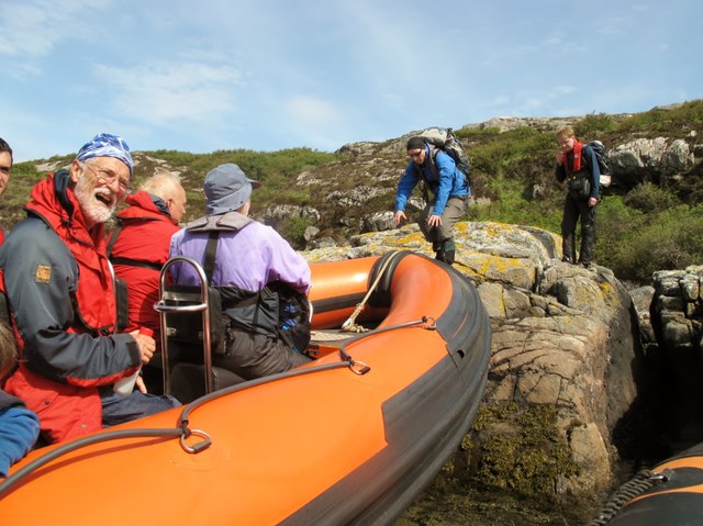
An Dubh Chamas Images

Images are sourced within 2km of 57.521799/-5.9888847 or Grid Reference NG6154. Thanks to Geograph Open Source API. All images are credited.

An Teampull Chapel South Rona View of the ruins of An Teampull chapel at the south of Rona with Skye in the background
An Teampull Chapel South Rona
View of the ruins of An Teampull chapel at the south of Rona with Skye in the background
Meall Mor, Eilean Tigh Looking from the 111m summit of Eilean Tigh to the very northernmost tip of Raasay. On the left is Caol Rona and on the right is Loch a' Sguirr. In the distance, centre, are the hills of Kylerhea at the east of Skye, with the Crowlin Islands in front of them and part of Applecross on the left.
Meall Mor, Eilean Tigh
Looking from the 111m summit of Eilean Tigh to the very northernmost tip of Raasay. On the left is Caol Rona and on the right is Loch a' Sguirr. In the distance, centre, are the hills of Kylerhea at the east of Skye, with the Crowlin Islands in front of them and part of Applecross on the left.
Acairseid Mhor from Meall Acairseid South Top, Rona A view on the west side of the Isle of Rona (north of Raasay), with the Trotternish hills beyond the Sound of Raasay, on Skye. Just in case you are wondering, Acairsaid means Harbour. Sheltering the entrance to the harbour is Eilean Garbh.
Acairseid Mhor from Meall Acairseid South Top, Rona
A view on the west side of the Isle of Rona (north of Raasay), with the Trotternish hills beyond the Sound of Raasay, on Skye. Just in case you are wondering, Acairsaid means Harbour. Sheltering the entrance to the harbour is Eilean Garbh.
Arcairseid Mhòr, Rona An idyllic day to arrive on a 14-m yacht on the Great Anchorage of Rona. The yacht is Ismana built in 1951.  See <span class="nowrap"><a title="http://www.sandemanyachtcompany.co.uk/yacht/272/laurent-giles-47-ft-yawl-1951" rel="nofollow ugc noopener" href="http://www.sandemanyachtcompany.co.uk/yacht/272/laurent-giles-47-ft-yawl-1951">Link</a><img style="margin-left:2px;" alt="External link" title="External link - shift click to open in new window" src="https://s1.geograph.org.uk/img/external.png" width="10" height="10"/></span>
Arcairseid Mhòr, Rona
An idyllic day to arrive on a 14-m yacht on the Great Anchorage of Rona. The yacht is Ismana built in 1951. See LinkExternal link
Eilean Tigh The small island between Rona and Raasay peaks at 111m and is seen here across the Sound of Raasay from the Trotternish coast on Skye.  Despite its name ("house island") it is uninhabited.  The smaller island to its left is Garbh Eilean, which is separated from Rona, whose southern tip is at the left edge of the photo, only by a tidal beach.
Eilean Tigh
The small island between Rona and Raasay peaks at 111m and is seen here across the Sound of Raasay from the Trotternish coast on Skye. Despite its name ("house island") it is uninhabited. The smaller island to its left is Garbh Eilean, which is separated from Rona, whose southern tip is at the left edge of the photo, only by a tidal beach.
View across the Sound of Raasay The view from the bottom of the path to the Old Man of Storr across Bearreraig Bay and the Sound of Raasay towards Eilean Tigh and parts of its bigger neighbours Rona (left) and Raasay (right).  The even bigger island of Great Britain forms the backdrop.
View across the Sound of Raasay
The view from the bottom of the path to the Old Man of Storr across Bearreraig Bay and the Sound of Raasay towards Eilean Tigh and parts of its bigger neighbours Rona (left) and Raasay (right). The even bigger island of Great Britain forms the backdrop.
The eastern tip of Garbh Eilean This island extends just 15m into NG6253.  In the distance is (I think) Glamaig on Skye.
The eastern tip of Garbh Eilean
This island extends just 15m into NG6253. In the distance is (I think) Glamaig on Skye.
Meall Mòr, Eilean Tigh Second island of the day on a RIB from Portree on day after Marhofn 2011 annual meeting in Portree organised by Alan Holmes.

Name: Meall Mòr
Hill number: 4791
Height: 111m / 364ft
Area: 17A: North Skye and Raasay
Class: Hu
Grid ref: NG 60492 53956
Summit feature: rock 25m S of cairn
Drop: 111m
Col: Sea
Meall Mòr, Eilean Tigh
Second island of the day on a RIB from Portree on day after Marhofn 2011 annual meeting in Portree organised by Alan Holmes. Name: Meall Mòr Hill number: 4791 Height: 111m / 364ft Area: 17A: North Skye and Raasay Class: Hu Grid ref: NG 60492 53956 Summit feature: rock 25m S of cairn Drop: 111m Col: Sea
Rona RIB Pick Up Point First island of the day on a RIB from Portree on day after Marhofn 2011 annual meeting in Portree organised by Alan Holmes.  Our pick up point after walking down part of Rona.
Rona RIB Pick Up Point
First island of the day on a RIB from Portree on day after Marhofn 2011 annual meeting in Portree organised by Alan Holmes. Our pick up point after walking down part of Rona.
Eilean Tigh Looking across Caol Eilean Tigh from the northern extremity of Raasay. Eilean Tigh is a tidal island. The kyle is crossable on foot around low tide.
Eilean Tigh
Looking across Caol Eilean Tigh from the northern extremity of Raasay. Eilean Tigh is a tidal island. The kyle is crossable on foot around low tide.
Beach overlooking Caol Eilean Tigh On the far side of the water is the south end of Rona.
Beach overlooking Caol Eilean Tigh
On the far side of the water is the south end of Rona.
The north-east of Raasay Looking out from the Caol Rona path towards the mountains of Torridon on the Scottish mainland.
The north-east of Raasay
Looking out from the Caol Rona path towards the mountains of Torridon on the Scottish mainland.
View South from the North tip of Raasay View South from North tip of Raasay, Eilean Fladday is low lying island to the Right.
View South from the North tip of Raasay
View South from North tip of Raasay, Eilean Fladday is low lying island to the Right.
South East Corner of Rona Heading north up the coast of Rona, off Skye.
South East Corner of Rona
Heading north up the coast of Rona, off Skye.
Entrance to Acairseid Mhor on Rona Entering Acairseid Mhor on Rona by Kayak
Entrance to Acairseid Mhor on Rona
Entering Acairseid Mhor on Rona by Kayak
Acairseid Mhor, South Rhona From the shore below Rona Lodge <a href="https://www.geograph.org.uk/photo/94021">NG6157 : Rona Lodge, Isle of South Rona</a> (which in 1986 was an empty shell) having sailed from Portree
Acairseid Mhor, South Rhona
From the shore below Rona Lodge NG6157 : Rona Lodge, Isle of South Rona (which in 1986 was an empty shell) having sailed from Portree
Port an Teampuill, Rona The south side of Rona from the channel between Rona and Raasay
Port an Teampuill, Rona
The south side of Rona from the channel between Rona and Raasay
Show me another place!

An Dubh Chamas is located at Grid Ref: NG6154 (Lat: 57.521799, Lng: -5.9888847)

Unitary Authority: Highland

Police Authority: Highlands and Islands

What 3 Words

///remarried.routines.crouches. Near Portree, Highland

Related Wikis

Eilean Tigh

Eilean Tigh (Scottish Gaelic: Eilean Taighe) is a tidal island in the Sound of Raasay of Scotland, that lies between Rona and Raasay. Approximately 54...

South Rona

Rona (Scottish Gaelic: Rònaigh), sometimes called South Rona to distinguish it from North Rona (a small uninhabited island to the northwest of Cape Wrath...

Eilean Fladday

Eilean Fladday (also Fladda; Scottish Gaelic: Eilean Fladaigh) is a previously populated tidal island off Raasay, near the Isle of Skye, Scotland. ��2...

Sound of Raasay

The Sound of Raasay (Scottish Gaelic: Linne Ratharsair) is the sound between the islands of Raasay and Skye. == See also == Inner Sound, Scotland Isle...

Nearby Amenities

Located within 500m of 57.521799,-5.9888847
An Dubh Chamas
Natural: bay
Lat/Long: 57.5219499/-5.9904171
Rubha Dubh Chamais
Natural: cape
Lat/Long: 57.5212816/-5.9949232
The data included in this document is from www.openstreetmap.org. The data is made available under ODbL.

Have you been to An Dubh Chamas?

Leave your review of An Dubh Chamas below (or comments, questions and feedback).