Port Uamh nan Achlais

Bay in Argyllshire

Scotland

Port Uamh nan Achlais

Corpach Bay on Jura
Corpach Bay on Jura Credit: Nick Ray

The requested URL returned error: 429 Too Many Requests

If you have any feedback on the listing, please let us know in the comments section below.

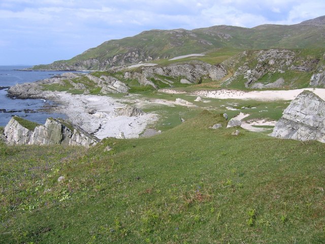
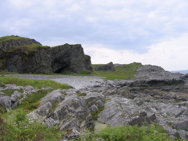
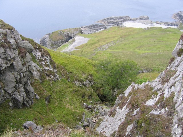
Port Uamh nan Achlais Images

Images are sourced within 2km of 56.059251/-5.9044471 or Grid Reference NR5792. Thanks to Geograph Open Source API. All images are credited.

Corpach Bay on Jura
Corpach Bay on Jura
Northern tip of Corpach Bay From the end of the rocks you get a good view into Corpach Bay, a well-known sandy beach and camping spot.
Northern tip of Corpach Bay
From the end of the rocks you get a good view into Corpach Bay, a well-known sandy beach and camping spot.
Sandy bay south of Corpach A lovely sandy area full of rabbits (and goats). It is one of only a handful of sandy places on the west coast. Corpach Bay can just be seen to the north.
Sandy bay south of Corpach
A lovely sandy area full of rabbits (and goats). It is one of only a handful of sandy places on the west coast. Corpach Bay can just be seen to the north.
Natural Arch A natural arch or really it's more a tunnel. One of many on the west coast of Jura. A sand dune can be seen through the arch.
Natural Arch
A natural arch or really it's more a tunnel. One of many on the west coast of Jura. A sand dune can be seen through the arch.
Cliff cave One of many caves in the cliffs down the west coast of Jura.
Cliff cave
One of many caves in the cliffs down the west coast of Jura.
Steep gully through the crags A stream drops down steeply through the crags in a gully. Perhaps of greater interest, a hugh natural arch can be seen down by the sea.
Steep gully through the crags
A stream drops down steeply through the crags in a gully. Perhaps of greater interest, a hugh natural arch can be seen down by the sea.
Approaching Corpach Bay Once past these cliffs you reach the lovely Corpach Bay.
Approaching Corpach Bay
Once past these cliffs you reach the lovely Corpach Bay.
Lochans on west side of Beinn Bhreac These two lochans are tucked on the western slopes of Beinn Bhreac. The sandy Corpach Bay can be seen way below, while Colonsay is on the horizon.
Lochans on west side of Beinn Bhreac
These two lochans are tucked on the western slopes of Beinn Bhreac. The sandy Corpach Bay can be seen way below, while Colonsay is on the horizon.
Grassy slopes into Cruaidh Ghleann Grassy slopes lead down into Cruaidh Ghleann. Crags beyond rise to the summit of Dubh Bheinn, the highest hill on the north part of Jura.
Grassy slopes into Cruaidh Ghleann
Grassy slopes lead down into Cruaidh Ghleann. Crags beyond rise to the summit of Dubh Bheinn, the highest hill on the north part of Jura.
Abhainn na Corpaich The Abhainn na Corpaich is in a little gorge here as it drops to the sea at Corpach Bay. Ben More on the island of Mull stands out in the distance.
Abhainn na Corpaich
The Abhainn na Corpaich is in a little gorge here as it drops to the sea at Corpach Bay. Ben More on the island of Mull stands out in the distance.
Show me another place!

Port Uamh nan Achlais is located at Grid Ref: NR5792 (Lat: 56.059251, Lng: -5.9044471)

Unitary Authority: Argyll and Bute

Police Authority: Argyll and West Dunbartonshire

What 3 Words

///votes.clothed.louder. Near Scalasaig, Argyll & Bute

Related Wikis

Ardlussa Fishing Loch

The Ardlussa Fishing Loch is an impounding reservoir, located 2 kilometres north of Lussagiven on a remote part of the Ardlussa Estate on Jura, Argyll...

Inverlussa

Inverlussa is a hamlet 1 mile (1.6 km) southwest of Ardlussa and 14 miles from Craighouse at the mouth of Lussa River on the east coast of the island of...

Ardlussa

Ardlussa is a hamlet and estate on The Long Road, just north of the Lussa River, overlooking Ardlussa Bay on the east coast of the island of Jura, in the...

Jura, Scotland

Jura ( JOOR-ə; Scottish Gaelic: Diùra) is an island in the Inner Hebrides of Scotland, adjacent to and northeast of Islay. With an area of 36,692 hectares...

Nearby Amenities

Located within 500m of 56.059251,-5.9044471
Corpach Bay
Natural: bay
Source: OS_OpenData_StreetView
Lat/Long: 56.0570525/-5.9055122
Corpach Challuim-chille
Natural: cave_entrance
Source: OS_OpenData_StreetView
Lat/Long: 56.0550292/-5.9028776
Port Uamh nan Achlais
Natural: bay
Source: OS_OpenData_StreetView
Lat/Long: 56.0581099/-5.9055122
Uamh nan Achlais
Natural: cave_entrance
Source: OS_OpenData_StreetView
Lat/Long: 56.0585113/-5.9032667
The data included in this document is from www.openstreetmap.org. The data is made available under ODbL.

Have you been to Port Uamh nan Achlais?

Leave your review of Port Uamh nan Achlais below (or comments, questions and feedback).