Bàgh na Grèine

Bay in Ross-shire

Scotland

Bàgh na Grèine

Coastline, Rubha nam Bàirneach, Eye Peninsula, Isle of Lewis
Coastline, Rubha nam Bàirneach, Eye Peninsula, Isle of Lewis Credit: Claire Pegrum

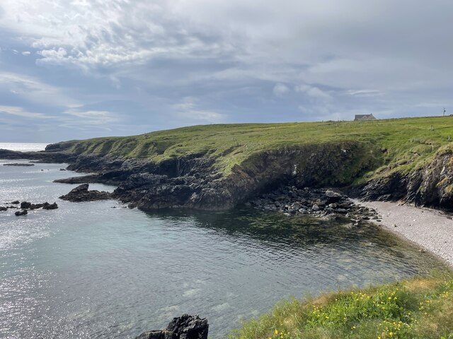
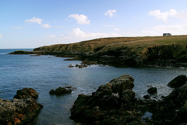
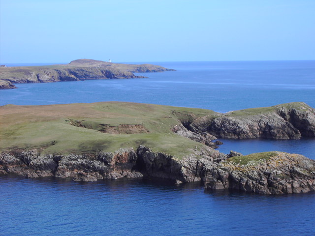
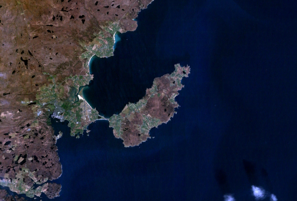
Bàgh na Grèine, located in Ross-shire, Scotland, is a picturesque bay situated along the northwest coast of the country. Renowned for its stunning natural beauty and tranquil atmosphere, the bay is a popular destination for tourists and locals alike.

Surrounded by rugged cliffs and rolling hills, Bàgh na Grèine offers breathtaking panoramic views of the North Atlantic Ocean. Its pristine sandy beach stretches for miles, providing ample space for leisurely walks, sunbathing, and picnicking. The crystal-clear turquoise waters of the bay are ideal for swimming and water sports, attracting visitors seeking a refreshing dip on warmer days.

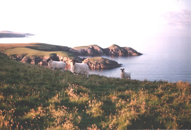
The bay also boasts rich biodiversity, with an abundance of marine life and bird species. Nature enthusiasts can spot seals lounging on the rocks and catch glimpses of dolphins and porpoises frolicking in the waves. Birdwatchers will be delighted by the presence of various seabirds, including gannets, puffins, and cormorants.

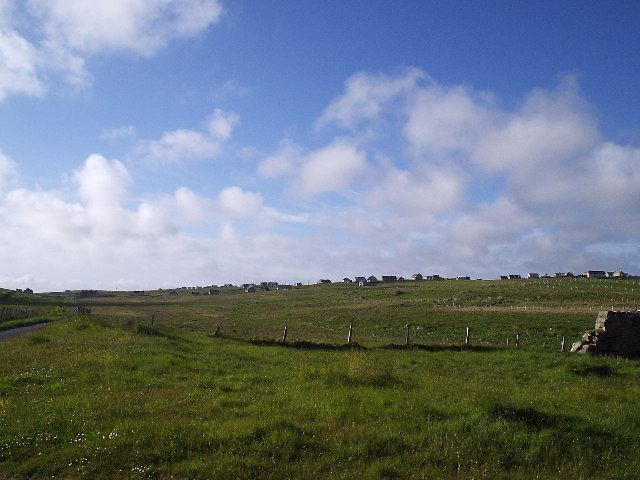
Tranquility and serenity define Bàgh na Grèine, making it a perfect spot for relaxation and rejuvenation. Visitors can enjoy peaceful walks along the bay, breathing in the fresh sea air while listening to the soothing sounds of crashing waves and calling seabirds. The area surrounding the bay is also dotted with charming villages and quaint cottages, offering a glimpse into the traditional Scottish way of life.

Overall, Bàgh na Grèine in Ross-shire is a captivating destination that combines natural beauty, recreational activities, and a sense of tranquility, making it an appealing choice for those seeking a retreat in the heart of Scotland's stunning coastline.

If you have any feedback on the listing, please let us know in the comments section below.

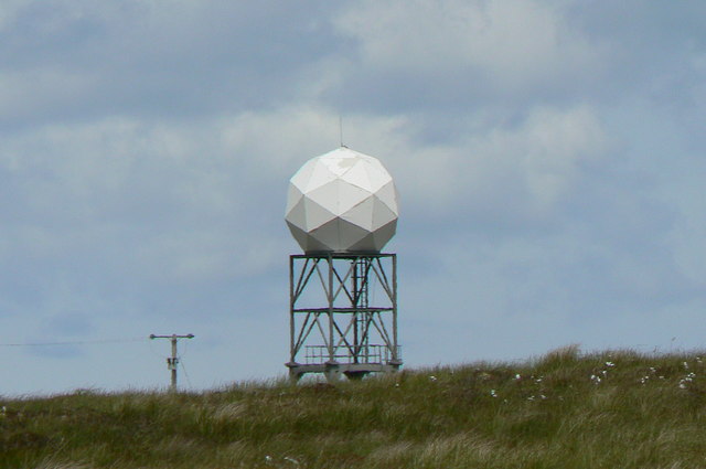
Bàgh na Grèine Images

Images are sourced within 2km of 58.220029/-6.1580519 or Grid Reference NB5533. Thanks to Geograph Open Source API. All images are credited.

Coastline, Rubha nam Bàirneach, Eye Peninsula, Isle of Lewis
Coastline, Rubha Chuidhtinis, Eye Peninsula, Isle of Lewis
Roads around An Rubha Geocaching is a type of global treasure hunt of people looking for caches, or hidden stashes of objects. Geocaching may also be described as a series of hide-and-seek games, where hiders provide online clues for seekers. Seekers use global positioning system (GPS) devices to find hidden caches
Roads around An Rubha
Geocaching is a type of global treasure hunt of people looking for caches, or hidden stashes of objects. Geocaching may also be described as a series of hide-and-seek games, where hiders provide online clues for seekers. Seekers use global positioning system (GPS) devices to find hidden caches
Slipway at Seisiadar
Coastline of An Rubhan
Sheep on Dun Dubh 1988 Rubha na Greine in background
Sheep on Dun Dubh 1988
Rubha na Greine in background
Dun Dubh Along the coast to the Dun Dubh
Dun Dubh
Along the coast to the Dun Dubh
Sheishader Slipway The Slipway at Sheishader was constructed in 2006 and is at the end of a narrow track leading to the shore from the centre of the village. There are two picnic tables for those that want to enjoy a quiet afternoon by the sea.
Sheishader Slipway
The Slipway at Sheishader was constructed in 2006 and is at the end of a narrow track leading to the shore from the centre of the village. There are two picnic tables for those that want to enjoy a quiet afternoon by the sea.
Dorus Beag Viewed from the slipway at Sheishader, Dorus Beag is a small outcrop of rock on the South side of Sheisader Bay with views into the North Minch and towards the Scottish Mainland.
Dorus Beag
Viewed from the slipway at Sheishader, Dorus Beag is a small outcrop of rock on the South side of Sheisader Bay with views into the North Minch and towards the Scottish Mainland.
Seisiadar Looking towards the southern part of the village, with The Minch beyond.
Seisiadar
Looking towards the southern part of the village, with The Minch beyond.
Moorland on the Eye Peninsula Looking south-eastwards from Seisiadar.
Moorland on the Eye Peninsula
Looking south-eastwards from Seisiadar.
The road into Seisiadar. A side turning from the A866 leads to this coastal settlement.
The road into Seisiadar.
A side turning from the A866 leads to this coastal settlement.
Weather Radar Equipment Locals call it the Golfball
Weather Radar Equipment
Locals call it the Golfball
Weather Radar Station This is a picture of the Bayble Weather Radar Station in the moor just about 3/4 of a mile North, North West of the Bayble Beacon and can be seen practically anywhere on the Eye Peninsula, the picture was taken on the road to the beacon.
Weather Radar Station
This is a picture of the Bayble Weather Radar Station in the moor just about 3/4 of a mile North, North West of the Bayble Beacon and can be seen practically anywhere on the Eye Peninsula, the picture was taken on the road to the beacon.
Rubha Dubh Sheisiadar
Eilean na Greine (front right) Rubhan Greine (back right) On the horizon can be seen Tiumpan Head with its lighthouse.
Eilean na Greine (front right) Rubhan Greine (back right)
On the horizon can be seen Tiumpan Head with its lighthouse.
On the Seisiadar common grazings Looking across Abhainn Ghlas.
On the Seisiadar common grazings
Looking across Abhainn Ghlas.
Rubha na Greine
Rubha na Greine
Show me another place!

Bàgh na Grèine is located at Grid Ref: NB5533 (Lat: 58.220029, Lng: -6.1580519)

Unitary Authority: Na h-Eileanan an Iar

Police Authority: Highlands and Islands

What 3 Words

///irritate.treble.ideal. Near Stornoway, Na h-Eileanan Siar

Related Wikis

Point, Lewis

Point (Scottish Gaelic: An Rubha), also known as the Eye Peninsula, is a peninsula some 11 km long in the Outer Hebrides (or Western Isles), Scotland....

Aird, Lewis

Aird (Scottish Gaelic: Àird an Rubha) is a village in the Scottish council area of Eileanan Siar (Western Isles). It is located on the Eye Peninsula on...

Shulishader

Shulishader (Scottish Gaelic: Siadar an Rubha) is a small village with a population of around 120 people in Point, Outer Hebrides on the Isle of Lewis...

Flesherin

Flesherin (Scottish Gaelic: Na Fleisirean) is a small village on the Point peninsula of the Isle of Lewis in the Outer Hebrides. Located near Portnaguran...

Portvoller

Portvoller (Scottish Gaelic: Port Mholair) is a small village on the north tip of the Eye Peninsula (which along with Melbost and Parkend makes up Point...

Broker, Lewis

Broker (Scottish Gaelic: Brocair) is a small hamlet next to the village of Portvoller and Portnaguran on the Eye Peninsula located on the east side of...

Garrabost

Garrabost (Scottish Gaelic: Garrabost) is a village in the Point (An Rubha) peninsula isthmus on the east coast of the Isle of Lewis, in the Outer Hebrides...

Bayble

Bayble (Scottish Gaelic: Pabail) is a large village in Point (An Rubha), on the Isle of Lewis, 6 miles (10 kilometres) east of Stornoway. Bayble is also...

Nearby Amenities

Located within 500m of 58.220029,-6.1580519
Rubha na Greine
Natural: cape
Lat/Long: 58.2212572/-6.1540926
Bàgh na Grèine
Natural: bay
Lat/Long: 58.2199972/-6.1575902
Bàgh a Tuath
Natural: bay
Lat/Long: 58.2175618/-6.1623108
Turning Circle
Turning Circle: knuckle
Lat/Long: 58.2241797/-6.1605016
The data included in this document is from www.openstreetmap.org. The data is made available under ODbL.

Have you been to Bàgh na Grèine?

Leave your review of Bàgh na Grèine below (or comments, questions and feedback).