Little Ponton

Settlement in Lincolnshire South Kesteven

England

Little Ponton

Gorse Lane, Grantham This bridge carries Gorse Lane over the A1 at SK 909 335. The water tower is at SK 910 335
Gorse Lane, Grantham Credit: Kate Jewell

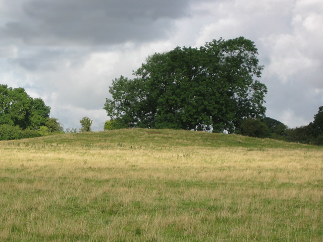
Little Ponton is a small village located in the South Kesteven district of Lincolnshire, England. Situated approximately 2 miles southeast of Grantham, it has a population of around 200 residents. The village is surrounded by picturesque countryside and offers a peaceful and idyllic setting.

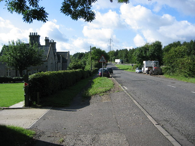
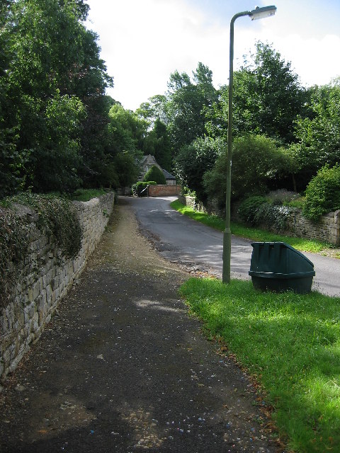
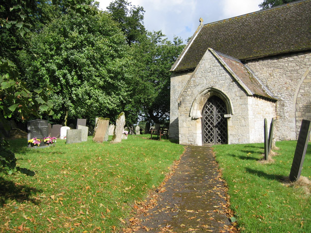
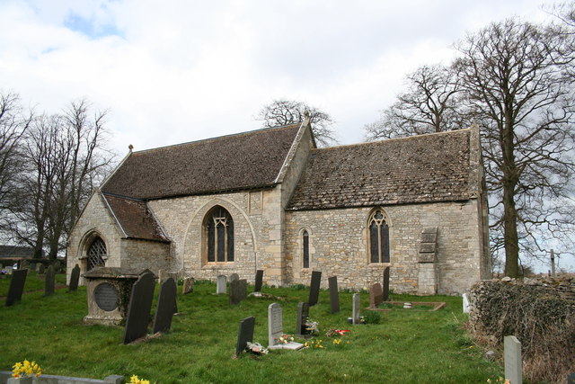
Historically, Little Ponton was mentioned in the Domesday Book in 1086, indicating its long-standing presence. The village has retained much of its traditional charm, with a collection of well-preserved period buildings and cottages. St. Guthlac's Church, a Grade II listed building, stands proudly in the heart of the village, providing a glimpse into its rich heritage.

Despite its size, Little Ponton benefits from a strong sense of community. The village has a small but active community center, which hosts a variety of social events and activities throughout the year, fostering a sense of togetherness among its residents.

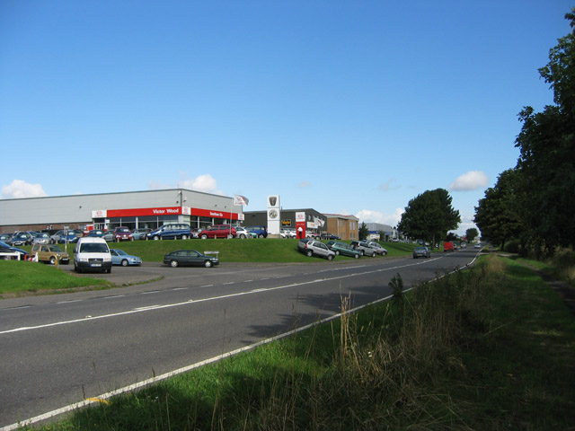
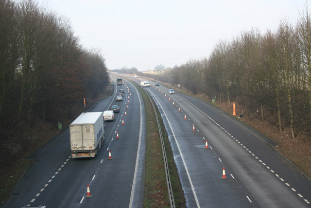
While Little Ponton may be a tranquil countryside retreat, it also benefits from its proximity to Grantham. The larger town offers a range of amenities, including shops, schools, and healthcare facilities, ensuring that residents have easy access to essential services.

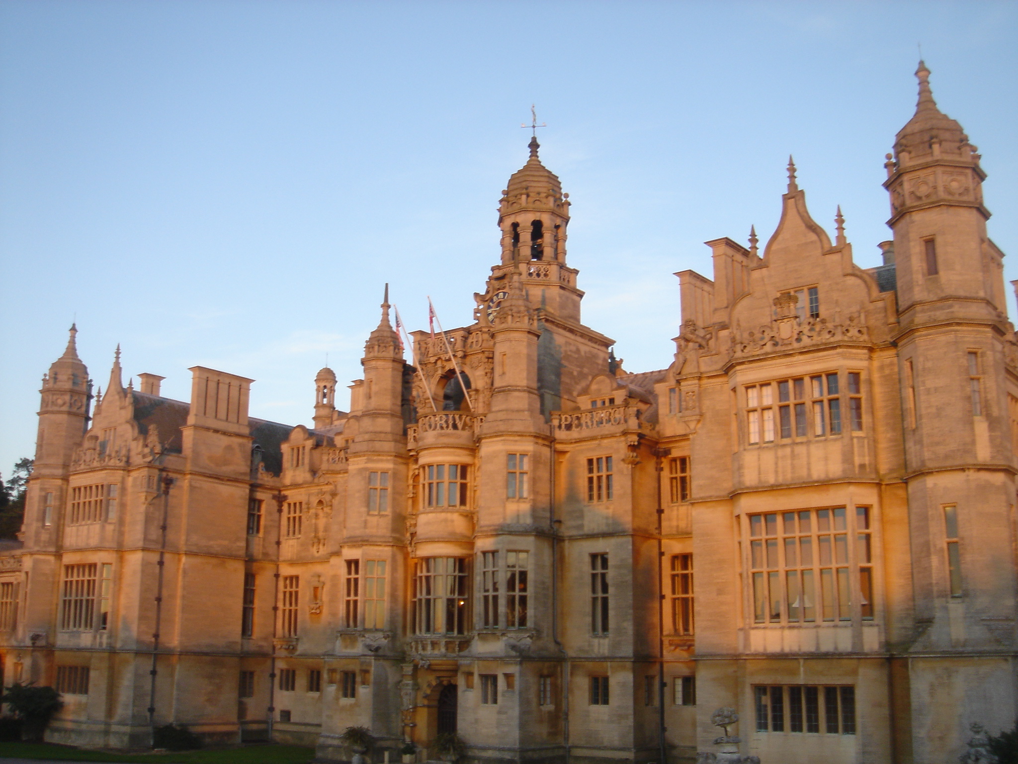
For those seeking outdoor recreation, the nearby Belton House offers stunning parkland and gardens to explore. The village is also well-placed for enjoying walks and bike rides in the surrounding countryside, allowing residents to appreciate the beauty of the Lincolnshire landscape.

In summary, Little Ponton is a charming and close-knit village with a rich history and a strong sense of community. Its idyllic location and proximity to amenities make it an attractive place to call home.

If you have any feedback on the listing, please let us know in the comments section below.

Little Ponton Images

Images are sourced within 2km of 52.879014/-0.632679 or Grid Reference SK9232. Thanks to Geograph Open Source API. All images are credited.

Gorse Lane, Grantham This bridge carries Gorse Lane over the A1 at SK 909 335. The water tower is at SK 910 335
Gorse Lane, Grantham
This bridge carries Gorse Lane over the A1 at SK 909 335. The water tower is at SK 910 335
Stroxton, Lincolnshire A few miles from Grantham this village sits in a small valley in a fairly flat landscape
Stroxton, Lincolnshire
A few miles from Grantham this village sits in a small valley in a fairly flat landscape
Spittlegate Level, Grantham, Lincolnshire Motorists' Paradise! Along this section of the old Great North Road leading into Grantham are at least four main dealers.
Spittlegate Level, Grantham, Lincolnshire
Motorists' Paradise! Along this section of the old Great North Road leading into Grantham are at least four main dealers.
Saltersford Water Treatment Works near Grantham At SK 926 332, the water treatment tanks and reservoir are just across the River Witham which is just out of sight at the bottom of the slope.
Saltersford Water Treatment Works near Grantham
At SK 926 332, the water treatment tanks and reservoir are just across the River Witham which is just out of sight at the bottom of the slope.
Junction on the A1, south of Grantham The B1174 is the first of the four Grantham junctions as you approach from the south. The lorry in the centre of the photograph is on the A1. Taken from SK 921 319 looking south.
Junction on the A1, south of Grantham
The B1174 is the first of the four Grantham junctions as you approach from the south. The lorry in the centre of the photograph is on the A1. Taken from SK 921 319 looking south.
Little Ponton near Grantham This tiny village on the line of Ermine Street is believed to have been a Roman military station. Now it is a sleepy hamlet with the dull noise of the A1 traffic disturbing the peace.
Little Ponton near Grantham
This tiny village on the line of Ermine Street is believed to have been a Roman military station. Now it is a sleepy hamlet with the dull noise of the A1 traffic disturbing the peace.
St Guthlac's Church, Little Ponton The Limestone church dates back to the 11th century. Judging from the outside it has some fine stained glass but unfortunately it was locked. Situated at SK 924 332
St Guthlac's Church, Little Ponton
The Limestone church dates back to the 11th century. Judging from the outside it has some fine stained glass but unfortunately it was locked. Situated at SK 924 332
Tumulus near Little Ponton This mound in the middle of pasture is marked on the OS map at SK 922 326
Tumulus near Little Ponton
This mound in the middle of pasture is marked on the OS map at SK 922 326
Over the stile and into the next square Well, almost! One of the well maintained stiles on this footpath, this is actually just south of the grid boundary at SK 924 328
Over the stile and into the next square
Well, almost! One of the well maintained stiles on this footpath, this is actually just south of the grid boundary at SK 924 328
Farmland at Stroxton Looking east from Stroxton Manor gates across typical Lincolnshire vale landscape.
Farmland at Stroxton
Looking east from Stroxton Manor gates across typical Lincolnshire vale landscape.
Bridge over the Great North Road The Stroxton to Little Ponton road crosses the A1 right at the edge of the square
Bridge over the Great North Road
The Stroxton to Little Ponton road crosses the A1 right at the edge of the square
Putting out the cones on the A1 A favourite pastime of the Highways Agency!
Putting out the cones on the A1
A favourite pastime of the Highways Agency!
Farmland at Stroxton Looking south towards Gibbet Hill
Farmland at Stroxton
Looking south towards Gibbet Hill
Farmland near Grantham This farmland is off Gorse Lane. Grantham Caravans, a caravan sales company, also runs a static site which can be seen in the photograph.
Farmland near Grantham
This farmland is off Gorse Lane. Grantham Caravans, a caravan sales company, also runs a static site which can be seen in the photograph.
Gorse Lane Water Tower A familiar landmark from the A1
Gorse Lane Water Tower
A familiar landmark from the A1
St.Guthlac's church, Little Ponton, Lincs. An interesting little church without tower or bellcote and lots of Norman work inside that Pevsner thinks may be even earlier.
St.Guthlac's church, Little Ponton, Lincs.
An interesting little church without tower or bellcote and lots of Norman work inside that Pevsner thinks may be even earlier.
Holy Cross church, Great Ponton, Lincs. The splendid tower is about 80 feet tall with a fiddle weather-vane is a familiar landmark seen from the A1. Built in 1519 by Anthony Ellys, merchant of the staple of Calais it joins 13th and 14th century architecture of the earlier church.
Holy Cross church, Great Ponton, Lincs.
The splendid tower is about 80 feet tall with a fiddle weather-vane is a familiar landmark seen from the A1. Built in 1519 by Anthony Ellys, merchant of the staple of Calais it joins 13th and 14th century architecture of the earlier church.
Great Ponton Manor House Built by Anthony Ellys c1519 with crow-stepped gables and traces of 16th century wall paintings inside
Great Ponton Manor House
Built by Anthony Ellys c1519 with crow-stepped gables and traces of 16th century wall paintings inside
Show me another place!

Little Ponton is located at Grid Ref: SK9232 (Lat: 52.879014, Lng: -0.632679)

Division: Parts of Kesteven

Administrative County: Lincolnshire

District: South Kesteven

Police Authority: Lincolnshire

What 3 Words

///draw.start.homes. Near Grantham, Lincolnshire

Related Wikis

Little Ponton and Stroxton

Little Ponton and Stroxton is a civil parish in the South Kesteven district of Lincolnshire, England. According to the 2001 Census it had a population...

Little Ponton

Little Ponton is a village in the South Kesteven district of Lincolnshire, England. It lies 2 miles (3 km) south of Grantham, about 60 metres (200 ft)...

Ellys Manor House

Ellys Manor House (pronounced "Ellis"), or the Old Rectory is a late-fifteenth to early sixteenth century manor house in Great Ponton, Lincolnshire, England...

RAF Harlaxton

Royal Air Force Harlaxton or more simply RAF Harlaxton is a former Royal Air Force station near the village of Harlaxton, 3 mi (4.8 km) south west of Grantham...

Stroxton

Stroxton () is a village in the South Kesteven district of Lincolnshire, England. It is situated 3 miles (4.8 km) south from the centre of Grantham and...

Grantham Preparatory School

Grantham Preparatory School is a private preparatory school in Grantham, Lincolnshire, England. == History == It was founded in 1986 by a local individual...

Great Ponton

Great Ponton is an English village and civil parish in the South Kesteven district of Lincolnshire, 3 miles (5 km) south of Grantham on the A1 trunk road...

Gorse Lane

Gorse Lane is a cricket ground in Grantham, Lincolnshire. It was constructed from scratch when the London Road ground was sold to Safeway. Opened for junior...

Nearby Amenities

Located within 500m of 52.879014,-0.632679
Little Ponton
Place: hamlet
Source: NPE
Lat/Long: 52.8781442/-0.6266418
Bus Stop
A1 Slip Roads
Bus: yes
Naptan AtcoCode: 270000008606
Naptan Bearing: N
Naptan CommonName: A1 Slip Roads
Naptan Indicator: N - bound
Naptan Landmark: A1 Slip Roads
Naptan NaptanCode: lingtjgp
Naptan Street: B1174
Naptan Verified: no
Public Transport: platform
Source: naptan_import
Lat/Long: 52.8791668/-0.6328298
Bus Stop
A1 Slip Roads
Bus: yes
Naptan AtcoCode: 2700LLP00799
Naptan Bearing: S
Naptan CommonName: A1 Slip Roads
Naptan Indicator: S - bound
Naptan Landmark: A1 Slip Roads
Naptan NaptanCode: linagjtg
Naptan Street: B1174
Naptan Verified: no
Public Transport: platform
Source: naptan_import
Lat/Long: 52.8789299/-0.6325549
Design: barrel
Line Attachment: suspension
Material: steel
Power: tower
Structure: lattice
Lat/Long: 52.8752343/-0.6365556
Parking
Description: Layby
Ele: 83.0389404
Parking: street_side
Lat/Long: 52.8752912/-0.6325676
Parking
Description: Layby
Ele: 78.4727783
Parking: street_side
Lat/Long: 52.8795648/-0.6353571
Power: pole
Lat/Long: 52.875539/-0.6308813
Power: pole
Lat/Long: 52.8776447/-0.6314805
Power: pole
Lat/Long: 52.8785637/-0.6317438
Power: pole
Lat/Long: 52.8794438/-0.6319886
Power: pole
Lat/Long: 52.8806407/-0.6309893
Power: pole
Lat/Long: 52.8817304/-0.6300783
Power: pole
Lat/Long: 52.8827509/-0.6292273
Power: pole
Lat/Long: 52.8772697/-0.6315529
Power: pole
Lat/Long: 52.8779561/-0.6317407
Power: pole
Lat/Long: 52.8787104/-0.6319445
Power: pole
Lat/Long: 52.8794469/-0.6321538
Power: pole
Lat/Long: 52.8801818/-0.631561
Power: pole
Lat/Long: 52.8809393/-0.6309199
Power: pole
Lat/Long: 52.8817389/-0.6302601
Power: pole
Lat/Long: 52.8825045/-0.6295922
The data included in this document is from www.openstreetmap.org. The data is made available under ODbL.

Have you been to Little Ponton?

Leave your review of Little Ponton below (or comments, questions and feedback).