Port Bheathain

Bay in Argyllshire

Scotland

Port Bheathain

Eilean Chormaic, Port Uisken
Eilean Chormaic, Port Uisken Credit: Steven Brown

Port Bheathain, also known as Bay, is a small coastal village located in the county of Argyllshire, Scotland. Situated on the western coast of the country, it is nestled between the scenic hills and the picturesque coastline. The village is home to a small population of approximately 300 residents.

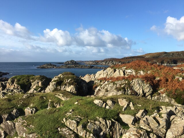
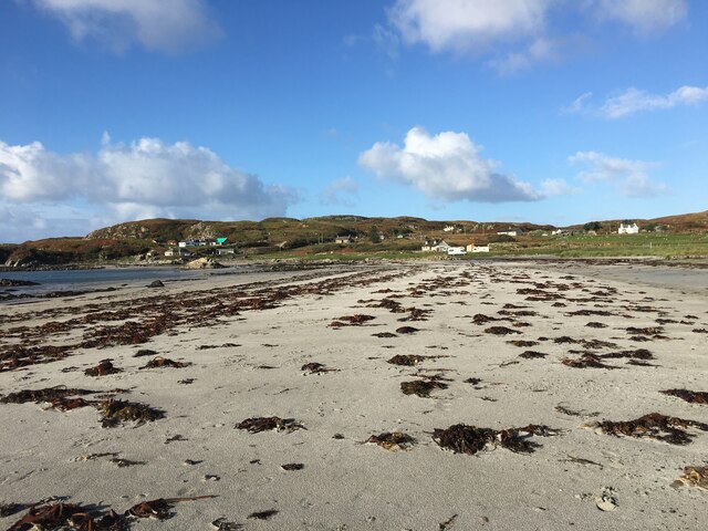
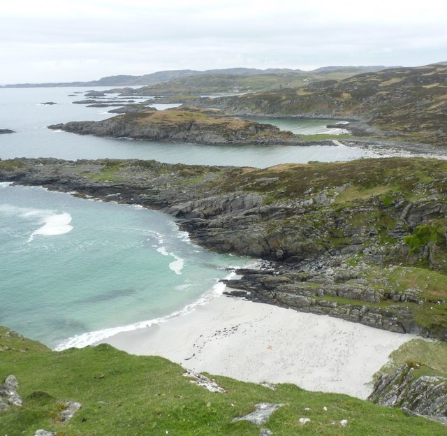
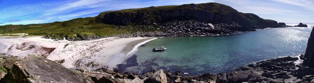
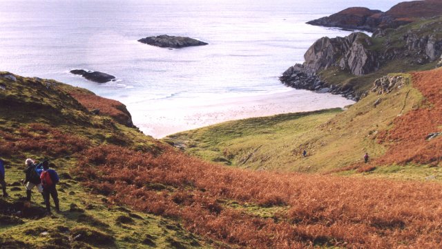
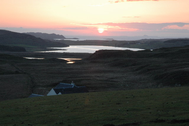
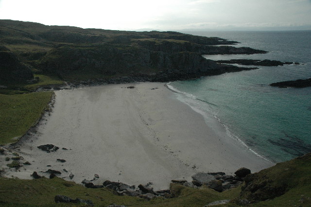
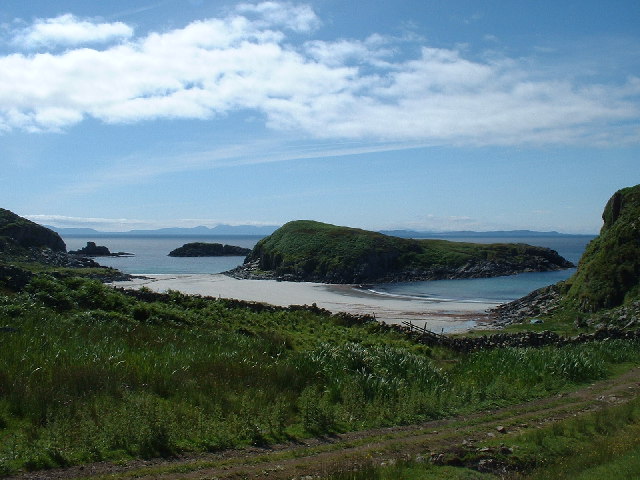
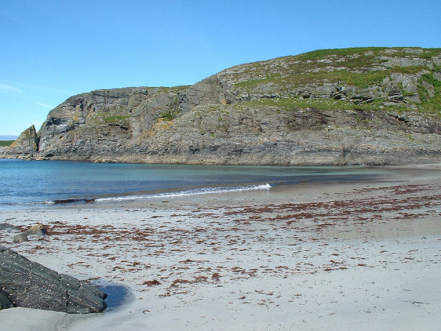
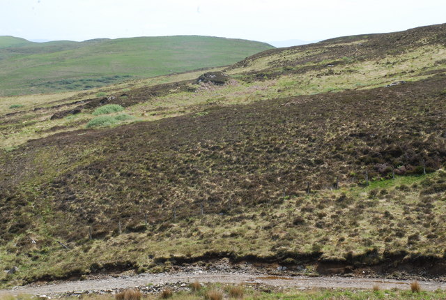
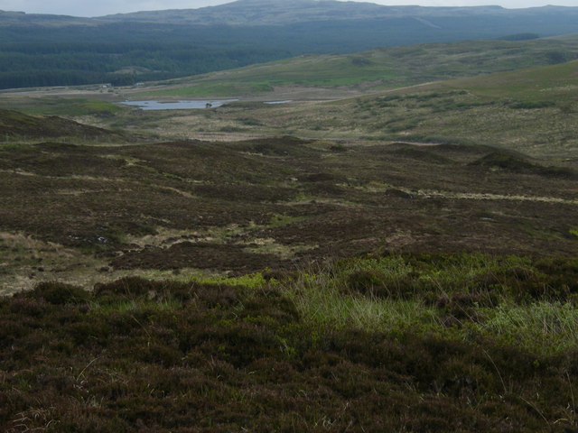
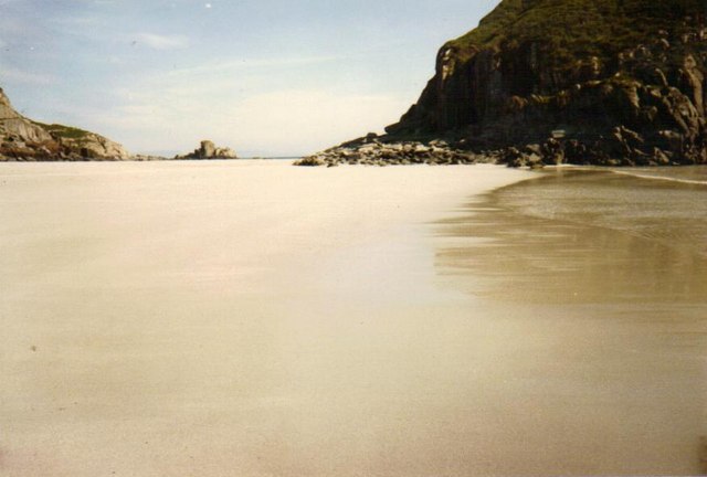
Port Bheathain boasts stunning natural beauty with its rugged cliffs, sandy beaches, and crystal-clear waters. It is a popular destination for outdoor enthusiasts, offering a range of activities such as hiking, fishing, and birdwatching. The area is blessed with an abundance of wildlife, including seals, dolphins, and various bird species.

The village itself has a quaint and charming atmosphere, with traditional stone cottages and a small harbor where local fishing boats can be seen. There are a few local amenities, including a pub, a grocery store, and a primary school. Residents also have access to essential services in nearby towns.

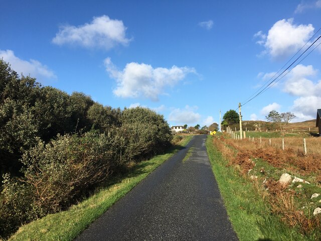
Despite its remote location, Port Bheathain is well-connected to other parts of Argyllshire. The nearest town is just a short drive away, providing additional amenities and services. The village is also served by regular bus services, connecting it to the wider region.

Overall, Port Bheathain offers a peaceful and idyllic setting for those seeking a tranquil coastal retreat. With its breathtaking scenery and close-knit community, it is a hidden gem in the beautiful county of Argyllshire.

If you have any feedback on the listing, please let us know in the comments section below.

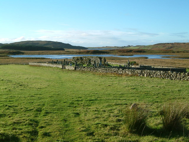
Port Bheathain Images

Images are sourced within 2km of 56.289523/-6.2000828 or Grid Reference NM4018. Thanks to Geograph Open Source API. All images are credited.

Eilean Chormaic, Port Uisken
Beach at Uisken
Beach at Uisken
Near the road end at Uisken
Dun a' Gheird, Mull The name is probably a corruption of Dun nan Geard (Fort of the Guard). It is a well-preserved galleried dun with spectacular views west across the south coast of the Ross of Mull and south to Colonsay, Islay and Jura. At the time of our visit, however, we could only imagine such views!

For more information, visit <span class="nowrap"><a title="http://www.scotlandsplaces.gov.uk/record/rcahms/21974/dun-gheird-mull/rcahms" rel="nofollow ugc noopener" href="http://www.scotlandsplaces.gov.uk/record/rcahms/21974/dun-gheird-mull/rcahms">Link</a><img style="margin-left:2px;" alt="External link" title="External link - shift click to open in new window" src="https://s1.geograph.org.uk/img/external.png" width="10" height="10"/></span>
Dun a' Gheird, Mull
The name is probably a corruption of Dun nan Geard (Fort of the Guard). It is a well-preserved galleried dun with spectacular views west across the south coast of the Ross of Mull and south to Colonsay, Islay and Jura. At the time of our visit, however, we could only imagine such views! For more information, visit LinkExternal link
View south-west from Dun a' Gheird, Mull The south coast of the Ross of Mull is dotted with rocky islets and many attractive beaches, like this one.
View south-west from Dun a' Gheird, Mull
The south coast of the Ross of Mull is dotted with rocky islets and many attractive beaches, like this one.
Looking east from Garbh Eilean One of many beautiful and undisturbed beaches on the Ross of Mull
Looking east from Garbh Eilean
One of many beautiful and undisturbed beaches on the Ross of Mull
Tràigh Bhàn na Sgùrra One of a series of sandy coves on the south coast of the Ross of Mull
Tràigh Bhàn na Sgùrra
One of a series of sandy coves on the south coast of the Ross of Mull
Loch Assapol from Scoor House The sunset from behind Scoor House, looking NW across the fields to Loch Assapol with the Treshnish Islands beyond.
Loch Assapol from Scoor House
The sunset from behind Scoor House, looking NW across the fields to Loch Assapol with the Treshnish Islands beyond.
Traigh Bhan na Sgurra Early morning at Scoor Beach with the tide out.
Traigh Bhan na Sgurra
Early morning at Scoor Beach with the tide out.
Garbh Eilean and  Kilvickeon Beach, Mull Garbh Eilean is a tidal island on a beautiful beach. The grid line runs right down the middle of Garbh Eilean, so the left-hand side as seen here is actually in <a href="https://www.geograph.org.uk/gridref/NM4118">NM4118</a>. The islands of Jura and Islay are visible on the horizon.
Garbh Eilean and Kilvickeon Beach, Mull
Garbh Eilean is a tidal island on a beautiful beach. The grid line runs right down the middle of Garbh Eilean, so the left-hand side as seen here is actually in NM4118. The islands of Jura and Islay are visible on the horizon.
Kilvickeon Beach, Isle of Mull This is the beach in the North-East corner of the square - the photo is taken from NM409186 looking West. For a panoramic view of this beach, see adjoining grid square <a href="https://www.geograph.org.uk/gridref/NM4118">NM4118</a>.
Kilvickeon Beach, Isle of Mull
This is the beach in the North-East corner of the square - the photo is taken from NM409186 looking West. For a panoramic view of this beach, see adjoining grid square NM4118.
Old church on shore of Loch Assapol, Mull
Cnoc Mòr, L.Assapol, Mull Heather moorland in the foreground, but bracken and grass on Cnoc Mòr in the distance.
Cnoc Mòr, L.Assapol, Mull
Heather moorland in the foreground, but bracken and grass on Cnoc Mòr in the distance.
View over hillside towards Loch Assapol
Garbh Eilean and Kilvickeon Beach, Mull at low tide Near to Scoor, on the south side of Mull, lies Garbh Eilean, an island only when the tide comes in.  Here it can be seen on the right of the picture.  The areas of sand on both sides form a kind of double-beach when the tide is out.
Garbh Eilean and Kilvickeon Beach, Mull at low tide
Near to Scoor, on the south side of Mull, lies Garbh Eilean, an island only when the tide comes in. Here it can be seen on the right of the picture. The areas of sand on both sides form a kind of double-beach when the tide is out.
High tide at Kilvickeon Beach, Isle of Mull View from Kilvickeon Beach, with Garbh Eilean on the right of the picture.
High tide at Kilvickeon Beach, Isle of Mull
View from Kilvickeon Beach, with Garbh Eilean on the right of the picture.
Sheep near Kilvickeon Beach, Isle of Mull Near to Scoor, on the Ross of Mull.  Sheep graze near to Kilvickeon Beach.  The island in the centre of the photo is Garbh Eilean, which becomes part of the mainland again once the tide goes out.
Sheep near Kilvickeon Beach, Isle of Mull
Near to Scoor, on the Ross of Mull. Sheep graze near to Kilvickeon Beach. The island in the centre of the photo is Garbh Eilean, which becomes part of the mainland again once the tide goes out.
Garbh Eilean, Isle of Mull On Garbh Eilean, looking towards mainland Mull (the island is an island only when the tide is in, as it is in this photo).  Fishermen have wedged their fishing rods in cracks in the rocks.
Garbh Eilean, Isle of Mull
On Garbh Eilean, looking towards mainland Mull (the island is an island only when the tide is in, as it is in this photo). Fishermen have wedged their fishing rods in cracks in the rocks.
Show me another place!

Port Bheathain is located at Grid Ref: NM4018 (Lat: 56.289523, Lng: -6.2000828)

Unitary Authority: Argyll and Bute

Police Authority: Argyll and West Dunbartonshire

What 3 Words

///goats.pepper.dignitary. Near Fionnphort, Argyll & Bute

Related Wikis

Uisken

Uisken (Scottish Gaelic: Uisgean, meaning "water-bay") is a settlement on a sandy bay on the Ross of Mull in the south of the Isle of Mull, on the west...

Ardalanish

Ardalanish (Scottish Gaelic: Àird Dealanais) is a village on the Isle of Mull in Argyll and Bute, Scotland. It is now an organic farm and weaving mill...

Knocknafenaig

Knocknafenaig (Scottish Gaelic: Cnoc na Fennaig) is a ruined township on the Isle of Mull, Scotland. Located in the south-western portion of the island...

Bunessan

Bunessan (Scottish Gaelic: Bun Easain) is a small village on the Ross of Mull in the south-west of the Isle of Mull, off the west coast of Scotland. The...

Nearby Amenities

Located within 500m of 56.289523,-6.2000828
Created By: dmgroom_coastlines
Source: PGS
Lat/Long: 56.2881/-6.19361
Source: PGS
Lat/Long: 56.28817/-6.1946266
Source: PGS
Lat/Long: 56.2885338/-6.1943262
Created By: dmgroom_coastlines
Source: PGS
Lat/Long: 56.28876/-6.19449
Created By: dmgroom_coastlines
Source: PGS
Lat/Long: 56.289/-6.19401
Created By: dmgroom_coastlines
Source: PGS
Lat/Long: 56.28912/-6.19308
Source: PGS
Lat/Long: 56.288607/-6.1934035
Created By: dmgroom_coastlines
Source: PGS
Lat/Long: 56.28836/-6.19359
Created By: dmgroom_coastlines
Source: PGS
Lat/Long: 56.28973/-6.19211
Created By: dmgroom_coastlines
Source: PGS
Lat/Long: 56.2895/-6.19305
Source: PGS
Lat/Long: 56.289483/-6.1954452
Source: PGS
Lat/Long: 56.2895425/-6.1957253
Created By: dmgroom_coastlines
Source: PGS
Lat/Long: 56.28969/-6.1958
Created By: dmgroom_coastlines
Source: PGS
Lat/Long: 56.2902/-6.19553
Created By: dmgroom_coastlines
Source: PGS
Lat/Long: 56.29044/-6.19505
Source: PGS
Lat/Long: 56.290627/-6.194881
Source: PGS
Lat/Long: 56.290892/-6.1956328
Source: PGS
Lat/Long: 56.2907655/-6.1960826
Created By: dmgroom_coastlines
Source: PGS
Lat/Long: 56.29073/-6.19642
Source: PGS
Lat/Long: 56.29062/-6.19665
Created By: dmgroom_coastlines
Source: PGS
Lat/Long: 56.28998/-6.19739
Created By: dmgroom_coastlines
Source: PGS
Lat/Long: 56.28973/-6.19741
Created By: dmgroom_coastlines
Source: PGS
Lat/Long: 56.28922/-6.19745
Source: PGS
Lat/Long: 56.2890145/-6.1976262
Created By: dmgroom_coastlines
Source: PGS
Lat/Long: 56.28885/-6.19816
Source: PGS
Lat/Long: 56.288652/-6.1989942
Created By: dmgroom_coastlines
Source: PGS
Lat/Long: 56.28912/-6.19906
Source: PGS
Lat/Long: 56.2892094/-6.1990681
Source: PGS
Lat/Long: 56.2896746/-6.1989603
Source: PGS
Lat/Long: 56.2904577/-6.1985536
Source: PGS
Lat/Long: 56.2909844/-6.1983256
Source: PGS
Lat/Long: 56.2910288/-6.1998415
Source: PGS
Lat/Long: 56.29056/-6.20011
Source: PGS
Lat/Long: 56.2901978/-6.2001835
Source: PGS
Lat/Long: 56.2898883/-6.2005532
Source: PGS
Lat/Long: 56.2893753/-6.2011694
Created By: dmgroom_coastlines
Source: PGS
Lat/Long: 56.28905/-6.2016
Source: PGS
Lat/Long: 56.2887394/-6.2021234
Source: PGS
Lat/Long: 56.2884893/-6.2024881
Source: PGS
Lat/Long: 56.2884238/-6.2025525
Source: PGS
Lat/Long: 56.288406/-6.2027027
Source: PGS
Lat/Long: 56.2883881/-6.2028636
Source: PGS
Lat/Long: 56.288394/-6.203046
Created By: dmgroom_coastlines
Source: PGS
Lat/Long: 56.28858/-6.20302
Created By: dmgroom_coastlines
Source: PGS
Lat/Long: 56.28909/-6.20298
Source: PGS
Lat/Long: 56.2892727/-6.2027562
Source: PGS
Lat/Long: 56.289825/-6.2023341
Source: PGS
Lat/Long: 56.2906321/-6.2016554
Source: PGS
Lat/Long: 56.291629/-6.2031105
Source: PGS
Lat/Long: 56.2912557/-6.2037714
Source: PGS
Lat/Long: 56.2907381/-6.2041457
Created By: dmgroom_coastlines
Source: PGS
Lat/Long: 56.2904/-6.20427
Source: PGS
Lat/Long: 56.2896985/-6.2045
Source: PGS
Lat/Long: 56.288848/-6.2050354
Source: PGS
Lat/Long: 56.2886851/-6.2059199
Created By: dmgroom_coastlines
Source: PGS
Lat/Long: 56.28839/-6.20626
Source: PGS
Lat/Long: 56.2883223/-6.2062745
Source: PGS
Lat/Long: 56.2882974/-6.2072673
Source: PGS
Lat/Long: 56.2889985/-6.206813
Created By: dmgroom_coastlines
Source: PGS
Lat/Long: 56.28942/-6.20641
Source: PGS
Lat/Long: 56.2897747/-6.2061705
Source: PGS
Lat/Long: 56.2899783/-6.2065657
Source: PGS
Lat/Long: 56.2900657/-6.2068242
Created By: dmgroom_coastlines
Source: PGS
Lat/Long: 56.29008/-6.20729
Source: PGS
Lat/Long: 56.2897224/-6.2074055
Source: PGS
Lat/Long: 56.2894617/-6.2079564
Source: PGS
Lat/Long: 56.2891633/-6.2081172
Source: PGS
Lat/Long: 56.29084/-6.20124
Source: PGS
Lat/Long: 56.2914926/-6.2006482
Source: PGS
Lat/Long: 56.2913067/-6.2023165
Source: PGS
Lat/Long: 56.2915163/-6.2017548
Source: PGS
Lat/Long: 56.2912084/-6.2036435
The data included in this document is from www.openstreetmap.org. The data is made available under ODbL.

Have you been to Port Bheathain?

Leave your review of Port Bheathain below (or comments, questions and feedback).