Acairseid Mhòr

Bay in Argyllshire

Scotland

Acairseid Mhòr

A yacht sailing south past the west end of Gometra
A yacht sailing south past the west end of Gometra Credit: Elliott Simpson

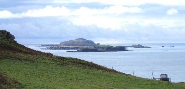
Acairseid Mhòr is a picturesque bay located in Argyllshire, on the western coast of Scotland. Nestled between rolling hills and surrounded by stunning natural beauty, it is a popular destination for nature lovers and those seeking a peaceful retreat. The bay is known for its crystal-clear turquoise waters, which are ideal for swimming, snorkeling, and diving.

The beach itself is a mix of golden sand and small pebbles, perfect for leisurely walks or sunbathing. Visitors can also enjoy a range of water activities, such as kayaking and paddleboarding, thanks to the calm and tranquil nature of the bay.

Acairseid Mhòr is not only renowned for its natural beauty but also for its rich history. The bay is home to several historical sites, including ancient burial mounds and standing stones, which provide a glimpse into the area's past.

For those interested in wildlife, Acairseid Mhòr is a haven. The bay is teeming with marine life, and visitors may spot seals, dolphins, and a variety of seabirds. The surrounding hills and forests are also home to an array of wildlife, including red deer and otters.

Acairseid Mhòr offers a range of amenities to ensure a comfortable visit. There are nearby accommodations, including guesthouses and camping sites, as well as cafes and restaurants serving delicious local cuisine. Visitors can also explore the nearby coastal villages and enjoy the warm hospitality of the local community.

Overall, Acairseid Mhòr is a captivating and serene bay that offers a perfect blend of natural beauty, historical significance, and opportunities for outdoor activities.

If you have any feedback on the listing, please let us know in the comments section below.

Acairseid Mhòr Images

Images are sourced within 2km of 56.493828/-6.3007968 or Grid Reference NM3541. Thanks to Geograph Open Source API. All images are credited.

A yacht sailing south past the west end of Gometra
Gometra and Ulva Gometra and Loch Tuath, late afternoon from the road above Torloisk House on Mull
Gometra and Ulva
Gometra and Loch Tuath, late afternoon from the road above Torloisk House on Mull
Eilean Droghlum Summit Fourth TuMP after a military march from the Ulva ferry with Jim Bloomer and Richard Tibbetts on a bright sunny day. Saw seven feral goats on this tidal island.
Name: Eilean Droghlum
Hill number: 102505
Height: 38m / 125ft
Area: 17E: Mull and Nearby Islands
Class: 0
Grid ref: NM350422 (est)
Drop: 38m
Eilean Droghlum Summit
Fourth TuMP after a military march from the Ulva ferry with Jim Bloomer and Richard Tibbetts on a bright sunny day. Saw seven feral goats on this tidal island. Name: Eilean Droghlum Hill number: 102505 Height: 38m / 125ft Area: 17E: Mull and Nearby Islands Class: 0 Grid ref: NM350422 (est) Drop: 38m
Feral Goats On The Rocky Eilean Droghlum Seven feral goats caught running away over the rocky tidal island of Eilean Droghlum near Gometra.
Feral Goats On The Rocky Eilean Droghlum
Seven feral goats caught running away over the rocky tidal island of Eilean Droghlum near Gometra.
Torr Mor Summit Fifth TuMP of a busy sunny day with Richard Tibbetts and Jim Bloomer.
Name: Torr Mor
Hill number: 102421
Height: 79m / 259ft
Area: 17E: Mull and Nearby Islands
Class: 0
Grid ref: NM366403 (est)
Drop: 42m
Col: 37m
Torr Mor Summit
Fifth TuMP of a busy sunny day with Richard Tibbetts and Jim Bloomer. Name: Torr Mor Hill number: 102421 Height: 79m / 259ft Area: 17E: Mull and Nearby Islands Class: 0 Grid ref: NM366403 (est) Drop: 42m Col: 37m
Gometra Cairn And Vanessa Trig Third TuMP of a bright sunny morning with Jim Bloomer and Richard Tibbetts.
Name: Gometra
Hill number: 1331
Height: 155m / 509ft
Area: 17E: Mull and Nearby Islands
Class: Ma
Grid ref: NM 36120 41405
Summit feature: trig point: OS measurement
Drop: 155m
Col: Sea
Gometra Cairn And Vanessa Trig
Third TuMP of a bright sunny morning with Jim Bloomer and Richard Tibbetts. Name: Gometra Hill number: 1331 Height: 155m / 509ft Area: 17E: Mull and Nearby Islands Class: Ma Grid ref: NM 36120 41405 Summit feature: trig point: OS measurement Drop: 155m Col: Sea
Torr Mor NE Top Second TuMP today with Jim Bloomer and Richard Tibbetts.
Name: Torr Mor NE Top
Hill number: 102436
Height: 74m / 243ft
Area: 17E: Mull and Nearby Islands
Class: 0
Grid ref: NM370409 (est)
Drop: 31m
Col: 43m
Torr Mor NE Top
Second TuMP today with Jim Bloomer and Richard Tibbetts. Name: Torr Mor NE Top Hill number: 102436 Height: 74m / 243ft Area: 17E: Mull and Nearby Islands Class: 0 Grid ref: NM370409 (est) Drop: 31m Col: 43m
Farm Building Near Gometra House A busy area on Geometra around this farm near Gometra House which is sadly in need of repair.  The island is agricultural, formerly growing grain for the monastery on Iona. Once home to a population of over a hundred, it is now down to a tight-knit community of a handful of people, up to a thousand black face sheep, highland cattle, pigs, horses, a flock of feral goats, and red deer.
Farm Building Near Gometra House
A busy area on Geometra around this farm near Gometra House which is sadly in need of repair. The island is agricultural, formerly growing grain for the monastery on Iona. Once home to a population of over a hundred, it is now down to a tight-knit community of a handful of people, up to a thousand black face sheep, highland cattle, pigs, horses, a flock of feral goats, and red deer.
View Towards Gometra House Gometra House had fallen into disrepair and parts were near collapse by the 1980s, but was reoccupied and restored as a family home in the 1990s. Principal exports include blackface breeding stock, lamb, mutton, wool, venison, oysters, vegetables, art and jewellery. There are currently four households on the island, and the islanders are dedicated to a low-impact lifestyle, living off-grid, doing without electricity in their homes, washing machines or cars on the island.
Weather and tides permitting, it takes about 1 hour and 15 minutes to travel by track from the houses on the west of Gometra to the ferry landing stage on Ulva for the crossing to Mull, using a 4x4 vehicle. The same trip can be done in 50 minutes on a quad bike. By boat from Acarseid Mhòr the journey only takes 20 minutes.
View Towards Gometra House
Gometra House had fallen into disrepair and parts were near collapse by the 1980s, but was reoccupied and restored as a family home in the 1990s. Principal exports include blackface breeding stock, lamb, mutton, wool, venison, oysters, vegetables, art and jewellery. There are currently four households on the island, and the islanders are dedicated to a low-impact lifestyle, living off-grid, doing without electricity in their homes, washing machines or cars on the island. Weather and tides permitting, it takes about 1 hour and 15 minutes to travel by track from the houses on the west of Gometra to the ferry landing stage on Ulva for the crossing to Mull, using a 4x4 vehicle. The same trip can be done in 50 minutes on a quad bike. By boat from Acarseid Mhòr the journey only takes 20 minutes.
Two Highland Bulls We found these two Highland bulls happily grazing on a remote part of Gometra.  They then started banging their heads together as they put on a show for us.
Two Highland Bulls
We found these two Highland bulls happily grazing on a remote part of Gometra. They then started banging their heads together as they put on a show for us.
Gometra Vanessa Trig Plus Coastal View Third TuMP of a bright sunny morning with Jim Bloomer and Richard Tibbetts plus soon joined by Martin Collins and Richard Wood.
Name: Gometra
Hill number: 1331
Height: 155m / 509ft
Area: 17E: Mull and Nearby Islands
Class: Ma
Grid ref: NM 36120 41405
Summit feature: trig point: OS measurement
Drop: 155m
Col: Sea
Gometra Vanessa Trig Plus Coastal View
Third TuMP of a bright sunny morning with Jim Bloomer and Richard Tibbetts plus soon joined by Martin Collins and Richard Wood. Name: Gometra Hill number: 1331 Height: 155m / 509ft Area: 17E: Mull and Nearby Islands Class: Ma Grid ref: NM 36120 41405 Summit feature: trig point: OS measurement Drop: 155m Col: Sea
House on Gometra Gometra (Gòmastra) is an island in the Inner Hebrides, west of Mull. It lies immediately west of Ulva, to which it is linked by a bridge, and at low tide also by a beach (<span class="nowrap"><a title="https://en.wikipedia.org/wiki/Gometra" rel="nofollow ugc noopener" href="https://en.wikipedia.org/wiki/Gometra">Link</a><img style="margin-left:2px;" alt="External link" title="External link - shift click to open in new window" src="https://s1.geograph.org.uk/img/external.png" width="10" height="10"/></span> Wikipedia).
House on Gometra
Gometra (Gòmastra) is an island in the Inner Hebrides, west of Mull. It lies immediately west of Ulva, to which it is linked by a bridge, and at low tide also by a beach (LinkExternal link Wikipedia).
Rocky Islet West of Gometra
Western Shore of Gometra and Gometra House Gometra (Gòmastra) is an island in the Inner Hebrides, west of Mull. It lies immediately west of Ulva, to which it is linked by a bridge, and at low tide also by a beach (<span class="nowrap"><a title="https://en.wikipedia.org/wiki/Gometra" rel="nofollow ugc noopener" href="https://en.wikipedia.org/wiki/Gometra">Link</a><img style="margin-left:2px;" alt="External link" title="External link - shift click to open in new window" src="https://s1.geograph.org.uk/img/external.png" width="10" height="10"/></span> Wikipedia).
Western Shore of Gometra and Gometra House
Gometra (Gòmastra) is an island in the Inner Hebrides, west of Mull. It lies immediately west of Ulva, to which it is linked by a bridge, and at low tide also by a beach (LinkExternal link Wikipedia).
A pass on Gometra Leaving Bail' a' Chlaidh for a low and scenic pass on the way to Gometra House.
A pass on Gometra
Leaving Bail' a' Chlaidh for a low and scenic pass on the way to Gometra House.
A pass on Gometra The road descends back to the coast on the way to Gometra House.  Even with the highest point on the island being only 155m above sea level there is some spectacular hill scenery here.
A pass on Gometra
The road descends back to the coast on the way to Gometra House. Even with the highest point on the island being only 155m above sea level there is some spectacular hill scenery here.
Pasture, Gometra A good place to start an ascent of the 155m high point of the island. Over the dyke the cropped grass gives way to deep heather, but deer paths aid progress.
Pasture, Gometra
A good place to start an ascent of the 155m high point of the island. Over the dyke the cropped grass gives way to deep heather, but deer paths aid progress.
Gometra's main road Descending beside Torr Mòr to the south coast and eventually Gometra House. The view is out to Staffa and Iona.
Gometra's main road
Descending beside Torr Mòr to the south coast and eventually Gometra House. The view is out to Staffa and Iona.
Show me another place!

Acairseid Mhòr is located at Grid Ref: NM3541 (Lat: 56.493828, Lng: -6.3007968)

Unitary Authority: Argyll and Bute

Police Authority: Argyll and West Dunbartonshire

What 3 Words

///handfuls.december.stumpy. Near Calgary, Argyll & Bute

Related Wikis

Gometra

Gometra (Scottish Gaelic: Gòmastra) is an island in the Inner Hebrides of Scotland, lying west of Mull. It lies immediately west of Ulva, to which it is...

Cairn na Burgh Beag

Cairn na Burgh Beag is one of the Treshnish Isles in the Inner Hebrides, Scotland. Cairn na Burgh Beag is the smaller of the two "Carnburgs" (as they...

Cairnburgh Castle

Cairnburgh Castle is a ruined castle that is located on the islands of Cairn na Burgh Mòr and Cairn na Burgh Beag, Argyll and Bute, Scotland. These islands...

Cairn na Burgh Mòr

Cairn na Burgh Mòr (also Cairnburgh More) is one of the Treshnish Isles in the Inner Hebrides of Scotland. Cairn na Burgh Mòr is the larger of the two...

Little Colonsay

Little Colonsay (Scottish Gaelic: Colbhasa Beag) is an uninhabited island west of the island of the Isle of Mull in Scotland. The geology of the island...

Fladda, Treshnish Isles

Fladda is the northernmost of the Treshnish Isles. Its name comes from the Old Norse Flat-ey meaning "flat island". Fladda is owned by the Hebridean Trust...

Ulva

Ulva (; Scottish Gaelic: Ulbha) is a small island in the Inner Hebrides of Scotland, off the west coast of Mull. It is separated from Mull by a narrow...

Loch Tuath

Loch Tuath (Scottish Gaelic: Loch-a-Tuath) is a sea loch in the Inner Hebrides, Scotland that separates the Isle of Mull and the island of Ulva. Loch Tuath...

Nearby Amenities

Located within 500m of 56.493828,-6.3007968
Source: PGS
Lat/Long: 56.4973617/-6.3057165
Source: PGS
Lat/Long: 56.4970456/-6.3047212
Source: PGS
Lat/Long: 56.4969071/-6.304177
Source: PGS
Lat/Long: 56.4967075/-6.3040975
Source: PGS
Lat/Long: 56.4962966/-6.303628
Source: PGS
Lat/Long: 56.496872/-6.3040185
Source: PGS
Lat/Long: 56.4963143/-6.3034185
Source: PGS
Lat/Long: 56.4961759/-6.3034761
Source: PGS
Lat/Long: 56.4959329/-6.303351
Source: PGS
Lat/Long: 56.4963148/-6.3037521
Source: PGS
Lat/Long: 56.4969032/-6.3042903
Source: PGS
Lat/Long: 56.4963998/-6.3038917
Source: PGS
Lat/Long: 56.4958355/-6.3011019
Source: PGS
Lat/Long: 56.4959276/-6.3013604
Ele: 41
Natural: peak
Lat/Long: 56.4963461/-6.3001671
Ele: 38
Natural: peak
Lat/Long: 56.4968803/-6.3066576
Lochan a' Churraidh
Natural: bay
Lat/Long: 56.4926524/-6.3069083
Acairseid Mhòr
Natural: bay
Lat/Long: 56.4932997/-6.3004143
The data included in this document is from www.openstreetmap.org. The data is made available under ODbL.

Have you been to Acairseid Mhòr?

Leave your review of Acairseid Mhòr below (or comments, questions and feedback).