Sloc a' Choin Bhàin

Bay in Argyllshire

Scotland

Sloc a' Choin Bhàin

Eilean Dubh na Ciste Eilean Dubh na Ciste is a rocky skerry at the NNE end of Bull Hole, a narrow channel and anchorage between Iona and the Ross of Mull. Its advantage from my perspective is that the two main rocks are linked by a small sandy tombolo beach which provides a convenient place to land a sea kayak and wander around getting the best views. This view looks northwards to more skerries outside Kinta harbour, where the water is a lot calmer than on my last visit <a href="https://www.geograph.org.uk/photo/5796448">NM3125 : Paddling into the sun - Eilean Corrach</a>.
Eilean Dubh na Ciste Credit: Andy Waddington

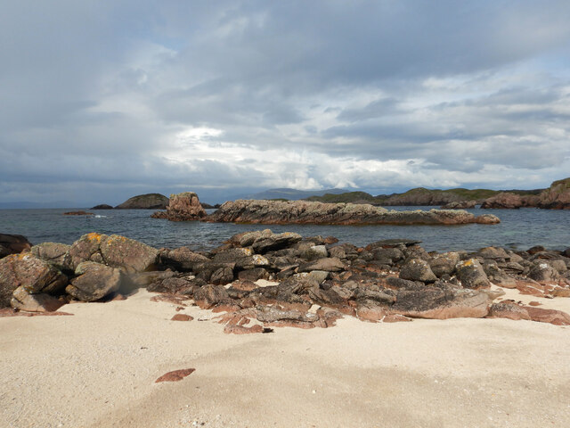
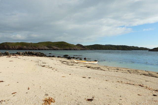
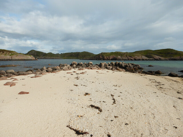
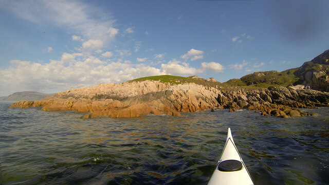
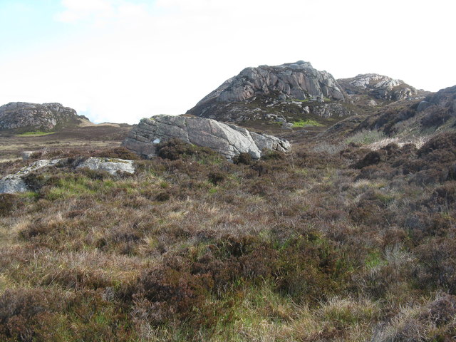
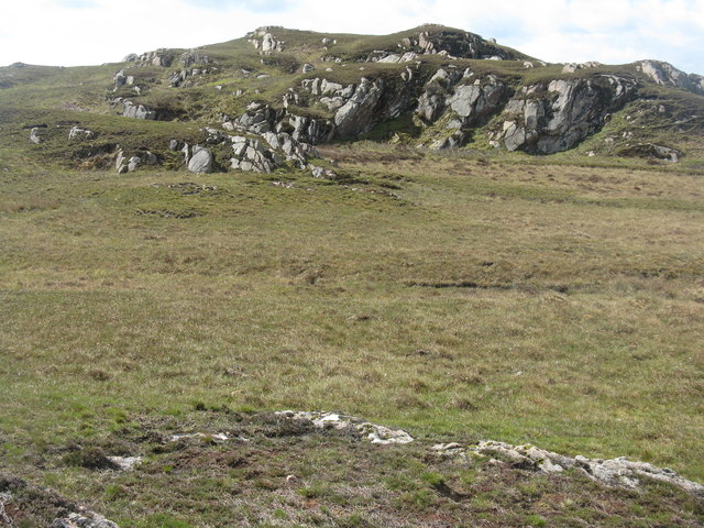
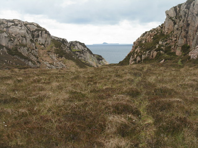
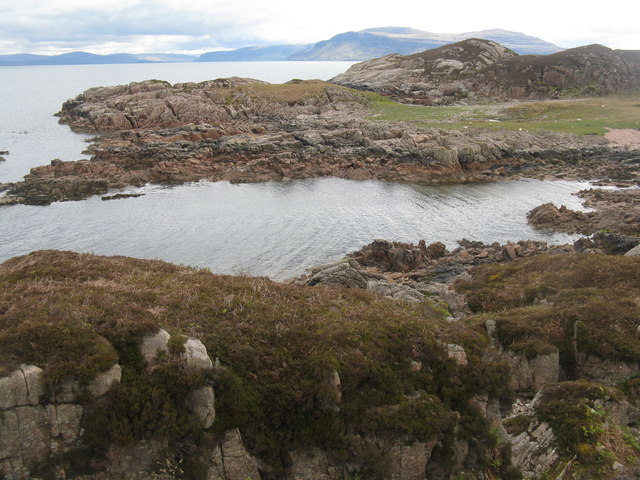
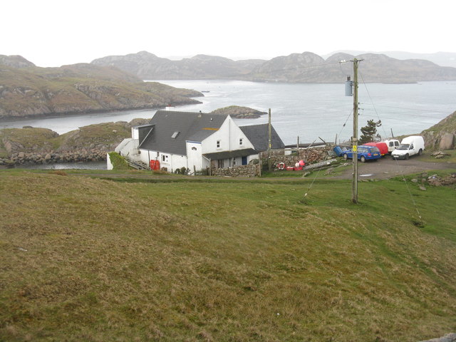
Sloc a' Choin Bhàin, also known as the Bay of the White Dog, is a picturesque coastal area located in Argyllshire, Scotland. Situated on the western coast of Scotland, this bay offers stunning views of the surrounding landscapes and the nearby islands.

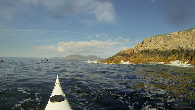
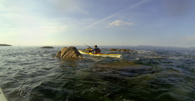
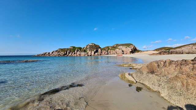
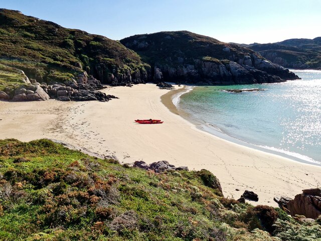
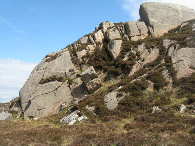
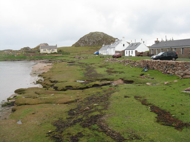
The bay is characterized by its pristine sandy beaches, crystal-clear turquoise waters, and rugged cliffs. It is a popular destination for outdoor enthusiasts and nature lovers, offering a variety of activities such as swimming, fishing, kayaking, and hiking.

The area is rich in wildlife, with a diverse range of bird species, seals, and occasionally dolphins and whales spotted in the bay. The bay's natural beauty and tranquil atmosphere make it an ideal place for birdwatching and wildlife photography.

Sloc a' Choin Bhàin is also steeped in history, with remnants of ancient settlements and historical sites scattered throughout the bay. Visitors can explore ancient ruins and stone circles, providing a glimpse into the area's fascinating past.

For those seeking a peaceful and relaxing retreat, Sloc a' Choin Bhàin offers a sense of serenity and tranquility. The bay's secluded location and unspoiled surroundings make it a perfect spot for a peaceful picnic or a leisurely stroll along the beach.

Overall, Sloc a' Choin Bhàin is a hidden gem in Argyllshire, offering breathtaking natural beauty, rich history, and a peaceful escape from the hustle and bustle of everyday life.

If you have any feedback on the listing, please let us know in the comments section below.

Sloc a' Choin Bhàin Images

Images are sourced within 2km of 56.346351/-6.3305585 or Grid Reference NM3225. Thanks to Geograph Open Source API. All images are credited.

Eilean Dubh na Ciste Eilean Dubh na Ciste is a rocky skerry at the NNE end of Bull Hole, a narrow channel and anchorage between Iona and the Ross of Mull. Its advantage from my perspective is that the two main rocks are linked by a small sandy tombolo beach which provides a convenient place to land a sea kayak and wander around getting the best views. This view looks northwards to more skerries outside Kinta harbour, where the water is a lot calmer than on my last visit <a href="https://www.geograph.org.uk/photo/5796448">NM3125 : Paddling into the sun - Eilean Corrach</a>.
Eilean Dubh na Ciste
Eilean Dubh na Ciste is a rocky skerry at the NNE end of Bull Hole, a narrow channel and anchorage between Iona and the Ross of Mull. Its advantage from my perspective is that the two main rocks are linked by a small sandy tombolo beach which provides a convenient place to land a sea kayak and wander around getting the best views. This view looks northwards to more skerries outside Kinta harbour, where the water is a lot calmer than on my last visit NM3125 : Paddling into the sun - Eilean Corrach.
Landing on Eilean Dubh na Ciste Eilean Dubh na Ciste is a rocky skerry at the NNE end of Bull Hole, a narrow channel and anchorage between Iona and the Ross of Mull. Its advantage from my perspective is that the two main rocks are linked by a small sandy tombolo beach which provides a convenient place to land a sea kayak and wander around getting the best views. This is the full extent of the beach - my back is almost against the rocks looking over my landing spot towards the bay south of Kintra.
Landing on Eilean Dubh na Ciste
Eilean Dubh na Ciste is a rocky skerry at the NNE end of Bull Hole, a narrow channel and anchorage between Iona and the Ross of Mull. Its advantage from my perspective is that the two main rocks are linked by a small sandy tombolo beach which provides a convenient place to land a sea kayak and wander around getting the best views. This is the full extent of the beach - my back is almost against the rocks looking over my landing spot towards the bay south of Kintra.
Sand on Eilean Dubh na Ciste Eilean Dubh na Ciste is a rocky skerry at the NNE end of Bull Hole, a narrow channel and anchorage between Iona and the Ross of Mull. Its advantage from my perspective is that the two main rocks are linked by a small sandy tombolo beach which provides a convenient place to land a sea kayak and wander around getting the best views. These are the rocks on the eastern edge of the beach, beyond which lie the shallow bays and rocky coast hiding the settlement of Kintra.
Sand on Eilean Dubh na Ciste
Eilean Dubh na Ciste is a rocky skerry at the NNE end of Bull Hole, a narrow channel and anchorage between Iona and the Ross of Mull. Its advantage from my perspective is that the two main rocks are linked by a small sandy tombolo beach which provides a convenient place to land a sea kayak and wander around getting the best views. These are the rocks on the eastern edge of the beach, beyond which lie the shallow bays and rocky coast hiding the settlement of Kintra.
Rubh' Eilean an t-Santachaidh from the west, evening Taken during a paddle from Bunessan round to Fidden Farm on the Ross of Mull, the evening sun made for sore eyes paddling west, but provided great lighting looking back. The Ross of Mull Granite is here part of the RM1 zone of equigranular biotite monzogranite, well outside the zone with diorite xenoliths seen so well to the SW (eg. in Erraid). Reference: BGS Scotland Sheet 43S, "Ross of Mull", provisional series 1:50000, 1999. The lovely pink feldspars catch the rays of the setting sun, but the quartz crystals provide a rough time for any rock-hopping sea kayaker who gets a bit too close. There was very little swell here this evening, but further west as we approached the Sound of Iona, conditions got more exciting.
Rubh' Eilean an t-Santachaidh from the west, evening
Taken during a paddle from Bunessan round to Fidden Farm on the Ross of Mull, the evening sun made for sore eyes paddling west, but provided great lighting looking back. The Ross of Mull Granite is here part of the RM1 zone of equigranular biotite monzogranite, well outside the zone with diorite xenoliths seen so well to the SW (eg. in Erraid). Reference: BGS Scotland Sheet 43S, "Ross of Mull", provisional series 1:50000, 1999. The lovely pink feldspars catch the rays of the setting sun, but the quartz crystals provide a rough time for any rock-hopping sea kayaker who gets a bit too close. There was very little swell here this evening, but further west as we approached the Sound of Iona, conditions got more exciting.
Passing Rubha na Reing, seen from the entrance of Garbh Phort Taken during a paddle from Bunessan round to Fidden Farm on the Ross of Mull, the evening sun made for sore eyes paddling west, but provided great lighting looking back. The Ross of Mull Granite is here part of the RM1 zone of equigranular biotite monzogranite, well outside the zone with diorite xenoliths seen so well to the SW (eg. in Erraid). Reference: BGS Scotland Sheet 43S, "Ross of Mull", provisional series 1:50000, 1999. The lovely pink feldspars catch the rays of the setting sun, but the quartz crystals provide a rough time for any rock-hopping sea kayaker who gets a bit too close. There had been little swell to the east, protected by this small headland, but as we pass to its west, the conditions are getting a bit more interesting and we would meet some quite big waves as we headed for the Sound of Iona.
Passing Rubha na Reing, seen from the entrance of Garbh Phort
Taken during a paddle from Bunessan round to Fidden Farm on the Ross of Mull, the evening sun made for sore eyes paddling west, but provided great lighting looking back. The Ross of Mull Granite is here part of the RM1 zone of equigranular biotite monzogranite, well outside the zone with diorite xenoliths seen so well to the SW (eg. in Erraid). Reference: BGS Scotland Sheet 43S, "Ross of Mull", provisional series 1:50000, 1999. The lovely pink feldspars catch the rays of the setting sun, but the quartz crystals provide a rough time for any rock-hopping sea kayaker who gets a bit too close. There had been little swell to the east, protected by this small headland, but as we pass to its west, the conditions are getting a bit more interesting and we would meet some quite big waves as we headed for the Sound of Iona.
Rock-hopping towards Rubh na Cearc, Ross of Mull Like most sea kayaking trips, we'd chosen our time of day to get the tides working for us - soon after this shot was taken, the ebb tide was whisking us south down the Sound of Iona with very little effort on our part. That meant that we were passing Rubha na Cearc close to the top of the tide (and getting towards evening). These skerries look a lot bigger on the map and on aerial photos which are mostly shot near low tide. Even with this much water covering them, the small swell was causing the occasional breaking wave, one of which had just knocked Pete somewhat off-course, needing a swift reactive steering stroke to avoid the biggest barnacle-encrusted bit of granite.
Rock-hopping towards Rubh na Cearc, Ross of Mull
Like most sea kayaking trips, we'd chosen our time of day to get the tides working for us - soon after this shot was taken, the ebb tide was whisking us south down the Sound of Iona with very little effort on our part. That meant that we were passing Rubha na Cearc close to the top of the tide (and getting towards evening). These skerries look a lot bigger on the map and on aerial photos which are mostly shot near low tide. Even with this much water covering them, the small swell was causing the occasional breaking wave, one of which had just knocked Pete somewhat off-course, needing a swift reactive steering stroke to avoid the biggest barnacle-encrusted bit of granite.
Traigh Eilean an t-Santachaidh View along the beach called Traigh Eilean an t-Santachaidh
Traigh Eilean an t-Santachaidh
View along the beach called Traigh Eilean an t-Santachaidh
Traigh Eilean an t-Santachaidh View of Traigh Eilean an t-Santachaidh and the rocky promontory that separates it from Traigh na Margaidh
Traigh Eilean an t-Santachaidh
View of Traigh Eilean an t-Santachaidh and the rocky promontory that separates it from Traigh na Margaidh
Cnoc Rubha nan Cearc Granite outcrops on the northern side of the Ross of Mull, interspersed with wet boggy land.
Cnoc Rubha nan Cearc
Granite outcrops on the northern side of the Ross of Mull, interspersed with wet boggy land.
Moorland and granite outcrops near Kintra A large area of wet and rough going  near the northern end of the Ross of Mull.
Moorland and granite outcrops near Kintra
A large area of wet and rough going near the northern end of the Ross of Mull.
Moorland and granite near Cnoc Gart an Fhithrich With Bac Mor or the Dutchman's Cap 16km northwest.
Moorland and granite near Cnoc Gart an Fhithrich
With Bac Mor or the Dutchman's Cap 16km northwest.
Port Gart an Fhithrich Looking across to Ardmenach.
Port Gart an Fhithrich
Looking across to Ardmenach.
House at Creich On the road to Kintra. Named after the nearby inlet, Dearg Phort
House at Creich
On the road to Kintra. Named after the nearby inlet, Dearg Phort
Bridge over a drainage channel Near Kintra on the northwest tip of the Ross of Mull.
Bridge over a drainage channel
Near Kintra on the northwest tip of the Ross of Mull.
Dearg Phort near Kintra Overlooking the Sound of Iona.
Dearg Phort near Kintra
Overlooking the Sound of Iona.
Houses near the old quarry at Dearg Phort
Cnoc-na-Ciste A striking granite outcrop at Kintra.
Cnoc-na-Ciste
A striking granite outcrop at Kintra.
Houses at Kintra A small settlement of houses by the small harbour.
Houses at Kintra
A small settlement of houses by the small harbour.
Show me another place!

Sloc a' Choin Bhàin is located at Grid Ref: NM3225 (Lat: 56.346351, Lng: -6.3305585)

Unitary Authority: Argyll and Bute

Police Authority: Argyll and West Dunbartonshire

What 3 Words

///frosted.elevated.accordion. Near Fionnphort, Argyll & Bute

Related Wikis

Kintra

Kintra (Scottish Gaelic: Ceann na Tràgha), literally "country" in Scots is a settlement on the North-Western coast of the Ross of Mull, Scotland. The settlement...

Camas Tuath

Camas Tuath (Scottish Gaelic: north bay) is an inlet bay on the Ross of Mull. The bay has two small tidal islands and two Quarrymans' Cottages which the...

Aridhglas

Aridhglas is a village on the Ross of Mull, Isle of Mull in Argyll and Bute, Scotland. == References ==

Fionnphort

Fionnphort (English: , Scottish Gaelic: [ˈfjun̪ˠafɔrˠt̪]) is the principal port of the Ross of Mull, and the second largest settlement in the area (its...

Have you been to Sloc a' Choin Bhàin?

Leave your review of Sloc a' Choin Bhàin below (or comments, questions and feedback).