Òs Shiadair

Bay in Ross-shire

Scotland

Òs Shiadair

Dun in Loch an Dùnain Relatively well preserved dun close to the main road <span class="nowrap"><a title="https://canmore.org.uk/site/4092/lewis-loch-an-duin" rel="nofollow ugc noopener" href="https://canmore.org.uk/site/4092/lewis-loch-an-duin">Link</a><img style="margin-left:2px;" alt="External link" title="External link - shift click to open in new window" src="https://s1.geograph.org.uk/img/external.png" width="10" height="10"/></span>
Dun in Loch an Dùnain Credit: Sandy Gerrard

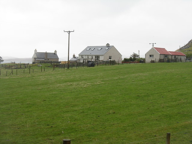
Ós Shiadair Bay is a picturesque coastal area located in the county of Ross-shire, Scotland. Situated on the eastern shore of the Scottish Highlands, this bay spans a stretch of approximately 2 kilometers along the North Sea. The bay is known for its stunning natural beauty, with rugged cliffs, sandy beaches, and crystal-clear waters.

The bay is surrounded by rolling hills and green pastures, providing a tranquil and idyllic setting for visitors. It offers breathtaking panoramic views of the coastline and the distant mountains, making it a popular spot for nature enthusiasts and photographers.

The bay is home to a diverse range of wildlife, including various seabirds, seals, and occasionally dolphins and whales. Birdwatchers can spot species such as puffins, guillemots, and gannets nesting on the cliffs.

The area is also rich in history, with several ancient landmarks nearby. The ruins of an Iron Age broch, an ancient circular stone tower, can be found on the cliffs overlooking the bay. This historical site offers a glimpse into the region's past and attracts history enthusiasts and archaeology lovers.

Ós Shiadair Bay is a peaceful retreat away from the bustling city life, offering visitors a chance to relax, explore, and immerse themselves in the beauty of the Scottish Highlands. With its stunning landscapes, abundant wildlife, and rich history, this bay is a true gem of Ross-shire.

If you have any feedback on the listing, please let us know in the comments section below.

Òs Shiadair Images

Images are sourced within 2km of 58.248089/-6.8004109 or Grid Reference NB1838. Thanks to Geograph Open Source API. All images are credited.

Dun in Loch an Dùnain Relatively well preserved dun close to the main road <span class="nowrap"><a title="https://canmore.org.uk/site/4092/lewis-loch-an-duin" rel="nofollow ugc noopener" href="https://canmore.org.uk/site/4092/lewis-loch-an-duin">Link</a><img style="margin-left:2px;" alt="External link" title="External link - shift click to open in new window" src="https://s1.geograph.org.uk/img/external.png" width="10" height="10"/></span>
Dun in Loch an Dùnain
Relatively well preserved dun close to the main road LinkExternal link
Doune Braes Hotel
Doune Braes Hotel
Loch an Dùnain
Loch an Dùnain
Isle of Lewis, Loch an Dùnain
View towards Tolsta Chaolais
West Point
West Point
The Road to Tolsta Chaolais
Port a' Chaoil Stream flowing from Loch a' Bhaile enters Loch Rog an Ear, a sea loch, at Aird na Moine.
Port a' Chaoil
Stream flowing from Loch a' Bhaile enters Loch Rog an Ear, a sea loch, at Aird na Moine.
Loch a' Bhaile The narrow loch, hemmed in by steep hillsides, flows out into Loch Rog an Ear, a sea loch, via a short river.
Loch a' Bhaile
The narrow loch, hemmed in by steep hillsides, flows out into Loch Rog an Ear, a sea loch, via a short river.
Loch a' Bhaile Loch a' Bhaile & Tolastadh a' Chaolais beyond.
Loch a' Bhaile
Loch a' Bhaile & Tolastadh a' Chaolais beyond.
Tolstachaolais: the post office While many post offices have a buzzer which sounds as the door opens, the postmistress here is alerted to the arrival of customers by the loud bark of the dog tethered to the outside wall.
Tolstachaolais: the post office
While many post offices have a buzzer which sounds as the door opens, the postmistress here is alerted to the arrival of customers by the loud bark of the dog tethered to the outside wall.
Tolstachaolais: along the shore of Loch a' Bhaile Looking across the loch, which runs alongside the road through the village. However, this is the far side that we are looking along.
Tolstachaolais: along the shore of Loch a' Bhaile
Looking across the loch, which runs alongside the road through the village. However, this is the far side that we are looking along.
Tolstachaolais: postbox № HS2 62 This postbox stands more or less in the centre of the village, in front of a house that is set particularly well back from the road. The larger-scale map still marks that house as a post office, although it has actually (as reflected in the 1:50,000 and 1:25,000 map) relocated just over a kilometre to the north - see <a href="https://www.geograph.org.uk/photo/3086624">NB1939 : Tolstachaolais: the post office</a>.
Tolstachaolais: postbox № HS2 62
This postbox stands more or less in the centre of the village, in front of a house that is set particularly well back from the road. The larger-scale map still marks that house as a post office, although it has actually (as reflected in the 1:50,000 and 1:25,000 map) relocated just over a kilometre to the north - see NB1939 : Tolstachaolais: the post office.
Tolstachaolais: Loch a’ Bhaile Looking down this loch from its northern end, with the main part of the village visible far right.
Tolstachaolais: Loch a’ Bhaile
Looking down this loch from its northern end, with the main part of the village visible far right.
Tolstachaolais: hillside cows and Bernera view Looking across the sound separating the eastern side of Bernera from the Lewis mainland, beyond three cows grazing on the slopes to the south of Tolstachaolais village.
Tolstachaolais: hillside cows and Bernera view
Looking across the sound separating the eastern side of Bernera from the Lewis mainland, beyond three cows grazing on the slopes to the south of Tolstachaolais village.
Outlet from Loch a' Bhaile into Port a' Chaoil At the crofting community of Tolastadh a' Chaolais.
Outlet from Loch a' Bhaile into Port a' Chaoil
At the crofting community of Tolastadh a' Chaolais.
Loch a' Bhaile In the crofting community of Tolastadh a' Chaolais.
Loch a' Bhaile
In the crofting community of Tolastadh a' Chaolais.
Cnoc Feoal Part of the crofting community of Tolastadh a' Chaolais on the shores of Loch Ròg an Ear.
Cnoc Feoal
Part of the crofting community of Tolastadh a' Chaolais on the shores of Loch Ròg an Ear.
Show me another place!

Òs Shiadair is located at Grid Ref: NB1838 (Lat: 58.248089, Lng: -6.8004109)

Unitary Authority: Na h-Eileanan an Iar

Police Authority: Highlands and Islands

What 3 Words

///sculpture.mysteries.obviously. Near Carloway, Na h-Eileanan Siar

Related Wikis

Tolsta Chaolais

Tolsta Chaolais (also Tolastadh Chaolais, Tolstadh a' Chaolais) is a village on the Isle of Lewis, Scotland. It consists of about forty houses, clustered...

Dun Carloway

Dun Carloway (Scottish Gaelic: Dùn Chàrlabhaigh) is a broch situated in the district of Carloway, on the west coast of the Isle of Lewis, Scotland (grid...

Breaclete

Breacleit (or Roulanish; Scottish Gaelic: Breacleit; Old Norse: Breiðiklettr) is the central village on Great Bernera in the Outer Hebrides, Scotland....

Great Bernera

Great Bernera (; Scottish Gaelic: Beàrnaraigh Mòr), often known just as Bernera (Scottish Gaelic: Beàrnaraigh), is an island and community in the Outer...

Nearby Amenities

Located within 500m of 58.248089,-6.8004109
Creag Ruadh
Place: locality
Lat/Long: 58.2505442/-6.7942492
Cnocan Òis
Place: locality
Lat/Long: 58.2487488/-6.8010298
Sgeir a' Chàrrain
Place: locality
Lat/Long: 58.2492344/-6.8021027
Creag Àrd
Place: locality
Lat/Long: 58.2499119/-6.7998067
Rubha Geodha na Cloinne
Natural: cape
Lat/Long: 58.2505893/-6.8035189
Cnoc a' Charnain
Place: locality
Lat/Long: 58.2516055/-6.8008367
Druim Teanraigir
Place: locality
Lat/Long: 58.2514249/-6.798369
Loch Shiadair
Natural: bay
Lat/Long: 58.2491102/-6.7948714
Òs Shiadair
Natural: bay
Lat/Long: 58.2474616/-6.80118
Rubha Fianuis
Natural: cape
Lat/Long: 58.2455418/-6.8005792
Cnoc na Buaile Mòra
Place: locality
Lat/Long: 58.2449546/-6.7959014
Mol Mòr
Place: locality
Lat/Long: 58.2456774/-6.7976609
The data included in this document is from www.openstreetmap.org. The data is made available under ODbL.

Have you been to Òs Shiadair?

Leave your review of Òs Shiadair below (or comments, questions and feedback).