Ob Liath

Bay in Inverness-shire

Scotland

Ob Liath

View south over Leac a' Li Looking from a window of a house in Leac a' Li. 
A few sheep graze the poor vegetation between the exposed bedrock. 
The water is Loch Stocanais.
View south over Leac a' Li Credit: Richard Dorrell

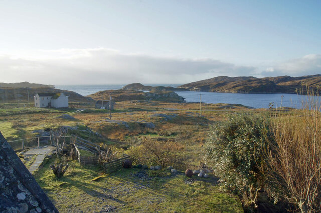
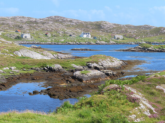
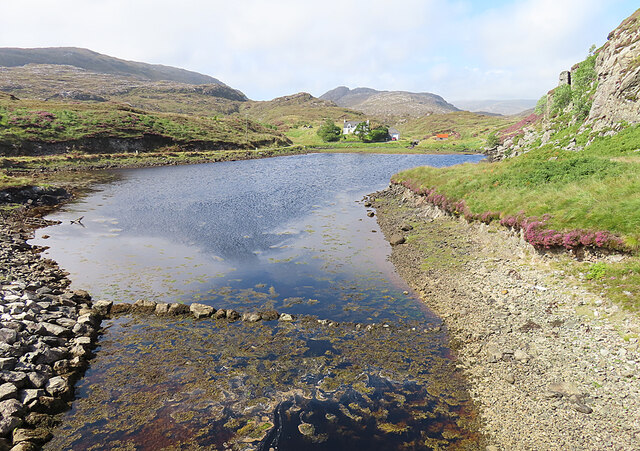
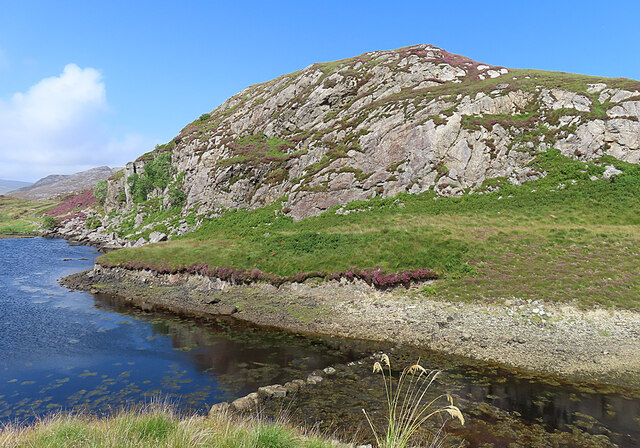
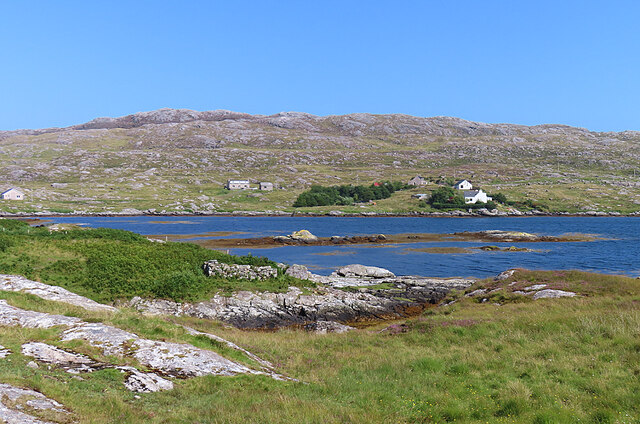
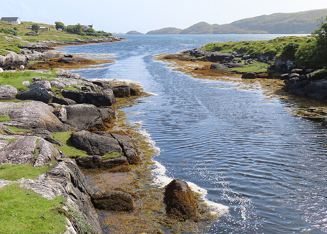
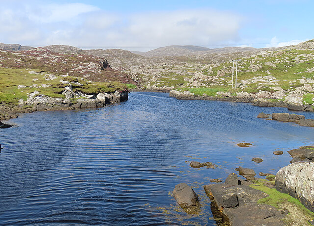
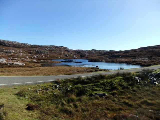
Ob Liath, also known as Bay of Liath, is a picturesque coastal area located in Inverness-shire, Scotland. Situated along the eastern shores of Loch Ness, it offers stunning views of the famous loch and the surrounding mountainous landscape. The name "Liath" refers to the grayish hue of the rocks found in the area.

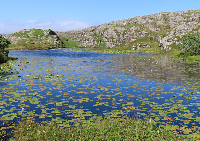
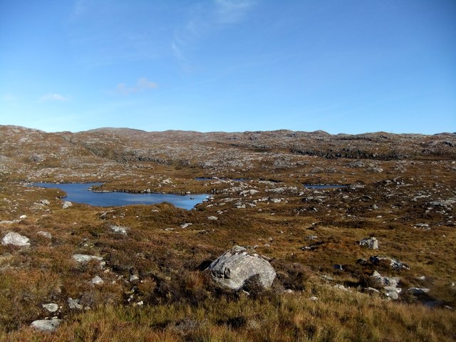
The bay itself is a natural inlet that stretches for approximately 2 miles, providing a sheltered spot for boats and a haven for wildlife enthusiasts. The calm waters of the bay are ideal for various water activities, such as kayaking, fishing, and sailing. It is not uncommon to spot seals or otters playing in the water or resting on the rocky shores.

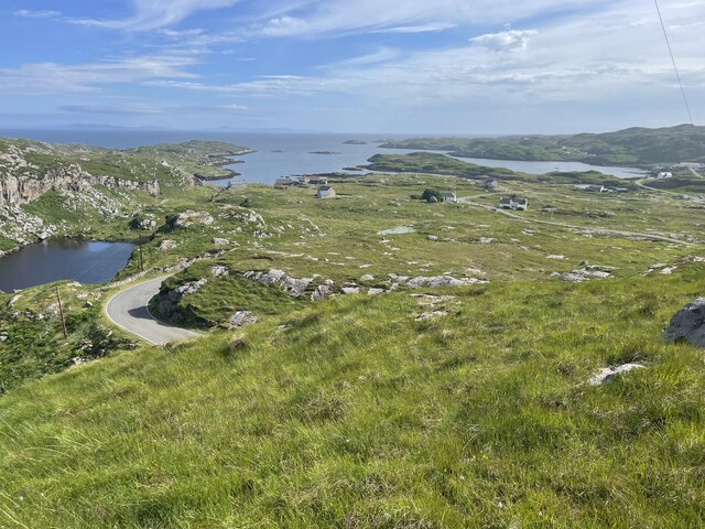
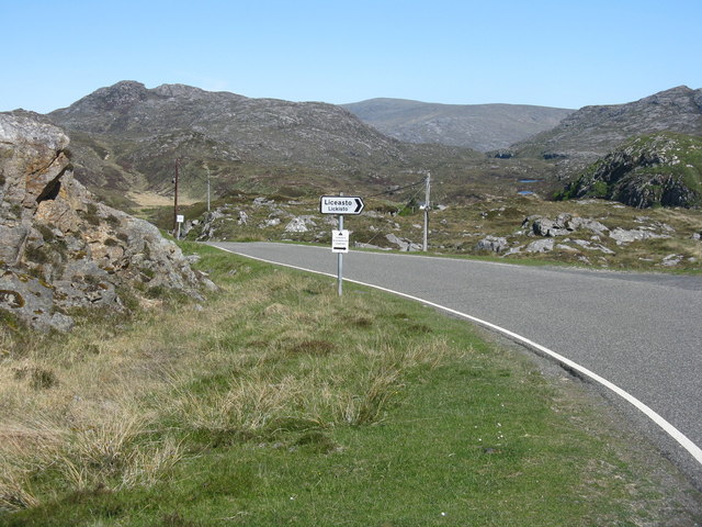
The rugged beauty of Ob Liath attracts many nature lovers and hikers, as it is surrounded by an abundance of walking trails and paths. One of the most popular routes is the Great Glen Way, which passes through the bay, offering breathtaking views of Loch Ness and its surrounding hills.

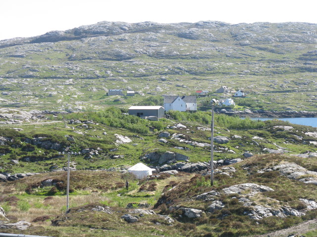
Although relatively secluded, Ob Liath is not far from the town of Inverness, which is only a short drive away. Inverness provides a range of amenities, including shops, restaurants, and accommodations, making it a convenient base for exploring the bay and its surroundings.

Overall, Ob Liath in Inverness-shire is a hidden gem, offering a tranquil and scenic setting for outdoor enthusiasts, wildlife lovers, and those seeking a peaceful getaway.

If you have any feedback on the listing, please let us know in the comments section below.
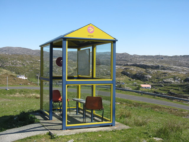
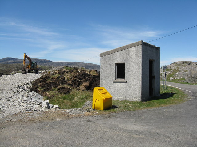
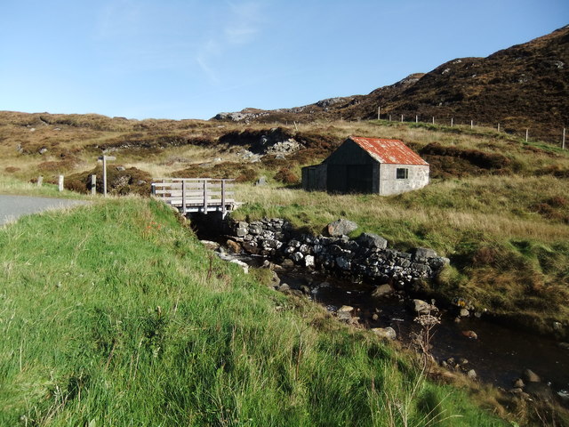
Ob Liath Images

Images are sourced within 2km of 57.829894/-6.8447036 or Grid Reference NG1292. Thanks to Geograph Open Source API. All images are credited.

View south over Leac a' Li Looking from a window of a house in Leac a' Li. 
A few sheep graze the poor vegetation between the exposed bedrock. 
The water is Loch Stocanais.
View south over Leac a' Li
Looking from a window of a house in Leac a' Li. A few sheep graze the poor vegetation between the exposed bedrock. The water is Loch Stocanais.
Rocky landscape Much of the Harris landscape consists of exposed bedrock. This view is over a minor road from Aird Mhighe towards the main road, the A859.
Rocky landscape
Much of the Harris landscape consists of exposed bedrock. This view is over a minor road from Aird Mhighe towards the main road, the A859.
Landscape of Harris
Landscape of Harris
Geocrab A dispersed settlement around the head of Loch Geocrab.
Geocrab
A dispersed settlement around the head of Loch Geocrab.
Bus Shelter The bus shelter is above the turning to Liceasto. I was pleasantly surprised to find a timetable suggesting that there are six buses a day from Roghadal via here to Tarbert.
Bus Shelter
The bus shelter is above the turning to Liceasto. I was pleasantly surprised to find a timetable suggesting that there are six buses a day from Roghadal via here to Tarbert.
Ceann a' Bhàigh Mhòr The name means 'head of the big bay'; the 'big bay' seems to be Loch Stockinish.
Ceann a' Bhàigh Mhòr
The name means 'head of the big bay'; the 'big bay' seems to be Loch Stockinish.
Ceann a' Bhàigh Mhòr The sea-loch in the foreground is the 'head of the big bay' but the rock face appears not to have a name of its own.
Ceann a' Bhàigh Mhòr
The sea-loch in the foreground is the 'head of the big bay' but the rock face appears not to have a name of its own.
Leac a' Li across Ob Liath Leac a' Li or Lackalee is on the shore of Loch Stockinish, and the head of the loch is Ob Liath, the 'grey bay'.
Leac a' Li across Ob Liath
Leac a' Li or Lackalee is on the shore of Loch Stockinish, and the head of the loch is Ob Liath, the 'grey bay'.
Unnamed Inlet The map suggests that this inlet dries at low tide. It opens into Ob Liath, and then into Loch Stocanais.
Unnamed Inlet
The map suggests that this inlet dries at low tide. It opens into Ob Liath, and then into Loch Stocanais.
Landlocked Inlet This inlet of the sea near Àird Mhìghe is almost completely landlocked.
Landlocked Inlet
This inlet of the sea near Àird Mhìghe is almost completely landlocked.
Loch a' Chaolais This lochan is well covered with the floating leaves of the White Water-lily (Nymphaea alba).
Loch a' Chaolais
This lochan is well covered with the floating leaves of the White Water-lily (Nymphaea alba).
The road to Liceasto/Lickisto One of several turnings off into the rocky landscape of the Golden Road area of Harris.
The road to Liceasto/Lickisto
One of several turnings off into the rocky landscape of the Golden Road area of Harris.
Lickisto and Ãird Mhìghe With a tent of Lickisto Blackhouse Camping in the dip in the foreground.
Lickisto and Ãird Mhìghe
With a tent of Lickisto Blackhouse Camping in the dip in the foreground.
Bus stop at Liceasto/Lickisto With facilities.
Bus stop at Liceasto/Lickisto
With facilities.
Kyles Road End at Stockinish Opposite the church, a bus stop and some ground preparation in progress.
Kyles Road End at Stockinish
Opposite the church, a bus stop and some ground preparation in progress.
At Ceann a' Bhaigh
At Ceann a' Bhaigh
Loch Glumradh Mor
Loch Glumradh Mor
Loch Airigh Iain Oig
Show me another place!

Ob Liath is located at Grid Ref: NG1292 (Lat: 57.829894, Lng: -6.8447036)

Unitary Authority: Na h-Eileanan an Iar

Police Authority: Highlands and Islands

What 3 Words

///domestic.scooters.scrap. Near Tarbert, Na h-Eileanan Siar

Related Wikis

Stockinish Island

Stockinish Island (Scottish Gaelic: Eilean Stocainis) is an uninhabited island off Harris, in the Outer Hebrides. == Geography and geology == Stockinish...

East Loch Tarbert

East Loch Tarbert (Scottish Gaelic: Loch an Tairbeairt) is a sea loch that lies to the east of Harris in the Outer Hebrides of Scotland. The loch contains...

Sgeotasaigh

Scotasay (Scottish Gaelic: Sgeotasaigh) is small island in the Outer Hebrides of Scotland. It lies 1 kilometre (0.6 miles) off the east coast of Harris...

Harris distillery

Harris distillery is a Scotch whisky and Gin distillery in Tarbert on the Isle of Harris, Scotland. The distillery was the first legal distillery ever...

Borsham

Borsham (Scottish Gaelic: Boirseam) is a village in the 'Bays' area of Harris in the Outer Hebrides, Scotland. Borsham is within the parish of Harris....

Tarbert, Harris

Tarbert (Scottish Gaelic: An Tairbeart [ən̪ˠ ˈt̪ɛrʲɛbərˠʃt̪]) is the main community on Harris in the Western Isles of Scotland. The name means "isthmus...

Luskentyre

Luskentyre (Scottish Gaelic: Losgaintir) is a sparse settlement on the west coast of Harris, in the Outer Hebrides, Scotland. Luskentyre is situated within...

Harris, Outer Hebrides

Harris (Scottish Gaelic: Na Hearadh, pronounced [nə ˈhɛɾəɣ] ) is the southern and more mountainous part of Lewis and Harris, the largest island in the...

Nearby Amenities

Located within 500m of 57.829894,-6.8447036
Created By: dmgroom_coastlines
Lat/Long: 57.8321/-6.84322
Passing Place
Lat/Long: 57.8302929/-6.8517544
Passing Place
Lat/Long: 57.8297344/-6.8503185
Passing Place
Lat/Long: 57.8302204/-6.8495112
Passing Place
Lat/Long: 57.8319087/-6.8457033
Passing Place
Lat/Long: 57.8330012/-6.8447988
Passing Place
Lat/Long: 57.8337146/-6.8425173
Passing Place
Lat/Long: 57.8328686/-6.8458867
Ardvey
Naptan AtcoCode: 6010731515
Naptan Bearing: NE
Naptan BusStopType: CUS
Naptan CommonName: Ardvey
Naptan Indicator: Stockinish Junction
Naptan Landmark: main road junction
Naptan NaptanCode: 94723645
Naptan Street: Stockinish Junction
Naptan Verified: no
Source: naptan_import
Lat/Long: 57.8334835/-6.843191
Bus Stop
Lackalee
Naptan AtcoCode: 6010731708
Naptan Bearing: N
Naptan CommonName: Lackalee
Naptan Indicator: Village
Naptan Landmark: Village
Naptan NaptanCode: 94723642
Naptan Street: Village
Naptan Verified: no
Source: naptan_import
Lat/Long: 57.8285123/-6.8383947
Restaurant
The Bays Centre
Lat/Long: 57.8324631/-6.8422583
Post Box
Lat/Long: 57.8302361/-6.8494552
Passing Place
Lat/Long: 57.8329386/-6.8424671
Ob Liceasto
Natural: bay
Source: OS_OpenData_StreetView
Lat/Long: 57.8295418/-6.8522962
Generator Method: wind_turbine
Generator Output Electricity: small_installation
Generator Source: wind
Generator Type: horizontal_axis
Power: generator
Source: visual survey;estimate
Lat/Long: 57.8310702/-6.8501282
Recycling
Recycling Cans: yes
Recycling Glass: yes
Recycling Plastic Bottles: yes
Source: survey
Lat/Long: 57.8335045/-6.8430317
Àird Mhìghe
Name En: Ardvey
Name Gd: Àird Mhìghe
Place: hamlet
Source: visual survey;OS_OpenData_StreetView
Lat/Long: 57.8321488/-6.8473178
Ob Liath
Natural: bay
Source: OS_OpenData_StreetView
Lat/Long: 57.8309661/-6.8447074
Passing Place
Lat/Long: 57.8278964/-6.837564
Power: pole
Lat/Long: 57.8342357/-6.8434645
Power: pole
Lat/Long: 57.8333256/-6.8464056
Power: pole
Lat/Long: 57.8336655/-6.8452547
Power: pole
Lat/Long: 57.8324933/-6.8491347
Power: pole
Lat/Long: 57.8324187/-6.8497522
Power: pole
Lat/Long: 57.8322829/-6.8510543
Power: pole
Lat/Long: 57.8330821/-6.8472338
Barrier: cattle_grid
Lat/Long: 57.8296717/-6.84993
Passing Place
Lat/Long: 57.8311922/-6.8485142
Barrier: cattle_grid
Lat/Long: 57.8338036/-6.8428621
Access: private
Entrance: yes
Lat/Long: 57.8316347/-6.8401309
Passing Place
Lat/Long: 57.8296088/-6.8397265
Passing Place
Lat/Long: 57.8318358/-6.841479
Passing Place
Lat/Long: 57.8315717/-6.8473904
Generator Method: photovoltaic
Generator Output Electricity: small_installation
Generator Source: solar
Generator Type: solar_photovoltaic_panel
Power: generator
Lat/Long: 57.8275031/-6.8380334
Generator Method: photovoltaic
Generator Output Electricity: small_installation
Generator Source: solar
Generator Type: solar_photovoltaic_panel
Power: generator
Lat/Long: 57.8273377/-6.8382819
Material: wood
Power: pole
Lat/Long: 57.8285846/-6.8385844
Material: wood
Power: pole
Lat/Long: 57.828714/-6.8388031
Material: wood
Power: pole
Lat/Long: 57.8286421/-6.8381711
Material: wood
Power: pole
Lat/Long: 57.8297465/-6.8394811
Material: wood
Power: pole
Lat/Long: 57.8287543/-6.8392326
Material: wood
Power: pole
Lat/Long: 57.8292044/-6.8388247
Material: wood
Power: pole
Lat/Long: 57.830375/-6.8398457
Material: wood
Power: pole
Lat/Long: 57.8309366/-6.840178
Material: wood
Power: pole
Lat/Long: 57.8304296/-6.8408207
Material: wood
Power: pole
Lat/Long: 57.8314183/-6.8401132
Material: wood
Power: pole
Lat/Long: 57.8316217/-6.8405884
Material: wood
Power: pole
Lat/Long: 57.8323162/-6.8409881
Material: wood
Power: pole
Lat/Long: 57.8323062/-6.8415364
Material: wood
Power: pole
Lat/Long: 57.8336607/-6.8417849
Material: wood
Power: pole
Lat/Long: 57.8330381/-6.8414311
Material: wood
Power: pole
Lat/Long: 57.8276002/-6.851937
Material: wood
Power: pole
Lat/Long: 57.8271189/-6.851237
Noexit: yes
Lat/Long: 57.8315624/-6.8471422
Natural: rock
Lat/Long: 57.8279484/-6.8378065
Tourism: picnic_site
Lat/Long: 57.8325294/-6.8426256
Power: pole
Lat/Long: 57.8323074/-6.8425263
Power: pole
Lat/Long: 57.8328486/-6.8449241
Power: pole
Lat/Long: 57.8325052/-6.8434945
Power: pole
Lat/Long: 57.8328159/-6.847959
Power: pole
Lat/Long: 57.833434/-6.8449532
Power: pole
Lat/Long: 57.8331649/-6.8449612
Power: pole
Lat/Long: 57.8309714/-6.8523628
Power: pole
Lat/Long: 57.8310571/-6.8518236
Power: pole
Lat/Long: 57.8313027/-6.8509144
Power: pole
Lat/Long: 57.8318693/-6.8487683
Power: pole
Lat/Long: 57.8330506/-6.8467006
Power: pole
Lat/Long: 57.8332491/-6.8459576
Power: pole
Lat/Long: 57.833529/-6.8449491
Power: pole
Lat/Long: 57.8340259/-6.8431386
Power: pole
Lat/Long: 57.8307247/-6.8523395
Power: pole
Lat/Long: 57.8315064/-6.8501076
Power: pole
Lat/Long: 57.8325955/-6.8474972
Power: pole
Lat/Long: 57.830734/-6.8404304
Power: pole
Lat/Long: 57.8340297/-6.8441228
The data included in this document is from www.openstreetmap.org. The data is made available under ODbL.

Have you been to Ob Liath?

Leave your review of Ob Liath below (or comments, questions and feedback).