Camas Chleiter
Bay in Inverness-shire
Scotland
Camas Chleiter
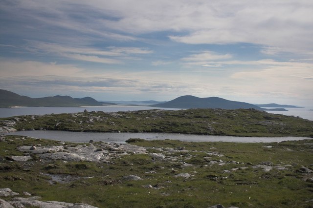
Camas Chleiter is a picturesque bay located in Inverness-shire, Scotland. Situated on the western coast of Scotland, this bay offers stunning views of the surrounding landscape and is a popular destination for nature enthusiasts and photographers.
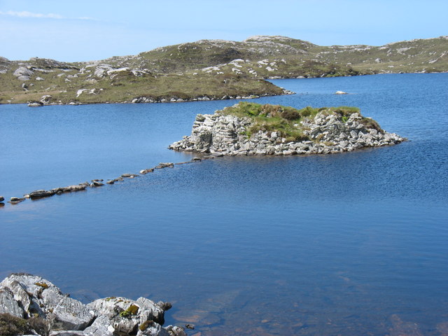
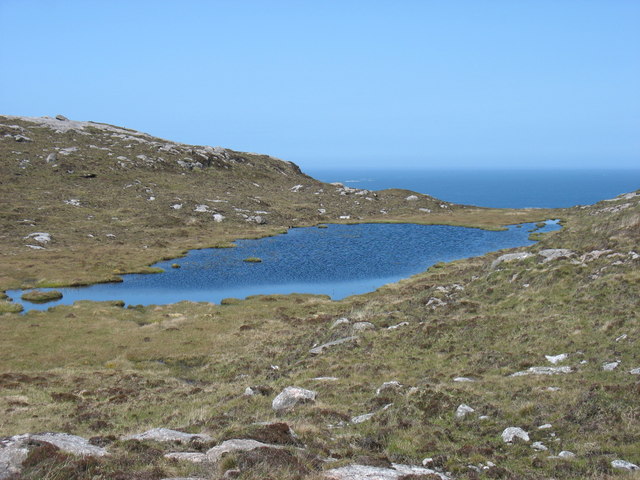
The bay is known for its pristine and unspoiled beauty, with its crystal clear waters and golden sandy beach. It is surrounded by rugged cliffs and rolling hills, providing a dramatic backdrop to the bay. The area is rich in flora and fauna, with a variety of bird species and marine life often spotted in the bay.
Camas Chleiter is a haven for outdoor activities such as hiking, birdwatching, and beachcombing. The bay is also a great spot for picnics and relaxation, allowing visitors to soak in the tranquility and serenity of the surroundings.
In addition to its natural beauty, Camas Chleiter is also steeped in history. There are several archaeological sites in the area, including ancient burial sites and ruins of old settlements, offering a glimpse into the past.
Visitors to Camas Chleiter can enjoy the peace and solitude that this remote bay offers, while also taking advantage of the nearby amenities and accommodation options in Inverness-shire. Whether it's a leisurely stroll along the beach or an adventurous hike in the surrounding hills, Camas Chleiter offers a memorable experience for nature lovers and history enthusiasts alike.
If you have any feedback on the listing, please let us know in the comments section below.
Camas Chleiter Images
Images are sourced within 2km of 57.914668/-7.0345674 or Grid Reference NB0102. Thanks to Geograph Open Source API. All images are credited.
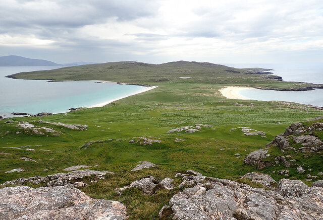
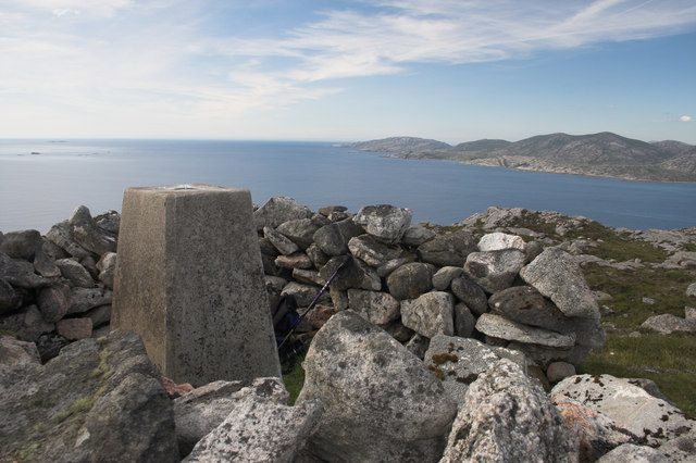
![Ben Raah [Beinn RÃ ] Pabbay, Scarp and Taransay with Sea Harris. Landed to the south and climbed the Marilyn with Martin Richardson, Jim Bloomer, Alex Cameron and Jonathan Whitehead on a lovely afternoon.
Name: Ben Raah [Beinn Rà]
Hill number: 1606
Height: 267m / 876ft
Area: 24B: Harris and Nearby Islands
Class: Ma,2
Grid ref: NB 03438 01900
Summit feature: small pile of stones 35m E of trig point
Drop: 267m
Col: Sea](https://s3.geograph.org.uk/geophotos/03/68/48/3684811_56ded9c9.jpg)
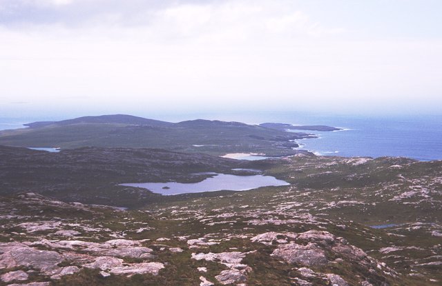
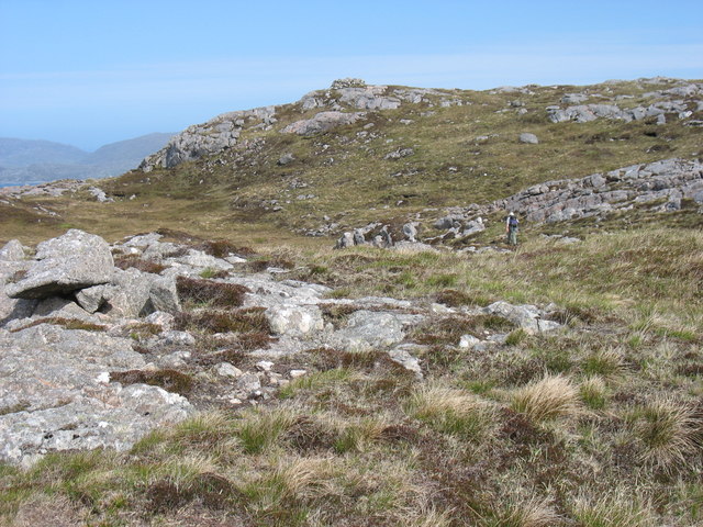
![View Towards A Distant Ceapabhal A view towards a distance Ceapabhal on South Harris from the lower slopes of Ben Raah [Beinn Rà]. Loch an Dùin and Loch Sionadail are seen on Taransay.](https://s1.geograph.org.uk/geophotos/03/68/54/3685497_3605f17b.jpg)
Camas Chleiter is located at Grid Ref: NB0102 (Lat: 57.914668, Lng: -7.0345674)
Unitary Authority: Na h-Eileanan an Iar
Police Authority: Highlands and Islands
What 3 Words
///launched.encrusted.employer. Near Tarbert, Na h-Eileanan Siar
Nearby Locations
Related Wikis

Taransay
Taransay (Scottish Gaelic: Tarasaigh, pronounced [ˈt̪ʰaɾas̪aj]) is an island in the Outer Hebrides of Scotland. It was the host of the British television...

Soay Beag
Soay Beag (Scottish Gaelic: Sòdhaigh Beag) is a small, uninhabited tidal island in West Loch Tarbert, between the northern and southern parts of Harris...

Soay Mòr
Soay Mòr (Scottish Gaelic: Sòdhaigh Mòr) is an island in West Loch Tarbert, between the northern and southern parts of Harris. The uninhabited island is...

Soay Sound
Soay Sound (Scottish Gaelic: Caolas Shòdhaigh) is a strait separating the islands of Soay Mòr and Soay Beag from the northern part of Harris. The sound...
Nearby Amenities
Located within 500m of 57.914668,-7.0345674Have you been to Camas Chleiter?
Leave your review of Camas Chleiter below (or comments, questions and feedback).