Loch Sigean

Bay in Inverness-shire

Scotland

Loch Sigean

Glas Eilean Mòr From the ferry into Lochmaddy.
Glas Eilean Mòr Credit: Hugh Venables

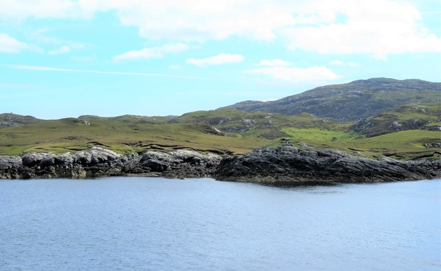
Loch Sigean, also known as Sigean Bay, is a picturesque body of water located in the county of Inverness-shire, Scotland. Situated on the western coast of the Scottish Highlands, it is one of the many stunning lochs that dot the landscape of this region.

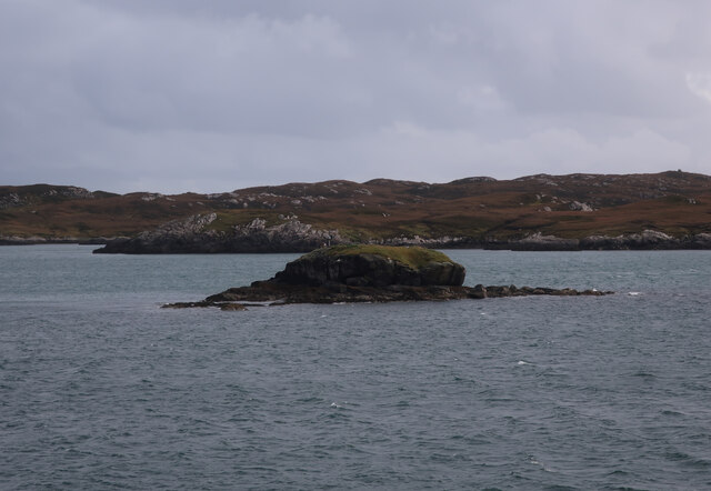
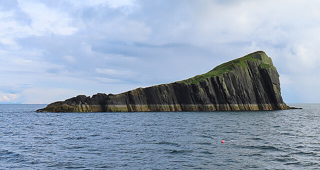
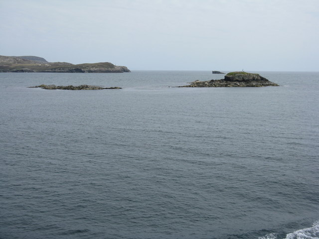
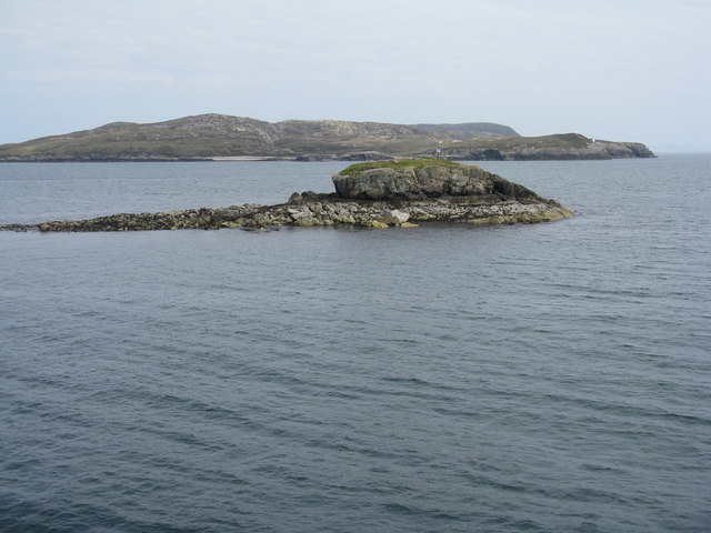
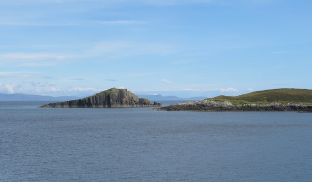
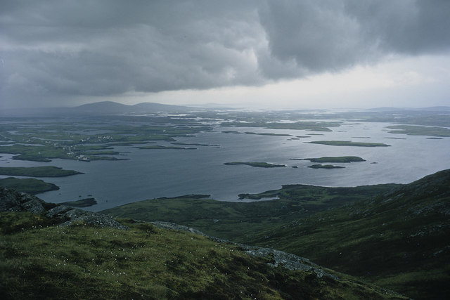
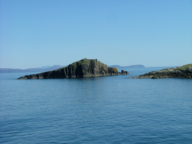
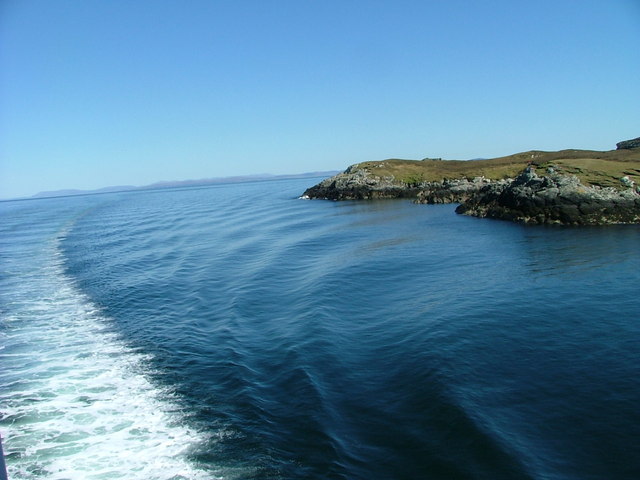
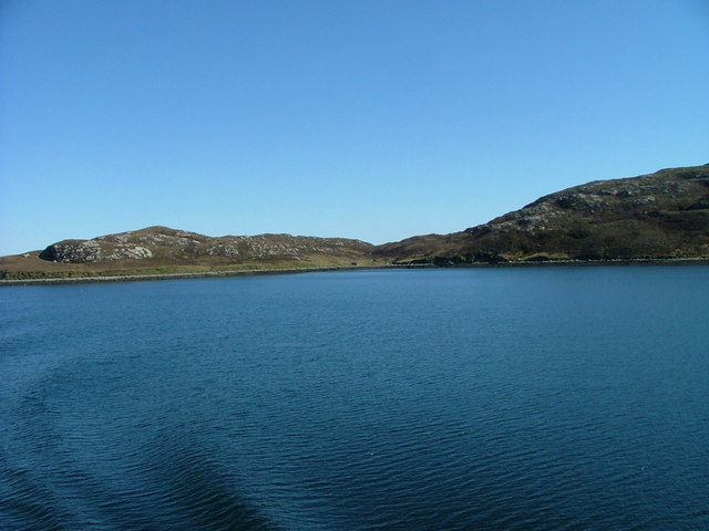
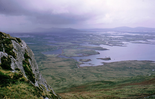
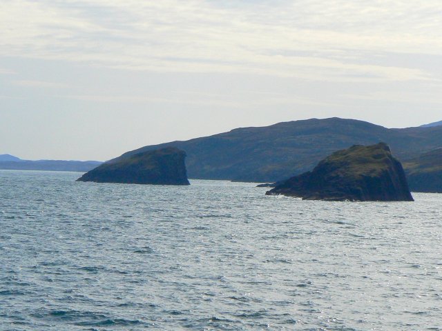
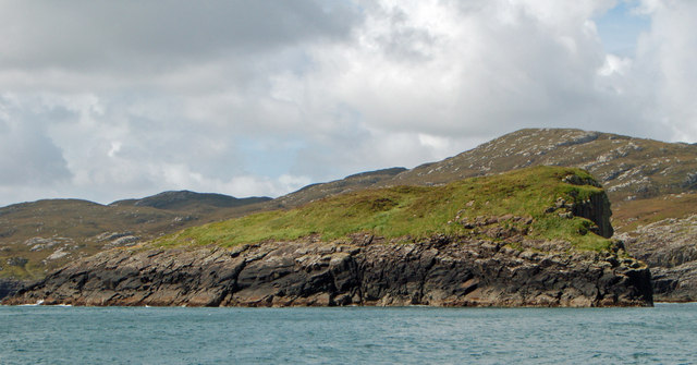
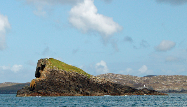
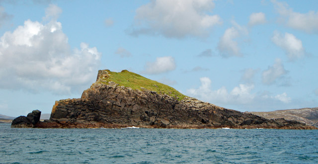
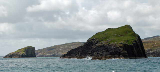
Loch Sigean stretches approximately 3.5 miles in length and spans an area of around 2 square miles. Its shape is reminiscent of a crescent moon, with its northern end being wider and gradually narrowing towards the south. The bay is surrounded by rugged hills and lush greenery, creating a tranquil and scenic atmosphere.

The waters of Loch Sigean are known for their clarity and deep blue color, which is a result of the loch's depth that reaches up to 100 feet in some areas. The bay is home to a diverse array of wildlife, including various species of fish, birds, and marine mammals. It is not uncommon to spot seals basking on the rocks or dolphins gracefully swimming through the bay's waters.

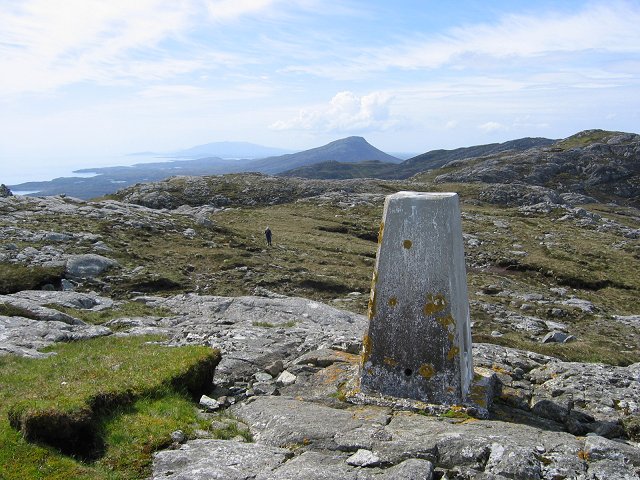
The surrounding area of Loch Sigean offers numerous recreational opportunities for visitors. It is a popular destination for fishing enthusiasts, with brown trout being the most commonly caught fish in the loch. The bay also provides a stunning backdrop for water sports like kayaking and sailing. Additionally, the nearby hills and trails attract hikers and nature lovers, offering breathtaking views of the bay and its surroundings.

Overall, Loch Sigean is a captivating and idyllic location that showcases the natural beauty of Inverness-shire. Its tranquil waters, diverse wildlife, and stunning scenery make it a must-visit destination for those seeking a peaceful escape in the Scottish Highlands.

If you have any feedback on the listing, please let us know in the comments section below.

Loch Sigean Images

Images are sourced within 2km of 57.582972/-7.1085428 or Grid Reference NF9466. Thanks to Geograph Open Source API. All images are credited.

Glas Eilean Mòr From the ferry into Lochmaddy.
Glas Eilean Mòr
From the ferry into Lochmaddy.
Madadh Mòr Madadh Mòr means 'big dog (or wolf)' and the name is applied to this rock just outside Loch nam Madadh (Loch Maddy), whose name means 'loch of the dogs'. Its counterpart Madadh Beag, the 'small dog', is on the north of the loch. Clearly different from the prevailing Lewisian gneiss, it is in fact part of the Little Minch Sill complex. It is igneous in origin, formed between 23 and 66 million years ago and quite young by comparison with the 3000-million-year-old gneiss!
Madadh Mòr
Madadh Mòr means 'big dog (or wolf)' and the name is applied to this rock just outside Loch nam Madadh (Loch Maddy), whose name means 'loch of the dogs'. Its counterpart Madadh Beag, the 'small dog', is on the north of the loch. Clearly different from the prevailing Lewisian gneiss, it is in fact part of the Little Minch Sill complex. It is igneous in origin, formed between 23 and 66 million years ago and quite young by comparison with the 3000-million-year-old gneiss!
Glas Eilean Mòr Looking northeast from the Lochmaddy-Uig ferry. The lighthouse on Rubha an Fhigheadair is just visible on the headland beyond.
Glas Eilean Mòr
Looking northeast from the Lochmaddy-Uig ferry. The lighthouse on Rubha an Fhigheadair is just visible on the headland beyond.
Glas Eilean Mòr Looking northeast from the Lochmaddy-Uig ferry. Beyond is the headland of Rubha an Fhigheadair
Glas Eilean Mòr
Looking northeast from the Lochmaddy-Uig ferry. Beyond is the headland of Rubha an Fhigheadair
Rubha Mhic ille-mhalaidh Headland seen off the port side of the MV Hebrides as she slows on the approach to Lochmaddy. If a certain on line translation service is correct, this is 'Son in-law's headland'. There's a navigation light on the rocks to the right of centre with solar panels visible.
Rubha Mhic ille-mhalaidh
Headland seen off the port side of the MV Hebrides as she slows on the approach to Lochmaddy. If a certain on line translation service is correct, this is 'Son in-law's headland'. There's a navigation light on the rocks to the right of centre with solar panels visible.
Madadh Mor from the ferry The sea stack of Madadh Mor from the MV Hebrides as she steams towards Lochmaddy. I'm sure the captain was kind enough to edge into this square to enable a 'geograph' to be taken.
Madadh Mor from the ferry
The sea stack of Madadh Mor from the MV Hebrides as she steams towards Lochmaddy. I'm sure the captain was kind enough to edge into this square to enable a 'geograph' to be taken.
Hebridean line squall, North Lee, Lochmaddy The hill was being climbed instead of sailing the coast of North Uist in a full westerly gale.
Hebridean line squall, North Lee, Lochmaddy
The hill was being climbed instead of sailing the coast of North Uist in a full westerly gale.
North Lee trig. This is the lower north summit of Li a'Tuath/North Lee. A very good view point for Loch nam Madadh. The higher southern summit can be seen along with Eabhal, the highest hill on North Uist.
North Lee trig.
This is the lower north summit of Li a'Tuath/North Lee. A very good view point for Loch nam Madadh. The higher southern summit can be seen along with Eabhal, the highest hill on North Uist.
Madadh Mór Off Aird nam Madadh.
Madadh Mór
Off Aird nam Madadh.
Rubha nam Plèac On Aird nam Madadh.
Rubha nam Plèac
On Aird nam Madadh.
Bágh Áird nam Madadh Bay on Loch nam Madadh (Loch Maddy). The ruins of an old Croft House can be seen in centre of image.
Bágh Áird nam Madadh
Bay on Loch nam Madadh (Loch Maddy). The ruins of an old Croft House can be seen in centre of image.
Outcrop below a summit of North Lee North Lee was climbed from a yacht at anchor in Bagh Ard nan Madadh while sheltering from a westerly gale.
Outcrop below a summit of North Lee
North Lee was climbed from a yacht at anchor in Bagh Ard nan Madadh while sheltering from a westerly gale.
Madadh Mor A jagged rock, with the similar Madadh Gruamach just a little farther away.
Madadh Mor
A jagged rock, with the similar Madadh Gruamach just a little farther away.
Glas Eilean Mòr Despite its name, a very small island at the entrance to Loch nam Madadh. It carries a solar powered navigation beacon.
Glas Eilean Mòr
Despite its name, a very small island at the entrance to Loch nam Madadh. It carries a solar powered navigation beacon.
Madadh Gruamach, North Uist
Madadh Mòr, North Uist
Madadh Mòr, North Uist Madadh Gruamach lies in the background to the left
Madadh Mòr, North Uist
Madadh Gruamach lies in the background to the left
Show me another place!

Loch Sigean is located at Grid Ref: NF9466 (Lat: 57.582972, Lng: -7.1085428)

Unitary Authority: Na h-Eileanan an Iar

Police Authority: Highlands and Islands

What 3 Words

///cascade.photocopy.cold. Near Lochmaddy, Na h-Eileanan Siar

Nearby Locations

Partachal Loch Sigean

Related Wikis

Weavers Point

Weavers Point (Scottish Gaelic: Rubha an Fhigheadair) is a headland to the north of the entrance to Loch Maddy, on the north eastern coastline of North...

Taigh Chearsabhagh

Taigh Chearsabhagh is an arts centre and museum in Lochmaddy on the island of North Uist, Scotland.Taigh Chearsabhagh was built in 1741 and originally...

Lochmaddy

Lochmaddy (Scottish Gaelic: Loch nam Madadh [l̪ˠɔx nə ˈmat̪əɣ], "Loch of the Hounds") is the administrative centre of North Uist in the Outer Hebrides...

Ceallasaigh Beag

Ceallasaigh Beag (or Keallasay Beg) is a low-lying island in Loch Maddy off North Uist in the Outer Hebrides of Scotland. This an area of shallow lagoons...

Have you been to Loch Sigean?

Leave your review of Loch Sigean below (or comments, questions and feedback).