Pentle Bay

Bay in Cornwall

England

Pentle Bay

Cottages on Tresco With the backdrop of Vane Hill.
Cottages on Tresco Credit: Derek Harper

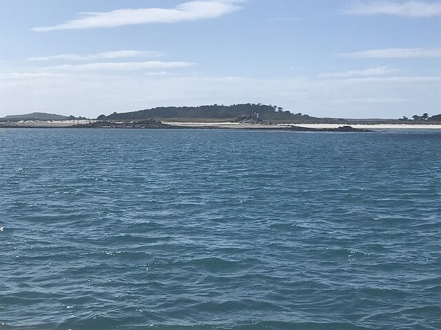
Pentle Bay is a picturesque bay located on the island of Tresco in the Isles of Scilly, Cornwall, England. This bay is renowned for its stunning natural beauty, pristine white sandy beaches, and clear turquoise waters. It is often considered one of the most beautiful and unspoiled beaches in Cornwall.

Surrounded by lush greenery and with breathtaking views of the Atlantic Ocean, Pentle Bay offers visitors a tranquil and idyllic retreat. The beach stretches for approximately one kilometer and is perfect for long walks, sunbathing, and picnicking. Its soft sand is ideal for building sandcastles or simply relaxing under the warm Cornish sun.

The bay is also a popular spot for water activities such as swimming, snorkeling, and paddleboarding due to its calm and crystal-clear waters. It offers a safe and family-friendly environment for children to enjoy the sea.

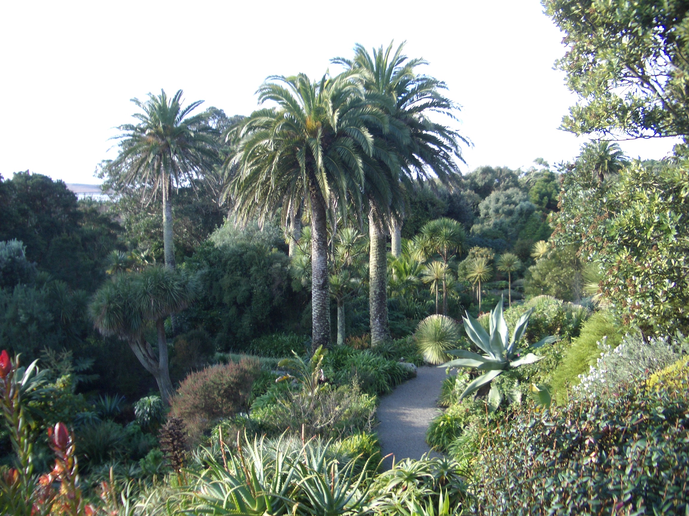
Pentle Bay is part of the Tresco Abbey Garden, a world-renowned subtropical paradise with an impressive collection of exotic plants and flowers. Visitors can explore the garden's stunning landscapes and unique flora, adding to the overall charm of the bay.

Access to Pentle Bay is possible via a short walk from the island's main settlement, New Grimsby. It is recommended to check the tide times before visiting as the beach is submerged during high tide. Visitors can also enjoy the nearby amenities such as cafes, restaurants, and shops in New Grimsby.

Overall, Pentle Bay offers a serene and picturesque coastal experience, making it a must-visit destination for nature lovers and beach enthusiasts in Cornwall.

If you have any feedback on the listing, please let us know in the comments section below.
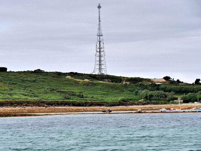
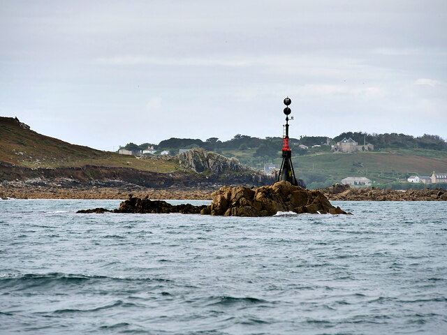
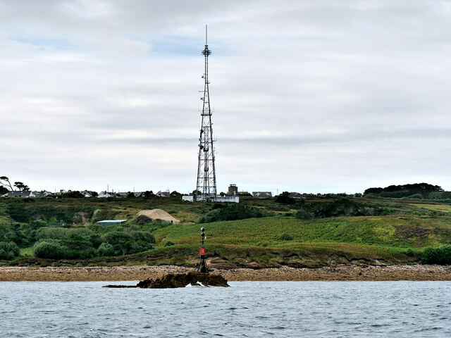
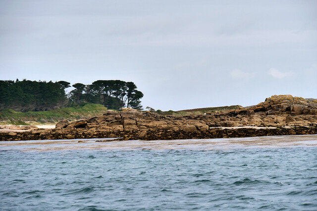
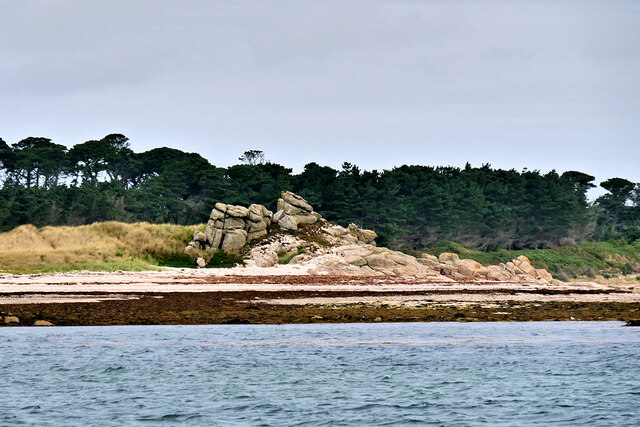
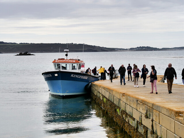
Pentle Bay Images

Images are sourced within 2km of 49.947254/-6.3189686 or Grid Reference SV9014. Thanks to Geograph Open Source API. All images are credited.

Cottages on Tresco With the backdrop of Vane Hill.
Cottages on Tresco
With the backdrop of Vane Hill.
Archway, Tresco Abbey Gardens I think this is the feature described at <span class="nowrap"><a title="https://historicengland.org.uk/listing/the-list/list-entry/1141172?section=official-list-entry" rel="nofollow ugc noopener" href="https://historicengland.org.uk/listing/the-list/list-entry/1141172?section=official-list-entry">Link</a><img style="margin-left:2px;" alt="External link" title="External link - shift click to open in new window" src="https://s1.geograph.org.uk/img/external.png" width="10" height="10"/></span> as: "Chamfered arch of 2 orders to possible former crossing arch", referring to the layout of the old priory. More detail is given at the Scheduled Monument entry: "The south transept crossing has a broad pointed arch also with a stepped and chamfered moulding which uses two types of imported freestone: the vertical sides in a dark stone, the arch in a pale yellow limestone; each side also rests on a base of white limestone" <span class="nowrap"><a title="https://historicengland.org.uk/listing/the-list/list-entry/1016184?section=official-list-entry" rel="nofollow ugc noopener" href="https://historicengland.org.uk/listing/the-list/list-entry/1016184?section=official-list-entry">Link</a><img style="margin-left:2px;" alt="External link" title="External link - shift click to open in new window" src="https://s1.geograph.org.uk/img/external.png" width="10" height="10"/></span> . Many other later photos <a title="https://www.geograph.org.uk/search.php?i=211373132" href="https://www.geograph.org.uk/search.php?i=211373132">Link</a> seem to show far fewer succulents adorning the wall, which is probably wise from a preservation point of view.

The gardens are grade I listed <span class="nowrap"><a title="https://historicengland.org.uk/listing/the-list/list-entry/1000427?section=official-list-entry" rel="nofollow ugc noopener" href="https://historicengland.org.uk/listing/the-list/list-entry/1000427?section=official-list-entry">Link</a><img style="margin-left:2px;" alt="External link" title="External link - shift click to open in new window" src="https://s1.geograph.org.uk/img/external.png" width="10" height="10"/></span> .
Archway, Tresco Abbey Gardens
I think this is the feature described at LinkExternal link as: "Chamfered arch of 2 orders to possible former crossing arch", referring to the layout of the old priory. More detail is given at the Scheduled Monument entry: "The south transept crossing has a broad pointed arch also with a stepped and chamfered moulding which uses two types of imported freestone: the vertical sides in a dark stone, the arch in a pale yellow limestone; each side also rests on a base of white limestone" LinkExternal link . Many other later photos Link seem to show far fewer succulents adorning the wall, which is probably wise from a preservation point of view. The gardens are grade I listed LinkExternal link .
Arches, Tresco Abbey Gardens From the listed building entry: "Chamfered arch of 2 orders to possible former crossing arch and smaller arch to ritual epistle side of nave" <span class="nowrap"><a title="https://historicengland.org.uk/listing/the-list/list-entry/1141172?section=official-list-entry" rel="nofollow ugc noopener" href="https://historicengland.org.uk/listing/the-list/list-entry/1141172?section=official-list-entry">Link</a><img style="margin-left:2px;" alt="External link" title="External link - shift click to open in new window" src="https://s1.geograph.org.uk/img/external.png" width="10" height="10"/></span> . From the Scheduled Monument entry: "The south transept crossing has a broad pointed arch also with a stepped and chamfered moulding which uses two types of imported freestone: the vertical sides in a dark stone, the arch in a pale yellow limestone; each side also rests on a base of white limestone. Close to the west of the south transept crossing is a smaller doorway that originally linked the nave with the cloisters. The doorway has a slightly squatter pointed arch with a similar moulding profile and range of imported freestones as the transept crossings. Its adjacent wall fabric includes a narrow drip mouling of thin slabs over the apex and eastern curve of the doorway's arch moulding" <span class="nowrap"><a title="https://historicengland.org.uk/listing/the-list/list-entry/1016184?section=official-list-entry" rel="nofollow ugc noopener" href="https://historicengland.org.uk/listing/the-list/list-entry/1016184?section=official-list-entry">Link</a><img style="margin-left:2px;" alt="External link" title="External link - shift click to open in new window" src="https://s1.geograph.org.uk/img/external.png" width="10" height="10"/></span> . In addition, the gardens are grade I listed <span class="nowrap"><a title="https://historicengland.org.uk/listing/the-list/list-entry/1000427?section=official-list-entry" rel="nofollow ugc noopener" href="https://historicengland.org.uk/listing/the-list/list-entry/1000427?section=official-list-entry">Link</a><img style="margin-left:2px;" alt="External link" title="External link - shift click to open in new window" src="https://s1.geograph.org.uk/img/external.png" width="10" height="10"/></span> .
Arches, Tresco Abbey Gardens
From the listed building entry: "Chamfered arch of 2 orders to possible former crossing arch and smaller arch to ritual epistle side of nave" LinkExternal link . From the Scheduled Monument entry: "The south transept crossing has a broad pointed arch also with a stepped and chamfered moulding which uses two types of imported freestone: the vertical sides in a dark stone, the arch in a pale yellow limestone; each side also rests on a base of white limestone. Close to the west of the south transept crossing is a smaller doorway that originally linked the nave with the cloisters. The doorway has a slightly squatter pointed arch with a similar moulding profile and range of imported freestones as the transept crossings. Its adjacent wall fabric includes a narrow drip mouling of thin slabs over the apex and eastern curve of the doorway's arch moulding" LinkExternal link . In addition, the gardens are grade I listed LinkExternal link .
Neptune Steps, Tresco Abbey Gardens Taken 21 years before Stephen's almost identical view at <a href="https://www.geograph.org.uk/photo/6156467">SV8914 : The Neptune Steps - Tresco Abbey Garden</a>. "The four flights of steps lead to the Lighthouse Walk and are flanked by specimen palms and other ornamental shrubs" <span class="nowrap"><a title="https://historicengland.org.uk/listing/the-list/list-entry/1000427?section=official-list-entry" rel="nofollow ugc noopener" href="https://historicengland.org.uk/listing/the-list/list-entry/1000427?section=official-list-entry">Link</a><img style="margin-left:2px;" alt="External link" title="External link - shift click to open in new window" src="https://s1.geograph.org.uk/img/external.png" width="10" height="10"/></span> (the gardens are grade I listed).
Neptune Steps, Tresco Abbey Gardens
Taken 21 years before Stephen's almost identical view at SV8914 : The Neptune Steps - Tresco Abbey Garden. "The four flights of steps lead to the Lighthouse Walk and are flanked by specimen palms and other ornamental shrubs" LinkExternal link (the gardens are grade I listed).
Watsonias, Tresco Abbey Gardens A striking array of bugle lilies seen from the Top Terrace. The gardens are grade I listed <span class="nowrap"><a title="https://historicengland.org.uk/listing/the-list/list-entry/1000427?section=official-list-entry" rel="nofollow ugc noopener" href="https://historicengland.org.uk/listing/the-list/list-entry/1000427?section=official-list-entry">Link</a><img style="margin-left:2px;" alt="External link" title="External link - shift click to open in new window" src="https://s1.geograph.org.uk/img/external.png" width="10" height="10"/></span>
Watsonias, Tresco Abbey Gardens
A striking array of bugle lilies seen from the Top Terrace. The gardens are grade I listed LinkExternal link
Middle Terrace, Tresco Abbey Gardens Seen from the Limpet Midden. The gardens are grade I listed <span class="nowrap"><a title="https://historicengland.org.uk/listing/the-list/list-entry/1000427?section=official-list-entry" rel="nofollow ugc noopener" href="https://historicengland.org.uk/listing/the-list/list-entry/1000427?section=official-list-entry">Link</a><img style="margin-left:2px;" alt="External link" title="External link - shift click to open in new window" src="https://s1.geograph.org.uk/img/external.png" width="10" height="10"/></span> .
Middle Terrace, Tresco Abbey Gardens
Seen from the Limpet Midden. The gardens are grade I listed LinkExternal link .
Plum Island Tresco View Across New Grimsby Harbour to Plum island  with the island of Bryher in the background and King Henry's Castle on the extreme right.
Plum Island Tresco
View Across New Grimsby Harbour to Plum island with the island of Bryher in the background and King Henry's Castle on the extreme right.
Bar Point at a low spring tide Looking across Crow Sound to the western end of St Martin’s, Tean, and St Helen’s.
Bar Point at a low spring tide
Looking across Crow Sound to the western end of St Martin’s, Tean, and St Helen’s.
Looking east from Bar Point At a low spring tide.
Looking east from Bar Point
At a low spring tide.
Tobaccoman’s Point and Green Island With Tresco Abbey behind.

Taken on the way back from St Martin’s.
Tobaccoman’s Point and Green Island
With Tresco Abbey behind. Taken on the way back from St Martin’s.
Red Squirrel at Tresco Abbey Gardens This squirrel seems delighted to have "liberated" a nut from one of the feeding stations near the entrance to Tresco Abbey Gardens.

The red squirrel or Eurasian red squirrel (Sciurus vulgaris) is an arboreal, omnivorous rodent. The decline in red squirrel numbers in Britain is often ascribed to the introduction of the eastern grey squirrel from North America in the late nineteenth century, but the loss and fragmentation of its native woodland habitat have also played a role.

A mixture of twenty male and female red squirrels was released into Tresco’s woodland in September 2013. Thanks to Tresco’s relative isolation, there are no grey squirrels on the island; ten years on, without competition from the greys, the population of red squirrels on Tresco is booming.
Red Squirrel at Tresco Abbey Gardens
This squirrel seems delighted to have "liberated" a nut from one of the feeding stations near the entrance to Tresco Abbey Gardens. The red squirrel or Eurasian red squirrel (Sciurus vulgaris) is an arboreal, omnivorous rodent. The decline in red squirrel numbers in Britain is often ascribed to the introduction of the eastern grey squirrel from North America in the late nineteenth century, but the loss and fragmentation of its native woodland habitat have also played a role. A mixture of twenty male and female red squirrels was released into Tresco’s woodland in September 2013. Thanks to Tresco’s relative isolation, there are no grey squirrels on the island; ten years on, without competition from the greys, the population of red squirrels on Tresco is booming.
Sciurus vulgaris. Tresco Abbey Garden A squirrel pauses whilst scampering up a tree, looking like he has been startled to see the group of visitors pointing their cameras at him. Close to one of the feeding stations near the entrance to Tresco Abbey Gardens.

The Sciurus vulgaris, commonly known as the red squirrel or Eurasian red squirrel, is a tree-dwelling rodent with an omnivorous diet. The decrease in the red squirrel population in Britain is frequently attributed to the arrival of the eastern grey squirrel from North America during the late 1800s. However, the destruction and division of its natural forest habitat have also contributed to this decline.

In September 2013, a group of twenty male and female red squirrels were introduced to the woodland area of Tresco. Since the island is relatively isolated, there are no grey squirrels present, which has allowed the red squirrel population to thrive without competition. Ten years later, the red squirrel population on Tresco is flourishing.
Sciurus vulgaris. Tresco Abbey Garden
A squirrel pauses whilst scampering up a tree, looking like he has been startled to see the group of visitors pointing their cameras at him. Close to one of the feeding stations near the entrance to Tresco Abbey Gardens. The Sciurus vulgaris, commonly known as the red squirrel or Eurasian red squirrel, is a tree-dwelling rodent with an omnivorous diet. The decrease in the red squirrel population in Britain is frequently attributed to the arrival of the eastern grey squirrel from North America during the late 1800s. However, the destruction and division of its natural forest habitat have also contributed to this decline. In September 2013, a group of twenty male and female red squirrels were introduced to the woodland area of Tresco. Since the island is relatively isolated, there are no grey squirrels present, which has allowed the red squirrel population to thrive without competition. Ten years later, the red squirrel population on Tresco is flourishing.
Halangy Down Transmitter Mast The Halangy Down transmitter on St Mary's, Isles of Scilly is a 500-watt FM radio and television transmitter with a 250-foot-high steel lattice tower, surmounted by a main TV antenna. It was built by the BBC in 1969.
Halangy Down Transmitter Mast
The Halangy Down transmitter on St Mary's, Isles of Scilly is a 500-watt FM radio and television transmitter with a 250-foot-high steel lattice tower, surmounted by a main TV antenna. It was built by the BBC in 1969.
Crow Rock and Beacon Crow Rock is an islet in the Isles of Scilly, situated near to Halangy Point on St Mary's. At high tide. only the central tip of the rock is visible above the water, hence the need for the beacon.
Crow Rock and Beacon
Crow Rock is an islet in the Isles of Scilly, situated near to Halangy Point on St Mary's. At high tide. only the central tip of the rock is visible above the water, hence the need for the beacon.
Isles of Scilly, Crow Rock and Halangy Down Transmitter Mast Crow Rock is an islet in the Isles of Scilly, situated near Halangy Point on St Mary's. At high tide. only the central tip of the rock is visible above the water, hence the need for the beacon. The Halangy Down transmitter on St Mary's is a 500-watt FM radio and television transmitter with a 250 feet high steel lattice tower, surmounted by a main TV antenna. It was built by the BBC in 1969.
Isles of Scilly, Crow Rock and Halangy Down Transmitter Mast
Crow Rock is an islet in the Isles of Scilly, situated near Halangy Point on St Mary's. At high tide. only the central tip of the rock is visible above the water, hence the need for the beacon. The Halangy Down transmitter on St Mary's is a 500-watt FM radio and television transmitter with a 250 feet high steel lattice tower, surmounted by a main TV antenna. It was built by the BBC in 1969.
Green Island, Tresco
Tresco, Skirt Island
Carn Near Landing Stage, Tresco Visitors to Tresco disembarking from the ferry "Kingfisher" at the Carn Near landing point.
Carn Near Landing Stage, Tresco
Visitors to Tresco disembarking from the ferry "Kingfisher" at the Carn Near landing point.
Show me another place!

Pentle Bay is located at Grid Ref: SV9014 (Lat: 49.947254, Lng: -6.3189686)

Division: Isles of Scilly

Unitary Authority: Isles of Scilly

Police Authority: Devon and Cornwall

What 3 Words

///host.unrated.cure. Near Tresco, Isles of Scilly

Related Wikis

Tresco Priory

Tresco Priory is a former monastic settlement on Tresco, Isles of Scilly founded in 946 AD. It was re-founded as the Priory of St Nicholas by monks from...

Tresco Heliport

Tresco Heliport (ICAO: EGHT) is a heliport located on the island of Tresco, in the Isles of Scilly off the southwest coast of the United Kingdom. The heliport...

Tresco Abbey Gardens

Tresco Abbey Gardens are located on the island of Tresco in the Isles of Scilly, United Kingdom. The 17 acre gardens were established by the nineteenth...

Oliver's Battery, Tresco

Oliver's Battery is a ruined artillery battery on the island of Tresco in the Isles of Scilly off of Cornwall, England. It was built by the Parliamentarian...

Nearby Amenities

Located within 500m of 49.947254,-6.3189686
Pentle Bay
Natural: bay
Lat/Long: 49.9479437/-6.3203279
Source: PGS
Lat/Long: 49.9446054/-6.3235114
Source: PGS
Lat/Long: 49.9446206/-6.3221587
Source: PGS
Lat/Long: 49.9451205/-6.319613
Source: PGS
Lat/Long: 49.9449608/-6.3198606
Source: PGS
Lat/Long: 49.9445319/-6.3205459
Source: PGS
Lat/Long: 49.9447705/-6.3202088
Source: PGS
Lat/Long: 49.9453082/-6.3198303
Source: PGS
Lat/Long: 49.9450552/-6.3203366
Source: PGS
Lat/Long: 49.9452897/-6.3192204
Source: PGS
Lat/Long: 49.9458586/-6.322661
Source: PGS
Lat/Long: 49.9477608/-6.3226413
Source: PGS
Lat/Long: 49.9449296/-6.3212199
Source: PGS
Lat/Long: 49.9450938/-6.321816
Source: PGS
Lat/Long: 49.9512678/-6.3211682
Source: PGS
Lat/Long: 49.9492818/-6.3219538
Source: PGS
Lat/Long: 49.950014/-6.3217443
Source: PGS
Lat/Long: 49.9454326/-6.3189913
Source: PGS
Lat/Long: 49.9454975/-6.3190532
Green Island
Place: islet
Lat/Long: 49.9441025/-6.3161657
Pentle Bay
Natural: bay
Lat/Long: 49.9500202/-6.3175908
Bench
Lat/Long: 49.9487072/-6.3233417
Seamark Beacon Special Purpose Colour: black
Seamark Beacon Special Purpose Shape: pile
Seamark Type: beacon_special_purpose
Lat/Long: 49.9445922/-6.3234472
The data included in this document is from www.openstreetmap.org. The data is made available under ODbL.

Have you been to Pentle Bay?

Leave your review of Pentle Bay below (or comments, questions and feedback).