Bàgh Mile-Feala

Bay in Inverness-shire

Scotland

Bàgh Mile-Feala

Nicolson's Leap The name Nicolson's Leap is given to this small (<100 metres long), steep rocky islet off the east coast of South Uist. If anybody did actually leap from the islet to the mainland it was a prodigious feat - frankly, I do not believe it. For a photo of the summit, see <a href="https://www.geograph.org.uk/photo/7171501">NF8633 : The summit of Nicolson's Leap</a>.

The distant summit at extreme right is Hecla (Thacla), 606m in <a href="https://www.geograph.org.uk/gridref/NF8234">NF8234</a>. On the left is Beinn Corradail, 527m in <a href="https://www.geograph.org.uk/gridref/NF8132">NF8132</a>.

Michael Earnshaw tells me that if you land at the right spot the climb is quite straightforward.  Not that it is something that I (the contributor) could ever have done!
Nicolson's Leap Credit: Michael Earnshaw

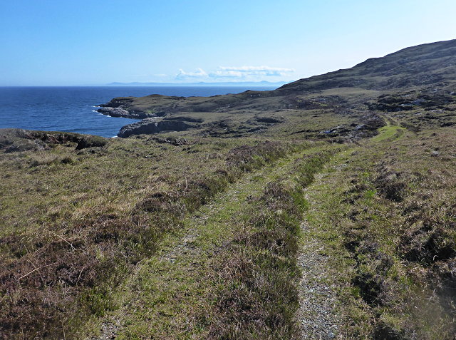
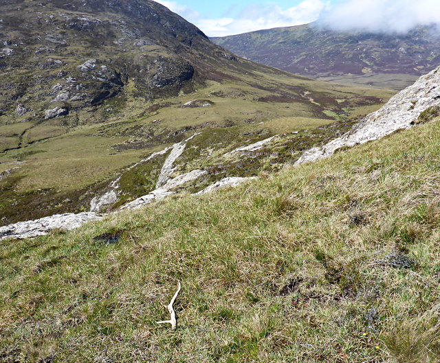
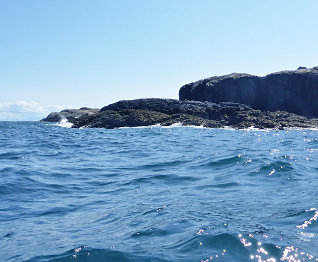
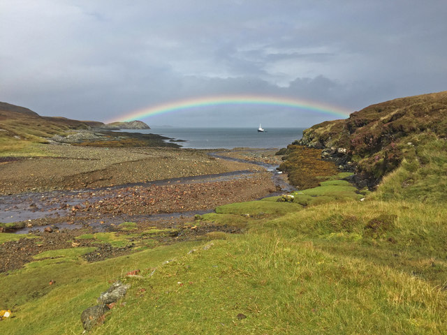
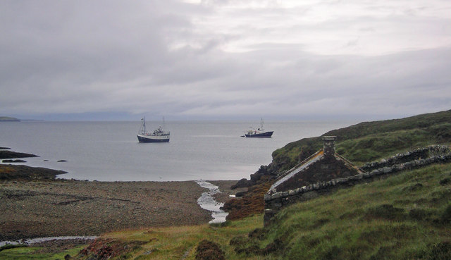
Bàgh Mile-Feala, also known as the Bay of Many Seals, is a picturesque bay located in Inverness-shire, Scotland. Situated on the west coast of the Scottish Highlands, this bay offers stunning views of the surrounding rugged landscapes and the vast expanse of the Atlantic Ocean.

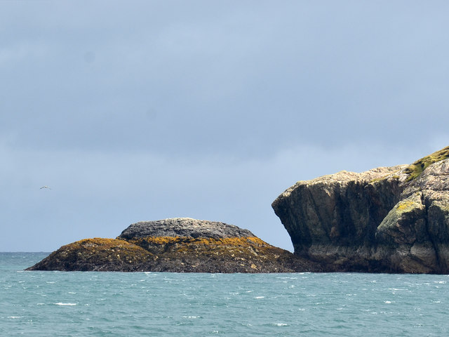
The bay is renowned for its abundant wildlife, particularly the large population of seals that inhabit the area. Visitors to Bàgh Mile-Feala can often spot these graceful creatures lounging on the rocks or swimming in the clear waters. It is a popular spot for wildlife enthusiasts and photographers looking to capture the beauty of these marine mammals in their natural habitat.

The bay is also home to a diverse range of bird species, making it a haven for birdwatchers. From majestic eagles soaring above to the smaller, colorful seabirds dotting the skies, there is always something to see for those with an interest in avian life.

In addition to its natural wonders, Bàgh Mile-Feala offers opportunities for outdoor activities such as kayaking, sailing, and fishing. The bay's calm waters and scenic surroundings make it an ideal location for these recreational pursuits.

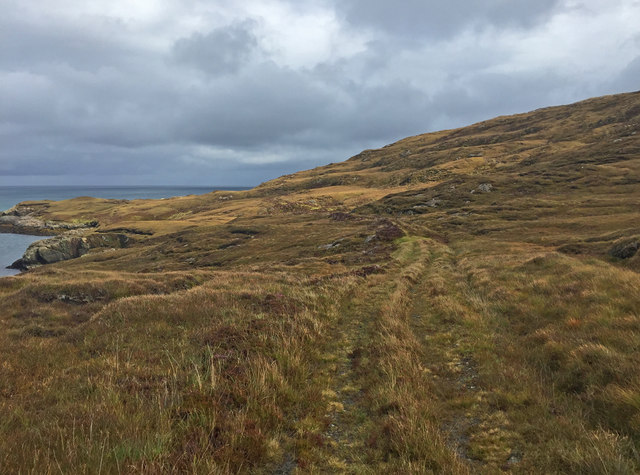
Access to Bàgh Mile-Feala is relatively easy, with a nearby car park and a well-maintained footpath leading to the bay. The area is also dotted with charming cottages and accommodations, allowing visitors to immerse themselves in the tranquility of this remote yet captivating location.

Overall, Bàgh Mile-Feala is a hidden gem in Inverness-shire, offering a unique blend of natural beauty, wildlife encounters, and outdoor adventures. Whether you are seeking relaxation or an active getaway, this bay has something to offer for everyone.

If you have any feedback on the listing, please let us know in the comments section below.

Bàgh Mile-Feala Images

Images are sourced within 2km of 57.294141/-7.1988937 or Grid Reference NF8634. Thanks to Geograph Open Source API. All images are credited.

Nicolson's Leap The name Nicolson's Leap is given to this small (<100 metres long), steep rocky islet off the east coast of South Uist. If anybody did actually leap from the islet to the mainland it was a prodigious feat - frankly, I do not believe it. For a photo of the summit, see <a href="https://www.geograph.org.uk/photo/7171501">NF8633 : The summit of Nicolson's Leap</a>.

The distant summit at extreme right is Hecla (Thacla), 606m in <a href="https://www.geograph.org.uk/gridref/NF8234">NF8234</a>. On the left is Beinn Corradail, 527m in <a href="https://www.geograph.org.uk/gridref/NF8132">NF8132</a>.

Michael Earnshaw tells me that if you land at the right spot the climb is quite straightforward.  Not that it is something that I (the contributor) could ever have done!
Nicolson's Leap
The name Nicolson's Leap is given to this small (<100 metres long), steep rocky islet off the east coast of South Uist. If anybody did actually leap from the islet to the mainland it was a prodigious feat - frankly, I do not believe it. For a photo of the summit, see NF8633 : The summit of Nicolson's Leap. The distant summit at extreme right is Hecla (Thacla), 606m in NF8234. On the left is Beinn Corradail, 527m in NF8132. Michael Earnshaw tells me that if you land at the right spot the climb is quite straightforward. Not that it is something that I (the contributor) could ever have done!
The summit of Nicolson's Leap You are advised not to get too close to the cliff-edge on your left!

Nicolson&amp;#039;s Leap is a small islet on the east coast of South Uist. For a photo from the sea, which gives a better impression of just what this islet is like, see &lt;a href=&quot;https://www.geograph.org.uk/photo/7171483&quot;&gt;NF8633 : Nicolson&#039;s Leap&lt;/a&gt;.
The summit of Nicolson's Leap
You are advised not to get too close to the cliff-edge on your left! Nicolson's Leap is a small islet on the east coast of South Uist. For a photo from the sea, which gives a better impression of just what this islet is like, see NF8633 : Nicolson's Leap.
Uisinis Lighthouse track When the Uisinis lighthouse was constructed for the Commissioners of Northern Lights in 1857, the designers, David and Thomas Stevenson, foolishly neglected to also invent helicopters.  Thus, generations of lighthouse keepers, and their supplies, arrived by sea.

The landing in the bay of Mol a Tuath is much more sheltered than the rocky coast at the lighthouse, and the gently-graded track provides an easier approach than steep steps to the shoreline as built at other locations.

The track has seen much less use since the introduction of helicopters, and especially since full automation of the light in 1970.
Uisinis Lighthouse track
When the Uisinis lighthouse was constructed for the Commissioners of Northern Lights in 1857, the designers, David and Thomas Stevenson, foolishly neglected to also invent helicopters. Thus, generations of lighthouse keepers, and their supplies, arrived by sea. The landing in the bay of Mol a Tuath is much more sheltered than the rocky coast at the lighthouse, and the gently-graded track provides an easier approach than steep steps to the shoreline as built at other locations. The track has seen much less use since the introduction of helicopters, and especially since full automation of the light in 1970.
Below Beinn a' Tuath
Gleann Mile-feala and the foot of Beinn Ghòt A discarded antler lies in the foreground.
Gleann Mile-feala and the foot of Beinn Ghòt
A discarded antler lies in the foreground.
Northern limit of Uisinis
Rubha Bhilidh
Rubha Bhilidh
Ruined building at Uisinis There were once several farmsteads around the bay; now the only remaining roofed building is the bothy (maintained by MBA), visible in the background at extreme right of picture.
Ruined building at Uisinis
There were once several farmsteads around the bay; now the only remaining roofed building is the bothy (maintained by MBA), visible in the background at extreme right of picture.
Pass of Uisinis This is the highest point on a route between Bàgh Uisinis and Mol a&amp;#039; Tuath.
Pass of Uisinis
This is the highest point on a route between Bàgh Uisinis and Mol a' Tuath.
Northernmost point of Uisinis The left side of the rocks shown is the only land in this square.
Northernmost point of Uisinis
The left side of the rocks shown is the only land in this square.
Mouth of the Abhainn Mol a' Tuath A rainbow curves over a ship at anchor in Mol a&amp;#039; Tuath bay.
Mouth of the Abhainn Mol a' Tuath
A rainbow curves over a ship at anchor in Mol a' Tuath bay.
Track to the Uisinis Lighthouse Apparently used only by pedestrian traffic now, the track connects the landing place at Mol a&amp;#039; Tuath Bay to the lighthouse, which is now unmanned and serviced by helicopter.
Track to the Uisinis Lighthouse
Apparently used only by pedestrian traffic now, the track connects the landing place at Mol a' Tuath Bay to the lighthouse, which is now unmanned and serviced by helicopter.
Approach to Uisinis Lighthouse Apparently used only by pedestrian traffic now, the track seen traversing the slope ahead connects the landing place at Mol a&amp;#039; Tuath Bay to the lighthouse, which is now unmanned and serviced by helicopter.
Approach to Uisinis Lighthouse
Apparently used only by pedestrian traffic now, the track seen traversing the slope ahead connects the landing place at Mol a' Tuath Bay to the lighthouse, which is now unmanned and serviced by helicopter.
Uisinis Lighthouse The lighthouse was undergoing a major refurbishment, hence the bags of materials that had been delivered by helicopter. The light was built by Thomas and David Stevenson in 1857. The Northern Lighthouse Board use the anglicised spelling &amp;quot;Ushenish&amp;quot; to name it.
Uisinis Lighthouse
The lighthouse was undergoing a major refurbishment, hence the bags of materials that had been delivered by helicopter. The light was built by Thomas and David Stevenson in 1857. The Northern Lighthouse Board use the anglicised spelling "Ushenish" to name it.
Uisnis Bay, beach and surrounding moorland seen from the summit of Hecla.
Uisnis
Bay, beach and surrounding moorland seen from the summit of Hecla.
Nicolson's Leap Presumably the leap is the gap between the stack and mainland of South Uist. View from Hecla.
Nicolson's Leap
Presumably the leap is the gap between the stack and mainland of South Uist. View from Hecla.
Storehouse for Uisinish Lighthouse A view of Uisinish Bay. In the foreground is the storehouse above the derelict jetty once used to land supplies for the lighthouse.
Storehouse for Uisinish Lighthouse
A view of Uisinish Bay. In the foreground is the storehouse above the derelict jetty once used to land supplies for the lighthouse.
Nicolson's Leap, South Uist The rock in the foreground is known as Nicolson&amp;#039;s Leap- if true, this must have been quite a feat! The view is looking W, the mountains in the background are Beinn Mhor (L) and Hecla (R)
Nicolson's Leap, South Uist
The rock in the foreground is known as Nicolson's Leap- if true, this must have been quite a feat! The view is looking W, the mountains in the background are Beinn Mhor (L) and Hecla (R)
Show me another place!

Bàgh Mile-Feala is located at Grid Ref: NF8634 (Lat: 57.294141, Lng: -7.1988937)

Unitary Authority: Na h-Eileanan an Iar

Police Authority: Highlands and Islands

What 3 Words

///swordfish.paintings.facing. Near Lochboisdale, Na h-Eileanan Siar

Related Wikis

Ushenish Lighthouse

The Ushenish Lighthouse is an active lighthouse located in South Uist, Outer Hebrides, Scotland. == History == Ushenish Lighthouse was designed by engineers...

Hecla (South Uist)

Hecla or Thacla is a mountain on the island of South Uist in the Outer Hebrides of Scotland. With a height of 606 metres (1,988 ft), it is the second-highest...

Beinn Mhòr (South Uist)

Beinn Mhòr is a mountain on the island of South Uist in the Outer Hebrides of Scotland. With a height of 620 metres (2,034 ft), it is the highest point...

South Uist

South Uist (Scottish Gaelic: Uibhist a Deas, [ˈɯ.ɪʃtʲ ə ˈtʲes̪] ; Scots: Sooth Uist) is the second-largest island of the Outer Hebrides in Scotland. At...

Have you been to Bàgh Mile-Feala?

Leave your review of Bàgh Mile-Feala below (or comments, questions and feedback).