Bàgh Rossel

Bay in Inverness-shire

Scotland

Bàgh Rossel

Uisinis Lighthouse track When the Uisinis lighthouse was constructed for the Commissioners of Northern Lights in 1857, the designers, David and Thomas Stevenson, foolishly neglected to also invent helicopters.  Thus, generations of lighthouse keepers, and their supplies, arrived by sea.

The landing in the bay of Mol a Tuath is much more sheltered than the rocky coast at the lighthouse, and the gently-graded track provides an easier approach than steep steps to the shoreline as built at other locations.

The track has seen much less use since the introduction of helicopters, and especially since full automation of the light in 1970.
Uisinis Lighthouse track Credit: Toby Speight

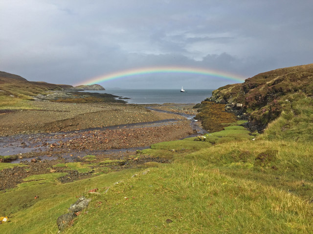
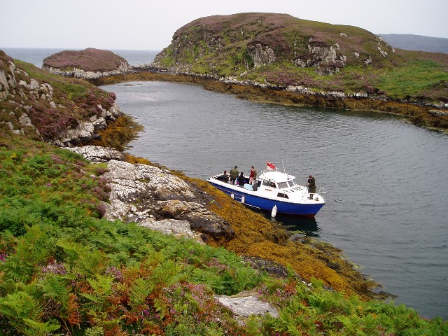
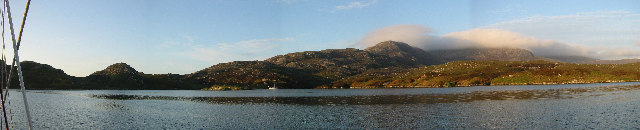
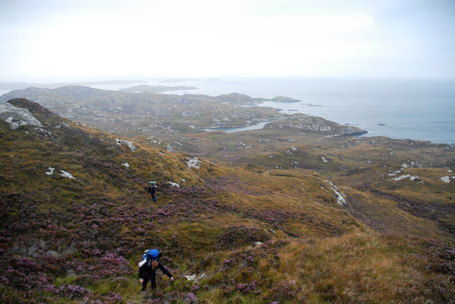
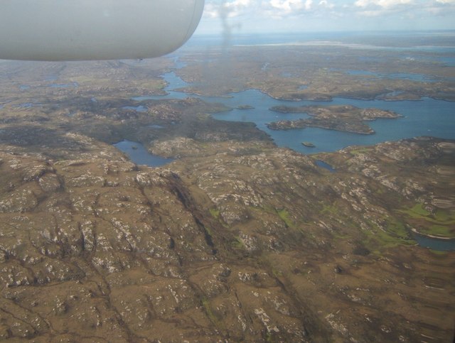
Bàgh Rossel, also known as Rossel Bay, is a picturesque coastal area located in Inverness-shire, Scotland. Situated on the west coast of Scotland, this bay offers stunning views of the surrounding landscape and is a popular destination for nature lovers and outdoor enthusiasts.

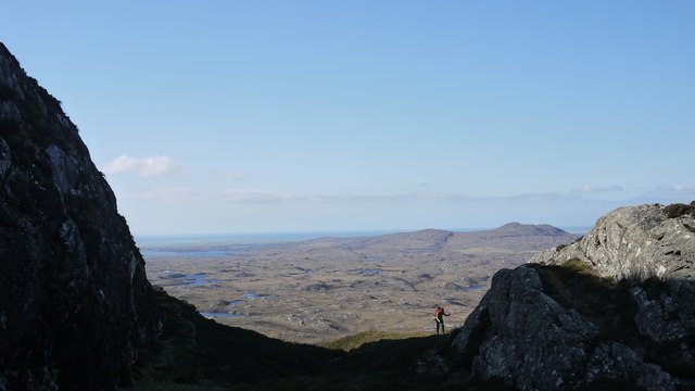
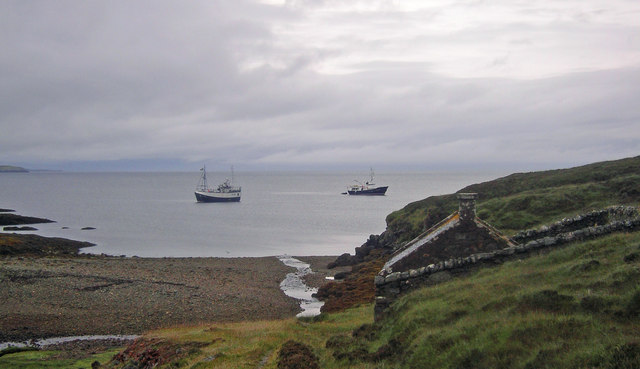
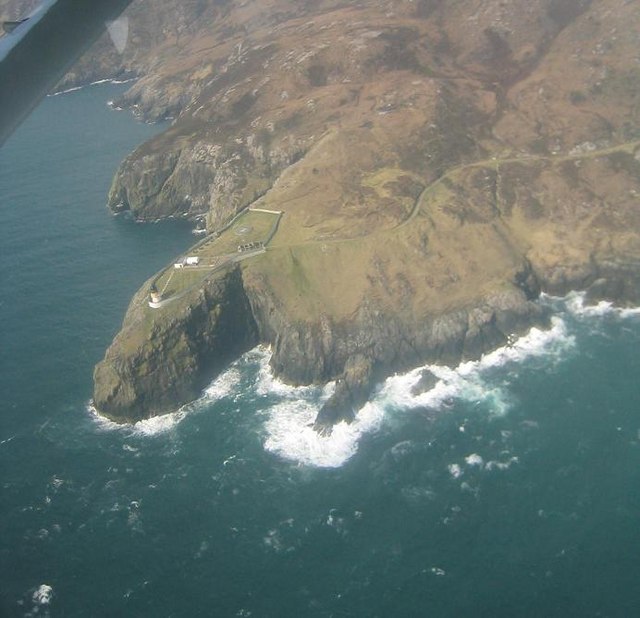
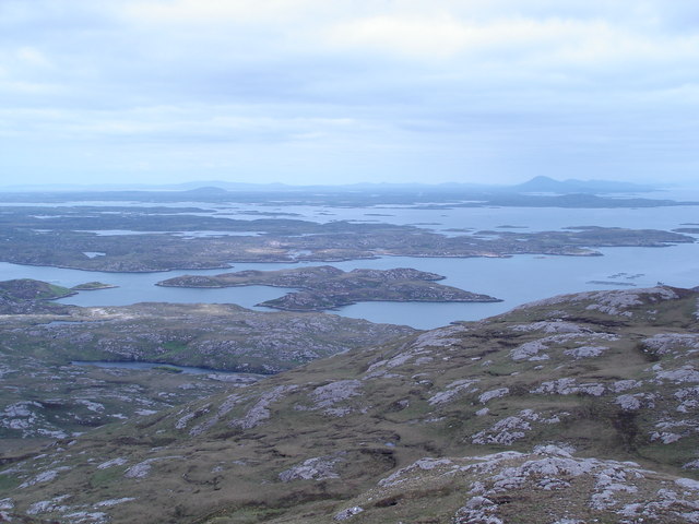
The bay is characterized by its rugged cliffs, golden sandy beaches, and crystal-clear turquoise waters. It is surrounded by rolling hills and green meadows, creating a tranquil and idyllic atmosphere. The bay is also home to a diverse range of wildlife, including seabirds, seals, and even the occasional dolphin or whale sighting.

Visitors to Bàgh Rossel can enjoy a variety of activities. The bay is an excellent spot for birdwatching, with several species of seabirds nesting in the cliffs and surrounding areas. The sandy beaches provide opportunities for sunbathing, picnicking, and leisurely walks along the shore. The clear waters are perfect for swimming, kayaking, and other water sports.

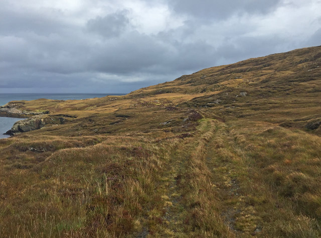
Bàgh Rossel is relatively secluded and peaceful, making it an ideal destination for those seeking a break from the hustle and bustle of city life. However, it is still easily accessible, with a nearby car park and a well-maintained walking path leading to the bay. The area is also well connected to nearby towns and villages, allowing visitors to explore the surrounding area and take in the breathtaking scenery of the Scottish Highlands.

In summary, Bàgh Rossel in Inverness-shire is a stunning bay that offers a perfect blend of natural beauty and outdoor activities. Whether you're interested in wildlife spotting, beach relaxation, or simply enjoying the tranquility of the Scottish coast, this bay is sure to captivate and inspire.

If you have any feedback on the listing, please let us know in the comments section below.
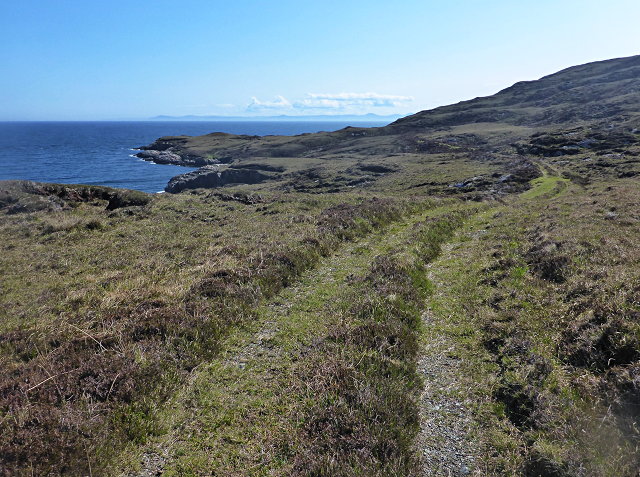
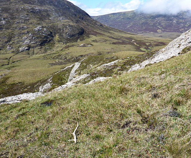
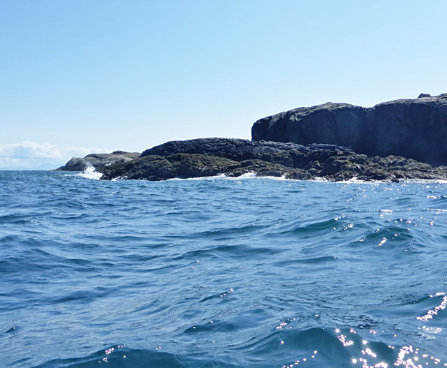
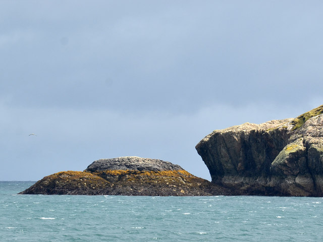
Bàgh Rossel Images

Images are sourced within 2km of 57.30918/-7.2200603 or Grid Reference NF8536. Thanks to Geograph Open Source API. All images are credited.

Uisinis Lighthouse track When the Uisinis lighthouse was constructed for the Commissioners of Northern Lights in 1857, the designers, David and Thomas Stevenson, foolishly neglected to also invent helicopters.  Thus, generations of lighthouse keepers, and their supplies, arrived by sea.

The landing in the bay of Mol a Tuath is much more sheltered than the rocky coast at the lighthouse, and the gently-graded track provides an easier approach than steep steps to the shoreline as built at other locations.

The track has seen much less use since the introduction of helicopters, and especially since full automation of the light in 1970.
Uisinis Lighthouse track
When the Uisinis lighthouse was constructed for the Commissioners of Northern Lights in 1857, the designers, David and Thomas Stevenson, foolishly neglected to also invent helicopters. Thus, generations of lighthouse keepers, and their supplies, arrived by sea. The landing in the bay of Mol a Tuath is much more sheltered than the rocky coast at the lighthouse, and the gently-graded track provides an easier approach than steep steps to the shoreline as built at other locations. The track has seen much less use since the introduction of helicopters, and especially since full automation of the light in 1970.
Below Beinn a' Tuath
Gleann Mile-feala and the foot of Beinn Ghòt A discarded antler lies in the foreground.
Gleann Mile-feala and the foot of Beinn Ghòt
A discarded antler lies in the foreground.
Northern limit of Uisinis
Pass of Uisinis This is the highest point on a route between Bàgh Uisinis and Mol a' Tuath.
Pass of Uisinis
This is the highest point on a route between Bàgh Uisinis and Mol a' Tuath.
Deer on Beinn Sgalabhat
Northernmost point of Uisinis The left side of the rocks shown is the only land in this square.
Northernmost point of Uisinis
The left side of the rocks shown is the only land in this square.
Mouth of the Abhainn Mol a' Tuath A rainbow curves over a ship at anchor in Mol a' Tuath bay.
Mouth of the Abhainn Mol a' Tuath
A rainbow curves over a ship at anchor in Mol a' Tuath bay.
Track to the Uisinis Lighthouse Apparently used only by pedestrian traffic now, the track connects the landing place at Mol a' Tuath Bay to the lighthouse, which is now unmanned and serviced by helicopter.
Track to the Uisinis Lighthouse
Apparently used only by pedestrian traffic now, the track connects the landing place at Mol a' Tuath Bay to the lighthouse, which is now unmanned and serviced by helicopter.
Approach to Uisinis Lighthouse Apparently used only by pedestrian traffic now, the track seen traversing the slope ahead connects the landing place at Mol a' Tuath Bay to the lighthouse, which is now unmanned and serviced by helicopter.
Approach to Uisinis Lighthouse
Apparently used only by pedestrian traffic now, the track seen traversing the slope ahead connects the landing place at Mol a' Tuath Bay to the lighthouse, which is now unmanned and serviced by helicopter.
Climbing to the ridge at Maol Martaig
Storehouse for Uisinish Lighthouse A view of Uisinish Bay. In the foreground is the storehouse above the derelict jetty once used to land supplies for the lighthouse.
Storehouse for Uisinish Lighthouse
A view of Uisinish Bay. In the foreground is the storehouse above the derelict jetty once used to land supplies for the lighthouse.
Natural harbour, Acarsaid Falaich The boat belongs to the owners of the local big house, who had landed on this remote part of the east coast of South Uist for a picnic!
Natural harbour, Acarsaid Falaich
The boat belongs to the owners of the local big house, who had landed on this remote part of the east coast of South Uist for a picnic!
Wizard Pool, Loch Skipport panorama of the anchorage of Wizard Pool. The mountain in the distance, partially in cloud, is Hecla (606m)
Wizard Pool, Loch Skipport
panorama of the anchorage of Wizard Pool. The mountain in the distance, partially in cloud, is Hecla (606m)
Uisinis Lighthouse, South Uist On the east coast of South Uist viewed from the Loganair (British Airways) Twin Otter en route from Barra to Benbecula
Uisinis Lighthouse, South Uist
On the east coast of South Uist viewed from the Loganair (British Airways) Twin Otter en route from Barra to Benbecula
Beinn na h-Aire The Lewisian landscape of Uist and Benbecula, from the top of
Beinn na h-Aire, on the northwest ridge of Hecla, South Uist
Beinn na h-Aire
The Lewisian landscape of Uist and Benbecula, from the top of Beinn na h-Aire, on the northwest ridge of Hecla, South Uist
The slog to Uisinish Bay Slogging through the trackless heather on a wild corner of South Uist.
The slog to Uisinish Bay
Slogging through the trackless heather on a wild corner of South Uist.
Loch Bein and Loch Sgiopoirt Loch Bein is on the left; the island to the right is Siolagh Mor in Loch Sgiopoirt.
Loch Bein and Loch Sgiopoirt
Loch Bein is on the left; the island to the right is Siolagh Mor in Loch Sgiopoirt.
Show me another place!

Bàgh Rossel is located at Grid Ref: NF8536 (Lat: 57.30918, Lng: -7.2200603)

Unitary Authority: Na h-Eileanan an Iar

Police Authority: Highlands and Islands

What 3 Words

///begins.sway.charmingly. Near Lochboisdale, Na h-Eileanan Siar

Nearby Locations

Bàgh Rossel

Related Wikis

Ushenish Lighthouse

The Ushenish Lighthouse is an active lighthouse located in South Uist, Outer Hebrides, Scotland. == History == Ushenish Lighthouse was designed by engineers...

Hecla (South Uist)

Hecla or Thacla is a mountain on the island of South Uist in the Outer Hebrides of Scotland. With a height of 606 metres (1,988 ft), it is the second-highest...

Loch Druidibeg

Loch Druidibeag is a freshwater loch situated on the island of South Uist, in the Outer Hebrides of Scotland. The loch is near the northern end of the...

Beinn Mhòr (South Uist)

Beinn Mhòr is a mountain on the island of South Uist in the Outer Hebrides of Scotland. With a height of 620 metres (2,034 ft), it is the highest point...

Have you been to Bàgh Rossel?

Leave your review of Bàgh Rossel below (or comments, questions and feedback).