Bun an Amair

Bay in Inverness-shire

Scotland

Bun an Amair

Cirrus Clouds Over Stulaigh Spectacular cloud formation above the east coast of South Uist on a balmy summer afternoon.
<span class="nowrap"><a title="http://en.wikipedia.org/wiki/List_of_cloud_types" rel="nofollow ugc noopener" href="http://en.wikipedia.org/wiki/List_of_cloud_types">Link</a><img style="margin-left:2px;" alt="External link" title="External link - shift click to open in new window" src="https://s1.geograph.org.uk/img/external.png" width="10" height="10"/></span>
Cirrus Clouds Over Stulaigh Credit: Colin Smith

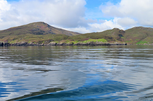
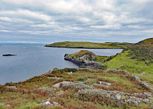
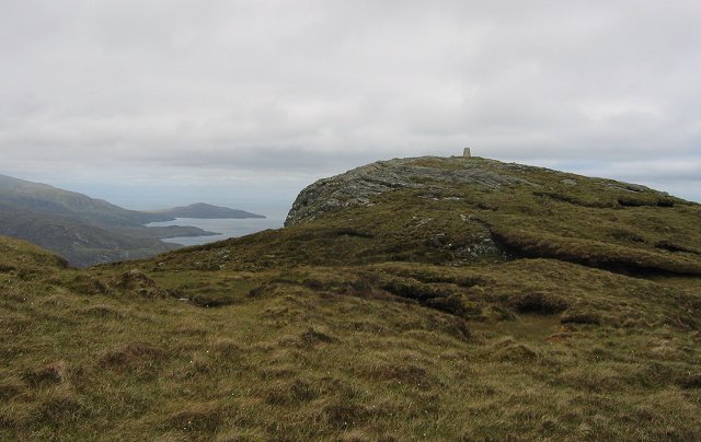
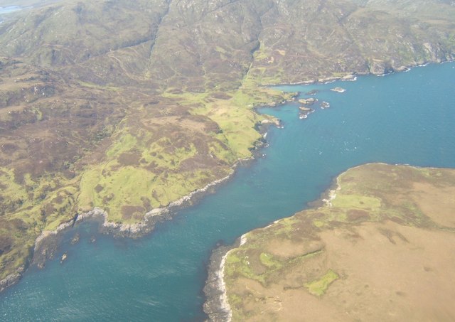
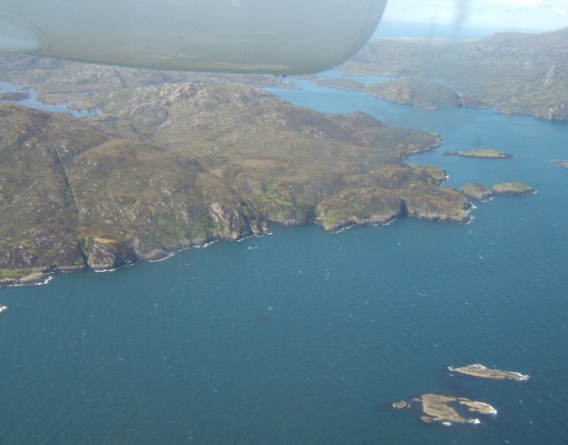
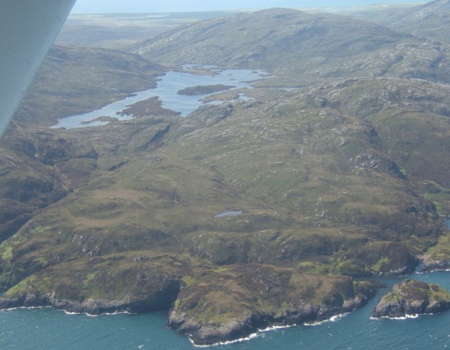
Bun an Amair is a picturesque bay located in Inverness-shire, Scotland. Situated on the west coast of the Highlands, this bay offers breathtaking views of the surrounding landscapes and the vast Atlantic Ocean. With its unspoiled beauty and tranquility, it has become a popular destination for nature lovers and those seeking a peaceful retreat.

The bay is characterized by its pristine sandy beach, which stretches for several miles along the coastline. The crystal-clear turquoise waters create a stunning contrast against the rugged cliffs and green hills that enclose the bay. The beach is perfect for long walks, picnics, and sunbathing, and it also provides an ideal spot for various water activities such as swimming, kayaking, and snorkeling.

The area surrounding Bun an Amair is rich in biodiversity, making it a haven for wildlife enthusiasts. Visitors may spot a variety of bird species, including puffins, gannets, and guillemots, nesting on the cliffs. Seals and dolphins can also be seen frolicking in the bay, adding to the magical atmosphere of the place.

For those interested in history, there are several archaeological sites in the vicinity of Bun an Amair. The remnants of ancient settlements and burial grounds offer a glimpse into the region's past and provide a fascinating insight into the lives of its former inhabitants.

Overall, Bun an Amair is a hidden gem that showcases the raw beauty of the Scottish Highlands. Its stunning bay, diverse wildlife, and historical significance make it a must-visit destination for anyone seeking a true Scottish experience.

If you have any feedback on the listing, please let us know in the comments section below.

Bun an Amair Images

Images are sourced within 2km of 57.201878/-7.2640231 or Grid Reference NF8224. Thanks to Geograph Open Source API. All images are credited.

Cirrus Clouds Over Stulaigh Spectacular cloud formation above the east coast of South Uist on a balmy summer afternoon.
<span class="nowrap"><a title="http://en.wikipedia.org/wiki/List_of_cloud_types" rel="nofollow ugc noopener" href="http://en.wikipedia.org/wiki/List_of_cloud_types">Link</a><img style="margin-left:2px;" alt="External link" title="External link - shift click to open in new window" src="https://s1.geograph.org.uk/img/external.png" width="10" height="10"/></span>
Cirrus Clouds Over Stulaigh
Spectacular cloud formation above the east coast of South Uist on a balmy summer afternoon. LinkExternal link
Cleit a' Ghlinn Mhòir Cleit a' Ghlinn Mhòir is the rocky peninsula with the bright green vegetation on it. The name means 'rock of the big glen'.
Cleit a' Ghlinn Mhòir
Cleit a' Ghlinn Mhòir is the rocky peninsula with the bright green vegetation on it. The name means 'rock of the big glen'.
Kyles Stuley The ruins of Kyles Stuley, last occupied around 1911. After Culloden, Prince Charles Edward Stuart spent a night here (June 14, 1746) while being pursued by English troops.
Kyles Stuley
The ruins of Kyles Stuley, last occupied around 1911. After Culloden, Prince Charles Edward Stuart spent a night here (June 14, 1746) while being pursued by English troops.
Summit of Stulabhal Stulabhal at 374m is the highest of the middle group of South Uist hills. Because of the exposed island setting it feels a lot higher.
Summit of Stulabhal
Stulabhal at 374m is the highest of the middle group of South Uist hills. Because of the exposed island setting it feels a lot higher.
South ridge of Stulabhal View up Stulabhal with the steep rocky ridge of A' Chir Ghorm visible as a "peak".
South ridge of Stulabhal
View up Stulabhal with the steep rocky ridge of A' Chir Ghorm visible as a "peak".
Triangulation pillar, Stulabhal View northwards past the pillar towards Beinn Mhòr.
Triangulation pillar, Stulabhal
View northwards past the pillar towards Beinn Mhòr.
Caolas Stulaigh The kyle from above the Isle of Stulaigh.
Caolas Stulaigh
The kyle from above the Isle of Stulaigh.
Bun an Amair The skerries in the foreground are those to the north of Stulaig. On the right is the mouth of Loch Aineort; on the left, beyond the lower slopes of Stulabhal, is Loch Snigiscleit.
Bun an Amair
The skerries in the foreground are those to the north of Stulaig. On the right is the mouth of Loch Aineort; on the left, beyond the lower slopes of Stulabhal, is Loch Snigiscleit.
Rubha na Gibhte Looking west over Loch Snigiscleit towards Airnebhal <a href="https://www.geograph.org.uk/photo/15970">NF7825 : On Airneabhal</a>.
Rubha na Gibhte
Looking west over Loch Snigiscleit towards Airnebhal NF7825 : On Airneabhal.
Show me another place!

Bun an Amair is located at Grid Ref: NF8224 (Lat: 57.201878, Lng: -7.2640231)

Unitary Authority: Na h-Eileanan an Iar

Police Authority: Highlands and Islands

What 3 Words

///replaying.decoded.nurtures. Near Lochboisdale, Na h-Eileanan Siar

Related Wikis

Stuley

Stuley is an island lying to the east of South Uist in the Outer Hebrides, Scotland. It lies off the section of coastline between Loch Eynort and Loch...

Beinn Ruigh Choinnich

Beinn Ruigh Choinnich is a hill which overlooks the port of Lochboisdale on the east coast of the island of South Uist in the Outer Hebrides Scotland....

Auratote

Auratote (Scottish Gaelic: Oratobht) is a location on South Uist in the Outer Hebrides, Scotland. Auratote is within the parish of South Uist. == References... ==

Lochboisdale

Lochboisdale (Scottish Gaelic: Loch Baghasdail [ɫ̪ɔx ˈbɤːs̪t̪ɪl]) is the main village and port on the island of South Uist, Outer Hebrides, Scotland. Lochboisdale...

Nearby Amenities

Located within 500m of 57.201878,-7.2640231
Rubha na Gibhte
Natural: cape
Lat/Long: 57.2055849/-7.2601586
Bun an Amair
Natural: bay
Lat/Long: 57.2019684/-7.2640407
The data included in this document is from www.openstreetmap.org. The data is made available under ODbL.

Have you been to Bun an Amair?

Leave your review of Bun an Amair below (or comments, questions and feedback).