Sloc Caol

Bay in Inverness-shire

Scotland

Sloc Caol

Eriskay, seen from Rubha Mealabhaig on South Uist Eriskay is a fairly small island, perhaps best known as the location of "Whisky Galore". Its summit is Beinn Sciathan, 185m in <a href="https://www.geograph.org.uk/gridref/NF7911">NF7911</a>. The causeway from South Uist can be seen on the right, and beyond Eriskay is the island of Barra.
Eriskay, seen from Rubha Mealabhaig on South Uist Credit: Michael Earnshaw

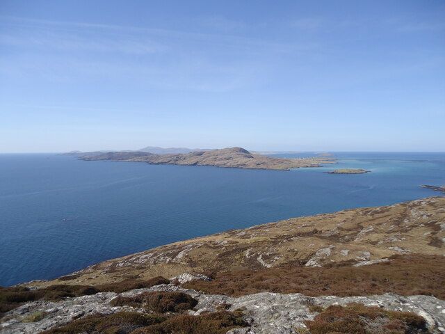
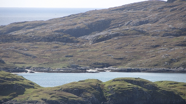
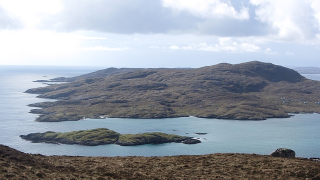
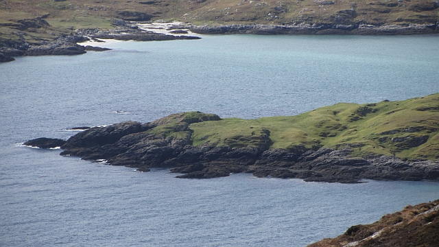
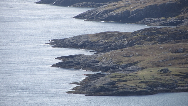
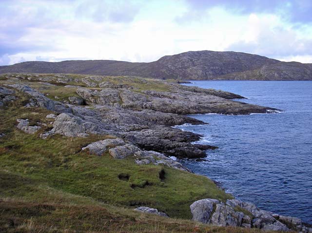
Sloc Caol, located in Inverness-shire, Scotland, is a picturesque bay that boasts stunning natural beauty and a rich history. Nestled along the western coast of Scotland, this tranquil bay offers visitors a peaceful retreat and a chance to immerse themselves in the region's stunning landscape.

Sloc Caol is known for its calm waters, which provide an ideal environment for various water activities such as sailing, kayaking, and fishing. The bay is also a popular spot for wildlife enthusiasts, as it is home to a diverse range of marine life, including seals, dolphins, and various species of seabirds. Exploring the bay by boat or taking a leisurely stroll along the shoreline allows visitors to appreciate the area's biodiversity.

The history of Sloc Caol is also worth noting. The bay was historically used as a trading route, with ships carrying goods between the local villages and nearby towns. The remnants of this maritime heritage can still be seen today in the form of old ruins and artifacts scattered along the coastline.

In terms of amenities, Sloc Caol offers limited facilities, with a small parking area and a few picnic spots available for visitors. However, nearby villages and towns provide additional options for accommodation, dining, and shopping.

Overall, Sloc Caol is a hidden gem in Inverness-shire, offering visitors a chance to escape the hustle and bustle of city life and immerse themselves in the natural beauty and history of Scotland's western coast.

If you have any feedback on the listing, please let us know in the comments section below.

Sloc Caol Images

Images are sourced within 2km of 57.089078/-7.2691927 or Grid Reference NF8012. Thanks to Geograph Open Source API. All images are credited.
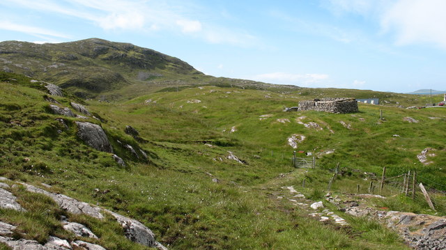
Eriskay, seen from Rubha Mealabhaig on South Uist Eriskay is a fairly small island, perhaps best known as the location of "Whisky Galore". Its summit is Beinn Sciathan, 185m in <a href="https://www.geograph.org.uk/gridref/NF7911">NF7911</a>. The causeway from South Uist can be seen on the right, and beyond Eriskay is the island of Barra.
Eriskay, seen from Rubha Mealabhaig on South Uist
Eriskay is a fairly small island, perhaps best known as the location of "Whisky Galore". Its summit is Beinn Sciathan, 185m in NF7911. The causeway from South Uist can be seen on the right, and beyond Eriskay is the island of Barra.
Sound of Eriskay shoreline The south coast of South Uist: low down the vegetation is a mix of heather and bracken with quite a few brambles.
Sound of Eriskay shoreline
The south coast of South Uist: low down the vegetation is a mix of heather and bracken with quite a few brambles.
Ròisinis Caolas Eirisgeigh, the Sound of Eriskay with a view over Calbhaigh (the island where the whisky exporting SS Politician ended up) from South Uist.  Ròisinis has several ruins and a path in from the now inhabited part of Eriskay.
Ròisinis
Caolas Eirisgeigh, the Sound of Eriskay with a view over Calbhaigh (the island where the whisky exporting SS Politician ended up) from South Uist. Ròisinis has several ruins and a path in from the now inhabited part of Eriskay.
Southern shore of South Uist Gneiss outcropping on the Sound of Eriskay.
Southern shore of South Uist
Gneiss outcropping on the Sound of Eriskay.
Calbhaigh and  Caolas Eirisgeigh The small island between Eriskay and South Uist was the last resting place of the SS Politician and a large, but rapidly diminishing cargo of whisky. A view from Roineabhal on South Uist of the sea east of the Eriskay Causeway.
Calbhaigh and Caolas Eirisgeigh
The small island between Eriskay and South Uist was the last resting place of the SS Politician and a large, but rapidly diminishing cargo of whisky. A view from Roineabhal on South Uist of the sea east of the Eriskay Causeway.
Calbhaigh The eastern side of the island.
Calbhaigh
The eastern side of the island.
Summit plateau, Ròineabhal A lochan near the summit of Ròineabhal, there is a good view of the Eriskay Causeway.
Summit plateau, Ròineabhal
A lochan near the summit of Ròineabhal, there is a good view of the Eriskay Causeway.
Ròisinis The northeastern corner of Eriskay.
Ròisinis
The northeastern corner of Eriskay.
Peat and gneiss, Ròineabhal Boggy areas between rock outcrops near the summit of Ròineabhal.
Peat and gneiss, Ròineabhal
Boggy areas between rock outcrops near the summit of Ròineabhal.
View south from Roineabhal A view towards Eriskay and Barra.
View south from Roineabhal
A view towards Eriskay and Barra.
Beinn Sciathan on Eriskay/Eiriosgaigh View from South Uist.
Beinn Sciathan on Eriskay/Eiriosgaigh
View from South Uist.
Rosinish, Eriskay A rather soggy path leading through the old settlement at Rosinish.
Rosinish, Eriskay
A rather soggy path leading through the old settlement at Rosinish.
Ruined croft at Rosinish. Maybe this was once a traditional 'black house', though the windows look a trifle large. Note that the photographer's rather dated OS map shows the Anglicised 'Rosinish', whereas the up to date map extract on the website shows the Gaelic form [Roisinis].
Ruined croft at Rosinish.
Maybe this was once a traditional 'black house', though the windows look a trifle large. Note that the photographer's rather dated OS map shows the Anglicised 'Rosinish', whereas the up to date map extract on the website shows the Gaelic form [Roisinis].
Triangulation pillar on Roineabhal Looking across the square to Hairtebreac.
Triangulation pillar on Roineabhal
Looking across the square to Hairtebreac.
Small lochan just below summit of Roineabhal This one is marked the 1:50000 but there were others unmarked.  The causeway to Eriskay can be seen in the background.
Small lochan just below summit of Roineabhal
This one is marked the 1:50000 but there were others unmarked. The causeway to Eriskay can be seen in the background.
The small island of Calbhaigh This attractive island is set in Caolas Eirisgeigh (Sound of Eriskay).
The small island of Calbhaigh
This attractive island is set in Caolas Eirisgeigh (Sound of Eriskay).
Beinn Sciathan from Rubha Basadearn
East coast of Eriskay. This is the wilder coastline of Eriskay where ruined crofts may be found indicating a once thriving community.
East coast of Eriskay.
This is the wilder coastline of Eriskay where ruined crofts may be found indicating a once thriving community.
Show me another place!

Sloc Caol is located at Grid Ref: NF8012 (Lat: 57.089078, Lng: -7.2691927)

Unitary Authority: Na h-Eileanan an Iar

Police Authority: Highlands and Islands

What 3 Words

///bunks.poster.tricycle. Near Lochboisdale, Na h-Eileanan Siar

Nearby Locations

Sloc Caol

Related Wikis

Calvay

Calvay (Scottish Gaelic: Calbhaigh) is a currently uninhabited island situated in the Sound of Eriskay in the Outer Hebrides, at grid reference NF810126...

SS Politician

SS Politician was a cargo ship that ran aground off the coast of the Hebridean island of Eriskay in 1941. Her cargo included 22,000 cases of scotch whisky...

Beinn Sciathan

Ben Scrien, is the highest point on the Outer Hebridean island of Eriskay. Described as an apparently "uninspiring lump" (Michael Fitzpatrick, 2012) it...

St Michael's Church, Eriskay

St Michael's Church (also known as St Michael's of the Sea) is a Category C listed building in Eriskay, South Uist, Scotland. Of Roman Catholic denomination...

Nearby Amenities

Located within 500m of 57.089078,-7.2691927
Ròisinis
Name En: Roshinish
Name Gd: Ròisinis
Place: locality
Lat/Long: 57.0896674/-7.2761832
Sloc Caol
Natural: bay
Lat/Long: 57.0891344/-7.2689368
Roc na Pollaidh
Place: locality
Lat/Long: 57.0929326/-7.268075
Glumag Dhòmhnaill Bhàin
Place: locality
Lat/Long: 57.0898223/-7.2693367
Fionnphort
Alt Name: Port Chaluim Mhòir
Natural: bay
Lat/Long: 57.0906258/-7.2763997
The data included in this document is from www.openstreetmap.org. The data is made available under ODbL.

Have you been to Sloc Caol?

Leave your review of Sloc Caol below (or comments, questions and feedback).