Bàgh nan Craobhag

Bay in Inverness-shire

Scotland

Bàgh nan Craobhag

Erskine Beveridge's house on Bhalaigh The abandoned house of the historian Erskine Beveridge.
Erskine Beveridge's house on Bhalaigh Credit: Tom Pullman

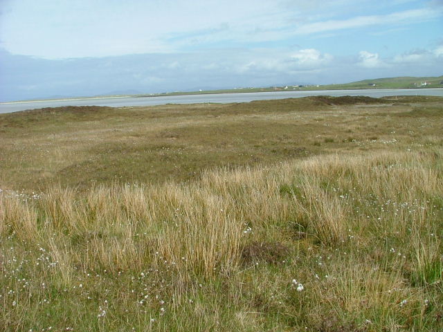
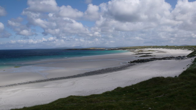
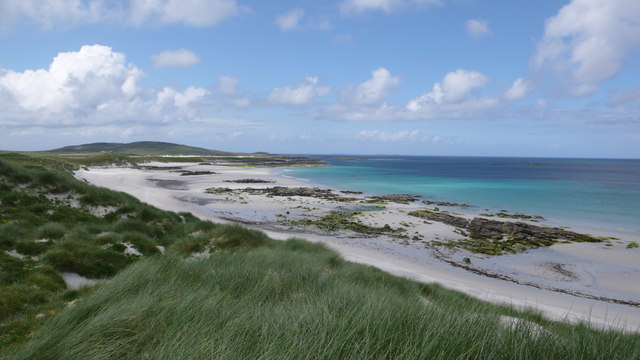
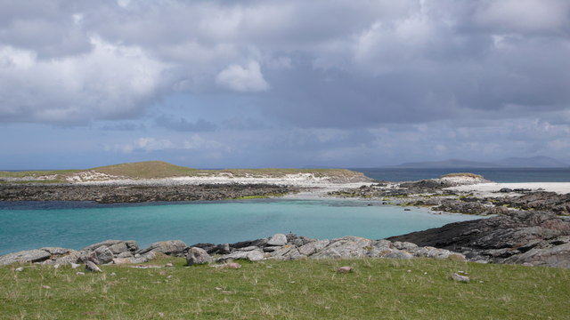
Bàgh nan Craobhag, also known as Bay of the Trees, is a picturesque bay located in Inverness-shire, Scotland. Situated on the western shore of Loch Carron, the bay is surrounded by stunning natural landscapes and offers a tranquil setting for visitors.

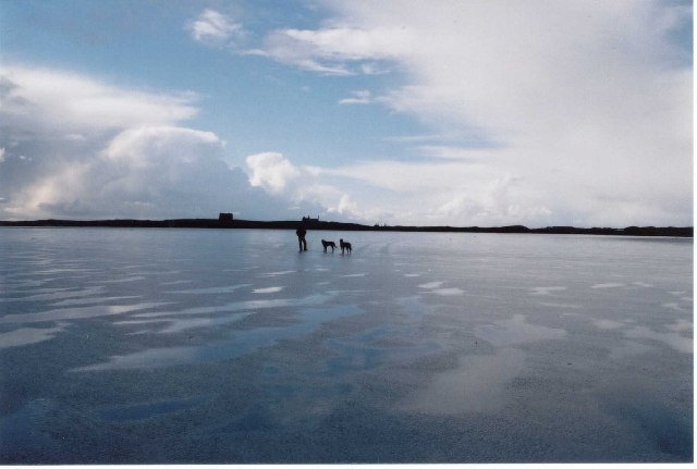
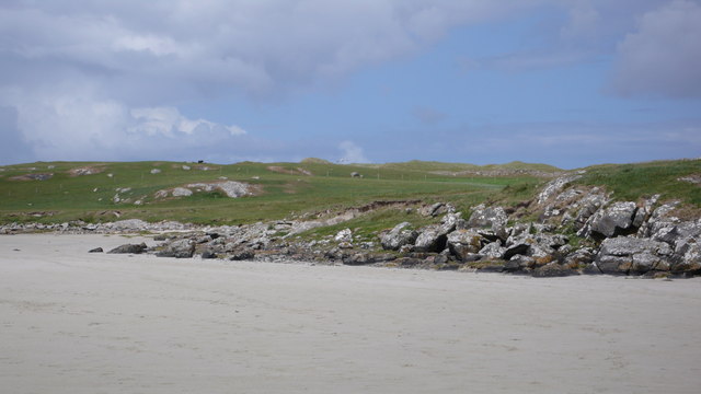
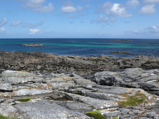
The bay is characterized by its sandy shoreline and crystal-clear waters, both of which make it an ideal spot for various recreational activities. Visitors can enjoy swimming, kayaking, and paddleboarding in the calm waters, or simply relax on the beach and soak up the breathtaking views of the surrounding mountains.

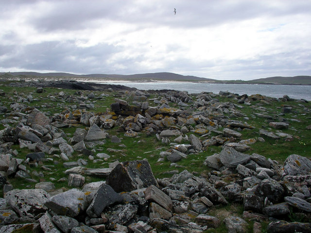
Bàgh nan Craobhag is notable for its rich biodiversity and is home to a variety of plant and animal species. The bay is fringed by a dense woodland of native trees such as oak, birch, and rowan, which provide habitat for a range of bird species including ospreys, herons, and kingfishers. The bay and its surrounding area are also known for their diverse marine life, with seals and otters often spotted in the waters.

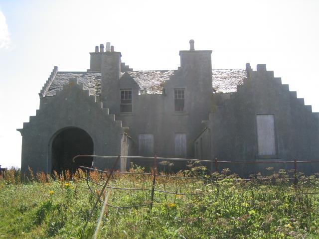
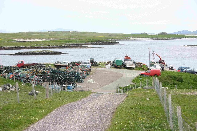
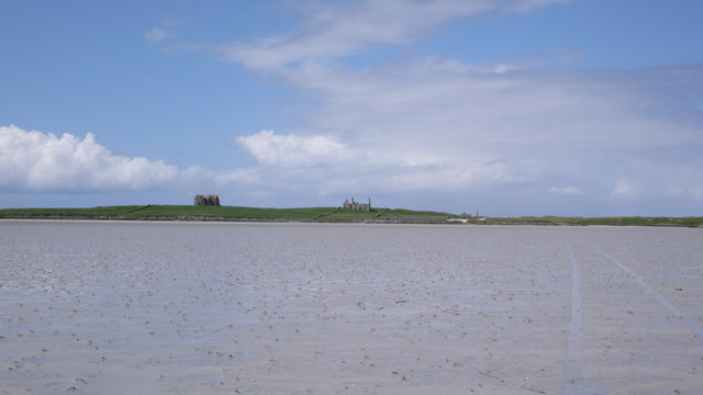
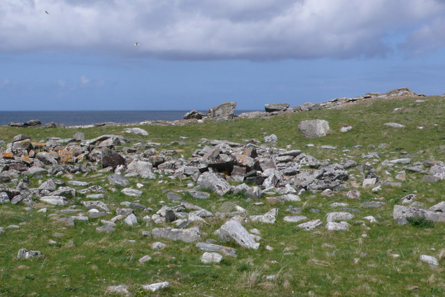
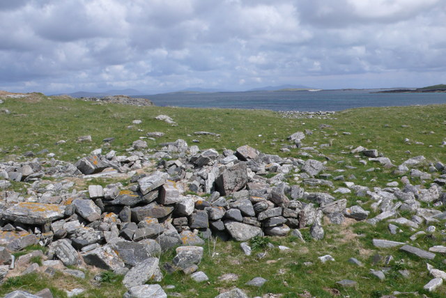
In addition to its natural beauty, Bàgh nan Craobhag also has historical significance. The bay was once a bustling harbor, serving as a hub for local fishing and trade activities. Today, remnants of the old pier can still be seen, adding to the bay's charm and providing a glimpse into its past.

Overall, Bàgh nan Craobhag is a hidden gem in Inverness-shire, offering visitors a peaceful and scenic retreat where they can connect with nature and appreciate the beauty of the Scottish Highlands.

If you have any feedback on the listing, please let us know in the comments section below.

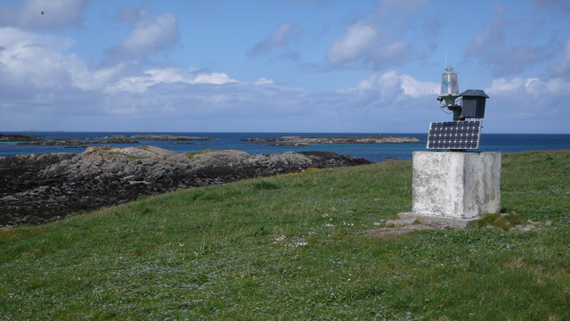
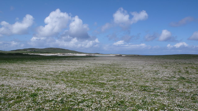
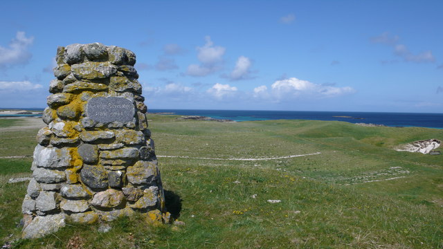
Bàgh nan Craobhag Images

Images are sourced within 2km of 57.665543/-7.4162166 or Grid Reference NF7776. Thanks to Geograph Open Source API. All images are credited.

Erskine Beveridge's house on Bhalaigh The abandoned house of the historian Erskine Beveridge.
Erskine Beveridge's house on Bhalaigh
The abandoned house of the historian Erskine Beveridge.
Traigh Bhalaigh The island of Vallay (Bhalaigh), is only accessible by foot at low tide. It is situated on the North of North Uist. The island itself has standing stones and remnants of ancient settlements and the crumbling ruins of Vallay House. This, once grand, building and several outhouses was owned by Erskine Beveridge, who contributed greatly to the archaeology of North Uist and wrote a weighty book on the subject.
Traigh Bhalaigh
The island of Vallay (Bhalaigh), is only accessible by foot at low tide. It is situated on the North of North Uist. The island itself has standing stones and remnants of ancient settlements and the crumbling ruins of Vallay House. This, once grand, building and several outhouses was owned by Erskine Beveridge, who contributed greatly to the archaeology of North Uist and wrote a weighty book on the subject.
Callernish House Callernish House was built in 1961 by the 5th Earl Granville. Designed by Sir Martyn Beckett, it has 14 bedrooms and 8 bathrooms. It is listed as a folly in Headley and Meulenkamp's Follies, the standard guide to follies in Britain
Callernish House
Callernish House was built in 1961 by the 5th Earl Granville. Designed by Sir Martyn Beckett, it has 14 bedrooms and 8 bathrooms. It is listed as a folly in Headley and Meulenkamp's Follies, the standard guide to follies in Britain
Pier with Bhalaigh in the background
Machair Looking towards Tràigh Bhàlaigh.
Machair
Looking towards Tràigh Bhàlaigh.
Teampull Orain The surf scattered ruin of Teampull Orain on Isle Oronsay
Teampull Orain
The surf scattered ruin of Teampull Orain on Isle Oronsay
Aird Mhic Caoilt Peninsula extending into the incredible vastness of Vallay Strand.
Aird Mhic Caoilt
Peninsula extending into the incredible vastness of Vallay Strand.
Bhalaigh House Bhalaigh viewed across Traigh Bhalaigh.  This vast expanse of sand dries to such an extent that at low tide cars can drive across to the island.
Bhalaigh House
Bhalaigh viewed across Traigh Bhalaigh. This vast expanse of sand dries to such an extent that at low tide cars can drive across to the island.
Navigation Beacon, Caolas Bhalaigh I think this beacon is used to aid navigation into the narrow and shallow Caolas Bhalaigh.
Navigation Beacon, Caolas Bhalaigh
I think this beacon is used to aid navigation into the narrow and shallow Caolas Bhalaigh.
Vallay Machair The machair is such a fine sight, no many how many times you see it.  A mass of wild flowers as far as the eye can see and buzzing with bumblebees and butterflies everywhere.
Vallay Machair
The machair is such a fine sight, no many how many times you see it. A mass of wild flowers as far as the eye can see and buzzing with bumblebees and butterflies everywhere.
George Beveridge Memorial Stone built memorial to George Beveridge 1891 - 1944.
George Beveridge Memorial
Stone built memorial to George Beveridge 1891 - 1944.
Vallay Shoreline Although mostly surrounded by sand there are a few rocky shores.  This one overlooking Caolas Bhalaigh.
Vallay Shoreline
Although mostly surrounded by sand there are a few rocky shores. This one overlooking Caolas Bhalaigh.
Camas na Criche, Bhalaigh As with many of the Western shores in the hebrides you have a long expanse of beautiful sandy beach.
Camas na Criche, Bhalaigh
As with many of the Western shores in the hebrides you have a long expanse of beautiful sandy beach.
Camas na Criche, Bhalaigh Dunes backing onto the white expanse of Camas na Criche.
Camas na Criche, Bhalaigh
Dunes backing onto the white expanse of Camas na Criche.
Bagh nan Craobhag Discarded lobster pot, of which there were many along this coast.
Bagh nan Craobhag
Discarded lobster pot, of which there were many along this coast.
Bagh na Craobhag Blue waters surround this island.  The shores held many nesting oystercatchers.
Bagh na Craobhag
Blue waters surround this island. The shores held many nesting oystercatchers.
Remains of Teampull Orain The outline is still clearly visible when you are on the ground.
Remains of Teampull Orain
The outline is still clearly visible when you are on the ground.
Remains of Teampull Orain Still some height visible in the walls.
Remains of Teampull Orain
Still some height visible in the walls.
Show me another place!

Bàgh nan Craobhag is located at Grid Ref: NF7776 (Lat: 57.665543, Lng: -7.4162166)

Unitary Authority: Na h-Eileanan an Iar

Police Authority: Highlands and Islands

What 3 Words

///published.official.sardine. Near Lochmaddy, Na h-Eileanan Siar

Related Wikis

Vallay

Vallay (Scottish Gaelic: Bhàlaigh) is an uninhabited tidal island in the Scottish Outer Hebrides. It can be reached from North Uist by a long beach at...

Eilean Dòmhnuill

Ian Armit identifies the islet of Eilean Dòmhnuill (Scottish Gaelic: Eilean Dòmhnaill, Scottish Gaelic pronunciation: [elan ˈt̪õː.ɪʎ], "The Isle of Donald...

Scolpaig Tower

Scolpaig Tower (also known as Dùn Scolpaig or MacLeod’s Folly) is a Georgian folly located near the village of Scolpaig on the island of North Uist in...

Scolpaig

Scolpaig (Scottish Gaelic: Sgolpaig) is a district on the north-west coast of the island of North Uist in the Outer Hebrides of Scotland. In 2018 it was...

Sollas

Sollas (Scottish Gaelic: Solas) is a small crofting township on the northern coast of the island of North Uist, Scotland. == History == === The Battle... ===

RRH Benbecula

Remote Radar Head Benbecula or RRH Benbecula, is an air defence radar station operated by the Royal Air Force. It is located at Cleitreabhal a'Deas, 17...

Oronsay, Outer Hebrides

Oronsay (Gaelic Orasaigh) is a tidal island off North Uist in the Outer Hebrides. Lying to the north of Vallaquie Strand, the island has been uninhabited...

Tigharry

Tigharry (Scottish Gaelic: Taigh a' Ghearraidh) is a small village on the west of North Uist. It is mostly a farming community. There are a few rocky beaches...

Nearby Amenities

Located within 500m of 57.665543,-7.4162166
Teampull Orain
Historic: archaeological_site
Lat/Long: 57.6678773/-7.4149878
Bàgh nan Craobhag
Natural: bay
Lat/Long: 57.6654491/-7.4162174
The data included in this document is from www.openstreetmap.org. The data is made available under ODbL.

Have you been to Bàgh nan Craobhag?

Leave your review of Bàgh nan Craobhag below (or comments, questions and feedback).