Little Marton

Settlement in Lancashire

England

Little Marton

Mythop Road
Mythop Road Credit: David Dixon

Little Marton is a small village located in the county of Lancashire, England. Situated approximately 4 miles east of the coastal town of Blackpool, it falls within the administrative boundaries of the borough of Fylde. With a population of around 3,000 residents, Little Marton offers a peaceful and close-knit community atmosphere.

The village is primarily residential, characterized by a mix of traditional and modern housing, including detached and semi-detached properties. The area is known for its picturesque surroundings, with green spaces and well-maintained gardens adding to its charm. Little Marton is also home to a number of local amenities, including a convenience store, a post office, and a primary school.

For leisure activities, residents have easy access to nearby attractions such as Blackpool Pleasure Beach, one of the UK's most popular amusement parks, as well as the iconic Blackpool Tower and the sandy beaches along the coast. Additionally, the village is surrounded by beautiful countryside, providing opportunities for outdoor activities such as walking, cycling, and horse riding.

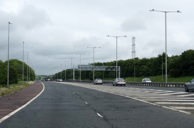
Transport links in Little Marton are well-established, with regular bus services connecting the village to Blackpool and other nearby towns. The M55 motorway is also easily accessible, facilitating convenient travel to other parts of Lancashire and beyond.

Overall, Little Marton offers a tranquil and family-friendly environment within close proximity to both the bustling seaside resort of Blackpool and the stunning Lancashire countryside.

If you have any feedback on the listing, please let us know in the comments section below.

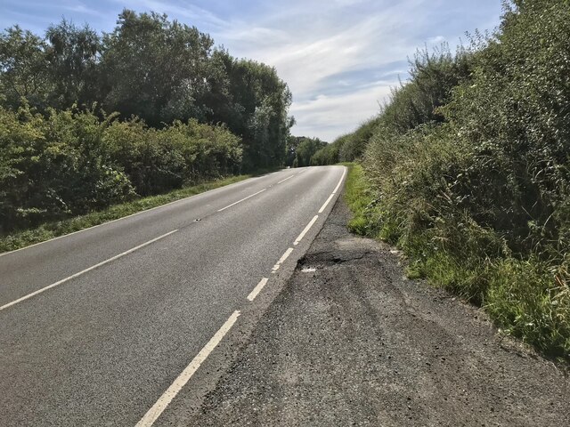
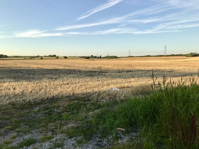
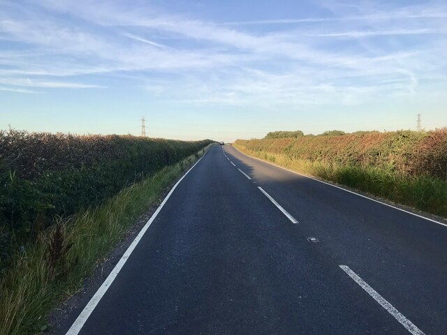
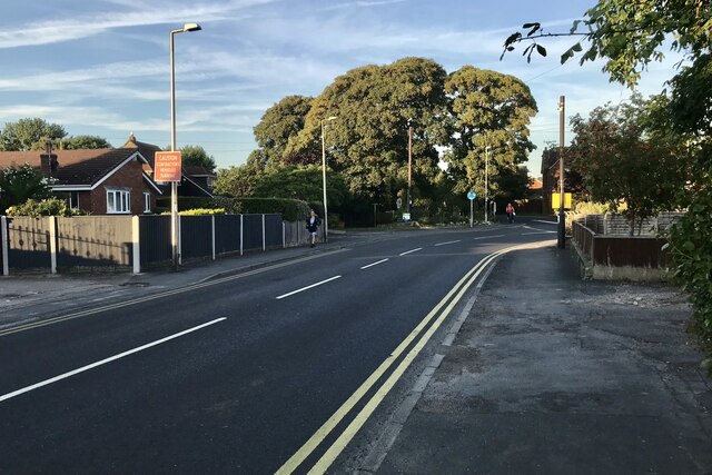
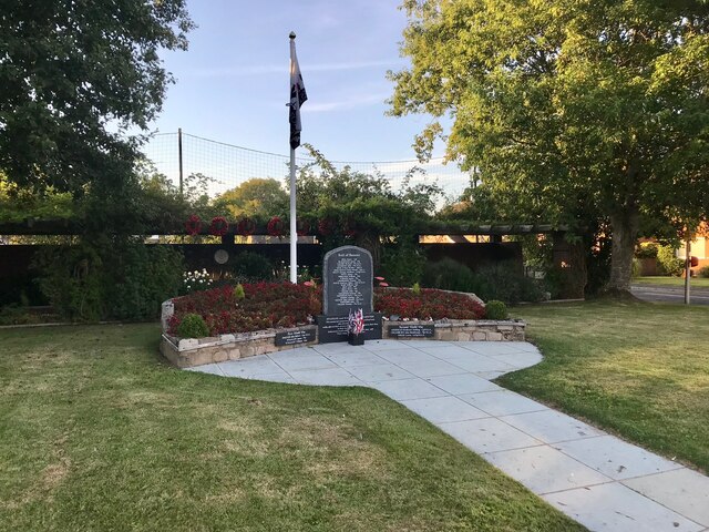
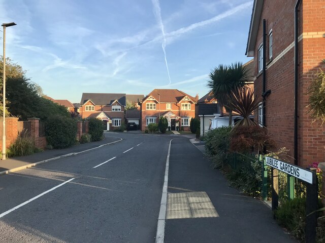
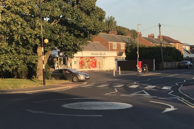
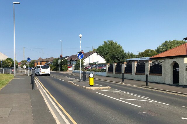
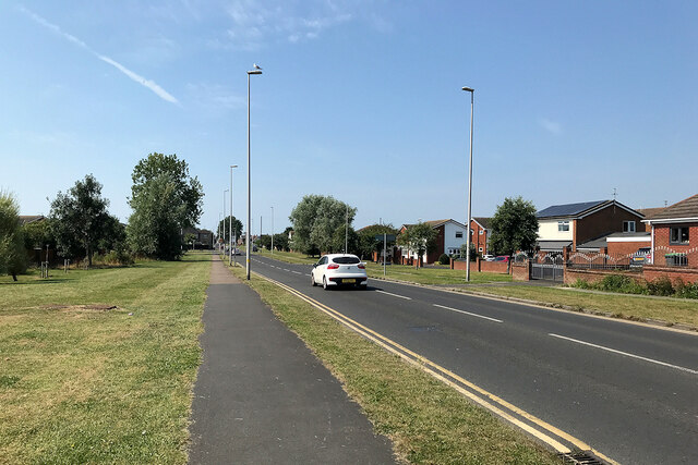
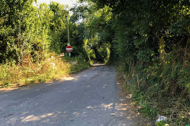
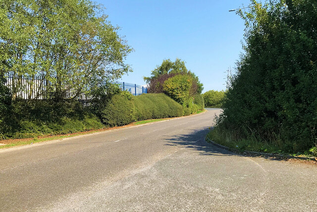
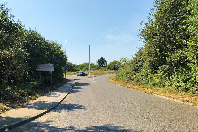
Little Marton Images

Images are sourced within 2km of 53.800435/-2.992948 or Grid Reference SD3434. Thanks to Geograph Open Source API. All images are credited.

Mythop Road
Mythop Road
Farmland at Little Marton A farmer’s field next to Mythop Road
Farmland at Little Marton
A farmer’s field next to Mythop Road
Staining, Chain Lane
Mythop Road Rural road between Little Marton and Mythop.
Mythop Road
Rural road between Little Marton and Mythop.
Chain Lane, Staining
Staining and Hardhorn with Newton War Memorial Garden A free-standing granite memorial roll of honour set in a neat garden off Chain Lane at Staining. It was dedicated on 27 April 2014.
Staining and Hardhorn with Newton War Memorial Garden
A free-standing granite memorial roll of honour set in a neat garden off Chain Lane at Staining. It was dedicated on 27 April 2014.
Staining, Jubilee Gardens Modern housing at Staining.
Staining, Jubilee Gardens
Modern housing at Staining.
Village Store at Staining McColl’s on Chain Lane.
Village Store at Staining
McColl’s on Chain Lane.
Midgeland Road
Midgeland Road
Highfield Road, Walker's Hill, Blackpool
Old House Lane
Old House Lane
Blackpool and Fylde Industrial Estate, Jenny Lane
Jenny Lane, Blackpool
Little Marton windmill A Grade II Listed tower mill from the 1830s. This has only recently lost its sails and they are to be replaced. Much of the machinery is missing but there were four sets of stones and there is a replica of one set. The upper part of the tower contains more machinery but due to a shortage of volunteers there was no access above the stone floor - disappointing.
Little Marton windmill
A Grade II Listed tower mill from the 1830s. This has only recently lost its sails and they are to be replaced. Much of the machinery is missing but there were four sets of stones and there is a replica of one set. The upper part of the tower contains more machinery but due to a shortage of volunteers there was no access above the stone floor - disappointing.
Borough of Fylde : The M55 Motorway Heading towards Blackpool on the M55 motorway.
Borough of Fylde : The M55 Motorway
Heading towards Blackpool on the M55 motorway.
Little Marton Windmill, Blackpool <span class="nowrap"><a title="https://en.wikipedia.org/wiki/Little_Marton_Mill" rel="nofollow ugc noopener" href="https://en.wikipedia.org/wiki/Little_Marton_Mill">Link</a><img style="margin-left:2px;" alt="External link" title="External link - shift click to open in new window" src="https://s1.geograph.org.uk/img/external.png" width="10" height="10"/></span>
Little Marton Windmill, Blackpool
Joining the M55 by Peel Hill The M55 runs from Blackpool to the M6 near Preston.
Joining the M55 by Peel Hill
The M55 runs from Blackpool to the M6 near Preston.
The M55 heading east The M55 runs from Blackpool to the M6 near Preston.
The M55 heading east
The M55 runs from Blackpool to the M6 near Preston.
Show me another place!

Little Marton is located at Grid Ref: SD3434 (Lat: 53.800435, Lng: -2.992948)

Unitary Authority: Blackpool

Police Authority: Lancashire

What 3 Words

///waters.shirt.digs. Near Great Marton, Lancashire

Related Wikis

The Harbour (hospital)

The Harbour is a mental health hospital in Blackpool, Lancashire, England. It is managed by Lancashire Care NHS Foundation Trust. The hospital provides...
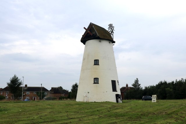
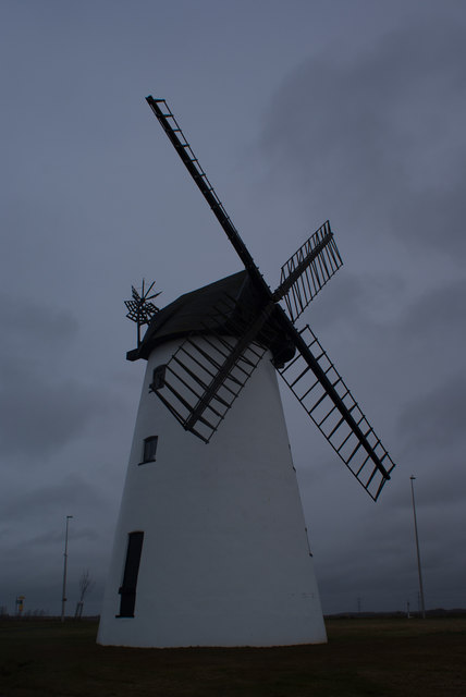
Little Marton Mill

Little Marton Mill is a 19th-century English tower windmill in Marton, Blackpool, Lancashire, England. It was built in 1838 by John Hays for grinding corn...

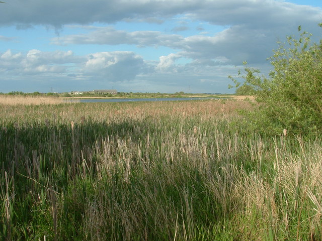
Marton Mere Local Nature Reserve

Marton Mere is a mere (lake) and Local Nature Reserve in Blackpool, Lancashire, England. It is located near to the Blackpool districts of Marton and Mereside...

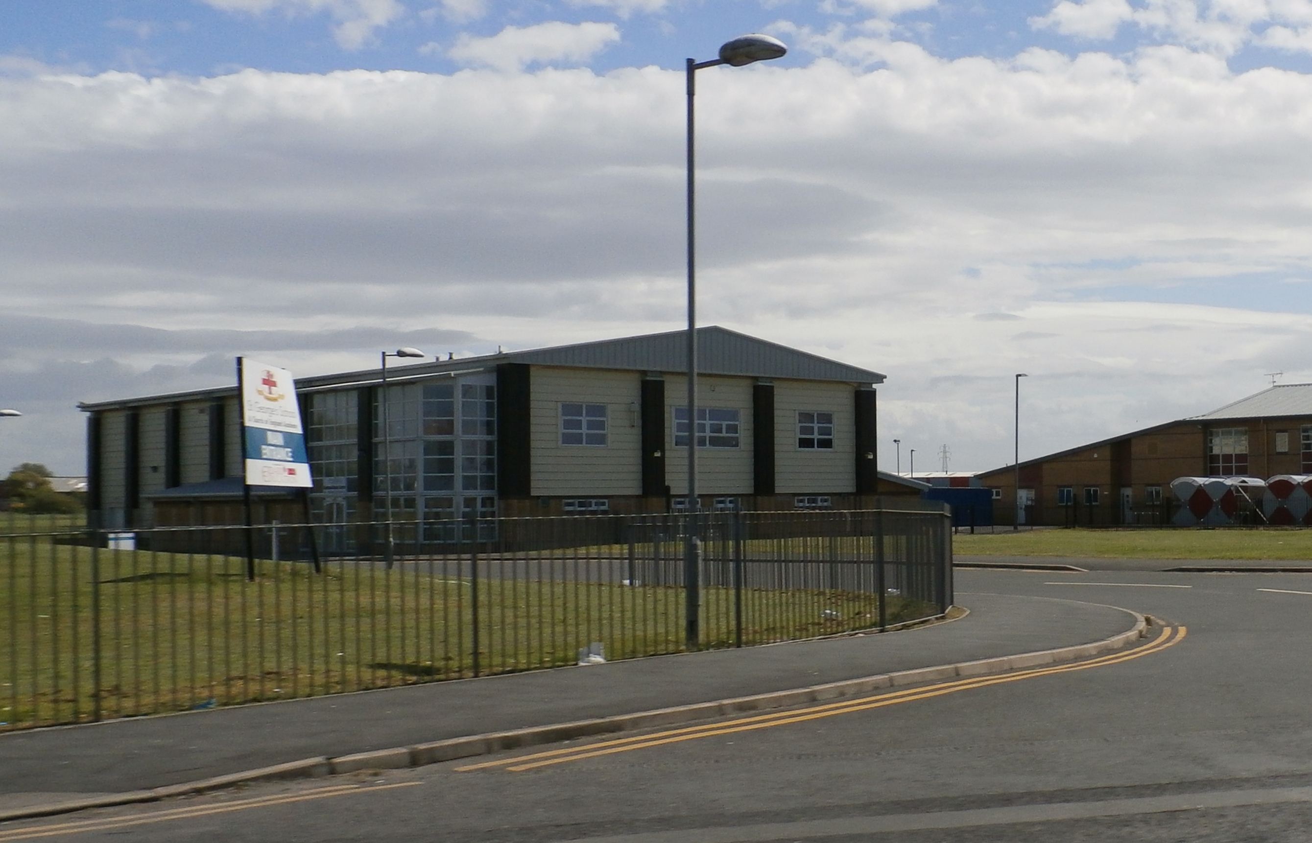
St George's School, Blackpool

St. George's School is a Church of England secondary school with academy status in Marton, Blackpool, Lancashire, England with an intake of both boys and...

Nearby Amenities

Located within 500m of 53.800435,-2.992948
Little Marton
Place: suburb
Source: npe
Lat/Long: 53.8031066/-2.9924746
Barrier: bollard
Lat/Long: 53.7967526/-2.9961261
Turning Circle
Lat/Long: 53.7990917/-2.9943738
Addr City: Blackpool
Addr Housenumber: 4
Addr Postcode: FY4 4TR
Addr Street: Langdale Place
Lat/Long: 53.7995874/-2.9969334
Little Marton Windmill
Man Made: windmill
Wikidata: Q1632162
Lat/Long: 53.799132/-2.989825
Turning Circle
Lat/Long: 53.7992976/-2.9972524
Place Of Worship
St Monica's
Addr City: Blackpool
Addr Postcode: FY4 4FA
Addr Street: St Monica's Way
Denomination: catholic
Religion: christian
Lat/Long: 53.8009654/-2.9933082
Place Of Worship
Mereside Methodists
Addr City: Blackpool
Addr Postcode: FY4 4TL
Addr Street: Grizedale Road
Denomination: methodist
Religion: christian
Lat/Long: 53.8021009/-2.9969943
Crossing
Crossing: uncontrolled
Horse: no
Lat/Long: 53.796054/-2.9924992
Crossing
Crossing: uncontrolled
Horse: no
Lat/Long: 53.7959668/-2.9923624
Post Box
Collection Times: Mo-Fr 16:15; Sa 11:00; Su off
Operator: Royal Mail
Operator Wikidata: Q638098
Post Box Type: pillar
Ref: FY3 312
Royal Cypher: EIIR
Royal Cypher Wikidata: Q33102113
Lat/Long: 53.8029956/-2.9986038
Traffic Signals
Traffic Signals: signal
Lat/Long: 53.8017037/-2.9930981
Traffic Signals
Traffic Signals: signal
Traffic Signals Direction: backward
Lat/Long: 53.8017202/-2.9934344
Traffic Signals
Traffic Signals: signal
Lat/Long: 53.8019566/-2.993659
Traffic Signals
Traffic Signals: signal
Traffic Signals Direction: forward
Lat/Long: 53.8020319/-2.9931788
Traffic Signals
Traffic Signals: signal
Traffic Signals Direction: backward
Lat/Long: 53.7994131/-2.9885651
Traffic Signals
Lat/Long: 53.7990034/-2.9888436
Traffic Signals
Lat/Long: 53.7990058/-2.9886939
Post Box
Collection Times: Mo-Fr 09:00; Sa 07:00; Su off
Operator: Royal Mail
Operator Wikidata: Q638098
Post Box Type: pillar
Ref: FY4 265D
Royal Cypher: GVIR
Royal Cypher Wikidata: Q33102169
Lat/Long: 53.7978742/-2.9902587
Post Box
Collection Times: Mo-Fr 17:15; Sa 12:00; Su off
Operator: Royal Mail
Operator Wikidata: Q638098
Post Box Type: pillar
Ref: FY4 82
Royal Cypher: EIIR
Royal Cypher Wikidata: Q33102113
Lat/Long: 53.7996596/-2.996939
Post Box
Collection Times: Mo-Fr 09:00; Sa 07:00; Su off
Operator: Royal Mail
Operator Wikidata: Q638098
Post Box Type: lamp
Ref: FY4 12D
Royal Cypher: EIIR
Royal Cypher Wikidata: Q33102113
Lat/Long: 53.8020714/-2.9959892
Mereside Butties
Addr City: Blackpool
Addr Housenumber: 6
Addr Postcode: FY4 4TR
Addr Street: Langdale Place
Fhrs Id: 1036586
Shop: bakery
Lat/Long: 53.7996025/-2.9971767
Fast Food
Mereside Chippy
Addr City: Blackpool
Addr Housenumber: 1
Addr Postcode: FY4 4TR
Addr Street: Langdale Place
Cuisine: fish_and_chips
Fhrs Id: 198414
Takeaway: yes
Lat/Long: 53.7995932/-2.9966916
Mereside Convience Store
Addr City: Blackpool
Addr Housenumber: 2-3
Addr Postcode: FY4 4TR
Addr Street: Langdale Place
Shop: convenience
Lat/Long: 53.7995932/-2.9967916
Pharmacy
Well Pharmacy
Addr City: Blackpool
Addr Housenumber: 5
Addr Postcode: FY4 4TR
Addr Street: Langdale Place
Brand: Well Pharmacy
Brand Wikidata: Q7726524
Healthcare: pharmacy
Opening Hours: Mo-Fr 09:00-18:00
Website: https://finder.well.co.uk/store/blackpool-langdale-place
Lat/Long: 53.7995981/-2.9970592
Crossing
Check Date Crossing: 2021-06-29
Crossing: uncontrolled
Crossing Island: no
Crossing Ref: zebra
Lat/Long: 53.7997992/-2.9965863
Post Box
Collection Times: Mo-Fr 09:00; Sa 07:00; Su off
Operator: Royal Mail
Operator Wikidata: Q638098
Post Box Type: lamp
Ref: FY4 363D
Royal Cypher: EIIR
Royal Cypher Wikidata: Q33102113
Lat/Long: 53.8031444/-2.9911702
Kindergarten
The Manor Nursery School
Addr City: Blackpool
Addr Postcode: FY4 4UZ
Addr Street: Mythop Road
Fhrs Id: 141855
Lat/Long: 53.8020019/-2.9924787
Doctors
The Harris Medical Centre
Addr City: Blackpool
Addr Housenumber: 25
Addr Postcode: FY4 4TW
Addr Street: Kentmere Drive
Healthcare: doctor
Opening Hours: Mo-Fr 08:00-18:30
Lat/Long: 53.801012/-2.9964513
Library
Langdale Library and Laundry Room
Addr City: Blackpool
Addr Housenumber: 1a
Addr Postcode: FY4 4TR
Addr Street: Langdale Place
Shop: laundry
Lat/Long: 53.7995955/-2.9963989
Traffic Signals
Traffic Signals: signal
Lat/Long: 53.8028433/-2.9974112
Traffic Signals
Traffic Signals: signal
Lat/Long: 53.8025929/-2.996609
Crossing
Crossing: marked
Lat/Long: 53.8001736/-2.9893909
Crossing
Crossing: marked
Lat/Long: 53.8001098/-2.9897697
Crossing
Crossing: marked
Lat/Long: 53.80011/-2.9890416
Crossing
Crossing: marked
Lat/Long: 53.7998692/-2.9880167
Leisure: playground
Lat/Long: 53.8000335/-2.9958158
Mereside
Place: suburb
Lat/Long: 53.7994602/-2.9956486
Parking
Access: private
Lat/Long: 53.8044173/-2.9961861
Parking
Access: yes
Lat/Long: 53.7963469/-2.9958815
Traffic Signals
Traffic Signals: signal
Lat/Long: 53.8020132/-2.9936077
Traffic Signals
Traffic Signals: signal
Lat/Long: 53.7994905/-2.9891243
Traffic Signals
Traffic Signals: signal
Lat/Long: 53.8029425/-2.9968355
Charging Station
Lat/Long: 53.7964187/-2.9901611
Cycleway: asl
Lat/Long: 53.7990373/-2.9887337
Cycleway: asl
Lat/Long: 53.7994633/-2.9890832
Bus Stop
Bus: yes
Public Transport: platform
Shelter: no
Lat/Long: 53.7998892/-2.9895557
Bus Stop
Bus: yes
Public Transport: platform
Shelter: no
Lat/Long: 53.7995685/-2.9897837
Cycleway: asl
Lat/Long: 53.8019439/-2.9935999
Cycleway: asl
Lat/Long: 53.801722/-2.9931519
Speed Camera
Direction: 135
Maxspeed: 30 mph
Lat/Long: 53.8025436/-2.9956195
Bus Stop
Bus: yes
Public Transport: platform
Shelter: yes
Lat/Long: 53.8021165/-2.9949464
Bus Stop
Bus: yes
Public Transport: platform
Shelter: no
Lat/Long: 53.8030066/-2.9986495
Bus Stop
Bus: yes
Public Transport: platform
Shelter: yes
Lat/Long: 53.8027575/-2.99935
Bus Stop
Bus: yes
Public Transport: platform
Shelter: no
Lat/Long: 53.8023302/-2.9947183
Speed Camera
Direction: 150
Maxspeed: 40 mph
Lat/Long: 53.8005978/-2.9907153
Speed Camera
Direction: 165
Maxspeed: 40 mph
Lat/Long: 53.7981972/-2.987383
The data included in this document is from www.openstreetmap.org. The data is made available under ODbL.

Have you been to Little Marton?

Leave your review of Little Marton below (or comments, questions and feedback).