Archy's Linn

Waterfall in Northumberland

England

Archy's Linn

Forest Track, Kielder Forest
Forest Track, Kielder Forest Credit: Les Hull

Archy's Linn is a picturesque waterfall located in the heart of Northumberland, England. Situated in a secluded area of the countryside, this natural wonder attracts visitors from near and far with its captivating beauty and tranquil surroundings.

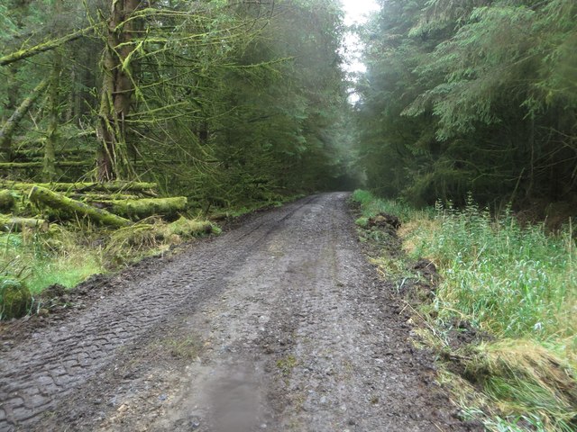
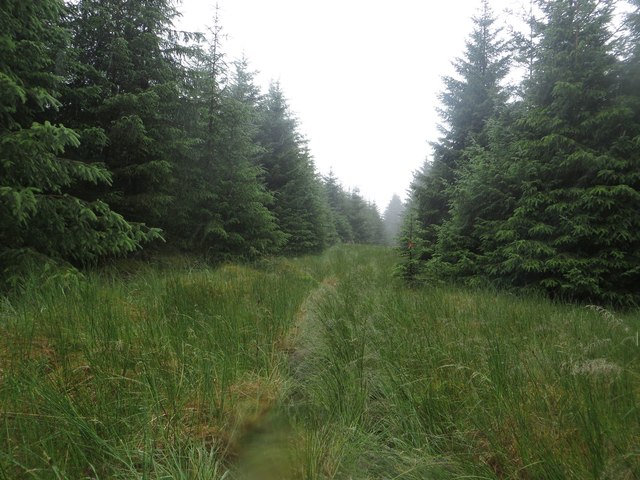
The waterfall is nestled within a dense forest, adding to its enchanting appeal. It is formed by the steady flow of the Archy Burn, a small river that cascades down a series of rocky steps, creating a mesmerizing sight and a gentle, soothing sound. The falls are characterized by their graceful yet powerful descent, as water tumbles over moss-covered rocks, creating small pools and rapids along the way.

What sets Archy's Linn apart is its unspoiled natural setting. Surrounded by lush greenery and towering trees, the waterfall offers a sense of serenity and tranquility. Visitors can explore the area on foot, following well-marked trails that lead to various viewpoints. These vantage points provide stunning vistas of the cascading water and the surrounding landscape, offering ample opportunities for photography and appreciation of nature's wonders.

Archy's Linn is also a habitat for a variety of wildlife, including birds, deer, and otters, adding to the allure of the location. Nature enthusiasts can enjoy observing these creatures in their natural habitat while immersing themselves in the peaceful ambiance.

Overall, Archy's Linn is a hidden gem in Northumberland, offering a delightful escape from the hustle and bustle of everyday life. Its untouched beauty, combined with the soothing sounds of flowing water, makes it a must-visit destination for those seeking a peaceful and immersive experience in nature.

If you have any feedback on the listing, please let us know in the comments section below.

Archy's Linn Images

Images are sourced within 2km of 55.142717/-2.4519892 or Grid Reference NY7183. Thanks to Geograph Open Source API. All images are credited.

Forest Track, Kielder Forest
Forest Road
Forest Road
Forest track near Smales
Forest track towards Allery Sike
Forest Track above Chirdon Head
Forest Track and Ride
Rowantree Cleugh
Rowantree Cleugh
Little-used forest road At Allerybank in Kielder Forest.
Little-used forest road
At Allerybank in Kielder Forest.
Waymark for the Alternative Pennine Way The marker indicates a public footpath, and also the logo of the Alternative Pennine Way. The APW is a strictly unofficial long distance walk from Ashbourne to Jedburgh, the subject of a Cicerone Guide published in 1992. It avoids much of the higher, boggier parts of the Pennine Way proper, but is little known and little walked. This and the one seen in <a href="https://www.geograph.org.uk/photo/5248386">NY7273 : Waymark in Wark Forest</a> are the only waymarks for the APW that I have ever seen.
Waymark for the Alternative Pennine Way
The marker indicates a public footpath, and also the logo of the Alternative Pennine Way. The APW is a strictly unofficial long distance walk from Ashbourne to Jedburgh, the subject of a Cicerone Guide published in 1992. It avoids much of the higher, boggier parts of the Pennine Way proper, but is little known and little walked. This and the one seen in NY7273 : Waymark in Wark Forest are the only waymarks for the APW that I have ever seen.
Forest track and public footpath A forest track and public footpath in amongst the immeasurable number of trees of Wark Forest, which itself is part of Kielder Forest.
Forest track and public footpath
A forest track and public footpath in amongst the immeasurable number of trees of Wark Forest, which itself is part of Kielder Forest.
Track maintenance vehicles in Wark Forest A tractor and a grading machine are parked for the weekend whilst they are used repairing a section of track in Wark Forest.
Track maintenance vehicles in Wark Forest
A tractor and a grading machine are parked for the weekend whilst they are used repairing a section of track in Wark Forest.
Forest track and footpath, Wark Forest A forest track and public footpath in Wark Forest. The track is in the process of being repaired with machinery parked nearby.
Forest track and footpath, Wark Forest
A forest track and public footpath in Wark Forest. The track is in the process of being repaired with machinery parked nearby.
Fallen trees in Wark Forest Fallen trees beside a forest track in Wark Forest. The dead trees are covered in moss and lichen.
Fallen trees in Wark Forest
Fallen trees beside a forest track in Wark Forest. The dead trees are covered in moss and lichen.
Little used forest track, Wark Forest A grassy track between blocks of trees in the large forest to the south of Kielder Water.
Little used forest track, Wark Forest
A grassy track between blocks of trees in the large forest to the south of Kielder Water.
Break between blocks of trees, Wark Forest A wide gap between blocks of densely planted trees, allowing slightly easier progress on foot through the forest.
Break between blocks of trees, Wark Forest
A wide gap between blocks of densely planted trees, allowing slightly easier progress on foot through the forest.
Fire break near Black Knowe A wide gap left unplanted between blocks of trees in the midst of the large Forestry Commission properties around Kielder Water.
Fire break near Black Knowe
A wide gap left unplanted between blocks of trees in the midst of the large Forestry Commission properties around Kielder Water.
Forest track in Wark Forest One of the many forest tracks providing access between and around the never ending blocks of trees in Kielder Forest.
Forest track in Wark Forest
One of the many forest tracks providing access between and around the never ending blocks of trees in Kielder Forest.
Forest track, Wark Forest A forest track between the trees of Wark Forest.
Forest track, Wark Forest
A forest track between the trees of Wark Forest.
Show me another place!

Archy's Linn is located at Grid Ref: NY7183 (Lat: 55.142717, Lng: -2.4519892)

Unitary Authority: Northumberland

Police Authority: Northumbria

What 3 Words

///tanks.tonsils.slyly. Near Bellingham, Northumberland

Nearby Locations

Archy's Linn

Related Wikis

Nearby Amenities

Located within 500m of 55.142717,-2.4519892
Black Knowe
Place: locality
Lat/Long: 55.139603/-2.4464392
The data included in this document is from www.openstreetmap.org. The data is made available under ODbL.

Have you been to Archy's Linn?

Leave your review of Archy's Linn below (or comments, questions and feedback).