Barrow Waterfalls

Waterfall in Cumberland Allerdale

England

Barrow Waterfalls

Derwent Water seen from Brandlehow Landing Stage Bleaberry Fell and Castlerigg Fell can be seen on the other side of the lake.
Derwent Water seen from Brandlehow Landing Stage Credit: Clive Nicholson

Barrow Waterfalls, also known as Cumberland Waterfalls, is a picturesque natural wonder located in Cumbria, England. Nestled within the stunning landscape of the Lake District National Park, these waterfalls are a popular attraction for locals and tourists alike.

The Barrow Waterfalls are formed by the cascading waters of the Barrow Beck, a small river that flows through the region. The falls are situated in a secluded woodland area, surrounded by lush greenery and towering trees, creating a tranquil and serene ambiance.

The main waterfall at Barrow Waterfalls is approximately 30 feet in height and is known for its impressive force and beauty. The rushing waters create a mesmerizing display as they plunge into a pool below, creating an ethereal mist that adds to the enchantment of the surroundings. The sound of the cascading water provides a soothing background melody, further enhancing the experience of visitors.

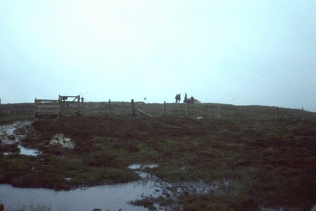
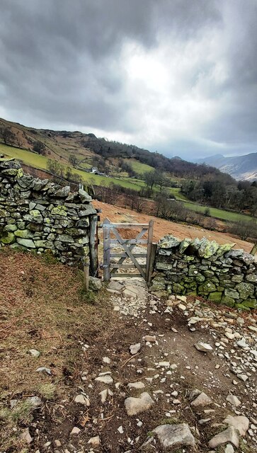
Access to Barrow Waterfalls is relatively easy, with a well-maintained footpath leading visitors through the woodland to the falls. The area is also home to a variety of wildlife, including birds, squirrels, and occasional deer, offering nature enthusiasts an opportunity to observe and appreciate the local fauna.

The Barrow Waterfalls and its surrounding area are ideal for leisurely walks, picnics, and photography. Visitors can enjoy the beauty of the falls from various viewpoints, capturing the perfect shot or simply immersing themselves in the tranquility of the natural surroundings.

Overall, Barrow Waterfalls in Cumberland is a captivating natural attraction that showcases the scenic beauty of the Lake District National Park. It offers a peaceful and rejuvenating experience for all who visit, promising a memorable encounter with nature.

If you have any feedback on the listing, please let us know in the comments section below.

Barrow Waterfalls Images

Images are sourced within 2km of 54.569496/-3.1318244 or Grid Reference NY2619. Thanks to Geograph Open Source API. All images are credited.

Derwent Water seen from Brandlehow Landing Stage Bleaberry Fell and Castlerigg Fell can be seen on the other side of the lake.
Derwent Water seen from Brandlehow Landing Stage
Bleaberry Fell and Castlerigg Fell can be seen on the other side of the lake.
Footbridge over the River Derwent Across the flat river flood plain can be seen Shepherds Crag.
Footbridge over the River Derwent
Across the flat river flood plain can be seen Shepherds Crag.
Roadside trees, Borrowdale The number of trees increases as you move away from the head of Derwent Water or the River Derwent.
Roadside trees, Borrowdale
The number of trees increases as you move away from the head of Derwent Water or the River Derwent.
River Derwent flood plain The flat ground at the head of Derwent Water frequently floods. Skiddaw is in the far distance.
River Derwent flood plain
The flat ground at the head of Derwent Water frequently floods. Skiddaw is in the far distance.
Summit, Bleaberry Fell
Ashness Bridge On the minor road from Barrow Bay to Watendlath, the Grade II listed Ashness Bridge over Barrow Beck is a popular tourist attraction.
Barrow Beck flows into Derwentwater and thence into the River Derwent.
Ashness Bridge
On the minor road from Barrow Bay to Watendlath, the Grade II listed Ashness Bridge over Barrow Beck is a popular tourist attraction. Barrow Beck flows into Derwentwater and thence into the River Derwent.
River Derwent From the Chinese Bridge — looks nice enough to swim in, but take a closer look into the water in the shadow of the bridge: a dead sheep.
River Derwent
From the Chinese Bridge — looks nice enough to swim in, but take a closer look into the water in the shadow of the bridge: a dead sheep.
Footpath through Lodore Hotel On my map this is supposed to be a Permissive path to avoid using the road. On the latest O.S. mapping it's classed as a Public Footpath.

Either way its use is not welcoming and the 'bridge' over the beck just beyond the gate is very precarious.
Footpath through Lodore Hotel
On my map this is supposed to be a Permissive path to avoid using the road. On the latest O.S. mapping it's classed as a Public Footpath. Either way its use is not welcoming and the 'bridge' over the beck just beyond the gate is very precarious.
Ashness Bridge
Ashness Bridge
Gate on Brown Knotts
Bleaberry Fell The wind shelter on the summit of the fell. Looking north west with Skiddaw in the distance on the right of the shot.
Bleaberry Fell
The wind shelter on the summit of the fell. Looking north west with Skiddaw in the distance on the right of the shot.
High Brandelhow The jetty here is currently undergoing repair.
High Brandelhow
The jetty here is currently undergoing repair.
High Brandelhow The landing stage is presently undergoing repair.
High Brandelhow
The landing stage is presently undergoing repair.
Brandelhow Point Housing at Brandelhow Point.
Brandelhow Point
Housing at Brandelhow Point.
Housing at Brandelhow Point
Southern end of Derwentwater On the left is the Lodore Falls Hotel.  The B5289 to Borrowdale hugs the ground beneath Shepherds Crag <a href="https://www.geograph.org.uk/photo/1513276">NY2618 : Shepherds Crag</a>.
Southern end of Derwentwater
On the left is the Lodore Falls Hotel. The B5289 to Borrowdale hugs the ground beneath Shepherds Crag NY2618 : Shepherds Crag.
Wooded cliffs overlooking Derwentwater 
Between the Bleaberry Fell and the lakeside are cliffs covered in trees. On the left, above a landslide, there seems to be some kind of face.
Wooded cliffs overlooking Derwentwater
Between the Bleaberry Fell and the lakeside are cliffs covered in trees. On the left, above a landslide, there seems to be some kind of face.
Buoys on Derwentwater Buoys direct boats into the channel for the Lodore landing stage. On the right water from the lake drains into the River Derwent. In the background is the Lodore Falls Hotel.
Buoys on Derwentwater
Buoys direct boats into the channel for the Lodore landing stage. On the right water from the lake drains into the River Derwent. In the background is the Lodore Falls Hotel.
Show me another place!

Barrow Waterfalls is located at Grid Ref: NY2619 (Lat: 54.569496, Lng: -3.1318244)

Administrative County: Cumbria

District: Allerdale

Police Authority: Cumbria

What 3 Words

///petty.coping.incline. Near Keswick, Cumbria

Related Wikis

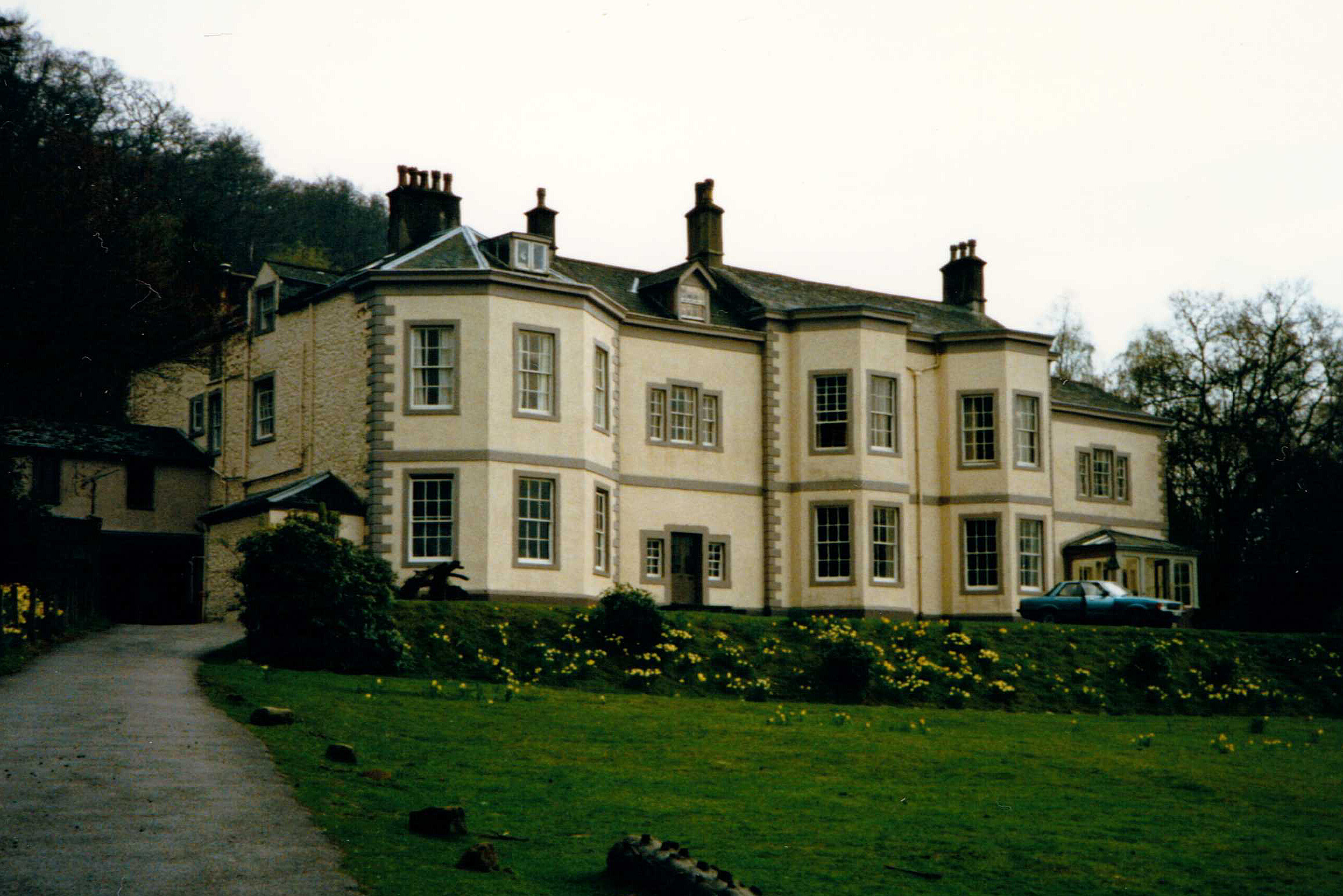
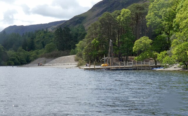
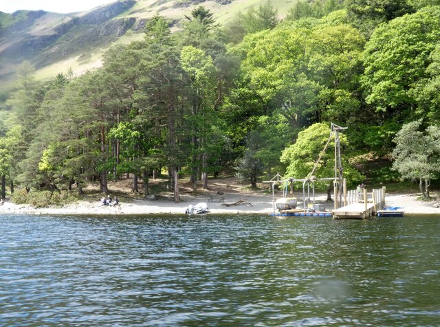
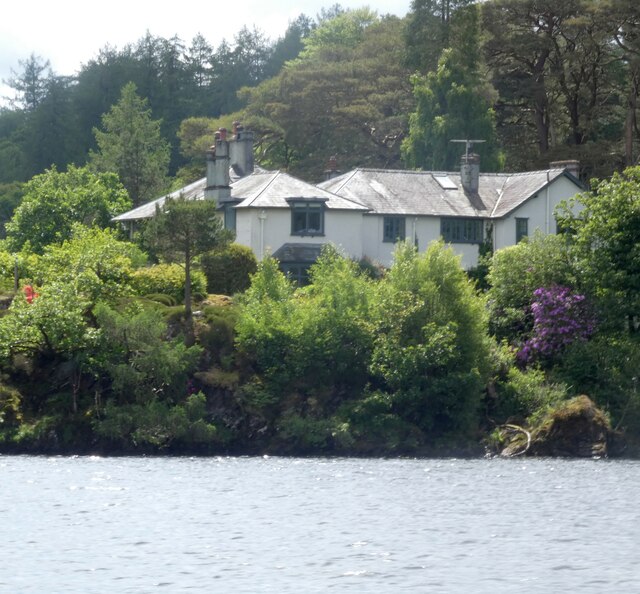
Barrow House, Cumbria

Barrow House is a late 18th-century mansion situated on the eastern shore of Derwentwater in Borrowdale within the Lake District National Park, in the...
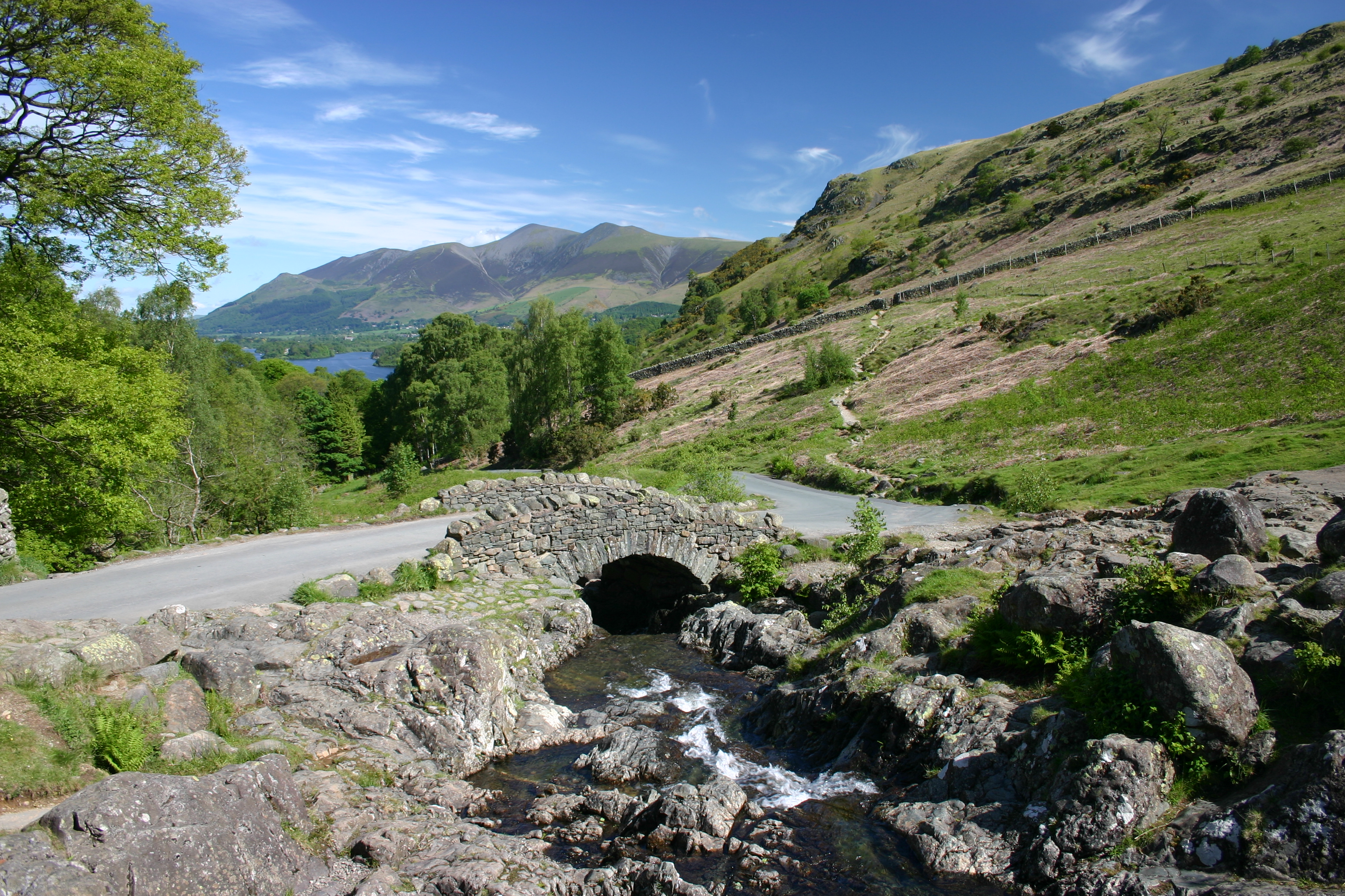
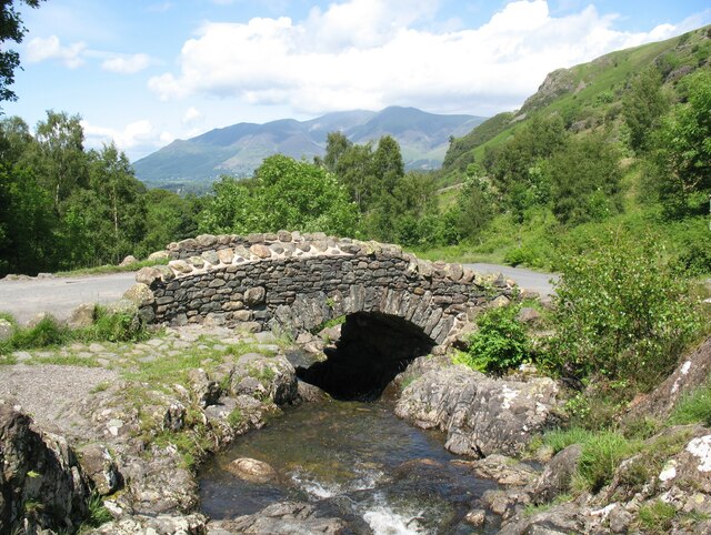
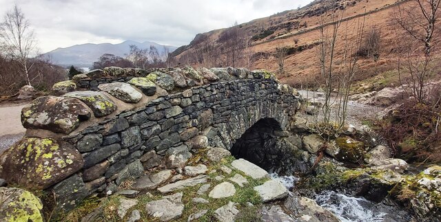
Ashness Bridge

Ashness Bridge is a traditional stone-built bridge on the single-track road from the Borrowdale road (B5289) to Watendlath, in the English Lake District...

Cataract of Lodore

"The Cataract of Lodore" is a poem written in 1820 by the English poet Robert Southey which describes the Lodore Falls on the Watendlath. == Publication... ==
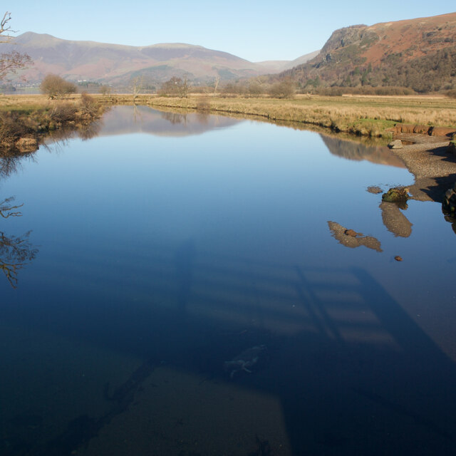
Lodore Falls

Lodore Falls is a waterfall in Cumbria, England, close to Derwentwater and downstream from Watendlath. The falls are located on the beck that flows from...

Nearby Amenities

Located within 500m of 54.569496,-3.1318244
Barrow Bay jetty
Bus: yes
Public Transport: stop_position
Lat/Long: 54.5734892/-3.132304
Bus Stop
Derwentwater Youth Hostel (S bound)
Bus: yes
Local Ref: AT
Naptan AtcoCode: 090002111322
Naptan Bearing: S
Naptan CommonName: Derwentwater Youth Hostel (S bound)
Naptan Indicator: at
Naptan Landmark: driveway to Derwentwater Youth Hostel
Naptan NaptanCode: cumadapa
Naptan Street: B5289
Naptan Verified: yes
Public Transport: platform
Source: naptan_import
Lat/Long: 54.572232/-3.1329711
Bus Stop
Barrow Bay jetty
Bus: yes
Local Ref: AT
Naptan AtcoCode: 090002111860
Naptan Bearing: N
Naptan CommonName: Barrow Bay jetty
Naptan Indicator: at
Naptan Landmark: junction with road to Watendlath
Naptan NaptanCode: cumdmwam
Naptan Street: B5289
Naptan Verified: no
Public Transport: platform
Source: naptan_import
Lat/Long: 54.5734294/-3.1322613
Bus Stop
Derwentwater Youth Hostel (N bound)
Bus: yes
Naptan AtcoCode: 090002111893
Naptan Bearing: N
Naptan CommonName: Derwentwater Youth Hostel (N bound)
Naptan Indicator: opp
Naptan Landmark: drive to Derwent Water YHA
Naptan NaptanCode: cumadawa
Naptan Street: B5289
Naptan Verified: yes
Public Transport: platform
Source: naptan_import
Lat/Long: 54.572227/-3.1330744
Ferry Terminal
Ferry: yes
Foot: yes
Motorcar: no
Public Transport: station
Lat/Long: 54.5736943/-3.1328264
Barrier: stile
Lat/Long: 54.5664204/-3.1296224
Ashness Bridge
Tourism: viewpoint
Waterway: waterfall
Lat/Long: 54.5672727/-3.1302352
Waterway: waterfall
Lat/Long: 54.569786/-3.1329304
Barrier: cattle_grid
Lat/Long: 54.5729683/-3.1320375
Barrier: stile
Lat/Long: 54.5669123/-3.1294301
Post Box
Ref: CA12 92
Source: survey
Lat/Long: 54.5703066/-3.1340474
Barrow Bay
Natural: bay
Lat/Long: 54.5720631/-3.134751
Strutta Wood
Natural: wood
Lat/Long: 54.5681374/-3.1333399
Lowcrag Wood
Natural: wood
Lat/Long: 54.5656473/-3.1319401
Low Strutta
Place: locality
Lat/Long: 54.5694459/-3.1331453
Brown Knotts
Place: locality
Lat/Long: 54.5697469/-3.1245045
Ashness Bridge
Description: Much photographed beauty spot
Tourism: viewpoint
Lat/Long: 54.5671521/-3.1300364
High Strutta
Place: locality
Lat/Long: 54.5660674/-3.1285371
Low Strutta
Place: locality
Lat/Long: 54.5674248/-3.1308115
Low Crag
Place: locality
Lat/Long: 54.5657902/-3.1336321
Ford: yes
Lat/Long: 54.5676665/-3.127208
Barrier: stile
Foot: yes
Material: wood_2_steps
Stile: stepover
Lat/Long: 54.5701987/-3.1276627
The data included in this document is from www.openstreetmap.org. The data is made available under ODbL.

Have you been to Barrow Waterfalls?

Leave your review of Barrow Waterfalls below (or comments, questions and feedback).